
The depopulated village of Al-Lajjun / District of Jenin
Al-Lajjun
About the depopulated village of Al-Lajjun
- District
- Jenin
- Date Al-Lajjun was occupied
- 30 May 1948
- Population in 1948
- 1,280
- Military operation
- Operation Gideon
- Brigade that carried it out
- Golani Brigade
- Who defended the village
- Arab Liberation Army
- Distance from the governorate centre
- May 30, 1948
- Elevation above sea level
- 150 m
- Cause of displacement
- Military assault by Zionist troops
- Extent of destruction
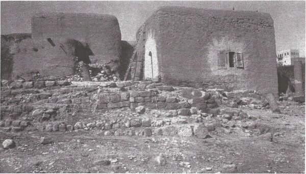
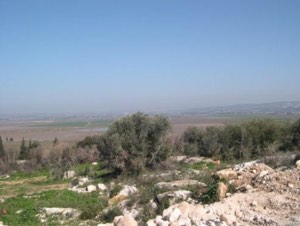
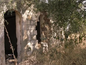
- al-Lajjun was mostly destroyed with the exception of the white stone mosque, one village mill, the village health center, and few partially destroyed houses still visible on the village site, ses Pictures section for details.
- Ethnic cleansing
- al-Lajjun inhabitants were completely ethnically cleansed.
Hover a dot to read the village name, or click to open its card.
Borders of the depopulated village of Al-Lajjun
Al-Lajjun – A Depopulated Palestinian Village in the Jenin Subdistrict
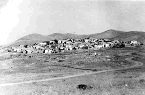
Al-Lajjun was a Palestinian village in the Jenin Subdistrict, situated approximately 16 km northwest of Jenin on the southwestern edge of Marj ibn 'Amir, at an average elevation of about 150 meters above sea level.
The village extended along both banks of Wadi al-Lajjun near the junction of the Jenin–Haifa highway and the road leading southwest toward Umm al-Fahm and Wadi 'Ara. Its strategic position gave it considerable economic and military importance.
Israeli occupation forces finally captured al-Lajjun at dawn on 30 May 1948 during the Golani Brigade's advance toward Jenin. Walid Khalidi considers it possible that Golani's Fourth Battalion was the unit that expelled the villagers, but he presents this battalion-level attribution as probable rather than certain.
- Subdistrict
- Jenin
- Distance from Jenin
- Approximately 16 km northwest
- Elevation
- Approximately 150 m above sea level
- Separate village population, 1944/45
- 1,103 according to PalQuest
- Estimated population, 1948
- 1,280
- Village land area
- Approximately 8,500 dunums in later Palestinian institutional sources; the official 1945 land table combines al-Lajjun with Umm al-Fahm and other localities
- Final occupation
- 30 May 1948
- Military force
- Golani Brigade; Fourth Battalion probable
- Military context
- Israeli advance toward Jenin in late May 1948; the final capture should not chronologically be classified as Operation Gideon
Location and Geography of Al-Lajjun
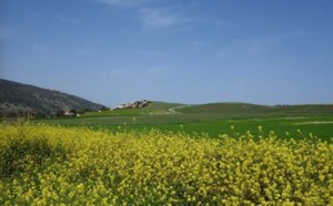
Al-Lajjun stood on a slightly elevated hill on the southwestern edge of the Marj ibn 'Amir plain and extended along both banks of Wadi al-Lajjun.
The Carmel Mountains bordered the area to the west and south. Tall al-Mutasallim, the site of ancient Megiddo, lay to the northeast, while Tall al-Asmar stood to the northwest.
The village was close to the junction of two major roads: the Jenin–Haifa highway and another road running southwest toward Umm al-Fahm.
Neighboring Villages and Sites
Palestinian maps and local documentation place al-Lajjun among a number of villages and sites, approximately as follows:
- North: al-Mansi.
- West and northwest: al-Kafrayn and the Marj ibn 'Amir area.
- South and southwest: Rummana and 'Anin.
- Southeast: Umm al-Fahm.
- Northeast: Tall al-Mutasallim and Khirbat Lidd al-'Awadin.
These are approximate geographical relationships and should not be treated as substitutes for detailed historical cadastral boundaries.
Name and Early History
The name al-Lajjun is linked to the Latin Legio, associated with the camp of the Roman Sixth Legion established in the region following the Bar Kokhba revolt in the second century CE.
After the Roman army withdrew in the third century, the military settlement developed into a town later known as Maximianopolis during the late Roman and Byzantine periods.
Following the Muslim conquest, the name survived in Arabic as al-Lajjun and continued to appear in geographical works for centuries.
Al-Lajjun in the Islamic Period
Al-Lajjun was an important locality in northern Palestine during the early Islamic centuries and was mentioned by several Arab geographers.
Ibn al-Faqih wrote about it in the early tenth century, al-Muqaddasi described it in 985, and Yaqut al-Hamawi referred to it in the thirteenth century.
Al-Muqaddasi described al-Lajjun as a spacious and pleasant town with abundant fresh springs. Medieval geographical traditions also associated one of its water sources with a place known as the Mosque of Ibrahim.
In 945, a battle near al-Lajjun between the Hamdanids and Ikhshidids ended in the defeat of Sayf al-Dawla.
The Crusaders later occupied the locality, and Salah al-Din recovered it in 1187.
Two Muslim scholars were also buried there: 'Ali al-Shafi'i, who died in 1310, and 'Ali ibn al-Jalal, who died in 1400.
Al-Lajjun under Ottoman Rule
In 1596, al-Lajjun was recorded in the nahiya of Sha'ra in the liwa' of Lajjun, with an estimated population of about 226.
Taxes were levied on wheat and barley as well as goats, beehives, buffalo, and other forms of production.
The region was attacked during Zahir al-'Umar's eighteenth-century campaigns toward Nablus, and artillery was reportedly used against al-Lajjun during the fighting of 1771–1773.
Settlement later declined substantially. When British consul James Finn visited the area in the nineteenth century, he did not find an established village at the site. The Survey of Western Palestine later recorded a khan south of the ruins.
Resettlement in the Late Nineteenth Century
During the late nineteenth century, residents of Umm al-Fahm began moving to the al-Lajjun area to cultivate its fertile agricultural lands.
They gradually settled permanently, building houses around the springs, especially near the khan.
When German archaeologists excavated Tall al-Mutasallim in 1903, some residents reused stones uncovered from ancient structures in the construction of new houses.
Additional inhabitants moved from Umm al-Fahm during the British Mandate, particularly in the late 1930s amid British repression associated with the 1936–1939 Palestinian revolt.
Built Form and Village Quarters
As al-Lajjun expanded, it developed three principal sections: an eastern quarter, a western quarter, and a third area known as Khirbat al-Khan.
The al-Mahajina al-Tahta and al-Ghubariyya families lived in parts of the village, alongside the Jabbarin, Mahamid, and al-Mahajina al-Fawqa clans.
The official 1931 census recorded 162 occupied houses.
Population of Al-Lajjun
The official 1922 Census of Palestine recorded 417 inhabitants in al-Lajjun.
By 1931, the population had risen to 857: 829 Muslims, 26 Christians, and two Jews. They lived in 162 occupied houses.
PalQuest gives a separate al-Lajjun population of 1,103 for 1944/45. This figure must be distinguished from the official Village Statistics total of 5,409, which applies to a much wider statistical unit including Umm al-Fahm, al-Lajjun, 'Aqqaba, 'Ayn Ibrahim, Khirbat al-Buwayshat, al-Murtafi'a, Mu'awiya, Mushayrifa, and Musmus.
The figure of 5,409 therefore should not be presented as the population of al-Lajjun alone.
Palestine Remembered later estimated the village's population at 1,280 in 1948 and the number of refugees and their descendants at 7,857 in 1998. These are retrospective estimates rather than official British Mandate census counts.
- 1596Approximately 226Estimate derived from Ottoman tax records
- 1922417Official census
- 1931857Official census; 829 Muslims, 26 Christians, and 2 Jews
- 1944/451,103Separate al-Lajjun figure given by PalQuest
- 1944/455,409Official aggregated statistical unit including Umm al-Fahm, al-Lajjun, and several other localities; not al-Lajjun alone
- 19481,280Later Palestine Remembered estimate
- 19987,857 refugeesLater estimate of refugees and descendants
Number of Houses
- 1931162Occupied houses recorded in the official census
- 1948241Later estimate reported by Palestine Remembered, not an official census count
Education in Al-Lajjun
An elementary school was established in al-Lajjun in 1937 in the al-Mahajina al-Fawqa quarter at Khirbat al-Khan.
By 1944, the school enrolled 83 pupils.
Oral testimony from former villagers indicates that at one stage the school provided instruction through the fourth grade.
Mosques
In 1943, a major landowner financed the construction of a white-stone mosque in the al-Ghubariyya, or eastern, quarter.
At approximately the same time, another mosque was built in the Mahamid quarter and financed by the residents themselves.
The white mosque later became one of the most prominent structures to survive the Nakba.
Economic Life
Al-Lajjun's strategic location, the fertility of the Marj ibn 'Amir plain, and the abundance of water supported rapid economic growth during the Mandate period.
Villagers cultivated cereals, vegetables, and citrus fruits, while numerous springs and streams irrigated fields and powered grain mills.
The village had six grain mills, a small market, a health center, and several shops in each quarter.
A bus company founded in al-Lajjun by a resident originally from Umm al-Fahm linked Umm al-Fahm with Haifa and surrounding villages including Zir'in.
By 1937, the company operated seven buses. It later received a license to carry passengers to and from Jenin and became known as the al-Lajjun Bus Company.
Water and Springs
Al-Lajjun was particularly rich in springs and streams, supporting settlement, agriculture, and the operation of its grain mills.
One of the best-known water sources was 'Ayn al-Hajja.
Medieval Muslim geographers also emphasized the abundance and quality of water in the locality.
Land Ownership
Land statistics for al-Lajjun require particular caution because the official 1944/45 Village Statistics did not provide a standalone ownership row for the village. Instead, al-Lajjun was included within a large statistical unit centered on Umm al-Fahm.
That unit included Umm al-Fahm, al-Lajjun, 'Aqqaba, 'Ayn Ibrahim, Khirbat al-Buwayshat, al-Murtafi'a, Mu'awiya, Mushayrifa, and Musmus.
- Arab68,311 dunums88%
- Jewish0 dunums0%
- Public8,931 dunums12%
These figures do not represent al-Lajjun alone. They should therefore not be converted into a village-specific “Palestinian / Transferred to Zionists / Communal/Public” ownership table.
Later Palestinian institutional sources estimate al-Lajjun's own village lands at approximately 8,500 dunums. This figure is best treated as a later estimate of the village land area rather than a standalone ownership row from the official 1945 statistics.
Land Use in 1944/45
The same aggregation problem affects land-use statistics. Al-Lajjun was grouped with Umm al-Fahm and the other localities listed above.
The official table gives approximately 48,918 dunums of cultivable land for the combined statistical unit, or about 63 percent of the 77,242-dunum total.
The available official table used here does not isolate the cereal, orchard, and non-cultivable figures for al-Lajjun alone. This article therefore does not reproduce the aggregated figures as if they belonged exclusively to the village.
Archaeological Heritage
Al-Lajjun stood near one of Palestine's most famous archaeological sites, Tall al-Mutasallim / ancient Megiddo, northeast of the village.
The history of the al-Lajjun locality itself was also connected with Roman Legio, later Maximianopolis, and subsequent Byzantine, Islamic, and medieval settlement.
Khalidi notes that a significant portion of al-Lajjun's local archaeological heritage disappeared without adequate documentation or excavation when ruins were bulldozed and piled together to prepare land for cultivation.
Al-Lajjun and the 1936–1939 Revolt
Al-Lajjun was connected with Palestinian national activity during the Great Revolt of 1936–1939.
Additional residents from Umm al-Fahm moved there in the late 1930s, some amid British persecution associated with participation in the revolt.
The village cemetery contains the grave of Yusuf al-Hamdan, a prominent Palestinian nationalist killed during the revolt.
April 1948 Attacks
Al-Lajjun became an early military target because of its strategic position at the entrance to Wadi 'Ara and on the approach toward Jenin.
On 13 April 1948, Haganah forces attempted to reach the al-Lajjun road junction in an outflanking maneuver. According to Arab Liberation Army commander Fawzi al-Qawuqji, the assault failed.
A contemporary press report stated that twelve people were killed and fifteen wounded in the attack.
On 17 April, the New York Times reported that al-Lajjun had been captured and that twenty-seven buildings in al-Lajjun and nearby villages had been demolished.
Subsequent events and Arab military sources, however, demonstrate that this was not the final occupation of the village, since Arab Liberation Army forces continued to operate from the al-Lajjun area in May.
Fighting in May before the Final Capture
On 6 May 1948, Haganah forces attacked Arab Liberation Army positions around al-Lajjun. The ALA's Yarmouk Regiment and other units repelled the assault.
On 8 May, al-Qawuqji reported that Haganah forces were seeking to isolate al-Lajjun from Tulkarm in preparation for the seizure of al-Lajjun and Jenin.
The village therefore remained an important defensive and strategic point until late May.
Final Occupation on 30 May 1948
The best-supported date for the final occupation of al-Lajjun is 30 May 1948.
After the Golani Brigade had completed its operations in the Baysan Valley, Israeli columns advanced toward the Jenin area and captured several villages north of the town.
Al-Lajjun was among them. Golani forces entered the village at dawn on 30 May, shortly before the later Israeli assault on Jenin, which ultimately failed.
Khalidi considers it possible that Golani's Fourth Battalion carried out the expulsion, given that battalion's role in the captures of Nuris and al-Mazar and in preparations for the attack on Jenin. His wording, however, is explicitly qualified, so the battalion should not be presented as conclusively established.
Was Al-Lajjun Captured during Operation Gideon?
Palestine Remembered labels the capture of al-Lajjun as part of Operation Gideon.
Operation Gideon proper, however, was conducted in the Baysan Valley from 10 to 15 May 1948 by the Golani Brigade and had ended roughly two weeks before al-Lajjun's final occupation on 30 May.
It is therefore chronologically inaccurate to describe the 30 May capture of al-Lajjun itself as part of Operation Gideon.
The more accurate formulation is that Golani units—including the Fourth Battalion, which had previously participated in the Baysan Valley campaign—continued south and west toward Jenin and captured al-Lajjun, Nuris, and al-Mazar in late May as part of preparations for the assault on Jenin.
- 13 April 1948
First major assault
Attempt to seize the road junction; repelled according to the Arab Liberation Army
- 17 April 1948
Earlier reported capture
Press report claimed the village was taken, but subsequent fighting shows this was not the final occupation
- 6 May 1948
Attack on ALA positions
Yarmouk Regiment and other Arab units repelled the Haganah attack
- 8 May 1948
Attempt to isolate the area
Haganah forces sought to cut al-Lajjun off from Tulkarm before advancing toward Jenin
- 10–15 May 1948
Operation Gideon
Golani operation in the Baysan Valley; preceded the final capture of al-Lajjun
- 30 May 1948
Final occupation of al-Lajjun
Golani Brigade; Fourth Battalion probable but not conclusively established
Depopulation
The final assault and occupation led to the displacement of al-Lajjun's Palestinian inhabitants.
Oral histories indicate that many fled or returned toward Umm al-Fahm because of geographical proximity, kinship, and longstanding social and economic connections.
Others reached Jenin and surrounding villages.
The principal source does not provide a family-by-family refugee distribution, so no precise proportions are asserted here.
Israeli Settlements on Al-Lajjun's Lands
In 1949, a settlement initially called Yosef Kaplan was founded approximately half a kilometer northeast of the former village site and was later renamed Kibbutz Megiddo.
Khalidi is cautious about assigning all of its land directly to al-Lajjun. By the time the settlement was established, lands belonging to several Palestinian villages between Umm al-Fahm and al-Lajjun had been amalgamated into a large block.
Its proximity strongly suggests that at least some of the settlement was built on land formerly associated with al-Lajjun, but the source does not support claiming that the entire settlement lay exclusively on al-Lajjun's historical cadastral land.
Al-Lajjun Today
According to the field documentation published by Walid Khalidi in All That Remains, several important structures survived at the al-Lajjun site.
The white-stone mosque remained standing and had been converted into a carpentry workshop. One grain mill, the village health center, and several partially ruined houses also survived.
One house had been turned into a chicken coop, while the health center and mill were abandoned. The school building had disappeared.
The village cemetery remained, although neglected, and the grave of Yusuf al-Hamdan was still visible.
Parts of the surrounding lands had been planted with almonds, wheat, and barley, while agricultural installations and a pump at 'Ayn al-Hajja were also recorded.
Khalidi's field description relies mainly on visits and photographs from 1987 and 1991, before the 1992 publication of All That Remains. It should therefore not be treated as direct verification of every feature at the site in 2026.
Palestine Remembered contains later community documentation, including material uploaded in 2025 and maps and documents added in 2026. Upload dates do not necessarily establish when photographs were taken, so these materials are best used as later community documentation rather than a comprehensive independent field survey of the site in 2026.
Sources
- PalQuestPalQuest – Interactive Encyclopedia of the Palestine Question: al-Lajjun
- PalQuestPalQuest – Operation Gideon and its chronology
- Palestine RememberedPalestine Remembered – al-Lajjun, Jenin
- Institute for Palestine StudiesInstitute for Palestine Studies – Walid Khalidi, All That Remains
- pcbs.gov.psPalestinian Central Bureau of Statistics – Historical Census Reports
- maktabatsabil.comGovernment of Palestine – Village Statistics 1945: Jenin Sub-District, Population and Land Ownership
- palqura.comPalestinian Villages Encyclopedia – al-Lajjun / Bilad al-Rawha
- plord.psPLO Department of Refugee Affairs – Destroyed Villages of the Jenin Subdistrict
Photo gallery


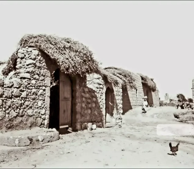
Photos from the village's people
Photos sent in by visitors and published after review.
Add a photo of this village
Log in to add photos of this village.
Other villages from Jenin
More from the archive
 Download Our Palestine App
The whole archive in the palm of your hand: depopulated villages, the Nakba, the massacres and Al-Aqsa — free, with no ads to erase the story.
Download Our Palestine App
The whole archive in the palm of your hand: depopulated villages, the Nakba, the massacres and Al-Aqsa — free, with no ads to erase the story.



Comments
No comments yet — be the first to write one.
Add your comment
Name and email are optional. Comments appear after review.