
The depopulated village of 'Ayn al-Mansi / District of Jenin

'Ayn al-Mansi
About the depopulated village of 'Ayn al-Mansi
- District
- Jenin
- Date 'Ayn al-Mansi was occupied
- 12 April 1948
- Population in 1948
- 104
- Military operation
- The Battle of Mishmar ha-'Emeq
- Brigade that carried it out
- Palmach
- Who defended the village
- Local militia & Arab Liberation Army
- Distance from the governorate centre
- 18.5 (km) Northwest of Jinin
- Elevation above sea level
- 125 m
- Cause of displacement
- Military assault by Zionist troops
- Extent of destruction
- 'Ayn al-Mansi was completely obliterated and defaced soon after occupation.
- Ethnic cleansing
- 'Ayn al-Mansi inhabitants were completely ethnically cleansed.
- Settlements built on the built-up area of 'Ayn al-Mansi after 1948
- Midrakh Oz
Hover a dot to read the village name, or click to open its card.
Borders of the depopulated village of 'Ayn al-Mansi
'Ayn al-Mansi – Depopulated Palestinian Village of the Jenin District
'Ayn al-Mansi was a small depopulated Palestinian village in the Jenin District, classified as a hamlet by the Palestine Index Gazetteer. It stood on the southwestern edge of the level Marj Ibn 'Amir plain, approximately 18.5 kilometers northwest of Jenin, at an average elevation of about 125 meters above sea level.
Palmach units occupied 'Ayn al-Mansi on the night of 12–13 April 1948 during the Haganah counteroffensive against Palestinian villages surrounding Mishmar HaEmek. Its inhabitants were displaced during the Nakba and the 1948 occupation of Palestine, and the village houses were blown up during the days following its capture.
Location and Geography
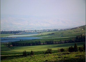
'Ayn al-Mansi stood on the southwestern side of the level Marj Ibn 'Amir plain. A short secondary road connected the hamlet with the main Jenin–Haifa highway, which passed to its northeast.
The village lay approximately 18.5 kilometers northwest of Jenin and had an average elevation of about 125 meters above sea level.
It stood extremely close to al-Mansi in the Haifa District. Walid Khalidi notes that the larger village of al-Mansi was less than half a kilometer northwest of 'Ayn al-Mansi and that the two settlements may have been connected in some way.
Nearby localities included al-Naghnaghiyya, al-Mansi, al-Lajjun, Khirbat Lid, and the archaeological site of Tall al-Mutasallim.
'Ayn al-Mansi and al-Mansi
A clear distinction must be maintained between 'Ayn al-Mansi in the Jenin District and al-Mansi in the Haifa District. Despite their very close proximity, they were separate administrative and statistical units under the British Mandate.
'Ayn al-Mansi had only 90 inhabitants in 1945 and a total land area of 1,295 dunams, while al-Mansi in the Haifa District was a much larger village in both population and land area.
Information about the elementary school, mosque, grain mill, and numerous springs documented for al-Mansi should therefore not be transferred to 'Ayn al-Mansi without independent evidence.
Population and Houses
'Ayn al-Mansi was a very small settlement. The 1931 census recorded 73 inhabitants living in 15 houses. By 1945 the population had increased to 90.
- 193173Official British Mandate census
- 194590Official statistics
- 1948About 104Later estimate, not an official British census
- 1998About 641 refugees and descendantsLater demographic estimate published by Palestine Remembered
The official 1931 census recorded 15 houses. Palestine Remembered gives a later estimate of approximately 21 houses for 1948, which should not be presented as an official census figure.
Built Environment
The built-up area of 'Ayn al-Mansi was extremely small. Only about two dunams were classified as built-up in the 1944/45 official statistics.
The principal sources reviewed do not provide a sufficiently detailed description of the construction materials or internal layout of the hamlet. Architectural details belonging to neighboring al-Mansi have therefore not been transferred to this village.
Education, Religious Sites, and Water
Walid Khalidi's entry for 'Ayn al-Mansi and the official statistical sources reviewed do not document an independent school, mosque, or shrine in the village.
They likewise do not provide securely documented names of wells or springs specifically used by the inhabitants of 'Ayn al-Mansi. Although neighboring al-Mansi in the Haifa District had numerous documented springs, those water-source names cannot be reassigned to 'Ayn al-Mansi without village-specific evidence.
These details are therefore left unspecified rather than reconstructed through inference.
Economic Life and Agriculture
Agriculture was the principal basis of the local economy, benefiting from the village's location on the fertile Marj Ibn 'Amir plain.
In 1944/45, 868 dunams were devoted to cereals and 186 dunams were classified as plantations or irrigable land.
The total cultivable or cultivated area was therefore 1,054 dunams, approximately 81 percent of the village's total land area.
Palestine Remembered separately gives a figure of 200 dunams for olive groves. Because the date and statistical relationship of this figure to the official 186-dunam plantation category are not sufficiently clear, and because it cannot be added to the balanced official table, it is not treated as a separate land-use category here.
Land Ownership, 1944/45
The total land area of 'Ayn al-Mansi was 1,295 dunams. Under the official Government of Palestine classification, ownership was distributed as follows:
- Arab1,278 dunums99%
- Jewish0 dunums0%
- Public17 dunums1%
Using Palestine Remembered's simplified terminology, the same figures would be presented as 1,278 dunams “Palestinian,” 0 dunams “Transferred to Zionists,” and 17 dunams “Communal/Public.” The source's terminology should be preserved and should not be confused with the categories of the official Government of Palestine table.
Land Use, 1944/45
- Arab
- Public
- Cereals868 dunums
- Plantations and irrigable land186 dunums
- Total cultivable/cultivated land1,054 dunums
- Non-cultivable land239 dunums
- Built-up land2 dunums
- Total non-cultivable and built-up241 dunums
The official table balances exactly: 1,054 dunams of cultivable or cultivated land plus 241 dunams of non-cultivable and built-up land equal the village's total area of 1,295 dunams.
Tall al-Mutasallim
Approximately one kilometer from 'Ayn al-Mansi stood Tall al-Mutasallim, an important archaeological site in the Marj Ibn 'Amir region.
The University of Chicago conducted major archaeological excavations there between 1925 and 1939. It is mentioned here as a nearby archaeological site; the principal village source does not establish that the entire tell formed part of the residential core of 'Ayn al-Mansi.
The Battle of Mishmar HaEmek
The Battle of Mishmar HaEmek began on 4 April 1948 when the Arab Liberation Army attacked the settlement of Mishmar HaEmek in the Marj Ibn 'Amir area.
After the initial attack stalled, a truce was proposed through British mediation. Haganah commanders rejected the proposal and instead launched a broad counteroffensive against surrounding Palestinian villages, with the stated aim of occupying and destroying them.
During the night of 8–9 April, Zionist forces began taking nearby villages, and the offensive widened over the following days. By 12 April, Palmach forces had already occupied several villages around Mishmar HaEmek, with further captures continuing into mid-April.
It is therefore more precise to describe the fall of 'Ayn al-Mansi as part of the Haganah counteroffensive following the Battle of Mishmar HaEmek rather than necessarily treating “Mishmar HaEmek” as a formally named operation equivalent to operations such as Yiftach or Hiram.
Occupation and Depopulation
'Ayn al-Mansi fell to Palmach units on the night of 12–13 April 1948 during the expansion of the counteroffensive into the Palestinian villages of Marj Ibn 'Amir.
Walid Khalidi, citing the History of the Haganah through his own account, states that the fall of 'Ayn al-Mansi together with neighboring al-Naghnaghiyya accelerated the withdrawal of the Arab Liberation Army from the area.
The village-specific sources do not provide a detailed reconstruction of every family's route of displacement, but they clearly associate the depopulation of the village with the military assault that resulted in its occupation.
Military Unit
Walid Khalidi identifies the force that occupied 'Ayn al-Mansi as Palmach units.
Members of the Palmach's First Battalion, together with Carmeli and Alexandroni Brigade forces, participated at different stages of the wider Mishmar HaEmek counteroffensive. However, the 'Ayn al-Mansi entry itself does not identify a particular battalion as the force that entered the village.
The village-level unit is therefore given as the Palmach without assigning the capture to a specific battalion for which there is no direct village-specific documentation.
Occupation Chronology
- 4 April 1948
Beginning of the Battle of Mishmar HaEmek
The Arab Liberation Army attacked Mishmar HaEmek in the Marj Ibn 'Amir area.
- 8–9 April 1948
Beginning of the Haganah counteroffensive
Following the rejection of a proposed truce, Haganah and Palmach forces began a broad counteroffensive against surrounding Palestinian villages.
- 9–12 April 1948
Expansion of village occupations
Several local villages were captured as the offensive and destruction campaign spread through the area.
- Night of 12–13 April 1948
Occupation of 'Ayn al-Mansi
The village fell to Palmach units.
- After the fall of 'Ayn al-Mansi and al-Naghnaghiyya
Arab Liberation Army withdrawal
Khalidi records that the capture of the two villages accelerated the Arab Liberation Army's withdrawal from the area.
- Days following the occupation
Demolition of the village
'Ayn al-Mansi was completely destroyed, and its houses were blown up after the village had been occupied.
Israeli Settlements on Village Lands
According to Walid Khalidi and PalQuest, no Israeli settlement was established on the lands of 'Ayn al-Mansi itself.
Midrakh Oz, established in 1952 approximately two kilometers west of the 'Ayn al-Mansi site, was built on land belonging to al-Mansi in the Haifa District, not on the lands of 'Ayn al-Mansi in the Jenin District.
This distinction is important because some secondary sources conflate the two neighboring villages and incorrectly attribute Midrakh Oz to 'Ayn al-Mansi.
'Ayn al-Mansi Today
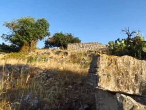
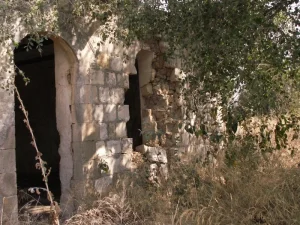
According to the field description published in Walid Khalidi's All That Remains, 'Ayn al-Mansi was completely destroyed and its structures were levelled.
During the early years after the Nakba, a temporary camp for Jewish immigrants was established at the site. After the camp was dismantled, a dense fir forest was planted over its location, and remnants of the camp could still be seen among the trees when the site was surveyed.
Remains of the village cemetery survived in the northern part of the site, covered by wild grass and thorns. A gasoline station had been built on the cemetery's eastern side, while almond, fig, and olive trees grew to its north and west.
This description should not be treated as a comprehensive field verification of the site in 2026. The fieldwork for All That Remains was conducted between 1987 and 1990, so it records the condition of the site during that survey period unless supplemented by more recent Palestinian field documentation.
Sources
- PalQuest – Interactive Encyclopedia of the Palestine Question: 'Ayn al-Mansi.
- PalQuest – Abu Shusha, Haifa District; for the wider context of the Battle of Mishmar HaEmek and the counteroffensive.
- Palestine Remembered – 'Ayn al-Mansi, Jenin District.
- Walid Khalidi, All That Remains.
- Government of Palestine, Village Statistics 1944/45.
- Palestinian Villages Encyclopedia – 'Ayn al-Mansi; supporting Palestinian local documentation.
Photo gallery

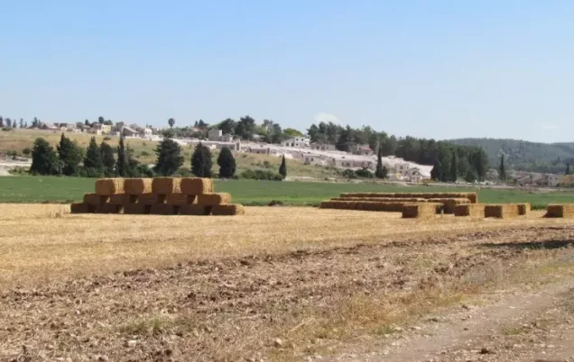
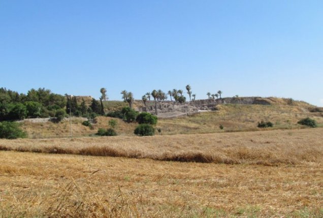
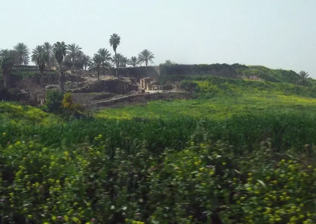
Photos from the village's people
Photos sent in by visitors and published after review.
Add a photo of this village
Log in to add photos of this village.
Other villages from Jenin
More from the archive
 Download Our Palestine App
The whole archive in the palm of your hand: depopulated villages, the Nakba, the massacres and Al-Aqsa — free, with no ads to erase the story.
Download Our Palestine App
The whole archive in the palm of your hand: depopulated villages, the Nakba, the massacres and Al-Aqsa — free, with no ads to erase the story.



Comments
No comments yet — be the first to write one.
Add your comment
Name and email are optional. Comments appear after review.