
The depopulated village of Zir'in / District of Jenin
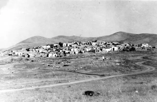
About the depopulated village of Zir'in
- District
- Jenin
- Date Zir'in was occupied
- 28 May 1948
- Population in 1948
- 1,650
- Military operation
- Operation Gideon
- Who defended the village
- Iraqi army units and some Palestinian and some ALA volunteers.
- Distance from the governorate centre
- 11 (km) North of Jinin
- Elevation above sea level
- 100 m
- Cause of displacement
- Military assault by Zionist troops
- Extent of destruction
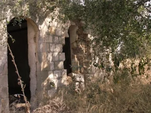
- Zir'in was mostly destroyed with the exception of one deserted village house.
- Ethnic cleansing
- Zir'in inhabitants were completely ethnically cleansed.
- Settlements built on the built-up area of Zir'in after 1948
- Yizrael, Avital, Yael, part of Firzon, part of Mitav
Hover a dot to read the village name, or click to open its card.
Borders of the depopulated village of Zir'in
Zir'in: A Depopulated Palestinian Village in the Jenin District
Zir'in was a Palestinian village in the Jenin District. Its population stood at 1,420 according to the official 1945 statistics, while its population in 1948 was estimated at approximately 1,647. Zionist forces occupied the village on 28 May 1948 during the Nakba and the occupation of Palestine in 1948. Its inhabitants were displaced, and most of its buildings were subsequently destroyed.
- Subdistrict
- Jenin
- Distance from district center
- 11 km North of Jinin
- Average Elevation
- 100 meters above sea level
- Population in 1931
- 978 inhabitants - Official Government of Palestine census
- Population in 1944/1945
- 1,420 inhabitants - Official Government of Palestine statistics
- Estimated Population in 1948
- 1,647 inhabitants - a later demographic estimate, not an official census
- Total Land Area in 1945
- 23,920 dunams
- Attack and Depopulation
- Earlier Attempts to Occupy the Village Zir'in and Nuris came under attempted attacks during March 1948. According to the account reproduced by Walid Khalidi, the Palmach command issued an order on 19 April 1948 calling for most of Zir'in's houses to be destroyed after its occupation, while leaving several buildings intact for accommodation and defensive purposes.
- Final Israeli Control
- 28 May 1948
- Military Operation
- Gideon
- Military Unit
- Golani Brigade's Fourth Battalion
- Cause of Depopulation
- Military assault by Zionist troops
- Settlements Documented on Village Lands
- Yizrael, Avital, Yael, part of Firzon, part of Mitav
Location and Geography
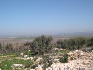
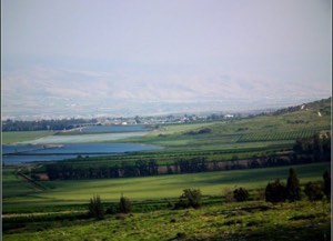
Zir'in was located approximately 11 kilometres north of the city of Jenin, at an elevation of about 100 metres above sea level. The village stood on a small plateau projecting from the Faqqu'a Mountains. The plateau rose only slightly above the Marj Ibn Amir plain, which surrounded it on its western and southern sides, while its northern and eastern sides sloped towards Wadi al-Jalud.
Zir'in was the northernmost village in the Jenin District. It stood on a secondary road connecting two main roads: one leading to Jenin and the other running southeast towards Baysan. The village lands covered 23,920 dunams, of which approximately 81 dunams formed the built-up area.
Name and Historical Background
Zir'in was built on a site associated with the ancient town of Yizre'el. Both the names Yizre'el and Zir'in contain a linguistic meaning related to sowing and cultivation. Crusader sources called the village “Le Petit Gerin” to distinguish it from Jenin, which they called “Le Grand Gerin.”
The decisive Battle of Ayn Jalut took place near the village in 1260. In that battle, Muslim forces led by al-Zahir Baybars defeated the Mongols. The spring known as Ayn Jalut, or Ayn Jalud, was located between Zir'in and the neighbouring village of Nuris.
Ottoman tax records from 1596 recorded 22 households or taxable units in Zir'in. The village was then part of the nahiya of Jenin in the liwa of Lajjun. Its residents paid taxes on wheat, barley, goats, beehives and other agricultural products and properties.
The Village before the Nakba
Buildings and Water Sources
In the late nineteenth century, Zir'in consisted of approximately 20 to 30 houses. One of the village's most prominent families lived in a tall building in the centre of the village that resembled a tower. The residents obtained water from a well and a spring. One of the local springs was known as Ayn al-Mayta.
Most of the houses were built of mud and stood close together, separated by narrow alleys. Construction expanded during the British Mandate, and many of the existing houses were improved.
Religious and Educational Landmarks
The centre of Zir'in contained a mosque whose renovation is attributed to al-Zahir Baybars. The village also had a small market and a cemetery. A primary school for boys was established during the Ottoman period and remained in operation until the village was occupied in 1948.
Economic Life
Agriculture was the principal source of livelihood. The villagers cultivated grain, vegetables and fruit, irrigating some crops with water from wells and springs. According to the Government of Palestine's 1945 statistics, 20,964 dunams of Arab-owned land were allocated to cereal cultivation.
Notable People
Zir'in was the home village of Mahmud Salim, identified in the sources as one of the leaders of the Great Palestinian Revolt that began in 1936.
Land Ownership in 1945
Ownership of Zir'in's land in dunams according to the Government of Palestine's village statistics
- Palestinian Arab ownership22,034 dunums92%
- Jewish ownership1,711 dunums7%
- Public land175 dunums<1%
Land Use in 1945
Use of Zir'in's land in dunams according to the published village statistics
- Arab-owned land
- Jewish-owned land
- Planted with cereals22,597 dunums
- Built-up area81 dunums
- Arable land22,597 dunums
- Non-arable land1,242 dunums
“Land planted with cereals” and “arable land” are separate classifications reproduced from the source table. Although their figures are identical for Zir'in, they must not be added together as separate areas.
Population
The Government of Palestine's 1922 census recorded 722 inhabitants in Zir'in. The population increased to 978 in the 1931 census. All were recorded as Muslim Arabs and lived in 239 houses.
The official population figure for 1945 was 1,420. The figure of 1,647 for 1948 is a demographic estimate rather than a new official census. The number of refugees originating from Zir'in and their descendants was estimated at approximately 10,116 in 1998.
| Year | Recorded number | Nature of figure |
|---|---|---|
| 1596 | 22 | Households or taxable units, not individual inhabitants |
| 1922 | 722 inhabitants | Official Government of Palestine census |
| 1931 | 978 inhabitants | Official Government of Palestine census |
| 1945 | 1,420 inhabitants | Official Government of Palestine statistics |
| 1948 | 1,647 inhabitants | Demographic estimate |
| 1998 | 10,116 people | Estimate of the village's refugees and their descendants |
| Official census figures must be distinguished from later demographic estimates. | ||
Archaeological Remains
Archaeological remains at Zir'in included a vaulted structure, a medieval church, the foundations of earlier buildings, caves, cisterns and grape presses. In 1990, Tel Aviv University and the British Institute of Archaeology in Jerusalem began a joint excavation programme at the site that was planned to continue for five years.
The Occupation of Zir'in and the Displacement of Its People
Earlier Attempts to Occupy the Village
Zir'in and Nuris came under attempted attacks during March 1948. According to the account reproduced by Walid Khalidi, the Palmach command issued an order on 19 April 1948 calling for most of Zir'in's houses to be destroyed after its occupation, while leaving several buildings intact for accommodation and defensive purposes.
Date of Occupation and Attacking Unit
The Fourth Battalion of the Golani Brigade occupied Zir'in on 28 May 1948. The same battalion also occupied the neighbouring village of Nuris. Zir'in was occupied after the capture of the Baysan Valley and in preparation for the attack on Jenin.
The Palestine Remembered database classifies the occupation of Zir'in as part of Operation Gideon. The detailed narrative derived from All That Remains confirms the date, battalion and brigade, but does not explicitly name the operation in its narrative passage.
Displacement and Attempts to Retake the Village
The military assault resulted in the displacement of Zir'in's inhabitants and the complete depopulation of the village. The reviewed sources do not provide a comprehensive and verifiable account of the destinations reached by all the displaced residents; therefore, no single destination can be stated as established fact.
Walid Khalidi's account reports that Arab forces launched a counterattack two days after the village was occupied. Iraqi forces attempted to retake Zir'in on 10 July, followed by another attack on 19 July 1948. These attempts were unsuccessful, and the armistice line was later established south of the village.
Fate of the Buildings
Most of Zir'in's buildings were destroyed after its occupation. According to Khalidi's description, only one dilapidated building remained, together with piles of stones, traces of former structures and one of the village wells.
Occupation and Depopulation Chronology
- March 1948
Earlier Attempts to Occupy the Village
Zir'in and Nuris came under attempted attacks during March 1948. According to the account reproduced by Walid Khalidi, the Palmach command issued an order on 19 April 1948 calling for most of Zir'in's houses to be destroyed after its occupation, while leaving several buildings intact for accommodation and defensive purposes.
- 28 May 1948
Date of Occupation and Attacking Unit
The Fourth Battalion of the Golani Brigade occupied Zir'in on 28 May 1948. The same battalion also occupied the neighbouring village of Nuris.
- 19 July 1948
Displacement and Attempts to Retake the Village
The military assault resulted in the displacement of Zir'in's inhabitants and the complete depopulation of the village. The reviewed sources do not provide a comprehensive and verifiable account of the destinations reached by all the displaced residents; therefore, no single destination can be stated as established fact.
Settlements Established on Zir'in's Land
- Yizre'el: established in 1948 northwest of the village site.
- Avital: established in 1933 on land traditionally considered part of Zir'in's territory. It was therefore not established after the village's depopulation during the Nakba.
The Village Site after Its Destruction
According to the field description recorded by Walid Khalidi in All That Remains, wild grass, thorns and cactuses covered the site. Piles of stones, one dilapidated building and a standing well remained visible. Cactuses and pomegranate trees grew around the outskirts, while parts of the surrounding hilly land were used for grazing and the slopes were cultivated.
An Israeli memorial surrounded by trees was also established at the site. This description reflects the condition of the village when documented for Khalidi's reference work and should not be interpreted as a current field survey.
Sources and References
- Palestine Remembered: Zir'in, Jenin District
- Walid Khalidi, All That Remains: The Palestinian Villages Occupied and Depopulated by Israel in 1948 , Institute for Palestine Studies, Washington, D.C., 1992, entry on Zir'in.
- Institute for Palestine Studies: Books and Publications
- Government of Palestine, Palestine Census of 1922.
- Government of Palestine, Census of Palestine 1931, edited by E. Mills, Jerusalem, 1932.
- Government of Palestine: Village Statistics, April 1945
- Mustafa Murad al-Dabbagh, Biladuna Filastin, Part III, Section II, pp. 203–204.
- Wolf-Dieter Hütteroth and Kamal Abdulfattah, Historical Geography of Palestine, Transjordan and Southern Syria in the Late 16th Century , entry concerning Zir'in.
- Interactive Encyclopedia of the Palestine Question — PalQuest
Photo gallery


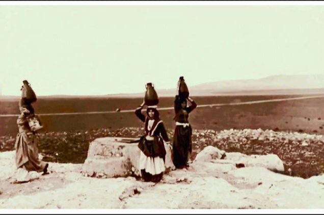
Photos from the village's people
Photos sent in by visitors and published after review.
Add a photo of this village
Log in to add photos of this village.
Other villages from Jenin
More from the archive
 Download Our Palestine App
The whole archive in the palm of your hand: depopulated villages, the Nakba, the massacres and Al-Aqsa — free, with no ads to erase the story.
Download Our Palestine App
The whole archive in the palm of your hand: depopulated villages, the Nakba, the massacres and Al-Aqsa — free, with no ads to erase the story.



Comments
No comments yet — be the first to write one.
Add your comment
Name and email are optional. Comments appear after review.