
The depopulated village of Khirbet al-Manshiyya / District of Tulkarm
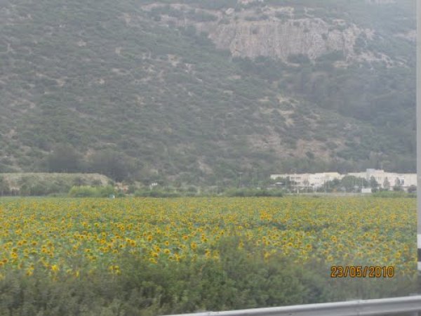
Khirbet al-Manshiyya
About the depopulated village of Khirbet al-Manshiyya
- District
- Tulkarm
- Date Khirbet al-Manshiyya was occupied
- 15 April 1948
- Population in 1948
- 300
- Military operation
- Coastal Clearing
- Distance from the governorate centre
- 12.5 (km) Northwest of Tulkarm
- Elevation above sea level
- 25 m
- Cause of displacement
- Fear of Jewish attack, or of being caught in the fighting
- Extent of destruction
- Soon after occupation, al-Manshiyya was completely obliterated, and only house rubble left behind.
- Ethnic cleansing
- Based on alleged security concerns, the Jewish National Fund encouraged the Hanaganh to ethnically cleanse the area.
Hover a dot to read the village name, or click to open its card.
Borders of the depopulated village of Khirbet al-Manshiyya
Al-Manshiyya – Depopulated Palestinian Village of the Tulkarm District
Al-Manshiyya, also known as Khirbat Manshiyya, was a depopulated Palestinian village in the Tulkarm District. It stood on a low, gradually sloping hill in the middle of a broad plain approximately 12.5 kilometers northwest of Tulkarm, at an average elevation of about 25 meters above sea level.
The village lay close to the administrative boundary between the Tulkarm and Haifa subdistricts and approximately 3 kilometers east of the main coastal highway. Its inhabitants depended primarily on agriculture, especially grain cultivation, and obtained drinking and irrigation water from several nearby wells.
The villagers left al-Manshiyya on or about 15 April 1948 amid the pressure and fear created by the Haganah's campaign to empty Arab communities from the coastal region. Although an agreement was reportedly reached under which neighboring Jewish settlements would protect village property and permit the inhabitants to return after the war, Haganah units began systematically demolishing the village houses before the end of April.
Location and Geography
Al-Manshiyya stood on a low, gradually sloping hill in a broad plain in the northwestern part of the Tulkarm Subdistrict.
It lay approximately 12.5 kilometers northwest of Tulkarm at an average elevation of about 25 meters above sea level.
The village was close to the administrative boundary between the Tulkarm and Haifa subdistricts and approximately 3 kilometers east of the main coastal highway.
A secondary road connected al-Manshiyya with the coastal highway, while similar roads linked it with neighboring villages.
The road toward Qaqun ran south from the village, and some houses were built parallel to it.
Name and Origin of the Inhabitants
The village appears in the sources as al-Manshiyya and is also known as Khirbat Manshiyya.
Walid Khalidi does not provide a specific linguistic explanation for the name.
The villagers themselves traced their origins to 'Abasan in the Gaza District.
Built Environment
Al-Manshiyya had a generally rectangular layout.
Some houses extended along the road leading south toward Qaqun, while the remainder formed the main village cluster on the low hill.
The official PalQuest land-use display does not provide a reliable separate built-up acreage, so no unsupported figure is added.
Population
The inhabitants of al-Manshiyya were Muslims.
| Year | Population | Note |
|---|---|---|
| 1922 | 94 | Official Census of Palestine: 50 males and 44 females, all Muslims |
| 1931 | Not available separately | Al-Manshiyya was enumerated together with 'Attil, al-Jalama, and Zalafa, so no secure village-specific figure is available |
| 1945 | 260 | Official statistics; all inhabitants were Palestinian Arab Muslims |
| 1948 | About 302 | Later demographic estimate, not an official Mandate census |
| 1998 | About 1,852 refugees and descendants | Later estimate published by Palestine Remembered |
In the 1931 census, al-Manshiyya was grouped with 'Attil, al-Jalama, and Zalafa in a single statistical unit totaling 2,207 persons living in 473 houses.
Neither the combined population nor the combined house count should be assigned to al-Manshiyya alone.
Education and Religious Institutions
Walid Khalidi and PalQuest do not provide clear documentation of an independent school or a specifically identified mosque in al-Manshiyya before the Nakba.
No specific educational or religious institution is therefore attributed to the village without stronger village-level Palestinian documentation.
Water Resources
The inhabitants obtained drinking and irrigation water from several wells surrounding the village site.
These wells supported limited irrigated cultivation, while grain farming remained the dominant agricultural activity.
Economic Life and Agriculture
Agriculture formed the foundation of al-Manshiyya's economy.
Grain was the principal crop, while villagers also cultivated watermelons and other fruits.
Only very small areas were devoted to citrus, bananas, plantations, and irrigated cultivation in 1944/45, while cereals occupied the overwhelming majority of cultivated land.
Wooded areas extended west and south of the village.
Land Ownership, 1944/45
The total land area of al-Manshiyya was 16,770 dunams.
- Arab12,520 dunums75%
- Jewish3,835 dunums23%
- Public415 dunums2%
The official figures balance exactly: 12,520 + 3,835 + 415 = 16,770 dunams.
Palestine Remembered presents the same figures using its own terminology: 12,520 dunams “Palestinian,” 3,835 dunams “Transferred to Zionists,” and 415 dunams “Communal/Public.”
The wording “Transferred to Zionists” should be preserved when reproducing that source's classification rather than automatically replacing it with the official “Jewish” category.
Land Use, 1944/45
- Arab
- Jewish
- Public
- Citrus and bananas88 dunums
- Plantations and irrigable land40 dunums
- Cereals16,205 dunums
- Total cultivable/cultivated land16,333 dunums
- Non-cultivable land437 dunums
The official table balances exactly: 16,333 dunams of cultivated or cultivable land plus 437 dunams of non-cultivable land equal the total village area of 16,770 dunams.
Palestine Remembered's simplified display lists the entire 437-dunam non-arable category under its Palestinian column. The official table shows that only 22 dunams were Arab land, while 415 were Public.
Public land is therefore kept separate above.
Conditions before Depopulation
Al-Manshiyya lay in a coastal region where pressure on Palestinian communities increased rapidly during the spring of 1948.
Walid Khalidi, citing Benny Morris, records that on 13 April 1948 Haganah leader Israel Galili wrote to the Jewish National Fund stressing the security importance of establishing settlements at several sites on Haganah-controlled territory, including al-Manshiyya.
This indicates that the future settlement of the village site was already under discussion before the population had completely departed.
Depopulation of Al-Manshiyya
On or about 15 April 1948, the inhabitants of al-Manshiyya left their village and moved eastward.
Khalidi, citing Morris, reproduces the later account of a local Haganah intelligence officer who claimed that he had urged the villagers to remain and accept Haganah protection.
According to the same account, an agreement was reached as they departed under which neighboring Jewish settlements would safeguard their property and permit them to return after the war.
The agreement should not be understood as a guarantee that was subsequently honored, because developments later in April moved in the opposite direction.
Destruction and Prevention of Return
By the end of April 1948, Haganah units had begun systematically demolishing the houses of al-Manshiyya with assistance from neighboring Jewish settlements.
Khalidi records that the Haganah General Staff had decided that the coastal zone stretching from Tel Aviv to Hadera should be emptied of its Arab inhabitants by 15 May.
The villagers' departure therefore did not preserve their homes or facilitate their return; it was followed by demolition of the village and the permanent prevention of return.
“Coastal Clearing” – A Formal Operation?
Palestine Remembered and several later indexes classify al-Manshiyya under the label “Coastal Clearing.”
Khalidi's village-specific narrative, however, does not identify a formally named military operation at al-Manshiyya with a defined starting date, ending date, and village-specific assault force.
What the source securely documents is a broader Haganah policy and campaign to empty the Arab population from the coastal region before 15 May.
“Coastal Clearing” is therefore retained here as an indexing label for the wider campaign rather than presented as a securely documented village-specific military operation.
Military Unit
The military organization securely documented in the principal sources is the Haganah.
The al-Manshiyya entry does not identify a particular brigade or battalion as having stormed the village on 15 April, nor does it describe a major direct battle on that date.
The subsequent demolition at the end of April is attributed to Haganah units assisted by neighboring Jewish settlements.
Al-Manshiyya should therefore not be assigned to the Alexandroni Brigade or any specific battalion without explicit village-level evidence.
Occupation and Depopulation Chronology
- Spring 1948
Increasing Haganah pressure in the coastal region
A broader policy developed to empty Arab communities from the coastal zone between Tel Aviv and Hadera.
- 13 April 1948
Settlement planning for the site
Khalidi, citing Morris, records that Israel Galili stressed the security importance of establishing a settlement at al-Manshiyya.
- About 15 April 1948
Depopulation
The villagers moved eastward; an agreement was reportedly reached to protect their property and allow their return after the war.
- April 1948
Effective Haganah control
The site passed into Haganah control after the villagers left; the source does not describe a separate major battle.
- By the end of April 1948
Systematic demolition
Haganah units began demolishing the village houses with assistance from neighboring Jewish settlements.
- By 15 May 1948
Regional objective
The Haganah General Staff sought to leave the coastal zone from Tel Aviv to Hadera without Arab communities.
Israeli Settlements on Village Lands
Al-Manshiyya is notable because Jewish settlements had already been established on land traditionally regarded as belonging to the village before the Nakba.
En ha-Horesh was founded in 1931 on land traditionally considered part of al-Manshiyya.
Giv'at Chayyim was established in 1932, also on village land.
After the Nakba, Ahituv was established in 1951 on al-Manshiyya's land east of the village site.
Some Arabic versions of Palestine Remembered display 1915 as the founding year of Ahituv. PalQuest and Khalidi give 1951, which is the date used in this article.
Al-Manshiyya Today
According to the field description published in Walid Khalidi's All That Remains, a paved street bisected the former village site.
Giv'at Chayyim extended along both sides of the street, with a large cow barn at its southern end.
Cactuses grew near the former village entrance.
Stones taken from the demolished Palestinian houses were being used as borders for flower beds, particularly along the street.
The surrounding land was cultivated with cotton, pistachios, and fruit trees at the time of the survey.
This description should not be treated as a comprehensive field verification of conditions in 2026. Fieldwork for All That Remains was conducted between 1987 and 1990 and therefore records the site's condition during that survey period.
Sources
- PalQuest – Interactive Encyclopedia of the Palestine Question: al-Manshiyya, Tulkarm
- PalQuest – المنشية، قضاء طولكرم
- Palestine Remembered – al-Manshiyya, Tulkarm District
- Palestine Remembered – المنشية، قضاء طولكرم
- Palestinian Villages Encyclopedia – al-Manshiyya; supporting Palestinian documentation
- Government of Palestine – Census of Palestine 1922: Manshiyeh, 94 inhabitants
- Government of Palestine / PCBS – Census of Palestine 1931
- Birzeit University FADA – Census of Palestine 1931 archival copy
- Institute for Palestine Studies – Walid Khalidi, All That Remains
- PalQuest – All That Remains: Methodology and Fieldwork
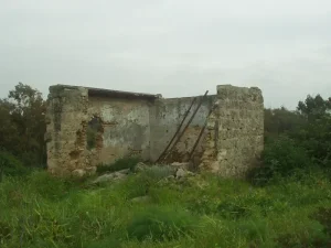
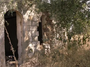
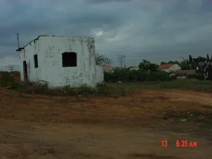
Photos from the village's people
Photos sent in by visitors and published after review.
Add a photo of this village
Log in to add photos of this village.
Other villages from Tulkarm
More from the archive
 Download Our Palestine App
The whole archive in the palm of your hand: depopulated villages, the Nakba, the massacres and Al-Aqsa — free, with no ads to erase the story.
Download Our Palestine App
The whole archive in the palm of your hand: depopulated villages, the Nakba, the massacres and Al-Aqsa — free, with no ads to erase the story.



Comments
No comments yet — be the first to write one.
Add your comment
Name and email are optional. Comments appear after review.