
The depopulated village of Tabsur (Khirbet 'Azzun) / District of Tulkarm
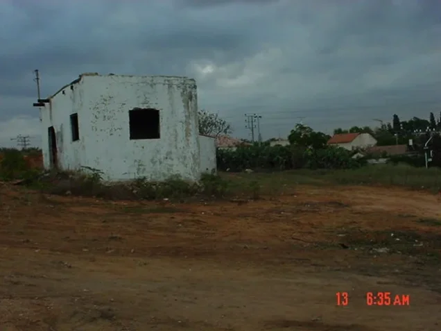
Tabsur (Khirbet 'Azzun)
About the depopulated village of Tabsur (Khirbet 'Azzun)
- District
- Tulkarm
- Date Tabsur (Khirbet 'Azzun) was occupied
- 03 April 1948
- Military operation
- Coastal Clearing
- Distance from the governorate centre
- 19 (km) Southwest of Tulkarm
- Elevation above sea level
- 50 m
- Cause of displacement
- Expulsion by Zionist troops
- Extent of destruction
- Tabsur was completely destroyed and defaced.
- Ethnic cleansing
- Tabsur inhabitants were mostly terrorized out of their homes on December 21st 1947.
- Settlements built on the built-up area of Tabsur (Khirbet 'Azzun) after 1948
- Kriat bin tsivi, kriat sharz, kriat golomb
Hover a dot to read the village name, or click to open its card.
Borders of the depopulated village of Tabsur (Khirbet 'Azzun)
Tabsur (Khirbat 'Azzun) – Tulkarm Subdistrict
Tabsur, also known as Khirbat 'Azzun, was a depopulated Palestinian village in the Tulkarm subdistrict. It stood on the coastal plain approximately 19 km southwest of Tulkarm at an average elevation of about 50 meters. Qalqilya lay about 8 km to the east and was connected to the village by a secondary road that crossed the main coastal highway.
The statistical land unit registered as Tabsur/Khirbat 'Azzun covered 5,328 dunums in 1944/45. The British Mandate censuses do not provide a clearly separable population count for Khirbat 'Azzun: its inhabitants were enumerated with the parent village of 'Azzun in the 1922 and 1931 censuses, while the population fields for Tabsar (Khirbat 'Azzun) were left blank in the 1945 Village Statistics.
The depopulation of the village occurred in stages. Most residents reportedly left on 21 December 1947 amid fear of attacks in the surrounding region. Some inhabitants remained into the spring of 1948; on 3 April, some of those remaining were expelled by order of the Haganah. A recent academic study indicates that the removal of the village's last inhabitants was completed on 16 April 1948.
Location of Tabsur
Tabsur stood on undulating land in the central coastal plain, in the southwestern part of the Tulkarm subdistrict. Its site was approximately 19 km from Tulkarm and about 8 km west of Qalqilya.
A secondary road connected the village with Qalqilya and intersected the main coastal highway nearby, integrating Tabsur into the transportation network of the coastal plain.
Palestine Remembered places Ghabat Miska, Miska, Ghabat al-'Ababisha, Kafr Saba, and the lands of Arab Abu Kishk in the surrounding geographical area. It also identifies the lands of Ghabat al-'Ababisha, Ghabat Miska, and Tira Bani Sa'b as adjoining or neighboring the village. Because historical landholdings in this part of the coastal plain were complex, these surrounding localities should not be converted into exact cadastral boundaries without consulting original land maps.
Tabsur and Khirbat 'Azzun: Name and Origins
The sources use the names Tabsur, Khirbat 'Azzun, and occasionally 'Azzun for the village. Khirbat 'Azzun in this context was the coastal-plain village and should not be confused with the surviving highland town of 'Azzun east of Qalqilya.
The modern history of Khirbat 'Azzun is linked to people from 'Azzun who moved down from the highlands to the coastal plain. The sources differ somewhat on chronology. Walid Khalidi states that Tabsur was built before the middle of the nineteenth century on an archaeological site. A recent academic study devoted specifically to Khirbat 'Azzun argues that settlers from 'Azzun established the modern community at the old Tabsur site in the late 1860s.
These accounts need not imply that the site itself was unoccupied or unknown before then. Archaeological remains attest to an older settlement history. The safest distinction is therefore between the antiquity of the site and the formation of the modern village of Khirbat 'Azzun.
Tabsur in the Late Nineteenth Century
In the late nineteenth century, Tabsur was described as a moderately sized hamlet or agricultural settlement with a well at its northern end. As the village developed, its built-up area took a broadly rectangular form, and its houses were constructed of mud and cement.
During the British Mandate, the residents established an elementary school for boys. The village also contained several small shops, while wells around the settlement supplied drinking water.
Population of Tabsur
Population figures for Tabsur require particular caution because of the way Khirbat 'Azzun was recorded in official statistics.
| Year | Figure | Nature of figure / Notes |
|---|---|---|
| 1922 | No verified separate figure | Khirbat 'Azzun's residents were enumerated with 'Azzun in the official census |
| 1931 | No verified separate figure | The figure of 994 often attributed to Tabsur is the 'Azzun census entry, which included Khirbat 'Azzun; it is not a separate village count |
| c. 1941 | About 300 | Research estimate reported in a recent academic study; not an official Government of Palestine census |
| 1945 | No separate population entered | Tabsar (Khirbat 'Azzun) appears in Village Statistics, but its population columns are blank |
| 1998 | 2,406 refugees and descendants | Later estimate published by Palestine Remembered; not an official census |
The frequently repeated figure of 994 should therefore not be presented as the population of Tabsur alone in 1931, nor should it be described as an independent official population base for the village.
Number of Houses
Some sources give 218 houses for 1931. This number comes from the same official 'Azzun census entry that included the inhabitants of Khirbat 'Azzun and cannot be treated as a separately enumerated total for Tabsur itself.
The official sources reviewed do not provide a securely separable house count for Tabsur alone in either 1931 or 1948. No estimated total has therefore been substituted for the missing official figure.
Land Ownership
The lands registered under Tabsur/Khirbat 'Azzun totaled 5,328 dunums in the 1944/45 statistics. Palestine Remembered presents the ownership categories as follows:
- Palestinian2,348 dunums44%
- Transferred to Zionists2,807 dunums53%
- Communal/Public173 dunums3%
The official Village Statistics use the original categories Arab, Jewish, and Public, recording 2,348 Arab dunums, 2,807 Jewish dunums, and 173 Public dunums, for the same total of 5,328.
Land Use in 1944/45
The published digital presentations of Tabsur's land-use table contain an important alignment or display problem. PalQuest currently displays only 2,718 dunums as cultivable and 197 dunums as built-up or non-cultivable, leaving 2,413 dunums of the registered village area unaccounted for.
Comparison of the ownership totals with the digitized Village Statistics tables shows that a 2,413-dunum citrus-and-banana entry has been displaced in the digital table extraction. Restoring it produces a fully balanced table:
- Arab
- Jewish
- Public
- Citrus and bananas2,413 dunums
- Plantations and irrigable land24 dunums
- Cereals2,694 dunums
- Built-up land29 dunums
- Non-cultivable land168 dunums
The corrected totals agree exactly with the official ownership table. This arithmetic check is essential because reproducing the current PalQuest or Palestine Remembered land-use display without verification would leave almost half of the registered village area unaccounted for.
Economic Life in Tabsur
Agriculture was the principal basis of village life. Khalidi records cereals, legumes, watermelons, and cucumbers among the crops cultivated by the villagers, while the official land figures demonstrate the major importance of citrus cultivation in the village lands.
In the corrected land-use table, 722 dunums of citrus and bananas remained in the Arab category, while substantial citrus land was registered under Jewish ownership. Arab cultivators also held 1,602 dunums devoted to cereals.
A recent academic study of Khirbat 'Azzun describes improvements in agricultural methods during the later Mandate period and records citrus groves, a mechanized well, and a grocery shop. These details complement Khalidi's description of the village wells, shops, and agricultural economy.
Water
Tabsur's residents obtained drinking water from wells around the village site, especially a well at its northern end.
The wells also supported the agricultural economy of the coastal plain. Recent academic research records the use of a mechanized well in the village during the later Mandate period.
Education
During the British Mandate, the villagers established an elementary school for boys. Palestine Remembered likewise records a boys' school in Tabsur.
The principal sources reviewed do not provide a securely documented founding date or a verified student enrollment figure, and neither has therefore been supplied.
Social and Religious Life
Khalidi's village entry does not provide detailed information on religious buildings. A recent academic study devoted to Khirbat 'Azzun, however, records a mosque in the village during the later Mandate period, together with the school and several guest rooms or dawawin used for hospitality and communal purposes.
These details are included as supplementary academic evidence rather than as figures drawn from an official Mandate administrative register.
Archaeological Remains
Tabsur was built on an older archaeological site. Khalidi records the foundations of a former building, a well, fragments of a mosaic pavement, and tombs.
These remains demonstrate earlier occupation of the site, but the principal sources reviewed do not provide a detailed archaeological investigation sufficient to date or identify every remain with certainty.
The Beginning of Depopulation
Tabsur was among the Palestinian villages of the coastal plain whose population began leaving at an early stage of the 1948 conflict.
Walid Khalidi, citing Israeli historian Benny Morris, states that most of the villagers left as early as 21 December 1947 out of fear of Jewish attacks. Raids had occurred in the surrounding region during the preceding weeks, but Khalidi notes that no specific attack on Tabsur itself is recorded at that stage.
21 December should therefore be treated as the date of the principal early mass departure, rather than as a documented date of military occupation.
Expulsion of the Remaining Residents
Tabsur was not entirely empty after the December 1947 departure. Khalidi states that at least some residents remained for approximately three additional months.
On 3 April 1948, some of those still in the village were expelled by order of the Haganah during what Khalidi describes as the final “clearing” of that coastal area. He relays this information from an Israeli military intelligence report. The source does not identify a specific brigade or battalion as the unit that carried out the expulsion in Tabsur.
A recent academic study devoted to Khirbat 'Azzun documents a further stage and states that the village's last inhabitants were removed on 16 April 1948. The depopulation of Tabsur should therefore not be reduced to 3 April alone.
Occupation and Depopulation
Palestine Remembered gives 3 April 1948 as the village's “occupation date.” The detailed evidence, however, more clearly identifies that date with the expulsion of some of the remaining inhabitants by Haganah order.
The principal sources do not document a separate battle in which the village was stormed on that date, nor do they name a specific military formation that entered it. The more accurate chronology distinguishes between the large-scale departure beginning in December 1947, the expulsion on 3 April, and the removal of the last residents on 16 April according to the recent academic study.
Occupation Chronology
- 21 December 1947
Principal early mass departure
Most residents reportedly left because of fear of attacks in the surrounding area. No specific assault on Tabsur itself is documented for that date.
- December 1947 – spring 1948
Residents remain in the village
The evidence indicates that at least part of the population remained for approximately three more months.
- 3 April 1948
Expulsion of some remaining inhabitants
Some residents were expelled by Haganah order during the final “clearing” of the coastal area, according to an Israeli military intelligence report relayed by Khalidi.
- 16 April 1948
Removal of the last inhabitants
A recent academic study based on archival evidence reports that the last residents of Khirbat 'Azzun were removed on this date.
- Later; exact date not established by the core sources
Destruction of the village
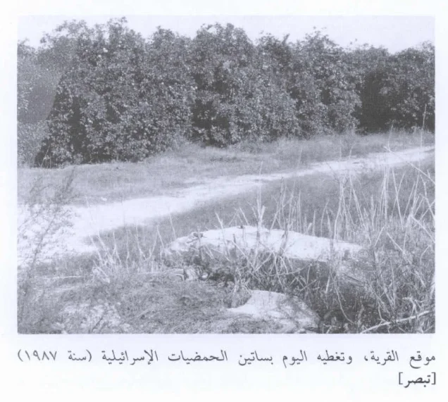
The village buildings subsequently disappeared and the site became covered by citrus orchards. The core sources do not establish one exact date for the demolition of all buildings.
Military Unit
The Haganah is the military organization that can be specifically documented in connection with the expulsion of the remaining residents. Khalidi states that the 3 April expulsion took place on Haganah orders.
The village-specific sources do not identify a particular brigade or battalion as carrying out the expulsion. It would therefore be inaccurate to assign Tabsur automatically to the Alexandroni Brigade or another formation simply because it operated elsewhere on the coastal plain.
The label “Coastal Clearing” used in the Palestine Remembered page header is treated here as a description of the policy or process of clearing the coastal area, rather than as a securely established formal operation name comparable to Operation Yiftach or Operation Hiram.
Refugees from Tabsur
Palestine Remembered gives a later estimate of approximately 2,406 refugees from Tabsur and their descendants in 1998. This is a later demographic estimate and not an official British Mandate statistic.
Because Tabsur did not receive a separately enumerated population figure in the 1922 or 1931 censuses, and because its population fields were blank in the 1945 Village Statistics, later demographic estimates should not be described as straightforward extensions of an independent official village census.
Israeli Settlements on Tabsur Village Lands
Two settlements are particularly relevant to the history of Tabsur's lands, but their geographical relationship to the village differed:
| Settlement | Established | Relationship to Tabsur |
|---|---|---|
| Ra'anana | 1921 | Originally established south of Tabsur, just beyond the Jaffa–Tulkarm subdistrict boundary; its later urban expansion extended onto parts of Tabsur's lands |
| Batzra | 1946 | Established directly on Tabsur village lands, north of the village site |
Ra'anana should therefore not be described as having originally been founded on Tabsur's land, whereas Batzra can clearly be identified as a pre-1948 settlement established on village land. Later expansion of Ra'anana subsequently incorporated portions of Tabsur's lands.
Tabsur Today
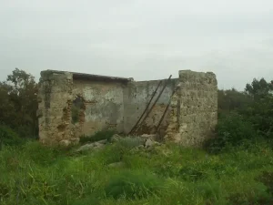
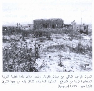
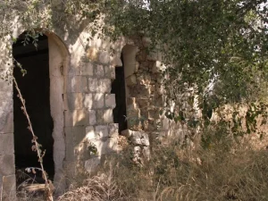
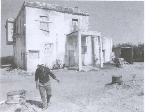
Walid Khalidi described the site of Tabsur as entirely covered by Israeli citrus orchards, making the former village site difficult to distinguish from the surrounding land. Citrus and cypress trees grew across village lands.
This description derives from the field research undertaken for All That Remains before the book's publication in 1992 and does not constitute direct field verification of conditions at the site in 2026.
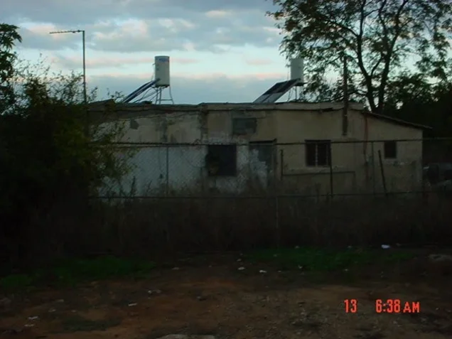
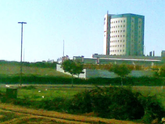
Palestine Remembered also hosts later community documentation, including a visit dated 2011, documentation of the cemetery from 2017, and later field material. Such records can help trace the continuing memory and surviving features of the village, but they do not constitute an independent comprehensive survey of all former village lands. Claims in community captions about the exact land status of individual modern buildings should therefore be independently verified before being treated as cadastral fact.
Sources
- PalQuestPalQuest – Tabsur
- Palestine RememberedPalestine Remembered – Tabsur (Khirbat 'Azzun), Tulkarm District
- Palestine RememberedPalestine Remembered – Tabsur entry from Walid Khalidi's All That Remains
- Institute for Palestine StudiesInstitute for Palestine Studies – Walid Khalidi, All That Remains
- sabil.meSami Hadawi – Village Statistics 1945: A Classification of Land and Area Ownership in Palestine
- escholarship.orgAmi Ayalon & Roy Marom – Arab-Jewish “neighbourly relations” in rural Mandatory Palestine: the case of Khirbat ʿAzzun–Raʿanana
- PalQuestPalQuest – All That Remains: Methodology and Sources
Photo gallery

Photos from the village's people
Photos sent in by visitors and published after review.
Add a photo of this village
Log in to add photos of this village.
Other villages from Tulkarm
More from the archive
 Download Our Palestine App
The whole archive in the palm of your hand: depopulated villages, the Nakba, the massacres and Al-Aqsa — free, with no ads to erase the story.
Download Our Palestine App
The whole archive in the palm of your hand: depopulated villages, the Nakba, the massacres and Al-Aqsa — free, with no ads to erase the story.



Comments
No comments yet — be the first to write one.
Add your comment
Name and email are optional. Comments appear after review.