
The depopulated village of Abu Kishk / District of Jaffa
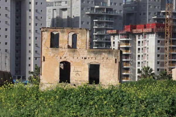
Abu Kishk
About the depopulated village of Abu Kishk
- District
- Jaffa
- Date Abu Kishk was occupied
- 30 March 1948
- Population in 1948
- 2,200
- Brigade that carried it out
- Irgun
- Distance from the governorate centre
- 12 (km) Northeast of Jaffa
- Elevation above sea level
- 50 m
- Cause of displacement
- Fear of Jewish attack, or of being caught in the fighting
- Extent of destruction
- The village was mostly destroyed with the exception of two houses
Hover a dot to read the village name, or click to open its card.
Borders of the depopulated village of Abu Kishk
Abu Kishk – A Depopulated Palestinian Village in the Jaffa Subdistrict
Abu Kishk, also known as 'Arab Abu Kishk, was a Palestinian village in the Jaffa Subdistrict, situated approximately 12 km northeast of Jaffa on level ground in the central coastal plain, at an average elevation of about 50 meters above sea level.
The village lay approximately 2 km northwest of the al-'Awja River. A secondary road linked it with the Jaffa–Haifa highway, while additional local roads connected it with neighboring Palestinian villages and tribal communities.
The site initially served as a seasonal encampment for the nomadic 'Arab Abu Kishk and gradually developed into a permanent agricultural village with houses, orchards, wells, a school, and small shops.
An intelligence report dated 30 June 1948 records the complete departure of Abu Kishk's population on 30 March 1948 following the impact of Irgun actions in Abu Kishk and nearby al-Shaykh Muwannis. Khalidi, however, does not establish 30 March as the precise date of final military occupation; he states more cautiously that the village probably fell into Zionist hands sometime before the end of the British Mandate on 15 May 1948.
- Subdistrict
- Jaffa
- Alternative name
- 'Arab Abu Kishk
- Distance from Jaffa
- Approximately 12 km northeast
- Elevation
- Approximately 50 m above sea level
- Population, 1944/45
- 1,900 Arabs
- Estimated population, 1948
- 2,204
- Total land area
- 18,470 dunums
- Date of complete depopulation
- 30 March 1948
- Date of final military occupation
- Not precisely established; before 15 May 1948 according to Khalidi
- Force directly associated with the flight
- Irgun/IZL, which abducted five village leaders in late March
- Final occupying unit
- Not conclusively identified by the principal source
- Israeli settlements on village lands
- Khalidi does not identify a separate new settlement; the site was absorbed into the expanding suburban area of Herzliya
Location and Geography of Abu Kishk
Abu Kishk stood on level ground in Palestine's central coastal plain, approximately two kilometers northwest of the al-'Awja River.
The flat terrain and abundant groundwater supported extensive agriculture, particularly citrus cultivation, cereals, and irrigated orchards.
A secondary road linked the village with the Jaffa–Haifa highway, while local roads connected it to neighboring villages and facilitated the marketing of agricultural produce in Jaffa.
Neighboring Villages and Localities
Palestinian maps and later local documentation indicate the following approximate geographical relationships:
- North: Tabsur / Khirbat 'Azzun.
- Northeast: Biyar 'Adas.
- East and southeast: the areas toward Jaljulya and al-Mirr / al-Mahmudiyya.
- Southwest: 'Arab al-Sawalima.
- West: Ijlil al-Qibliyya, with Ijlil al-Shamaliyya and the coast farther west.
- Northwest: the encampments of 'Arab al-Shubaki.
These are approximate geographical relationships rather than substitutes for historical cadastral boundaries.
Name and Origins
The village was also formally known as 'Arab Abu Kishk, reflecting the tribal community that settled in the area.
Khalidi states that the site initially served as a seasonal encampment for the nomadic Abu Kishk Arabs before gradually developing into a permanent village.
Local oral history records several earlier place-names in the area, including Baydus and al-Ruways, and associates the consolidation of the Abu Kishk name with the growing leadership of the Abu Kishk clan.
These latter details derive from local oral history rather than from Khalidi's principal village entry.
From Tribal Encampment to Permanent Village
During the early twentieth century, Abu Kishk retained some characteristics of a Bedouin tribal settlement even as permanent construction and agriculture expanded.
Some residents continued to live in tents and huts, while others occupied masonry houses. Leading families maintained larger stone houses, guesthouses, livestock enclosures, and stables.
Over time, citrus orchards expanded, artesian wells were drilled, permanent buildings increased, and Abu Kishk became a large settled agricultural community.
The 1922 Census
In the 1922 Census of Palestine, Abu Kishk was still treated as a tribal group, with approximately 155 people recorded.
The figure should not be compared mechanically with the much larger 1931 total because the definition and enumeration of the tribal community changed substantially between the two censuses.
Population of Abu Kishk
The official 1931 Census of Palestine recorded 1,007 inhabitants in Abu Kishk: 516 males and 491 females, all Muslims.
The community was counted under the census category of “non-synchronous enumeration,” which was used for certain tribal populations. As a result, the official village row does not provide an independent occupied-house figure comparable to those listed for many sedentary villages.
In 1944/45, the Village Statistics recorded a population of 1,900 Arabs.
Palestine Remembered later estimated the Palestinian population at 2,204 in 1948 and the number of refugees and their descendants at 13,535 in 1998. These are retrospective estimates rather than official Mandate census counts.
- 1922155Official census figure for the tribal group; enumeration differed from later years
- 19311,007Official census; all Muslims; non-synchronous enumeration
- 1944/451,900Official Village Statistics; all Arabs
- 19482,204Later Palestine Remembered estimate, not an official census
- 199813,535 refugeesLater estimate of refugees and their descendants
Number of Houses
The 1931 census does not provide a separate occupied-house count for Abu Kishk because the community was recorded through non-synchronous enumeration.
This article therefore does not supply an unsupported house count for either 1931 or 1948.
Built Form
Abu Kishk did not have a regular geometric street plan. Its houses were dispersed in small clusters, reflecting the community's gradual development from seasonal tribal encampments into a permanent rural settlement.
The village landscape included stone houses, huts, agricultural structures, guesthouses, storage buildings, livestock enclosures, orchards, and wells.
Education
A school was established in Abu Kishk in 1925.
By the mid-1940s, enrollment had reached 108 pupils, including 9 girls.
Later local documentation also records a village library and notes that a number of Abu Kishk children continued their education in Jaffa and other Palestinian schools.
Shops and Local Services
The village contained several small shops serving everyday needs.
Agriculture and livestock raising nevertheless remained the principal economic activities, complemented by commercial ties with Jaffa and neighboring villages.
Shrine of Shaykh Sa'd
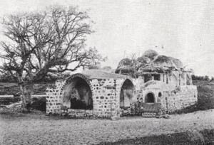
A shrine dedicated to Shaykh Sa'd stood north of Abu Kishk in the fields between the village and neighboring al-Sawalima.
Khalidi does not provide a secure construction date or detailed architectural history for the shrine.
Land Ownership in Abu Kishk
The total land area recorded for Abu Kishk in the 1944/45 Village Statistics was 18,470 dunums.
Using Palestine Remembered's simplified terminology:
- Palestinian17,121 dunums93%
- Transferred to Zionists901 dunums5%
- Communal/Public448 dunums2%
The official Village Statistics use the original categories Arab, Jewish, and Public: 17,121 dunums were Arab land, 901 dunums Jewish, and 448 dunums public.
Land Use in 1944/45
- Arab
- Jewish
- Public
- Citrus and bananas2,924 dunums
- Plantations and irrigable land226 dunums
- Cereals14,465 dunums
- Non-cultivable land855 dunums
Cultivable land totaled 17,615 dunums, approximately 95 percent of the statistical area.
This consisted of 16,731 Arab dunums and 884 Jewish dunums.
Non-cultivable land totaled 855 dunums: 390 Arab, 17 Jewish, and 448 public.
This corrects simplified tables that display 838 dunums as Palestinian non-arable land by combining 390 Arab dunums with 448 public dunums.
The PalQuest table used here does not supply a separate built-up-land figure, so no unsupported built-up total has been added.
Economic Life
Agriculture and livestock raising formed the economic foundation of Abu Kishk.
Cereals occupied the largest area, with 14,018 Arab dunums devoted to cereal cultivation in 1944/45.
Citrus was also exceptionally important: 2,487 Arab dunums were planted with citrus and bananas, while another 226 dunums were classified as plantations and irrigable land.
Rainfall supported dry farming, while artesian wells were especially important for irrigating citrus orchards and other plantations.
Cattle, sheep, horses, and other livestock also remained important to the community's economy.
Water and Artesian Wells
The expansion of Abu Kishk's orchards depended heavily on groundwater and artesian wells.
Contemporary local descriptions record citrus estates equipped with wells, pumping engines, and concrete irrigation pools.
The Events of 1921
The name of 'Arab Abu Kishk became prominent during the May 1921 confrontations in the Jaffa and Petah Tikva area.
Local Palestinian accounts emphasize the role of Shaykh Shakir Abu Kishk, who was arrested and tried by the British authorities after the fighting.
Because casualty and weapons figures vary across later narratives, this article does not reproduce disputed numerical claims without a separate study of the 1921 events.
Contacts with the Haganah before Depopulation
In December 1947 or January 1948, the mukhtar of Abu Kishk joined representatives of several Palestinian villages north of Jaffa in contacts with the Haganah intended to preserve calm and prevent fighting in the area.
The discussions also involved al-Shaykh Muwannis, al-Mas'udiyya, the Jammasin villages, and Ijlil.
These arrangements did not prevent subsequent armed actions against village leaders that undermined security across the coastal communities north of Jaffa.
Irgun Abduction of Village Leaders
In late March 1948, members of the Irgun/IZL infiltrated Abu Kishk and abducted five village leaders.
The action took place amid Irgun operations affecting Abu Kishk, al-Shaykh Muwannis, and other communities on the northern outskirts of Tel Aviv.
Khalidi considers these actions a major factor in the mass flight from the surrounding coastal region.
Depopulation on 30 March 1948
An intelligence report dated 30 June 1948 records that the entire population of 'Arab Abu Kishk departed on 30 March 1948.
The report associates the departure with the effect of actions carried out by the Zionist dissident organizations in nearby al-Shaykh Muwannis and the surrounding area.
30 March is therefore the strongest documented date for Abu Kishk's complete depopulation.
Was Abu Kishk Militarily Occupied on 30 March?
Palestine Remembered lists 30 March 1948 as the “occupation date,” but Khalidi's narrative is more cautious.
He states that Abu Kishk probably fell into Zionist hands sometime before the end of the British Mandate on 15 May 1948, without identifying the precise date on which a military force took permanent control of the site.
The chronology should therefore distinguish between:
- 30 March 1948: complete depopulation according to the intelligence report.
- Before 15 May 1948: the broader period in which Khalidi places the establishment of final Zionist military control.
Military Organization
The directly documented armed organization is the Irgun/IZL, which abducted five Abu Kishk leaders in late March and whose actions contributed to the mass departure from the area.
Khalidi's principal village entry, however, does not identify the Irgun—or any other brigade—as the force that finally entered and permanently occupied Abu Kishk on a specific date.
The most precise formulation is therefore: Irgun actions were directly associated with the abduction and intimidation preceding the depopulation; the final village-specific occupying unit is not conclusively identified in the principal source.
- December 1947 – January 1948
Truce contacts
Abu Kishk and neighboring village representatives seek to avoid fighting through contacts with the Haganah
- Late March 1948
Abduction of village leaders
Irgun members abduct five Abu Kishk leaders
- 30 March 1948
Complete depopulation
Later intelligence report records the departure of the entire population
- Before 15 May 1948
Final military control
Khalidi does not identify the precise day or village-specific occupying unit
Israeli Urban Expansion and Abu Kishk's Lands
Khalidi does not identify a separate new Israeli settlement established specifically on Abu Kishk's village lands after 1948.
He states instead that the former village site became part of the expanding suburban area of Herzliya.
Later Palestinian community documentation also describes modern urban expansion from Hod HaSharon across parts of the broader historical Abu Kishk landscape.
A distinction should therefore be maintained between later urban expansion over village lands and the establishment of a distinct new settlement directly on the village center.
Abu Kishk Today
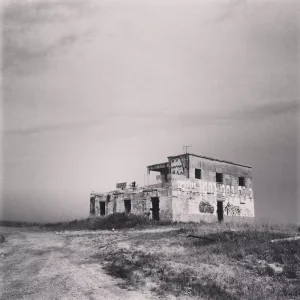
According to Walid Khalidi's field description in All That Remains, a fenced military-hardware manufacturing complex occupied the village site and a large area around it.
Cactus and almond trees grew near an overpass built above the road passing through the complex.
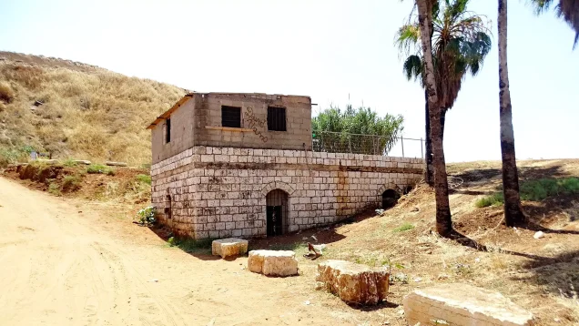
Outside the fence, on the southeastern side of the former village site, the remains of two houses were still visible. One had served as a private school for children from neighboring al-Sawalima.
This description derives from fieldwork conducted before the publication of All That Remains in 1992 and should not be treated as direct verification of every surviving feature in 2026.
Palestine Remembered contains later community documentation, including material uploaded in May 2025 showing surviving built remains with modern urban development in the background. Such upload dates do not necessarily establish when the photographs were taken, and the material does not constitute a comprehensive independent archaeological or architectural survey of the site in 2026.
Sources
- PalQuestPalQuest – Interactive Encyclopedia of the Palestine Question: Abu Kishk
- PalQuestPalQuest – Intelligence Report on the Depopulation of Palestine, 30 June 1948
- Palestine RememberedPalestine Remembered – Abu Kishk, Jaffa
- Palestine RememberedPalestine Remembered – Abu Kishk entry from All That Remains
- Palestine RememberedPalestine Remembered – 'Arab Abu Kishk: local history and tribal documentation
- Institute for Palestine StudiesInstitute for Palestine Studies – Walid Khalidi, All That Remains
- pcbs.gov.psGovernment of Palestine – Census of Palestine 1922
- pcbs.gov.psGovernment of Palestine – Census of Palestine 1931: Jaffa Sub-District
- commons.wikimedia.orgGovernment of Palestine – Village Statistics, April 1945
- palqura.comPalestinian Villages Encyclopedia – Abu Kishk: local boundaries and documentation
Photo gallery
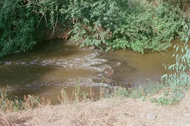
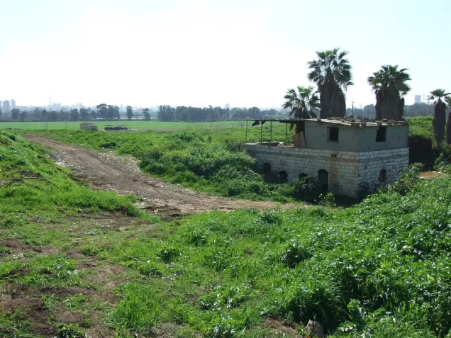
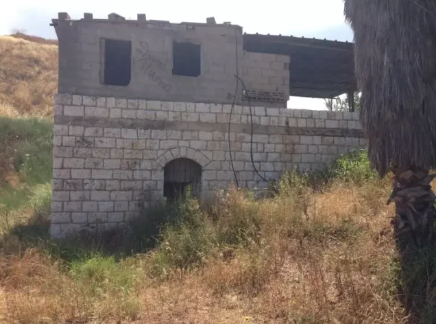
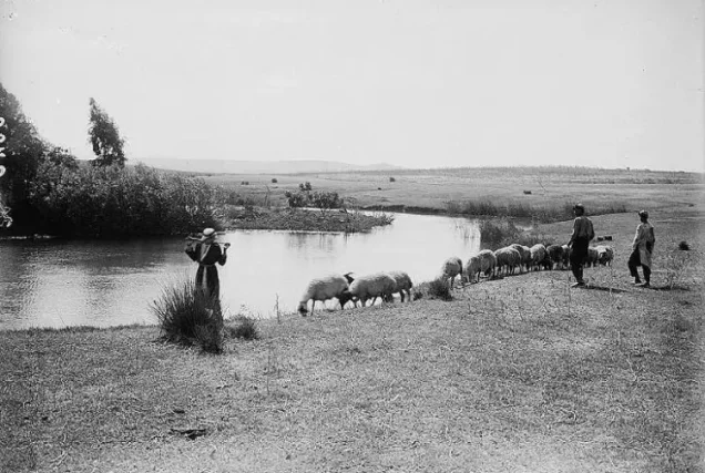
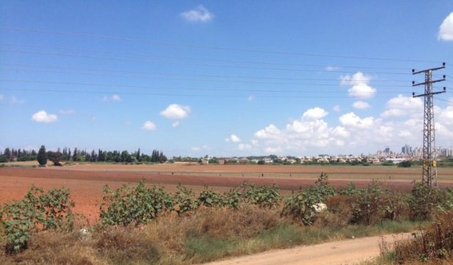
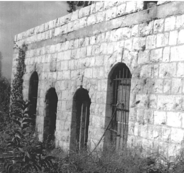
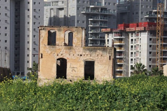
Photos from the village's people
Photos sent in by visitors and published after review.
Add a photo of this village
Log in to add photos of this village.
Other villages from Jaffa

More from the archive
 Download Our Palestine App
The whole archive in the palm of your hand: depopulated villages, the Nakba, the massacres and Al-Aqsa — free, with no ads to erase the story.
Download Our Palestine App
The whole archive in the palm of your hand: depopulated villages, the Nakba, the massacres and Al-Aqsa — free, with no ads to erase the story.



Comments
No comments yet — be the first to write one.
Add your comment
Name and email are optional. Comments appear after review.