
The depopulated village of Rantiya / District of Jaffa
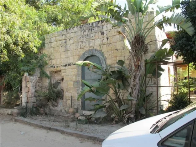
Rantiya
About the depopulated village of Rantiya
- District
- Jaffa
- Date Rantiya was occupied
- 10 July 1948
- Population in 1948
- 680
- Military operation
- Operation Dani
- Brigade that carried it out
- Alexandroni Brigade
- Distance from the governorate centre
- 16 (km) East of Jaffa
- Elevation above sea level
- 50 m
- Cause of displacement
- Military assault by Zionist troops
- Extent of destruction
- Rantiya was mostly destroyed with the exception of three deserted houses.
- Ethnic cleansing
- Rantiya inhabitants were completely ethnically cleansed.
- Settlements built on the built-up area of Rantiya after 1948
- Rinatia, Mazor
Hover a dot to read the village name, or click to open its card.
Borders of the depopulated village of Rantiya
Rantiya – A Depopulated Palestinian Village in the Jaffa Subdistrict
Rantiya was a Palestinian village in the Jaffa Subdistrict, located approximately 16 km east of Jaffa on a level portion of the central coastal plain, at an average elevation of about 50 meters above sea level.
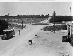
A secondary road linked the village to the nearby highway leading to Jaffa and Lydda, while the Lydda–Haifa railway passed approximately 1.5 km east of Rantiya. Its location between Jaffa and Lydda and its proximity to major transport routes supported a productive agricultural economy.
Rantiya was first attacked on 28 April 1948, but Zionist forces apparently failed to maintain control of the village. The final occupation occurred before dawn on 10 July 1948 during Operation Dani, when a composite force from the Palmach's Eighth Armored Brigade and the Third Infantry Battalion of the Alexandroni Brigade overran the village.
- Subdistrict
- Jaffa
- Distance from Jaffa
- Approximately 16 km east
- Average elevation
- Approximately 50 m above sea level
- Population, 1944/45
- 590 Arabs
- Estimated population, 1948
- 684
- Total land area
- 4,389 dunums
- First attack
- 28 April 1948; it did not result in permanent control
- Final occupation
- 10 July 1948
- Military operation
- Operation Dani
- Village-specific attacking units
- Palmach Eighth Armored Brigade and Third Infantry Battalion, Alexandroni Brigade
- Israeli settlements established on village land
- Mazor, Nofekh, and Rinnatya, all established in 1949
Location and Geography of Rantiya
Rantiya stood on level ground in Palestine's central coastal plain, an area characterized by fertile agricultural soils and abundant groundwater.
A main road passed close to the village, while a secondary road connected it with the highway between Jaffa and Lydda.
The Lydda–Haifa railway line ran approximately 1.5 km to the east, placing Rantiya near one of the principal transport corridors of Mandate Palestine.
Neighboring Villages and Localities
Palestinian maps and later local documentation indicate the following approximate geographical relationships:
- North: Fajja.
- Northeast: Majdal Yaba / Majdal al-Sadiq in the Ramla Subdistrict.
- East: al-Muzayri'a in the Ramla Subdistrict.
- Southeast: Qula in the Ramla Subdistrict.
- South: Wilhelma.
- Southwest and west: al-'Abbasiyya and the extension of its lands.
These directions describe approximate geographical relationships and should not be treated as substitutes for historical cadastral boundaries.
Name and Historical Background
During the Roman period the locality was known as Rantia, while Crusader sources later referred to it as Rentie.
Khalidi does not provide a definitive linguistic explanation for the modern name, but the survival of similar forms across historical periods suggests that “Rantiya” developed from the older place-name.
Rantiya should not be confused with Antipatris / Ras al-'Ayn; it was an independent village in the plain between Jaffa and Lydda, although both belonged to the same wider historical region.
Rantiya under Ottoman Rule
In 1596, Rantiya was recorded as a village in the nahiya of Ramla in the liwa' of Gaza, with an estimated population of approximately 132.
The inhabitants paid taxes on wheat, barley, fruit, and sesame, as well as goats, beehives, and other forms of production.
Rantiya remained a small agricultural village during the nineteenth century. The Survey of Western Palestine described it in the late nineteenth century as a small village built largely of adobe brick, with a main road passing immediately nearby.
Built Form
During the British Mandate, Rantiya had a rectangular plan extending along a north–south axis.
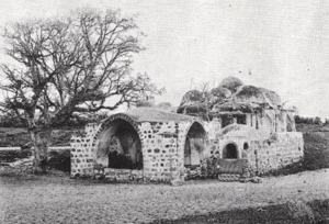
Its houses were built of stone and adobe, while the built-up area remained comparatively compact. In 1944/45, only 13 dunums were classified as built-up land.
The village contained a mosque, an elementary school, and several small shops.
Population of Rantiya
The official 1922 Census of Palestine recorded 351 inhabitants in Rantiya, all Muslims.
By the 1931 census, the population had risen to 411, again all Muslims, living in 105 occupied houses.
The 1944/45 Village Statistics recorded 590 Arabs.
Palestine Remembered later estimated the population at 684 in 1948 and the number of refugees and their descendants at 4,203 in 1998. These are retrospective estimates rather than official British Mandate census counts.
- 1596Approximately 132Estimate derived from Ottoman tax records
- 1922351Official census; all Muslims
- 1931411Official census; all Muslims
- 1944/45590Official statistics; all Arabs
- 1948684Later estimate, not an official census
- 19984,203 refugeesLater estimate of refugees and their descendants
Number of Houses
- 1931105Occupied houses recorded in the official census
- 1948174Later Palestine Remembered estimate, not an official Mandate census count
Education in Rantiya
Formal schooling in Rantiya began in 1931 when a teacher opened a private elementary school in the village.
In 1947, the school became an official public school and had approximately 45 pupils.
The villagers continued to contribute to its financing, reflecting the direct role of the community in supporting education.
Thus, 1947 should not be treated as the founding date of education in Rantiya; it was the year in which the private school established in 1931 acquired official status.
The Mosque and Public Services
Rantiya had one mosque serving its Muslim population, as well as several small shops.
The village did not possess all of the services required by its inhabitants, who relied principally on nearby al-'Abbasiyya in the Jaffa Subdistrict and al-Muzayri'a in the Ramla Subdistrict for some services and for marketing agricultural produce.
Land Ownership in Rantiya
The total land area recorded for Rantiya in the 1944/45 Village Statistics was 4,389 dunums.
Palestine Remembered presents the simplified ownership categories as follows:
- Palestinian4,155 dunums95%
- Transferred to Zionists142 dunums3%
- Communal/Public92 dunums2%
The official Village Statistics use the original categories Arab, Jewish, and Public: 4,155 dunums were classified as Arab land, 142 as Jewish land, and 92 as public land.
Land Use in 1944/45
- Arab
- Jewish
- Public
- Citrus and bananas505 dunums
- Plantations and irrigable land219 dunums
- Cereals3,540 dunums
- Built-up land13 dunums
- Non-cultivable land112 dunums
Cultivable land totaled 4,264 dunums, approximately 97 percent of the village area: 4,122 Arab and 142 Jewish dunums.
Built-up and non-cultivable land totaled 125 dunums: 33 Arab and 92 public.
This detailed breakdown corrects simplified tables that assign all 112 dunums of non-cultivable land to Palestinians. The official breakdown is 20 Arab and 92 public dunums.
Palestine Remembered also records approximately 20 dunums of olive trees. This is a crop-specific subset of the agricultural land categories above and should not be added again to the total area.
Economic Life
Agriculture formed the principal basis of Rantiya's economy, alongside livestock raising, small-scale trade, crafts, and employment in Jaffa.
Cereals, vegetables, and fruit were important crops, with citrus playing a major commercial role.
In 1944/45, 505 Arab dunums were devoted to citrus and bananas, 3,518 to cereals, and 99 to irrigated land and orchards.
Villagers also cultivated olives, grapes, figs, pomegranates, and seasonal fruits and vegetables.
Water and Artesian Wells
Rantiya benefited from abundant groundwater, and the inhabitants dug dozens of artesian wells to irrigate fields and orchards.
Khalidi's English entry places these wells mainly east and south of the village. Some Arabic reproductions use “east and north,” but the English PalQuest and Palestine Remembered versions support east and south.
These water resources were essential to the development of citrus groves and irrigated agriculture.
The First Attack – 28 April 1948
Rantiya experienced its first major documented attack on 28 April 1948.
The assault occurred in the wake of Irgun attacks on Jaffa and amid Zionist attempts to clear Palestinian communities from the surrounding coastal region.
Khalidi, citing Benny Morris, implies that the attacking forces did not establish a lasting foothold in Rantiya, since the village remained to be assaulted and captured again more than two months later.
The source does not establish that the Irgun itself was the village-specific attacking force on 28 April. It states that the Rantiya attack occurred following the Irgun offensive against Jaffa. The first assault should therefore not be attributed conclusively to the Irgun.
Operation Dani
Operation Dani began on 9 July 1948 and continued until 18 July during the “Ten Days” between the two truces.
It was one of the largest Israeli offensives of that period. Its first stage aimed to encircle and capture Lydda and Ramla, while its later stage extended toward the Ramallah–Latrun road.
The first stage involved a large composite force that included Har'el, Yiftach, and the Eighth Armored Brigade, together with infantry units from Kiryati and Alexandroni.
PalQuest explicitly lists Rantiya among the villages affected by Operation Dani.
Final Occupation and Depopulation
Before dawn on 10 July 1948, Israeli occupation forces attacked Rantiya during the first stage of Operation Dani.
According to the New York Times and the military account reproduced by Khalidi, the attacking force pushed deep into the northern approaches to Lydda and Ramla as part of the attempt to encircle the two cities.
Rantiya was overrun by a composite force of jeeps and armored vehicles from the Palmach's Eighth Armored Brigade and the Third Infantry Battalion of the Alexandroni Brigade.
The two units captured Rantiya along with a string of other Palestinian villages on the northern approaches to Lydda and Ramla.
It is therefore incomplete to attribute the capture simply to the Alexandroni Brigade: the village-specific source documents the direct participation of both the Eighth Armored Brigade and Alexandroni's Third Battalion.
- 28 April 1948
First attack
Attack following the Irgun offensive against Jaffa; it did not result in lasting Zionist control of Rantiya
- 9 July 1948
Beginning of Operation Dani
Major offensive designed initially to encircle Lydda and Ramla
- Before dawn, 10 July 1948
Final attack on Rantiya
Composite force attacks from the northern axis of the operation
- 10 July 1948
Attacking units
Palmach Eighth Armored Brigade and Third Infantry Battalion of the Alexandroni Brigade
- 10 July 1948
Final occupation and depopulation
Village captured and its Palestinian population displaced during Operation Dani
Israeli Settlements on Rantiya's Lands
Three Israeli settlements were established on Rantiya's lands in 1949:
- Rinnatya: Established in 1949 on village land and associated in local documentation with the former village site or its immediate vicinity.
- Nofekh: Established in 1949 on Rantiya's land.
- Mazor: Established in 1949 on the village's lands.
Be'erot Yitzchaq, established in 1948 southwest of Rantiya, was not built on the village's lands according to Khalidi.
Rantiya Today
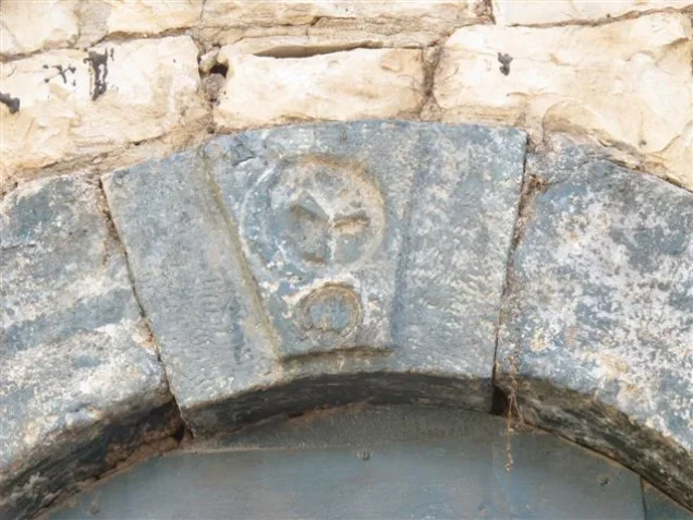
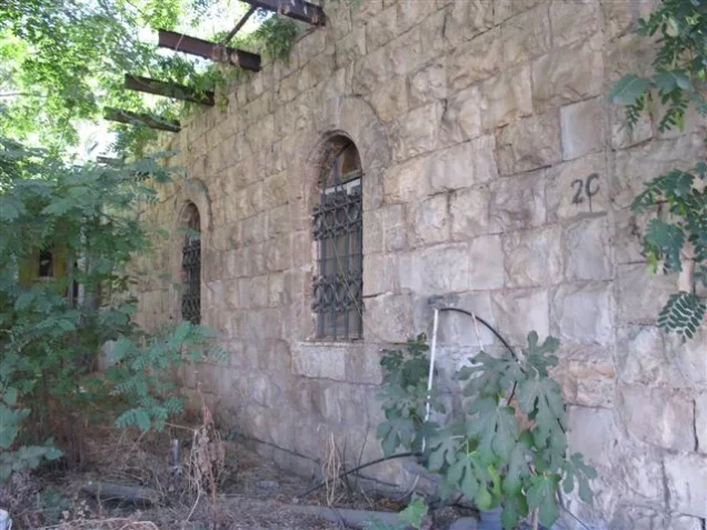
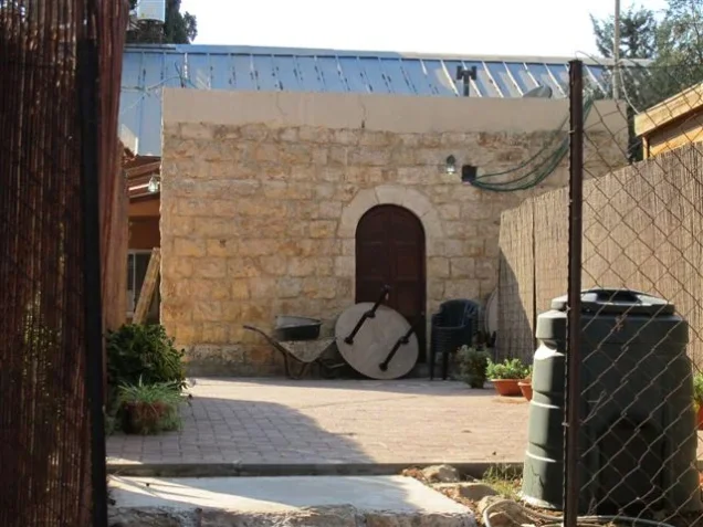
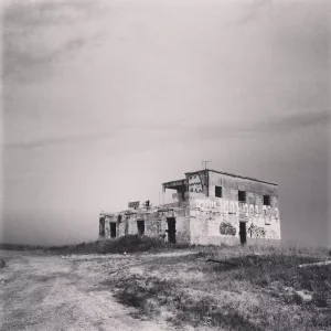
According to Walid Khalidi's field description in All That Remains, only three deserted houses remained at the village site when his survey was carried out, standing amid weeds and tall wild grasses together with the rubble of other houses.
Two of the surviving houses were built of stone and the third of concrete. Their doors and windows were rectangular. Two had flat roofs, while the third may originally have had a gabled roof.
Cactus, castor-oil plants, eucalyptus, cypress, and fig trees also marked the former village site.
Buildings belonging to the Israeli settlements occupied part of the surrounding land, while other areas were under cultivation.
This description derives from fieldwork carried out before the publication of All That Remains in 1992 and should not be treated as direct verification of the condition of every surviving structure in 2026.
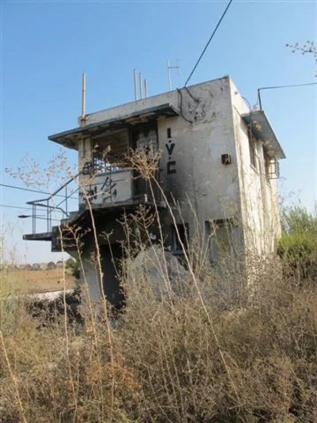
Palestine Remembered contains later community documentation, including photographs attributed to 2006 showing old houses, site visits in September 2012, and maps and materials uploaded in 2025.
These later materials are useful evidence that parts of the village landscape and some buildings continued to be identifiable after Khalidi's survey. They do not, however, constitute a comprehensive independent archaeological or architectural survey of Rantiya in 2026, and the date on which material was uploaded does not necessarily establish the date on which it was photographed.
Sources
- PalQuestPalQuest – Interactive Encyclopedia of the Palestine Question: Rantiya
- PalQuestPalQuest – Operation Dani
- Palestine RememberedPalestine Remembered – Rantiya, Jaffa
- Palestine RememberedPalestine Remembered – Rantiya entry from All That Remains
- Institute for Palestine StudiesInstitute for Palestine Studies – Walid Khalidi, All That Remains
- pcbs.gov.psGovernment of Palestine – Census of Palestine 1922
- fada.birzeit.eduBirzeit University Repository – Census of Palestine 1931
- maktabatsabil.comGovernment of Palestine – Village Statistics 1945: Jaffa Sub-District, Population and Land Ownership
- palqura.comPalestinian Villages Encyclopedia – Rantiya: local boundaries, families, education, and later documentation
- palestinapedia.psPalestinian Encyclopedia – Rantiya
Photo gallery
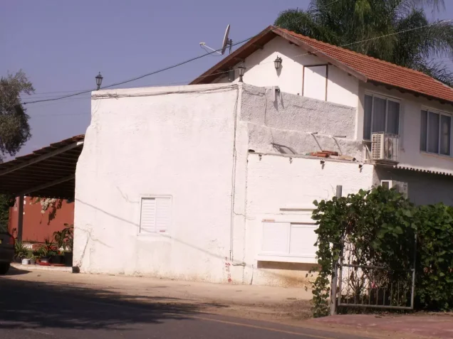

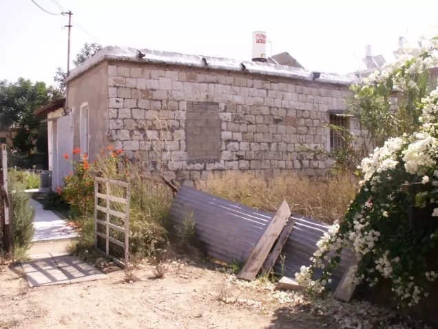
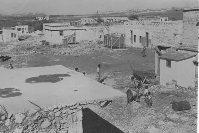



Photos from the village's people
Photos sent in by visitors and published after review.
Add a photo of this village
Log in to add photos of this village.
Other villages from Jaffa
More from the archive
 Download Our Palestine App
The whole archive in the palm of your hand: depopulated villages, the Nakba, the massacres and Al-Aqsa — free, with no ads to erase the story.
Download Our Palestine App
The whole archive in the palm of your hand: depopulated villages, the Nakba, the massacres and Al-Aqsa — free, with no ads to erase the story.



Comments
No comments yet — be the first to write one.
Add your comment
Name and email are optional. Comments appear after review.