
The depopulated village of Al-Sawalima / District of Jaffa
Al-Sawalima
About the depopulated village of Al-Sawalima
- District
- Jaffa
- Date Al-Sawalima was occupied
- 30 March 1948
- Population in 1948
- 930
- Elevation above sea level
- 50 m
- Cause of displacement
- Fear of Jewish attack, or of being caught in the fighting
- Extent of destruction
- al-Sawalima was completely obliterated with the exception of one school room still standing
- Ethnic cleansing
- al-Sawalima inhabitants were intimidated into fleeing by the Haganah and IZL (ETZEL) on March 30th 1948, especially after the IZL's kidnapping of al-Shaykh Muwannis notables.
- Settlements built on the built-up area of Al-Sawalima after 1948
- Tzahala and Neve Sharet (Tel Aviv), Neve Magen (Ramat Hasharon)
Hover a dot to read the village name, or click to open its card.
Borders of the depopulated village of Al-Sawalima
al-Sawalima – Jaffa Subdistrict
Al-Sawalima, also known as 'Arab al-Sawalima, was a depopulated Palestinian village in the Jaffa subdistrict. It stood approximately 11 km northeast of Jaffa at an average elevation of about 50 meters in the central coastal plain.
Its lands extended north of the al-'Awja River, whose channel ran approximately 2 km south of the village site. The village was established by the nomadic 'Arab al-Sawalima, who originally used the locality seasonally before gradually settling permanently and building adobe houses.
The official 1931 Census of Palestine recorded 429 inhabitants, and the 1944/45 statistics recorded 800. The village lands totaled 5,942 dunums.
Depopulation probably began or accelerated in late March 1948 as military pressure by the Haganah and Irgun spread across the Palestinian communities north of Tel Aviv, particularly after events in neighboring al-Shaykh Muwannis. The precise date on which Zionist forces physically occupied al-Sawalima is not established by Khalidi, who states only that the village probably fell before the end of the British Mandate on 15 May 1948. PalQuest also lists al-Sawalima among the villages affected by Operation Hametz.
Location of al-Sawalima
The village stood on relatively flat terrain that sloped gently from north to south.
The northern bank of the al-'Awja River formed the most important natural boundary of its lands to the south, while the village houses stood approximately 2 km from the river channel.
The location provided access to fertile coastal-plain agricultural land, irrigation water, Jaffa, and the network of Palestinian villages northeast of the city.
Neighboring Villages and Lands
Palestinian sources identify the following lands as immediately surrounding al-Sawalima:
| Village / Area | Notes |
|---|---|
| 'Arab Abu Kishk | Among the neighboring lands to the north and northeast |
| Ijlil al-Qibliyya | Within the northern and northwestern surroundings |
| al-Shaykh Muwannis | Among the neighboring lands to the west and southwest |
| al-'Awja River | The principal natural boundary to the south |
Palestinian village maps also show Qubaniyat to the west, al-Mirr/al-Mahmudiyya to the east, and al-Jammasin al-Sharqi and Fajja in the wider surroundings.
These nearby localities should not all automatically be treated as direct cadastral boundaries; original Mandate land maps remain the strongest evidence for exact boundary lines.
'Arab al-Sawalima and the Formation of the Village
Walid Khalidi identifies the founders as the nomadic 'Arab al-Sawalima, whose presence in Palestine predated Ottoman rule.
They initially used the site seasonally as one stage in their annual cycle of movement.
Over time, families increasingly settled permanently, replacing seasonal encampments with adobe houses and transforming the locality into a settled agricultural village.
al-Sawalima in the Late Nineteenth Century
The Survey of Western Palestine recorded a site rendered Khirbat al-Suwalimiyya in the late nineteenth century and noted visible remains there.
Continued settlement by 'Arab al-Sawalima during the late Ottoman and British Mandate periods transformed the locality into a permanent village with cultivated lands and, eventually, an elementary school.
Population of al-Sawalima
- 192270Official Census of Palestine; all enumerated inhabitants were Muslims
- 1931429Official census: 218 males and 211 females, all Muslims
- 1944/45800Official Government of Palestine statistics; all were Arabs and Muslims
- 1948928Later Palestine Remembered estimate; not an official census
- 19985,699 refugees and descendantsLater demographic estimate published by Palestine Remembered
Number of Houses
No securely documented independent house total for al-Sawalima in 1931 or 1948 was found in the principal sources reviewed.
No estimated house count has therefore been inserted without a clear source, although the village's historical development from tents and seasonal encampments toward permanent adobe dwellings is well documented.
Land Ownership in 1944/45
Al-Sawalima's registered lands totaled 5,942 dunums.
Using Palestine Remembered's simplified terminology:
- Palestinian5,844 dunums98%
- Transferred to Zionists0 dunums0%
- Communal/Public98 dunums2%
The official categories record 5,844 Arab dunums and 98 Public dunums, with no land in the Jewish ownership category.
Land Use in 1944/45
- Arab
- Public
- Citrus and bananas894 dunums
- Plantations and irrigable land191 dunums
- Cereals4,566 dunums
- Non-cultivable land291 dunums
The land-use categories balance exactly with the official ownership figures.
Palestine Remembered's simplified display can make the entire 291-dunum non-arable category appear Palestinian. The official breakdown shows that it consisted of 193 Arab dunums and 98 Public dunums.
The PalQuest table does not present a separate, reliable built-up-area figure for al-Sawalima, so none has been inferred.
Economic Life in al-Sawalima
Agriculture became the principal economic basis of the village after the community settled permanently.
The inhabitants cultivated cereals, citrus, and orchards. Citrus production was particularly important in the western and southern sections of the village lands.
In 1944/45, 894 dunums were devoted to citrus and bananas, 4,566 to cereals, and 191 to plantations and irrigable land.
The northern portions of the village lands were predominantly forested, while wells and intensive cultivation characterized much of the south.
Water and Wells
Numerous wells in the southern parts of the village lands supplied irrigation water for citrus groves and orchards.
Supplementary Palestinian sources also record wells used for drinking and irrigation and mention Wadi Samara, which drained toward the al-'Awja River.
The village's proximity to the al-'Awja formed an important part of its agricultural environment even though the built-up settlement stood about 2 km north of the river itself.
Education
The inhabitants opened an elementary boys' school in 1946.
Its initial enrollment was 31 pupils.
A separate summary field on Palestine Remembered gives a figure of 43 pupils, but Khalidi's text and PalQuest explicitly identify 31 as the initial enrollment. The better-supported figure is therefore used here.
The school was modest in size. According to Khalidi's later field description, only the remains of one room of the school building were still discernible after the destruction of the village.
Religious Life
The population was entirely Muslim in the Mandate-era censuses and statistics.
Khalidi's core village entry does not document a specific mosque or shrine inside al-Sawalima, so none has been added without evidence.
The shrine of Shaykh Sa'd stood in the fields between neighboring Abu Kishk and al-Sawalima according to the Abu Kishk entry, but it should not automatically be classified as a shrine within al-Sawalima itself without more precise cadastral evidence.
al-Sawalima before the Nakba
Al-Sawalima's location northeast of Jaffa and close to al-Shaykh Muwannis and Abu Kishk placed it within the Palestinian rural belt immediately north of Tel Aviv.
As fighting intensified during the first months of 1948, this zone came under increasing military and political pressure from the Haganah and Irgun, and Palestinian communities north of Tel Aviv faced growing isolation and fear of attack.
The Events at al-Shaykh Muwannis and Their Regional Impact
Events in neighboring al-Shaykh Muwannis contributed to the broader wave of displacement from the area.
Despite a local truce between al-Shaykh Muwannis and the Haganah, an Irgun unit infiltrated the village in late March 1948 and kidnapped five of its leaders.
The incident produced widespread fear and flight among Palestinian communities in the coastal zone north of Tel Aviv.
Palestine Remembered links al-Sawalima's displacement to this atmosphere and indexes 30 March as the village's occupation or depopulation date.
Was al-Sawalima Occupied on 30 March 1948?
The date cannot be established as a definitive village-specific military occupation date.
Palestine Remembered lists 30 March 1948 in its occupation field and classifies the cause of departure as fear of Zionist attack or fear of being caught in fighting.
It also relates the villagers' flight to the atmosphere created by Haganah and Irgun pressure in the surrounding area.
Khalidi's detailed al-Sawalima account, however, does not state that forces entered the village on 30 March and does not document a direct assault on al-Sawalima on that day.
Late March is therefore better understood as a likely beginning or acceleration of the exodus rather than an unquestionable final occupation date.
Operation Hametz
Operation Hametz ran from 24 April to 13 May 1948.
Its purpose was to encircle Jaffa, seize Palestinian villages around the city, and sever Jaffa from its rural hinterland and communication routes.
The Haganah's Alexandroni, Kiryati, and Giv'ati brigades participated in the operation.
PalQuest explicitly lists al-Sawalima among the villages affected by Operation Hametz.
The operation entry does not, however, identify which of the three brigades entered al-Sawalima itself. No individual brigade should therefore be assigned to the village without village-specific evidence.
Final Occupation of al-Sawalima
Walid Khalidi states that al-Sawalima probably fell into Zionist hands at some point before the end of the British Mandate on 15 May 1948.
By then, Zionist forces controlled the coastal zone stretching between Tel Aviv and Haifa.
The source does not provide one exact day for the final takeover, so neither 30 March nor a particular day during Operation Hametz should be converted into a certain final occupation date without additional evidence.
The most accurate formulation is that the villagers began leaving in late March under the impact of fear and military pressure; al-Sawalima was affected by Operation Hametz in late April and early May; and final Zionist control was established before 15 May 1948.
Military Units
No single brigade can be securely identified as the formation that occupied al-Sawalima itself.
The Irgun played a major role in generating fear and displacement in the Palestinian zone north of Tel Aviv in late March, particularly through its assault on the leadership of al-Shaykh Muwannis.
During Operation Hametz, the Haganah's Alexandroni, Kiryati, and Giv'ati brigades operated around Jaffa, and PalQuest lists al-Sawalima among the affected villages.
The village-specific source does not identify which formation physically entered al-Sawalima. The village should therefore not be assigned exclusively to the Irgun, Alexandroni, Kiryati, or Giv'ati without further documentation.
Occupation Chronology
- March 1948
Growing military pressure north of Tel Aviv
Haganah and Irgun activity intensified around al-Shaykh Muwannis, Abu Kishk, al-Sawalima, and neighboring Palestinian communities.
- Late March 1948
Kidnapping of al-Shaykh Muwannis leaders
An Irgun unit infiltrated al-Shaykh Muwannis and kidnapped five village leaders, triggering widespread fear and flight in the surrounding area.
- 30 March 1948
Palestine Remembered indexed date
Listed as al-Sawalima's occupation/depopulation date, but Khalidi's detailed account does not establish a military entry into the village on that specific day.
- 24 April 1948
Beginning of Operation Hametz
The Haganah launched its campaign to encircle Jaffa and seize the surrounding Palestinian villages.
- 24 April–13 May 1948
al-Sawalima affected by Operation Hametz
PalQuest lists the village among those affected by the operation, carried out by the Alexandroni, Kiryati, and Giv'ati brigades.
- Before 15 May 1948
Final Zionist control
Khalidi states that the village had probably fallen into Zionist hands by the end of the Mandate, without specifying an exact day.
- Later; exact date not documented
Destruction of the village
The former tents and adobe dwellings disappeared almost completely, with only remnants of one schoolroom visible during the later field survey.
Refugees from al-Sawalima
Palestine Remembered estimates the village population in 1948 at approximately 928. This is a later demographic estimate rather than an official Mandate census figure.
The same source estimates that al-Sawalima refugees and their descendants numbered approximately 5,699 in 1998.
Palestinian community sources record some villagers and descendants living in Balata refugee camp, but the principal sources do not provide a complete official distribution of all refugee families after the Nakba.
Israeli Settlements on al-Sawalima Village Lands
Walid Khalidi and PalQuest state that no Israeli settlement was originally established on al-Sawalima's village lands.
Later Palestinian sources differ. The Palestinian Encyclopedia associates Ramat HaHayal, Tzahala, and other later Israeli urban developments with former al-Sawalima land, while Palestine Remembered currently displays Neve Sharett in a separate settlement field.
The core All That Remains/PalQuest entry nevertheless explicitly states that there were no Israeli settlements on village lands.
This article therefore distinguishes between the original establishment of a settlement on the village's registered land and later urban expansion from Tel Aviv and adjoining localities into parts of the historical landscape once associated with al-Sawalima. Establishing the exact extent of later encroachment requires original cadastral maps.
al-Sawalima Today
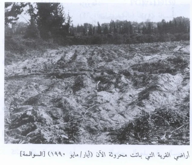
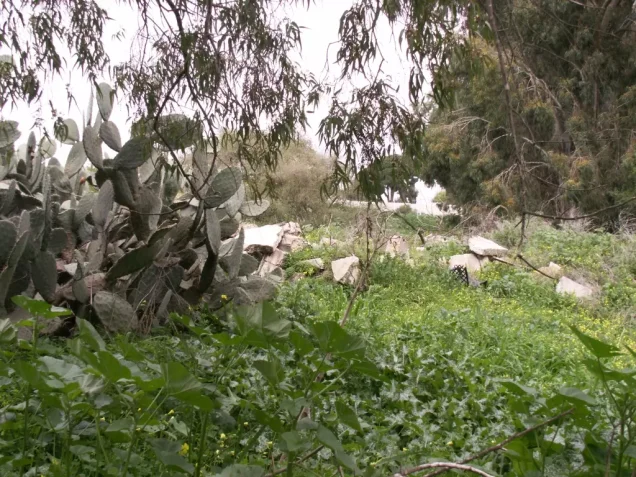
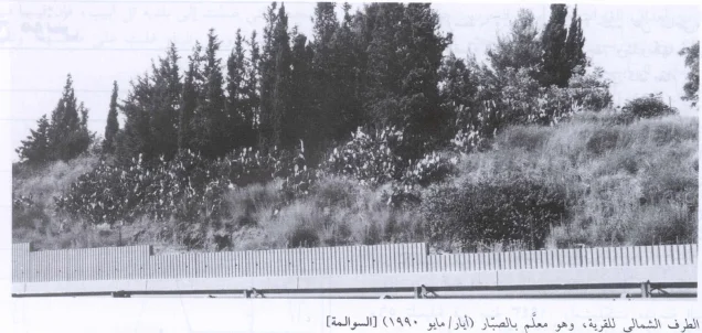
In Walid Khalidi's field description, cactus grew across the former village site.
No identifiable traces remained of the former dwellings, whether the older tents or the later adobe houses.
Only the remains of one room from the village school could still be identified, while a highway passed along the northern edge of the site.
PalQuest dates field photographs of the site to May 1990, including one showing the cactus-marked northern edge and another showing village lands under cultivation.
This description does not constitute direct field verification of conditions in 2026. Field research for All That Remains was conducted between 1987 and 1990, before the book's publication in 1992.
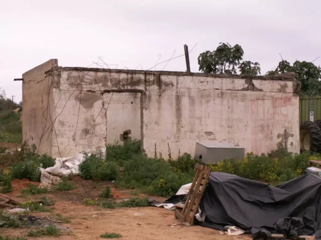
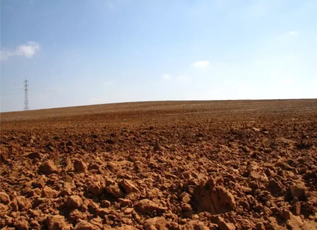
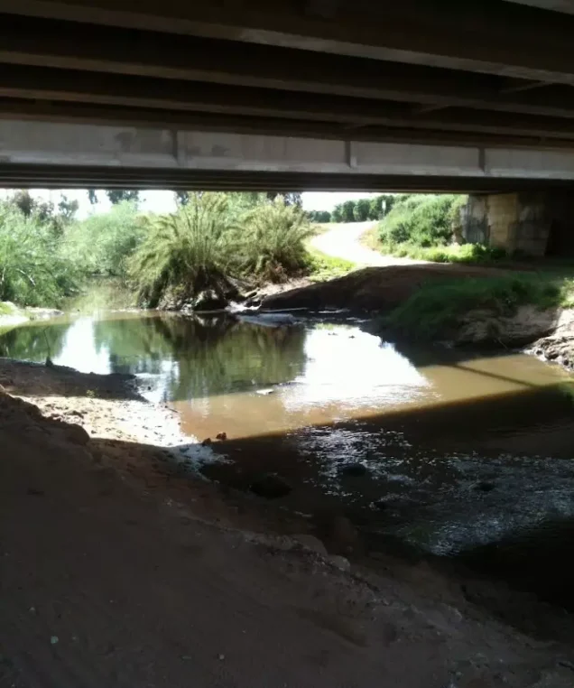
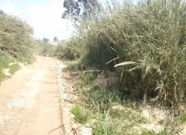
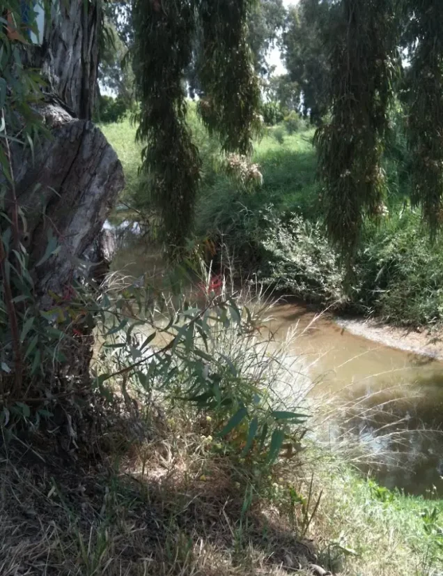
Palestine Remembered contains later community photographs suggesting substantial urban transformation in parts of the former village area. These materials are useful for tracing later change but do not constitute a comprehensive contemporary cadastral and field survey of all former village lands.
Sources
- PalQuestPalQuest – al-Sawalima
- PalQuestPalQuest – Operation Hametz
- Palestine RememberedPalestine Remembered – al-Sawalima, Jaffa District
- Palestine RememberedPalestine Remembered – al-Sawalima entry from Walid Khalidi's All That Remains
- Palestine RememberedPalestine Remembered – al-Shaykh Muwannis; context for the late-March 1948 displacement
- Palestine RememberedPalestine Remembered – Abu Kishk; context for displacement north of Tel Aviv
- Institute for Palestine StudiesInstitute for Palestine Studies – Walid Khalidi, All That Remains
- pcbs.gov.psGovernment of Palestine – Census of Palestine 1931, Jaffa Subdistrict
- palestinapedia.psPalestinian Encyclopedia – 'Arab al-Sawalima
- PalQuestPalQuest – All That Remains: Methodology and Field Research
Photo gallery



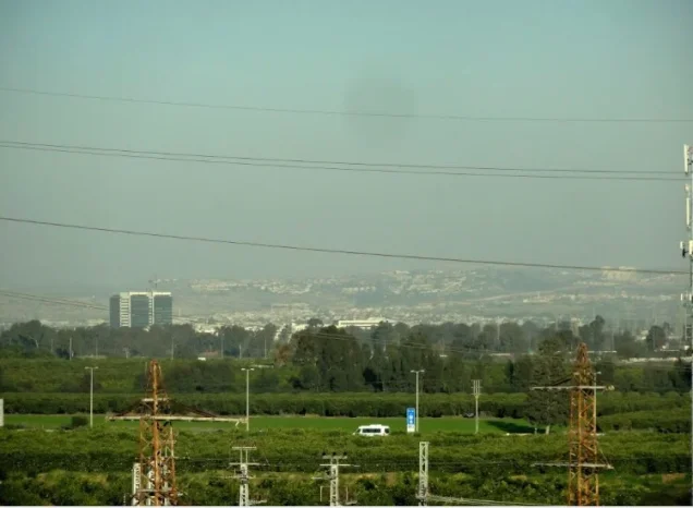
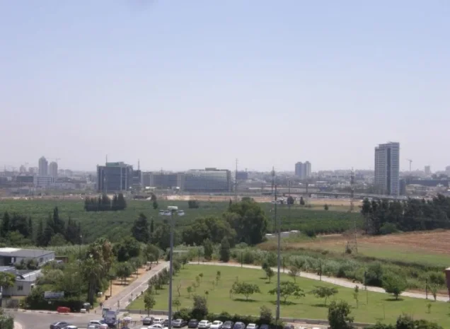
Photos from the village's people
Photos sent in by visitors and published after review.
Add a photo of this village
Log in to add photos of this village.
Other villages from Jaffa
More from the archive
 Download Our Palestine App
The whole archive in the palm of your hand: depopulated villages, the Nakba, the massacres and Al-Aqsa — free, with no ads to erase the story.
Download Our Palestine App
The whole archive in the palm of your hand: depopulated villages, the Nakba, the massacres and Al-Aqsa — free, with no ads to erase the story.



Comments
No comments yet — be the first to write one.
Add your comment
Name and email are optional. Comments appear after review.