
The depopulated village of Biyar 'Adas / District of Jaffa

Biyar 'Adas
About the depopulated village of Biyar 'Adas
- District
- Jaffa
- Date Biyar 'Adas was occupied
- 12 April 1948
- Population in 1948
- 350
- Brigade that carried it out
- Irgun
- Distance from the governorate centre
- 19 (km) Northeast of Jaffa
- Elevation above sea level
- 25 m
- Cause of displacement
- Military assault by Zionist troops
- Extent of destruction
- In June 1948, the village was destroyed based on the orders of Yosif Weitz, a Jewish National Fund official, and only few houses survived the destruction.
- Ethnic cleansing
- Biyar 'Adas was completely ethnically cleansed.
- Settlements built on the built-up area of Biyar 'Adas after 1948
- Hod Hasharon East Neighborhoods (Gil Amal), Hapoel Hamizrahi, Elishama , Adanim, Neve Ne'eman (Hod Hsharon)
Hover a dot to read the village name, or click to open its card.
Borders of the depopulated village of Biyar 'Adas
Biyar 'Adas – A Depopulated Palestinian Village in the Jaffa Subdistrict
Biyar 'Adas was a Palestinian village in the Jaffa Subdistrict, situated approximately 19 km northeast of Jaffa on uneven ground in the central coastal plain that sloped southwestward, at an average elevation of about 25 meters above sea level.
The coastal highway passed approximately 2.5 km east of the village and the railway approximately 1.5 km to the east. Secondary roads connected Biyar 'Adas with surrounding Palestinian communities.
The village experienced repeated attacks during February, March, and April 1948. The Third Battalion of the Alexandroni Brigade attacked it on 5 March, while the Stern/Lehi organization attacked on 5 April and announced the demolition of thirty houses. According to the chronology cited by Walid Khalidi, Zionist military activity around Biyar 'Adas had resulted in its complete evacuation by 12 April 1948.
- Subdistrict
- Jaffa
- Distance from Jaffa
- Approximately 19 km northeast
- Average elevation
- Approximately 25 m above sea level
- Population, 1944/45
- 300 Arabs
- Estimated population, 1948
- 348
- Total land area
- 5,492 dunums
- First documented 1948 attack
- 27 February 1948
- Alexandroni attack
- 5 March 1948 – Third Battalion
- Stern / Lehi attack
- 5 April 1948 – thirty houses reportedly demolished
- Completion of depopulation
- 12 April 1948
- Final occupying unit
- No single unit can be identified conclusively; Alexandroni is documented in March and Stern/Lehi in April
- Destruction of village
- Recorded as completed by 16 June 1948 in the diary account cited by Khalidi
- Israeli settlements on village lands
- 'Adanim, 1950; Elishama', 1951
Location and Geography
Biyar 'Adas stood on uneven terrain in Palestine's central coastal plain, sloping generally toward the southwest.
The coastal highway ran approximately 2.5 km east of the village, while the railway line passed approximately 1.5 km east.
This location connected the village with communities throughout the coastal plain and facilitated the transport and marketing of agricultural produce, particularly citrus fruit and vegetables.
Neighboring Villages and Localities
Palestinian maps and later local documentation place Biyar 'Adas west of Jaljulya, south of Kafr Saba, north of Ra's al-'Ayn, and northeast of Jaffa.
Its approximate geographical relationships were:
- North: Kafr Saba and its lands.
- East: Jaljulya, approximately two kilometers away according to local oral documentation.
- South and southwest: 'Arab Abu Kishk and the broader Ra's al-'Ayn area.
- West: the locality known in oral accounts as Khawr al-Wawi, with Ra'anana farther west.
- Farther east and northeast: lands adjoining Qalqiliya and other villages on the edge of the coastal plain.
These are approximate geographical relationships and should not be treated as substitutes for historical cadastral maps.
Name of Biyar 'Adas
Khalidi considers the name Biyar 'Adas to be associated with rock-cut underground storage pits found in the village and used for storing lentils.
This interpretation corresponds to older translations of the place-name as the “well” or “wells of lentils.”
Palestinian oral history preserves another explanation linking the name to a local holy man known as Abu al-'Adas and to the cultivation of lentils. This remains a community tradition rather than the sole securely established etymology.
Biyar 'Adas in the Late Ottoman Period
The village appeared on nineteenth-century maps under forms such as Bir 'Adas and Biyar 'Adas.
Around 1870, Victor Guérin recorded the locality, while an Ottoman village list from roughly the same period gave approximately 198 males and about sixty houses. Since that population figure counted males only, it should not be treated as the total population.
In 1882, the Survey of Western Palestine described Biyar 'Adas as an adobe-built village with a well on its eastern side.
Built Form
The older houses of Biyar 'Adas were closely clustered.
During the final years of the British Mandate, new houses were built mainly southeast of the older village core.
Traditional construction used adobe brick, while more permanent concrete structures also appeared during the later period.
The 1944/45 Village Statistics classified 14 dunums as built-up Arab land.
Population of Biyar 'Adas
The official 1922 Census of Palestine recorded 87 inhabitants in Biyar 'Adas, all Muslims.
By the 1931 census, the population had risen to 161, again all Muslims.
The number of occupied houses in 1931 requires a correction. PalQuest currently displays 38 houses, while sources reproducing the official 1931 census and citing Mills, page 13, give 28 occupied houses. Palestinian local documentation also gives 28. This article therefore uses 28 and treats the PalQuest figure as a likely transcription error.
The 1944/45 Village Statistics recorded 300 Arabs.
Palestine Remembered later estimated the population at 348 in 1948 and the number of refugees and their descendants at 2,137 in 1998. These are retrospective estimates rather than official Mandate census counts.
- 192287Official census; all Muslims
- 1931161Official census; all Muslims
- 1944/45300Official Village Statistics; all Arabs
- 1948348Later estimate, not an official census
- 19982,137 refugeesLater estimate of refugees and their descendants
Number of Houses
- 193128Official census figure as reproduced from Mills; PalQuest currently displays 38
- 194882Later Palestine Remembered estimate, not an official census count
Education
Khalidi's principal village entry does not document a government school in Biyar 'Adas.
Palestinian oral-history documentation states that the villagers established a privately funded community school because there was no government school.
'Abd al-Ghani Zaydan, reportedly from al-Tira/al-Tayyiba area, taught at the school, and oral testimony states that instruction extended to approximately the fifth grade and included Arabic, religion, arithmetic, and English.
The same oral documentation refers to a mosque and a village guesthouse.
These details are presented as Palestinian community and oral-history evidence rather than as official Department of Education statistics.
Economic Life
Agriculture was the principal source of livelihood, supported by fertile coastal-plain soils, rainfall, and wells.
Citrus fruit was one of the most important commercial crops, alongside cereals, vegetables, and other fruit trees.
Local oral histories additionally record oranges, watermelons, melons, wheat, and barley, with some produce marketed in Jaffa.
The agricultural economy also attracted seasonal workers from other Palestinian villages, particularly for citrus groves and harvesting.
Wells and Irrigation
Villagers relied on rainfall and wells for agricultural water.
The Survey of Western Palestine recorded a well on the eastern side of the village in the late nineteenth century.
Palestinian oral histories also refer to artesian wells and deep collection wells associated with citrus groves and irrigated agriculture.
Land Ownership
The total land area recorded for Biyar 'Adas in the 1944/45 Village Statistics was 5,492 dunums.
Using Palestine Remembered's simplified terminology:
- Palestinian5,232 dunums95%
- Transferred to Zionists109 dunums2%
- Communal/Public151 dunums3%
The official Village Statistics use the original categories Arab, Jewish, and Public: 5,232 dunums were Arab land, 109 Jewish, and 151 public.
Land Use in 1944/45
- Arab
- Jewish
- Public
- Citrus and bananas1,604 dunums
- Plantations and irrigable land181 dunums
- Cereals3,523 dunums
- Built-up land14 dunums
- Non-cultivable land170 dunums
Cultivable land totaled 5,308 dunums, approximately 97 percent of the village area: 5,198 Arab, 107 Jewish, and 3 public dunums.
Built-up and non-cultivable land totaled 184 dunums.
This breakdown corrects simplified tables that place 3,416 dunums of cereal land in the Palestinian column. The official figure is 3,413 Arab dunums plus 3 public dunums.
Likewise, the 168 dunums sometimes shown as Palestinian non-arable land actually combine 20 Arab and 148 public dunums. A further 2 dunums were Jewish.
Roman and Byzantine Remains
Remains of Roman-Byzantine structures were located on the northern and northwestern sides of the village.
The rock-cut underground storage pits associated with the village name also indicate older forms of agricultural storage and land use.
The principal source does not provide a detailed archaeological sequence, and these remains should therefore not be used to claim uninterrupted demographic continuity from antiquity to the modern Palestinian village without independent archaeological evidence.
The 1939 Attack
Biyar 'Adas experienced a serious armed attack on the night of 29 May 1939 during the final phase of the Great Palestinian Revolt.
Palestinian documentation citing Akram Zu'ayter records that armed men entered the home of village mukhtar Hamid al-Nays and other houses and opened fire on residents.
According to this account, five Palestinians—one man and four women—were killed and several others were wounded.
Local testimony places the incident within the broader pattern of retaliatory attacks against Palestinian communities associated with support for the 1936–1939 revolt.
Fighting around Biyar 'Adas in 1948
Fighting around the village began weeks before its final depopulation.
On 27 February 1948, a Zionist unit reportedly fired on Palestinian workers picking oranges in a grove outside the village, according to the Jaffa-based newspaper Filastin.
The raid led to continuing engagements between Zionist forces and the village defenders.
Tension intensified on 1–2 March and culminated in another infiltration attempt during the night of 4–5 March.
Alexandroni Attack – 5 March 1948
According to the account Khalidi cites from the History of the Haganah, a force from the Third Battalion of the Alexandroni Brigade attacked Biyar 'Adas at dawn on 5 March 1948.
The operation followed fighting in the area involving members of the Arab Liberation Army.
A contemporary press report stated that fifteen Arabs were killed during the attack.
Palestinian press reporting on the fighting did not state that this attack permanently emptied the village. The date should therefore not be treated as the final depopulation date.
Stern / Lehi Attack – 5 April 1948
On 5 April 1948, the Stern organization / Lehi announced that its units had blown up thirty houses in Biyar 'Adas.
The organization claimed that the houses had been fortified and that the village served as a base for attacks on a neighboring Zionist settlement.
The press account cited by Khalidi, however, stated that a truce had existed between the Haganah and the village population and that the attacking force met no resistance because villagers fled as the assault approached.
Occupation and Depopulation
The chronology does not support reducing the occupation of Biyar 'Adas to a single attack or one military formation.
Khalidi cites an account stating that Zionist military activity around the village had resulted in its evacuation by 12 April 1948.
This article therefore uses 12 April as the date by which depopulation had been completed while preserving the documented sequence:
- 27 February: beginning of the documented cycle of fighting.
- 5 March: attack by the Third Battalion of the Alexandroni Brigade.
- 5 April: Stern/Lehi attack and demolition of thirty houses.
- 12 April: completion of the village's evacuation.
It is therefore misleading to list only one “attacking unit” for the final depopulation. Alexandroni is securely documented in the 5 March attack, while Stern/Lehi is securely documented in the 5 April assault. Khalidi does not identify one single formation as the exclusive final occupying force on 12 April.
- 27 February 1948
Beginning of documented fighting
Palestinian orange workers fired upon outside the village, followed by sustained clashes
- 1–2 March 1948
Escalation
Fighting intensifies around Biyar 'Adas
- 5 March 1948
Alexandroni attack
Third Battalion of the Alexandroni Brigade attacks the village
- 5 April 1948
Stern / Lehi attack
Organization announces demolition of thirty houses; villagers flee before the assault
- 12 April 1948
Completion of depopulation
Military pressure around the village results in complete evacuation
- Not conclusively identified
Single final occupying unit
Multiple formations attacked Biyar 'Adas at different stages
Destruction of the Village in June 1948
After the establishment of Israel, Biyar 'Adas was selected for demolition in early June 1948 as part of plans affecting depopulated Palestinian villages along the coastal region between Tel Aviv and Hadera.
Khalidi states that the policy was connected with the intention to create an area free of its Palestinian Arab population.
On 16 June 1948, David Ben-Gurion recorded in his diary that Biyar 'Adas had been levelled.
The physical destruction therefore followed approximately two months after the village's complete depopulation.
Israeli Settlements on Village Lands
Two Israeli settlements were established on Biyar 'Adas's lands after the Nakba:
- 'Adanim: established in 1950 southwest of the former village site.
- Elishama': established in 1951 on village lands and closer to the former site than 'Adanim.
These are the two settlements that Khalidi explicitly identifies as having been founded on Biyar 'Adas's lands.
Biyar 'Adas Today
According to Walid Khalidi's field description in All That Remains, the former village site was marked by cactus, fig trees, palm trees, and house rubble.
Several houses or sections of houses that had once stood among the citrus groves remained abandoned amid wild vegetation.
These surviving concrete structures varied considerably in architectural design, from simple to elaborate. Their roofs included flat, sloping, and pyramidal forms, while doors and windows were generally rectangular.
The surrounding land was cultivated, with Israeli fruit orchards covering some areas.
This account derives from fieldwork conducted before the publication of All That Remains in 1992 and does not constitute direct verification of every surviving feature in 2026.
Later Palestinian community documentation includes photographs and field visits, including material associated with a 2013 visit. Such documentation helps trace the survival and transformation of the site but does not constitute a comprehensive current archaeological or architectural survey, and upload dates should not automatically be treated as photography dates.
Sources
- PalQuestPalQuest – Interactive Encyclopedia of the Palestine Question: Biyar 'Adas
- Palestine RememberedPalestine Remembered – Biyar 'Adas, Jaffa
- Palestine RememberedPalestine Remembered – Biyar 'Adas entry from All That Remains
- Institute for Palestine StudiesInstitute for Palestine Studies – Walid Khalidi, All That Remains
- pcbs.gov.psGovernment of Palestine – Census of Palestine 1922
- fada.birzeit.eduBirzeit University Repository – Census of Palestine 1931
- maktabatsabil.comGovernment of Palestine – Village Statistics 1945: Jaffa Sub-District, Population and Land Ownership
- maktabatsabil.comGovernment of Palestine – Village Statistics 1945: Jaffa Sub-District, Cultivable Land
- maktabatsabil.comGovernment of Palestine – Village Statistics 1945: Jaffa Sub-District, Built-up and Non-Cultivable Land
- palqura.comPalestinian Villages Encyclopedia – Biyar 'Adas: history, local geography, and oral documentation
- palqura.comPalestinian Villages Encyclopedia – Biyar 'Adas: education
Photo gallery

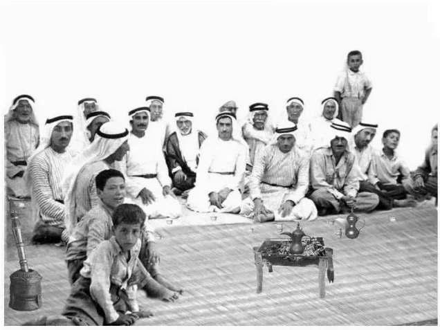


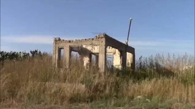


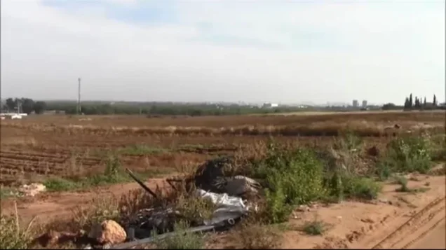
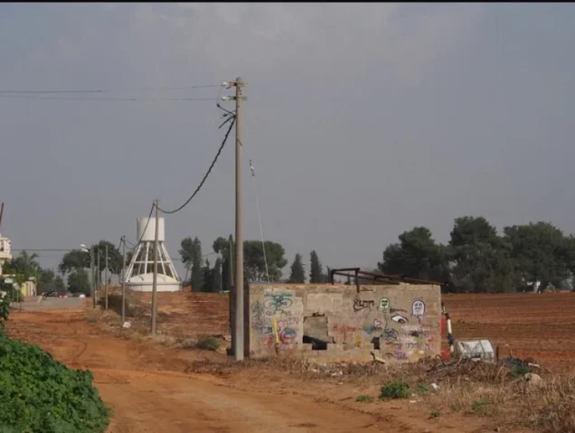


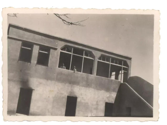
Photos from the village's people
Photos sent in by visitors and published after review.
Add a photo of this village
Log in to add photos of this village.
Other villages from Jaffa
More from the archive
 Download Our Palestine App
The whole archive in the palm of your hand: depopulated villages, the Nakba, the massacres and Al-Aqsa — free, with no ads to erase the story.
Download Our Palestine App
The whole archive in the palm of your hand: depopulated villages, the Nakba, the massacres and Al-Aqsa — free, with no ads to erase the story.



Comments
No comments yet — be the first to write one.
Add your comment
Name and email are optional. Comments appear after review.