
The depopulated village of Bayt Dajan / District of Jaffa
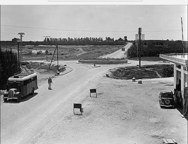
Bayt Dajan
About the depopulated village of Bayt Dajan
- District
- Jaffa
- Date Bayt Dajan was occupied
- 30 April 1948
- Population in 1948
- 4,454
- Military operation
- Operation Bi'ur Hametz
- Brigade that carried it out
- Alexandroni Brigade
- Distance from the governorate centre
- 9 km east of Jaffa
- Elevation above sea level
- 25 m
- Cause of displacement
- The influence of the Zionist assault on neighbouring Jaffa – the inhabitants evacuated the village on 25 April 1948 as the attacks on Jaffa began, according to Benny Morris as cited by Khalidi
- Settlements built on the built-up area of Bayt Dajan after 1948
- Beyt Dagan, established on the village site six months after its occupation in April 1948; Mishmar ha-Shiv'a (1949); Chemed (1950); and Gannot (1953)
Hover a dot to read the village name, or click to open its card.
Borders of the depopulated village of Bayt Dajan
Bayt Dajan: A Depopulated Palestinian Village in the Jaffa District
Bayt Dajan was a Palestinian village in the Jaffa District, situated on a sandy hill on the central coastal plain approximately 9 kilometres east of Jaffa, at an average elevation of about 25 metres above sea level. Its population reached 3,840 in the 1944/1945 statistics. The village came under repeated military attack from early 1948. Its inhabitants began evacuating on 25 April, while the principal Palestinian reference sources indicate that military occupation probably occurred in late April during Operation Hametz, although the exact date remains disputed. The village-specific account transmitted by Walid Khalidi and PalQuest attributes its capture to the Alexandroni Brigade.
- Subdistrict
- Jaffa
- Distance from district center
- 9 km east of Jaffa
- Average Elevation
- 25 m above sea level
- Population in 1931
- 2,653
- Number of Houses in 1931
- 591
- Population in 1944/1945
- 3,840 – including 130 Christians
- Estimated Population in 1948
- About 4,454 – a later demographic estimate, not an official census
- Total Land Area in 1945
- 17,327 dunams
- Attack and Depopulation
- The village was attacked by Palmach units from January 1948, perhaps the largest attack being a dawn raid on 26 February in which three villagers were killed and four wounded, according to Aref al-Aref. The inhabitants evacuated the village on 25 April 1948 under the influence of the beginning of the attacks on neighbouring Jaffa, according to Benny Morris as cited by Khalidi, and it probably fell to the Alexandroni Brigade in late April during Operation Hametz.
- Final Israeli Control
- Probably late April 1948, according to Khalidi; Aref al-Aref dates its occupation to 30 April 1948, while a New York Times account, as cited by Khalidi, states that it was captured about two weeks later, together with the village of al-Qubab.
- Military Operation
- Operation Hametz
- Military Unit
- Alexandroni Brigade, according to Khalidi's entry on the village
- Cause of Depopulation
- The influence of the Zionist assault on neighbouring Jaffa – the inhabitants evacuated the village on 25 April 1948 as the attacks on Jaffa began, according to Benny Morris as cited by Khalidi
- Settlements Documented on Village Lands
- Beyt Dagan, established on the village site six months after its occupation in April 1948; Mishmar ha-Shiv'a (1949); Chemed (1950); and Gannot (1953)
Location
Bayt Dajan stood on a sandy hill on the central coastal plain, approximately 9 kilometres east of Jaffa and at an average elevation of about 25 metres above sea level.
The village lay slightly south of the Jaffa–Jerusalem railway at the intersection of the Jaffa–Ramla highway and the coastal road running south toward Gaza.
This location made Bayt Dajan an important point on transportation routes connecting Jaffa with the Palestinian interior and contributed to its agricultural and commercial development.
Bayt Dajan Through History
Bayt Dajan had ancient roots and has been associated with the place called Beth Dagon in ancient sources.
It was known as Bit Daganna during the Assyrian period under King Sennacherib and by a form of the name Keparadagon during the Roman period.
Samaritans settled in the village from the fourth century CE and remained there until at least the tenth century.
During the Umayyad period, Caliph Hisham ibn 'Abd al-Malik built a palace in Bayt Dajan containing white marble columns.
The Crusaders later built a castle known as Casal Maen. Saladin destroyed it, and Richard the Lionheart rebuilt it in 1191.
In 1596, Bayt Dajan was a village in the nahiya of Ramla in the Gaza district, with an estimated population of approximately 633.
The inhabitants paid taxes on wheat, barley, fruit, sesame, vineyards, goats, beehives, and other forms of agricultural production.
In the late nineteenth century, Bayt Dajan was described as a medium-sized village surrounded by olive trees.
Architecture
The houses of Bayt Dajan were spread across the village without a rigid overall plan and were constructed of adobe brick or stone and cement.
The built-up area expanded significantly as the population grew during the first half of the twentieth century.
The Arab built-up area covered approximately 60 dunams in the 1944/1945 statistics.
Population
The 1922 census recorded 1,714 inhabitants in Bayt Dajan.
By the 1931 census, the population had increased to 2,653 people living in 591 houses.
According to the 1944/1945 statistics, Bayt Dajan had 3,840 Arab inhabitants. The population was predominantly Muslim, while 130 residents were Christians.
The figure of approximately 4,454 inhabitants in 1948 is a later demographic estimate rather than an official British Mandate census figure.
Palestine Remembered estimates the number of refugees and their descendants at 27,355 in 1998.
Population of Bayt Dajan
- 1596About 633Historical estimate based on Ottoman records
- 19221,714Official census
- 19312,653Official census
- 1944/19453,840Including 130 Christians; the population was otherwise predominantly Muslim
- 1948About 4,454Later estimate
- 199827,355Estimate of refugees and their descendants
Number of Houses
The 1931 census recorded 591 houses in Bayt Dajan.
The figure of approximately 992 houses in 1948 is a later estimate rather than an official census count.
Education
Bayt Dajan had two schools, one for boys and another for girls.
The boys' school was established in 1920 and had approximately 15 dunams of land used to teach pupils agricultural methods and agronomy.
Its library contained approximately 600 books.
In 1940, the boys' school had 353 pupils, while the girls' school had 102 pupils.
Land of Bayt Dajan
According to the 1944/1945 statistics, Bayt Dajan had a total land area of 17,327 dunams.
Arab ownership amounted to 12,261 dunams, Jewish ownership to 1,975 dunams, while 3,091 dunams were classified as public land.
Land Ownership in Bayt Dajan in 1944/1945
- Arab ownership12,261 dunums71%
- Jewish ownership1,975 dunums11%
- Public land3,091 dunums18%
Agriculture and Economic Life
Agriculture formed a major part of Bayt Dajan's economy, particularly its extensive citrus and banana cultivation.
Artesian wells allowed the inhabitants to develop large areas of irrigated orchards.
According to the 1944/1945 statistics, 7,990 Arab-owned dunams and 1,078 Jewish-owned dunams were devoted to citrus and bananas.
Irrigated and plantation land covered 3,195 Arab-owned dunams and 758 Jewish-owned dunams.
Cereal cultivation covered 676 Arab-owned dunams and 83 Jewish-owned dunams.
Palestine Remembered records approximately 35 dunams planted with olive trees. This represents a crop category within cultivated land and should not be added separately to the overall land-use total.
Land Use in Bayt Dajan in 1944/1945, in Dunams
- Arab
- Jewish
- Public
- Citrus and bananas9,068 dunums
- Irrigated and plantation land3,953 dunums
- Cereals759 dunums
- Built-up area60 dunums
- Uncultivable land3,487 dunums
Historical and Religious Sites
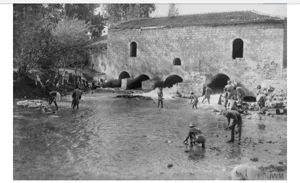
Remains of the medieval Crusader castle were still visible in Bayt Dajan in 1948.
Local Palestinian documentation records several shrines in the village, most notably the shrine of Shaykh Muhammad al-Zawawi and the shrine of Sa'd al-Ansari.
Local traditions connect the shrine of Sa'd al-Ansari with military events in the region during the Crusader period, although the precise identity of the person commemorated and the detailed chronology require additional documentation before being presented as conclusively established.
A local tradition also mentions a shrine dedicated to Shaykh 'Uthman, but the principal reference sources provide insufficient historical information about it.
Attacks on Bayt Dajan Before Its Occupation
Bayt Dajan was subjected to Palmach attacks from as early as January 1948. Some of the attacking units were based in a Jewish National Fund building south of the Jaffa–Jerusalem road.
One village house was destroyed during these early raids.
On 19 February, a clash occurred between villagers and a British military force attempting to arrest an armed man, resulting in casualties on both sides.
At dawn on 26 February 1948, Bayt Dajan was subjected to a larger Zionist attack involving mortars, machine guns, and hand grenades.
According to Palestinian historian 'Arif al-'Arif, three villagers were killed, four were wounded, and one house was destroyed.
Operation Hametz
Operation Hametz was the military operation associated with the occupation of Bayt Dajan. It should not be confused with Operation Bi'ur Hametz, which took place in the Haifa area.
Operation Hametz targeted Palestinian villages surrounding Jaffa on both sides of the Jaffa–Jerusalem railway in order to isolate the city from its Palestinian hinterland and from the routes leading toward Lydda and Ramla.
Bayt Dajan, Yazur, and al-Safiriyya were among the targeted villages south of the railway, while Salama, al-Khayriyya, Saqiya, Kafr 'Ana, and al-'Abbasiyya lay to its north.
PalQuest's chronological entry dates Operation Hametz from 24 April to 13 May 1948, while its detailed narrative states that the main coordinated Haganah offensive was launched on 29 April.
The operation involved the Alexandroni, Kiryati, and Giv'ati Brigades under the overall command of Dan Epstein, commander of the Alexandroni Brigade.
At the same time, the Irgun launched a frontal attack on Jaffa's al-Manshiyya quarter beginning on 25 April. The shelling, fighting, civilian flight from Jaffa, and fall of the surrounding villages reinforced one another and accelerated the depopulation of the area.
The Occupation and Depopulation of Bayt Dajan
The sources differ over the exact date on which Bayt Dajan came under final Zionist military control.
Palestine Remembered's summary gives 25 April 1948, which is also the date associated with the villagers' evacuation under the impact of the attack on and flight from nearby Jaffa.
Palestinian historian 'Arif al-'Arif dates the occupation to 30 April.
A contemporary newspaper account placed the capture later, around the middle of May, when Zionist forces were fighting to reopen the road toward Jerusalem.
This article therefore does not treat either 14 May or 25 April as an uncontested date of final occupation. It distinguishes the villagers' evacuation beginning on 25 April from the military occupation that Walid Khalidi and PalQuest consider most likely to have occurred in late April.
The village-specific account in Walid Khalidi and PalQuest attributes the capture of Bayt Dajan to the Alexandroni Brigade during Operation Hametz.
However, the broader operational narrative places the principal offensive south of the railway in the Giv'ati Brigade's sector and does not independently identify the unit that entered Bayt Dajan. Alexandroni should therefore be understood as the attribution given by the village-specific source rather than as an entirely uncontested unit identification.
Bayt Dajan was eventually emptied of its Palestinian population, whose inhabitants became displaced within Palestine and refugees elsewhere.
Information originating in Israeli accounts is cited here only as transmitted through Walid Khalidi and PalQuest and not through direct reliance on the original Israeli sources.
Occupation and Depopulation Chronology
- January 1948
First attack on the village
From January 1948 the village became the target of attacks by Palmach units stationed in the Jewish National Fund building just south of the Jaffa–Jerusalem highway; a village house was destroyed in one of these raids.
- 26 February 1948
Ground assault
A Zionist force armed with mortars, machine-guns and hand grenades carried out a dawn raid on the village, perhaps the largest attack of that period; three villagers were killed, four were wounded and one house was blown up, according to Palestinian historian Aref al-Aref.
- 25 April 1948
Depopulation of the village
The inhabitants of Bayt Dajan evacuated their village under the influence of the beginning of the attacks on “a neighbouring town”, that is Jaffa, according to Benny Morris as cited by Khalidi. On the same day the Irgun launched its frontal attack on Jaffa.
- Late April 1948 or about two weeks later
Final occupation
Khalidi considers that the village was probably not occupied until the end of April, when it fell to the Alexandroni Brigade during Operation Hametz, and Aref al-Aref dates its occupation to 30 April. A New York Times account, as cited by Khalidi, states that it was captured about two weeks later together with the village of al-Qubab, as Zionist forces fought to reopen the highway to Jerusalem.
- Early June 1948
Destruction of the village
The Jewish National Fund set to work to destroy Bayt Dajan along with a number of other villages, and on 16 June Israeli prime minister David Ben-Gurion wrote in his diary that destruction was proceeding in the village, as cited by Khalidi.
- 1948
Settlement on village lands
In September 1948 the village was named as a suitable site for the settlement of new Jewish immigrants, and the settlement of Beyt Dagan was established on its site six months after its occupation in April 1948.
- 1949–1953
Settlements on village lands
The settlements of Mishmar ha-Shiv'a (1949), Chemed (1950) and Gannot (1953) were established on village lands.
Destruction of Bayt Dajan
The destruction of Bayt Dajan began in early June 1948 along with the destruction of several other Palestinian villages.
By 16 June 1948, demolition of the village was proceeding on a large scale.
In September of the same year, Bayt Dajan was identified as a suitable site for the settlement of newly arrived Jewish immigrants.
Israeli Settlements on Bayt Dajan's Lands
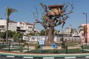
Beyt Dagan
Beyt Dagan was established on the Bayt Dajan village site approximately six months after the village's occupation in 1948.
Mishmar ha-Shiv'a
Mishmar ha-Shiv'a was established on Bayt Dajan's lands in 1949.
Chemed
Chemed was established on the village's lands in 1950.
Gannot
Gannot was established on Bayt Dajan's lands in 1953.
Some local maps and studies associate additional modern neighbourhoods in Rishon LeZion, Holon, and the surrounding urban area with portions of Bayt Dajan's historical lands. The principal Palestinian reference sources reviewed, however, do not provide sufficiently detailed cadastral documentation to list all of these neighbourhoods as conclusively established on village land.
- 1948Beyt Dagan
Established on the village site approximately six months after its occupation
- 1949Mishmar ha-Shiv'a
Established on Bayt Dajan's lands
- 1950Chemed
Established on Bayt Dajan's lands
- 1953Gannot
Established on Bayt Dajan's lands
Bayt Dajan After the Nakba
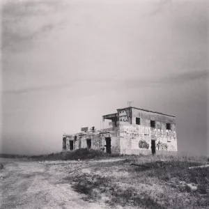
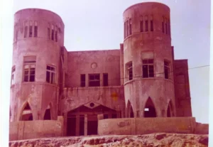
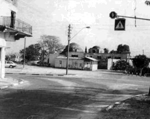
According to the field documentation relied upon by Walid Khalidi, several Palestinian houses survived the destruction of the village.
Some were abandoned, while others were used as residences, shops, offices, or warehouses.
One surviving Palestinian building was converted into a synagogue.
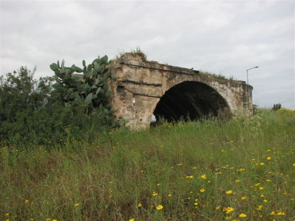
The remaining buildings display varied architectural features, including flat roofs, arched windows and doorways, and a house with a deteriorating pyramidal tiled roof.
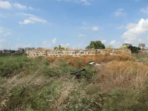
Cactus plants and cypress, fig, and date-palm trees continued to grow across the village site, while surrounding lands were cultivated.
Local Palestinian documentation also records the survival of village cemeteries and later disputes concerning construction and excavations affecting parts of the burial grounds.
Khalidi's description reflects the condition of the site during his field documentation and should not necessarily be interpreted as a comprehensive survey updated to 2026.
Sources
- PalQuest – Interactive Encyclopedia of the Palestine Question: Bayt Dajan.
- PalQuest: Operation Hametz.
- Palestine Remembered: Bayt Dajan, Jaffa District.
- Walid Khalidi, All That Remains, entry on Bayt Dajan.
- 'Arif al-'Arif, writings on the Nakba and the occupation of Bayt Dajan.
- Local documentation by the Bayt Dajan community published through Palestine Remembered.
- Government of Palestine, censuses of 1922 and 1931.
- Government of Palestine, Department of Statistics, Village Statistics, 1945.
Photo gallery




Photos from the village's people
Photos sent in by visitors and published after review.
Add a photo of this village
Log in to add photos of this village.
Other villages from Jaffa

More from the archive
 Download Our Palestine App
The whole archive in the palm of your hand: depopulated villages, the Nakba, the massacres and Al-Aqsa — free, with no ads to erase the story.
Download Our Palestine App
The whole archive in the palm of your hand: depopulated villages, the Nakba, the massacres and Al-Aqsa — free, with no ads to erase the story.



Comments
No comments yet — be the first to write one.
Add your comment
Name and email are optional. Comments appear after review.