
The depopulated village of Al-Muwaylih / District of Jaffa
Al-Muwaylih
About the depopulated village of Al-Muwaylih
- District
- Jaffa
- Date Al-Muwaylih was occupied
- 31 December 1947
- Population in 1948
- 420
- Distance from the governorate centre
- 16 (km) Northeast of Jaffa
- Elevation above sea level
- 25 m
- Cause of displacement
- Military assault by Zionist troops
- Extent of destruction
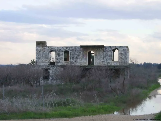
- Muwalih was mostly destroyed with the exception of few houses, one of which belongs to Halim al-Jayyusi.
- Ethnic cleansing
- Late December 1947, Muwalih's inhabitants were terrorized into fleeing their homes.
Hover a dot to read the village name, or click to open its card.
Borders of the depopulated village of Al-Muwaylih
Al-Muwaylih – Depopulated Palestinian Village of the Jaffa Subdistrict
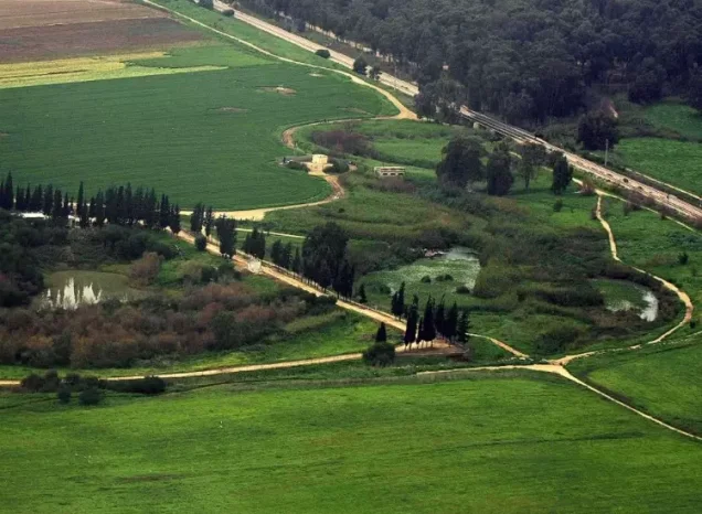
Al-Muwaylih was a Palestinian village in the Jaffa Subdistrict, situated on the central coastal plain approximately 16 km northeast of Jaffa and at an average elevation of about 25 metres above sea level. It stood about 1.5 km north of the al-'Awja River and near roads connecting the area with Jaffa, Ra's al-'Ayn, and neighboring villages.
The village originated as a settlement of formerly nomadic Bedouin whom the sources used by Walid Khalidi trace to the 'Arab al-Malaha. The inhabitants initially settled around a spring before extending their dwellings along the road toward Ra's al-'Ayn. During the British Mandate period, agriculture—particularly citrus, bananas, and cereals—became central to the village economy. Its Palestinian population was displaced during the early stages of the Nakba and the 1948 occupation of Palestine.
Location of Al-Muwaylih
Al-Muwaylih stood on the central coastal plain, approximately 16 km northeast of Jaffa and about 25 metres above sea level. The al-'Awja River passed roughly 1.5 km south of the village, while a major road serving Jaffa and other coastal localities lay approximately 1 km to the west.
The Palestinian Encyclopedia places the village west of Kafr Qasim and records local road connections with Ra's al-'Ayn, Kafr Qasim, and Jaljulya. Lands belonging to these neighboring localities bordered the wider village area, while the al-'Awja River formed a natural separation between part of al-Muwaylih's lands and those of al-Mahmudiyya.
Origins and Settlement
Walid Khalidi records that al-Muwaylih was founded by Bedouin settlers whose ancestry was traced in his sources to the nomadic 'Arab al-Malaha. The first dwellings were established around a spring, after which settlement expanded along the road leading toward Ra's al-'Ayn.
The houses followed no regular village plan and were scattered across the settlement. The population was predominantly Muslim. During the Mandate period, some large landowners built villas amid the citrus and banana groves outside the main residential area.
Population of Al-Muwaylih
- 193137Official Government of Palestine census figure; the census records the community under the name Malalha and lists its inhabitants as Muslims.
- 1944/45360Official statistics; 360 Arabs were recorded.
- 1948418Later estimate published by Palestine Remembered, not an official census.
- 19982,565 refugeesLater estimate of the village's refugee population and descendants published by Palestine Remembered.
One secondary Palestinian reference gives a population of 137 in 1931. The official 1931 census table, however, records Malalha with 37 inhabitants—18 males and 19 females. The official figure is therefore used here.
Number of Houses
The principal sources reviewed for this article do not provide a sufficiently clear and independently verifiable figure for the number of occupied houses in al-Muwaylih in 1931. No estimate is therefore added merely to complete the record.
Land Ownership in Al-Muwaylih
The total registered village land area in the 1944/45 statistics was 3,342 dunums. Using the terminology employed by Palestine Remembered, ownership was distributed as follows:
- Palestinian2,795 dunums84%
- Transferred to Zionists376 dunums11%
- Communal/Public171 dunums5%
These figures correspond exactly to the official categories Arab / Jewish / Public: 2,795 dunums Arab, 376 dunums Jewish, and 171 dunums Public.
Land Use in 1944/45
The following table preserves the official Arab / Jewish / Public categories and keeps Public land distinct from Arab land:
- Arab
- Jewish
- Public
- Citrus and Bananas949 dunums
- Plantations and Irrigable Land27 dunums
- Cereals2,172 dunums
- Non-Cultivable Land194 dunums
The total cultivable or cultivated area was therefore 3,148 dunums: 2,772 Arab and 376 Jewish. A further 194 dunums were classified as non-cultivable, divided between 23 Arab dunums and 171 Public dunums.
Economic Life in Al-Muwaylih
Agriculture formed the basis of the village economy. In 1944/45, 949 dunums of Arab land were devoted to citrus and bananas, 27 dunums to plantations and irrigable cultivation, and 1,796 Arab dunums to cereals. A further 376 dunums classified as Jewish land were devoted to cereals.
Citrus and banana groves were a prominent feature of the landscape around al-Muwaylih. During the Mandate period, some large landowners constructed villas among these groves outside the main residential concentration.
Water Resources
The earliest permanent settlement developed around a spring. Wells on the eastern side of the village later supplied water for irrigation and supported the cultivation of orchards and irrigated plots.
The nearby al-'Awja River was also an important feature of the local geography, flowing approximately 1.5 km south of the village.
Education
The principal sources reviewed do not provide sufficiently documented information confirming a formal village school, its foundation date, or enrolment figures. No unverified educational details are therefore added.
Occupation and Depopulation of Al-Muwaylih
The precise date on which al-Muwaylih was depopulated and occupied cannot be established with certainty. Walid Khalidi explicitly states that it is difficult to determine when the villagers were displaced, but considers it likely that the village was occupied relatively early, probably during the first weeks of 1948.
Al-Muwaylih stood in an area northeast of Jaffa and Tel Aviv that contained numerous Zionist settlements. Khalidi therefore notes that the village was within easy striking distance of either the Haganah or the Irgun. This, however, does not identify either organization as the confirmed force that entered al-Muwaylih.
Palestine Remembered lists 31 December 1947 as the village's “occupation date” and classifies the cause of depopulation as a direct military assault by Zionist forces. The detailed account derived from Khalidi is more cautious: it notes that many villages in this region were emptied between late December 1947 and late March 1948, generally in the context of direct attacks.
The most accurate formulation is therefore that al-Muwaylih was depopulated during the early phase of the Nakba, beginning around late December 1947, while Khalidi considers its occupation most likely to have occurred during the first weeks of 1948. The exact date of military entry remains uncertain.
Military Unit and Operation
No specific military unit is securely documented in the principal village entry as the force that occupied al-Muwaylih. Khalidi's reference to the Haganah and Irgun indicates that the village was vulnerable to a strike by either organization; it does not establish that both, or either one in particular, carried out the village's occupation.
The principal sources reviewed also do not associate al-Muwaylih with a specifically named military operation. No brigade or operation is therefore assigned to the village without direct documentation.
Occupation Chronology
- Late December 1947
Beginning of regional depopulation
A number of Palestinian villages in the area northeast of Jaffa and Tel Aviv began to be emptied amid escalating attacks and military pressure.
- 31 December 1947
Date listed by Palestine Remembered
Palestine Remembered lists this as the occupation date, but Khalidi does not independently establish it as the definitive date of military entry.
- First weeks of 1948
Probable depopulation and occupation
Khalidi considers it likely that al-Muwaylih was occupied relatively early in 1948, while the precise date and attacking unit remain uncertain.
Israeli Settlements on the Lands of Al-Muwaylih
Newe Yaraq, also commonly rendered Neve Yarak, was established in 1951. Walid Khalidi specifies that it was built partly on al-Muwaylih village land and partly on land belonging to the still-existing Palestinian town of Jaljulya.
It is therefore inaccurate to describe the entire settlement as having been established exclusively on al-Muwaylih's lands.
Al-Muwaylih Today
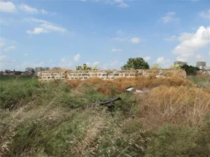
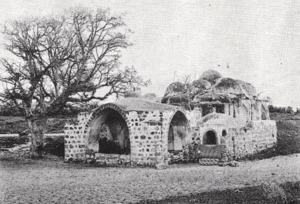
In the field description published in All That Remains, Walid Khalidi wrote that the village site was difficult to identify. Some villas were still standing but deserted amid wild vegetation, while other structures had been reduced to rubble.
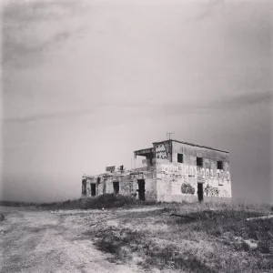
One of the surviving villas belonged to Hashim al-Jayyusi, who later served as a minister in the Jordanian government. Khalidi described it as a two-storey concrete building with rectangular doors and windows and a front stairway leading to the upper floor. The surrounding lands were cultivated.
This description derives from fieldwork conducted before the publication of All That Remains in 1992 and does not constitute direct field verification of the site's condition in 2026. Palestine Remembered also contains later community documentation indicating that some structures remained, but upload dates should not automatically be treated as dates of photography or as comprehensive modern surveys of the village site.
Sources
Photo gallery


Photos from the village's people
Photos sent in by visitors and published after review.
Add a photo of this village
Log in to add photos of this village.
Other villages from Jaffa
More from the archive
 Download Our Palestine App
The whole archive in the palm of your hand: depopulated villages, the Nakba, the massacres and Al-Aqsa — free, with no ads to erase the story.
Download Our Palestine App
The whole archive in the palm of your hand: depopulated villages, the Nakba, the massacres and Al-Aqsa — free, with no ads to erase the story.



Comments
No comments yet — be the first to write one.
Add your comment
Name and email are optional. Comments appear after review.