
The depopulated village of Al-Mirr (Mahmudiya) / District of Jaffa

Al-Mirr (Mahmudiya)
About the depopulated village of Al-Mirr (Mahmudiya)
- District
- Jaffa
- Date Al-Mirr (Mahmudiya) was occupied
- 03 February 1948
- Population in 1948
- 200
- Brigade that carried it out
- Irgun
- Elevation above sea level
- 25 m
- Cause of displacement
- Fear of Jewish attack, or of being caught in the fighting
- Extent of destruction
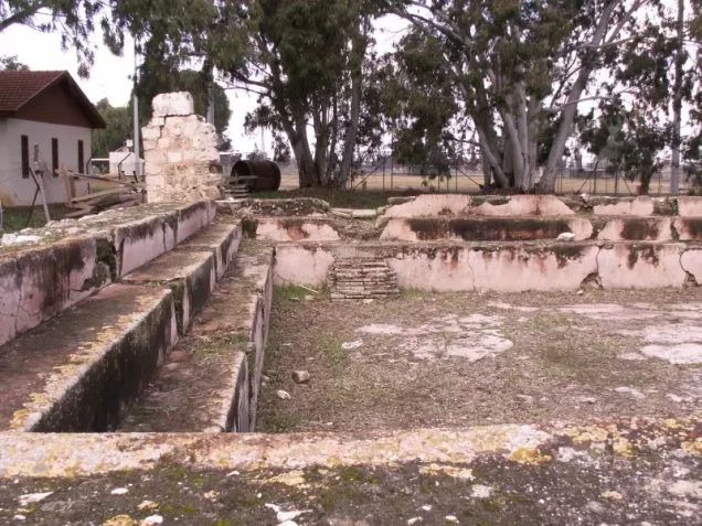
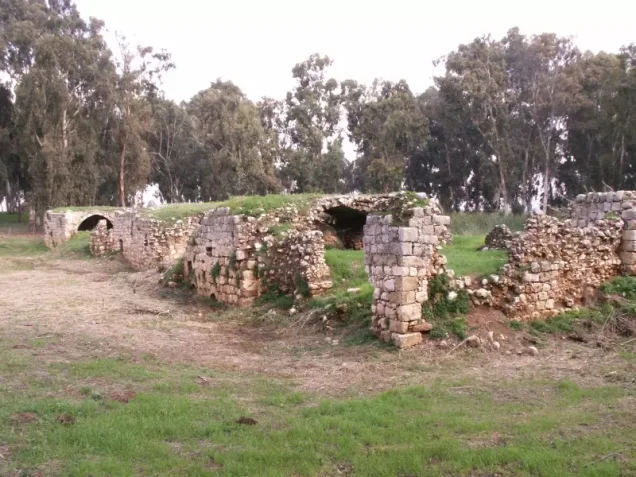
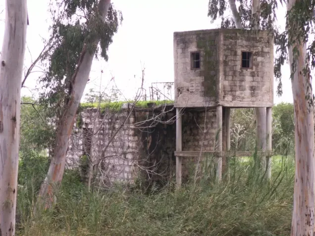
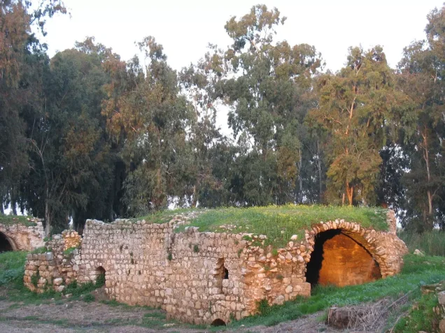
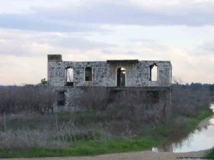
- The village has been mostly destroyed with the exception of few large deserted houses.
- Ethnic cleansing
- On the 3rd of February 1948, al-Mirr's inhabitants were terrorized in leaving the village by the terror gang of Irgun Zvai Leumi (IZL)..
Hover a dot to read the village name, or click to open its card.
Borders of the depopulated village of Al-Mirr (Mahmudiya)
Al-Mirr (al-Mahmudiyya) – A Depopulated Palestinian Village in the Jaffa Subdistrict
Al-Mirr, also known as al-Mahmudiyya, was a Palestinian village in the Jaffa Subdistrict, situated approximately 16.5 km northeast of Jaffa on flat terrain in the central coastal plain, along the southern bank of the al-'Awja River, at an average elevation of about 25 meters above sea level.
The village was small in both population and recorded land area and was classified during the British Mandate as a hamlet or agricultural settlement. A short branch railway linked it to the line running between Ra's al-'Ayn and Petach Tiqwa, while local roads connected it to neighboring villages.
According to a later military intelligence report cited by Khalidi, the inhabitants left al-Mirr on 3 February 1948 amid “general fear” generated by the attacks affecting Palestinian villages between Tel Aviv and Hadera. The principal village source does not establish the precise date on which permanent Zionist military control of the site was imposed; a further attack on al-Mirr was reported on 13 May 1948.
- Subdistrict
- Jaffa
- Alternative name
- al-Mahmudiyya
- Local Palestinian designation
- 'Arab al-Jaramna in some later community documentation
- Distance from Jaffa
- Approximately 16.5 km northeast
- Average elevation
- Approximately 25 m above sea level
- Population, 1944/45
- 170 Arabs
- Estimated population, 1948
- 197
- Total recorded land area
- 51 dunums
- Documented depopulation date
- 3 February 1948
- Later documented attack
- 13 May 1948
- Military force
- Haganah and Irgun attacks affected the wider region; the principal source does not conclusively identify the force that established final control of al-Mirr on a specific date
- Israeli settlements on village land
- None identified by Walid Khalidi
Location and Geography
Al-Mirr stood on flat land in Palestine's central coastal plain, on the southern bank of the al-'Awja River and close to Ra's al-'Ayn.
Its location northeast of Petach Tiqwa placed it near important road and railway connections across the eastern part of the Jaffa Subdistrict.
A short branch railway connected the village with the Ra's al-'Ayn–Petach Tiqwa railway, while local roads linked it with neighboring communities.
Neighboring Villages and Localities
Al-Mirr stood in an area where the lands of Jaffa Subdistrict villages met communities farther east in the coastal plain.
Fajja lay approximately four kilometers to the south, Ra's al-'Ayn lay to the east and southeast, Abu Kishk to the northwest, and Jaljulya and its lands occupied the broader northeastern area.
Local Palestinian mapping places al-Mirr southeast of Abu Kishk and north of Fajja.
These are approximate geographical relationships and should not be treated as substitutes for historical cadastral boundaries.
Name of Al-Mirr / Al-Mahmudiyya
The village was established during the reign of Ottoman Sultan Mahmud II, who ruled from 1808 to 1839, and for this reason it was also known as al-Mahmudiyya.
The name al-Mirr became the form widely used in maps, statistical records, and later historical documentation.
Some Palestinian community sources also call the inhabitants 'Arab al-Jaramna. This designation comes from local documentation and is not presented in that form in the official 1945 Village Statistics.
Al-Mirr in the Late Ottoman Period
In the late nineteenth century, al-Mirr was described as an adobe-built village.
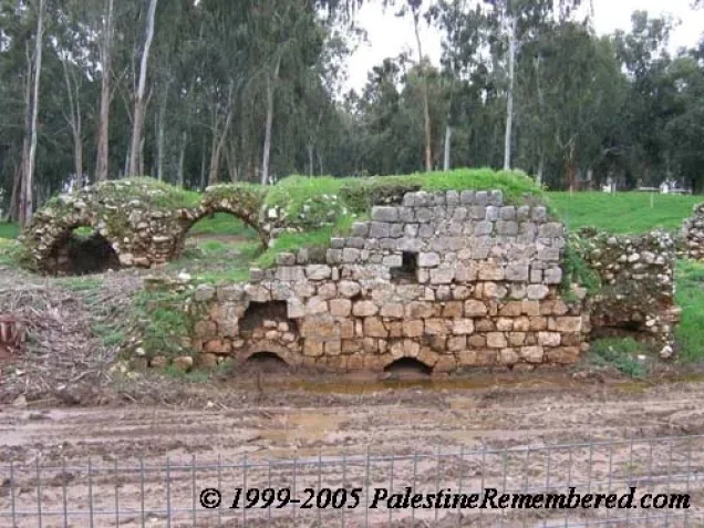
A grain mill stood beside the nearby al-'Awja River, reflecting the community's use of flowing water for milling.
Remains of an Ottoman-era bridge also survived at the edge of the village site, connected with the historical transport landscape around Ra's al-'Ayn and the river.
Built Form
Al-Mirr was a very small settlement. Its entire recorded statistical land unit amounted to only 51 dunums in 1944/45.
Older dwellings were constructed of adobe, while larger concrete houses had appeared by the final decades before the Nakba, including two-storey structures.
The 1944/45 statistics classified 2 dunums as built-up Arab land.
Population of Al-Mirr
Palestine Remembered gives a population of 75 in 1922, all Muslims.
The official 1931 data recorded 101 inhabitants and 25 occupied houses.
By 1944/45, the population had risen to 170 Arabs.
Palestine Remembered later estimated the population at 197 in 1948 and the number of refugees and their descendants at 1,211 in 1998. These are retrospective estimates rather than official Mandate census counts.
- 192275Figure reproduced by Palestine Remembered from Mandate-era statistics; population reported as Muslim
- 1931101Official census figure
- 1944/45170Official Village Statistics; all Arabs
- 1948197Later estimate, not an official census
- 19981,211 refugeesLater estimate of refugees and their descendants
Number of Houses
- 193125Occupied houses recorded by PalQuest from the 1931 census
- 194848Later Palestinian local estimate, not an official Mandate census count
Education and Public Institutions
Khalidi and PalQuest do not document a separate formal school in al-Mirr before the Nakba.
The principal sources used here also do not provide secure documentation for a separate mosque or health facility, and this article therefore does not add institutions unsupported by the available evidence.
The Palestine Index Gazetteer classified al-Mirr as a hamlet, reflecting its small population and compact rural character.
Land Ownership in 1944/45
The official Village Statistics recorded a total of 51 dunums for al-Mirr.
Using Palestine Remembered's simplified terminology:
- Palestinian41 dunums80%
- Transferred to Zionists0 dunums0%
- Communal/Public10 dunums20%
The official categories were Arab and Public: 41 dunums were Arab land and 10 dunums were public. No land was recorded under the Jewish category.
Land Use in 1944/45
- Arab
- Public
- Citrus and bananas2 dunums
- Cereals31 dunums
- Built-up land2 dunums
- Non-cultivable land16 dunums
Cultivable land totaled 33 dunums, approximately 65 percent of the statistical area: 31 dunums of cereals and 2 dunums of citrus and bananas.
Built-up and non-cultivable land totaled 18 dunums: 8 Arab and 10 public.
Khalidi also records olive cultivation on lands east and west of the village site. The 1945 table does not provide a separate olive figure, so no unsupported acreage has been added.
Economic Life
Agriculture was the principal source of livelihood, while some villagers worked in the transportation sector because of the nearby roads and railway.
The villagers cultivated cereals, citrus, bananas, and olives and benefited from their proximity to the al-'Awja River.
A grain mill beside the river was historically associated with the village and, according to later Palestinian local documentation, served people from al-Mirr and surrounding communities.
The Al-'Awja River and the Mill
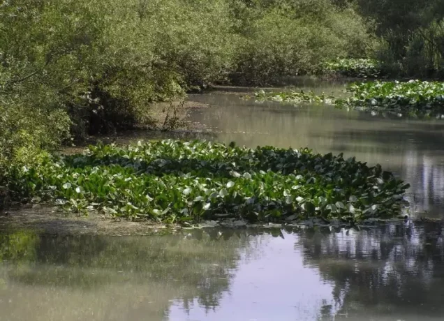
The al-'Awja River was the most important natural feature associated with al-Mirr, whose houses stood on its southern bank.
The river supported agriculture and historically powered a grain mill near the village.
The village also lay within the transport landscape of Ra's al-'Ayn, where the principal springs feeding the river emerge.
Railway and Ottoman Bridge
A short railway branch connected al-Mirr with the line running between Ra's al-'Ayn and Petach Tiqwa.
This transport connection helps explain why some villagers worked in the transportation sector.
Remains of an Ottoman bridge were also visible at the edge of the village site and were recorded by Khalidi.
Depopulation in February 1948
Khalidi cites an Israeli military intelligence report stating that the villagers left al-Mirr on 3 February 1948 because of what the report called “general fear.”
The village lay northeast of Petach Tiqwa and within an area containing several Zionist settlements, leading its inhabitants to fear that they would become an early target.
Palestinian villages between Tel Aviv and Hadera were being attacked by both the Haganah and the Irgun during late 1947 and early 1948.
Accordingly, 3 February 1948 is the strongest documented date for the complete departure of al-Mirr's inhabitants.
Was Al-Mirr Occupied on 1 February?
Palestine Remembered's statistical header and later Palestinian village documentation list 1 February 1948 as an occupation date and attribute it to the Irgun.
Khalidi's detailed account does not establish this claim. It dates the inhabitants' departure to 3 February and does not describe a final Irgun occupation of the village on 1 February.
This article therefore does not use 1 February as a securely established final occupation date and does not list the Irgun as the conclusive village-specific occupying force at that stage.
The Attack of 13 May 1948
Khalidi reports that the New York Times, citing a British Army statement, recorded a Jewish attack on al-Mirr in mid-May. The British report incorrectly referred to the village as Antipatris.
The attack is dated to 13 May 1948, and Khalidi considers it possible that it was connected to a foray into the Triangle area by two Irgun columns at approximately the same time.
The chronology therefore distinguishes between the villagers' departure on 3 February and a later military attack on 13 May.
Military Force and Final Control
Khalidi's village entry does not conclusively establish the date on which permanent military control of the al-Mirr site was imposed between February and May 1948.
What can be documented is that both the Haganah and Irgun attacked Palestinian villages in the wider region during late 1947 and early 1948, and that a further attack on al-Mirr occurred on 13 May and may have involved Irgun columns.
The most careful formulation is therefore: the population left on 3 February 1948 because of general fear of attack; the date and unit responsible for final military control are not conclusively identified by the principal source, while a later 13 May attack was possibly connected to the Irgun.
- Late 1947 – early 1948
Escalating attacks in the region
Haganah and Irgun attacks affect Palestinian villages between Tel Aviv and Hadera
- 3 February 1948
Depopulation of al-Mirr
Villagers leave amid “general fear” according to the intelligence account cited by Khalidi
- 1 February 1948
Alternative secondary date
Listed by some secondary sources as an occupation date but not supported by Khalidi's detailed chronology
- 13 May 1948
Later military attack
British Army report records an attack; Khalidi suggests possible connection with Irgun columns
- Uncertain
Final occupying unit
The principal village source does not conclusively identify a specific force and date for permanent control
Israeli Settlements and Al-Mirr's Lands
According to Walid Khalidi, no Israeli settlement was established on al-Mirr's village lands.
Newe Yaraq, established in 1951 approximately two kilometers from the village site, was founded on lands belonging to Jaljulya rather than al-Mirr.
Al-Mirr Today
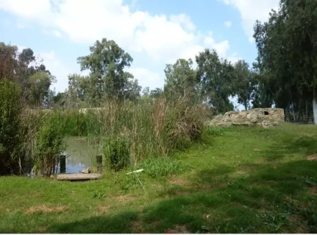
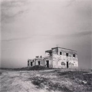
According to Walid Khalidi's field description in All That Remains, several large deserted houses survived at the village site, surrounded by tall thorny vegetation, together with old wells and unused village roads.
One surviving house was a two-storey concrete structure with a flat roof and rectangular windows and doors.
Another surviving two-storey concrete house was larger and architecturally more elaborate. Its ground-floor facade contained three round-arched entrances, while the upper floor had three arched windows and a serrated cornice.
A deteriorating stone-lined well also survived, as did portions of the railway tracks. Palm trees remained scattered across the former village site.
The surrounding land was being cultivated as fruit orchards.
This description derives from fieldwork conducted before the publication of All That Remains in 1992 and should not be treated as direct field verification of the condition of every house, well, or railway feature in 2026. The core sources used here do not provide a comprehensive recent field survey sufficient to establish the precise current condition of all surviving remains.
Sources
- PalQuestPalQuest – Interactive Encyclopedia of the Palestine Question: al-Mirr
- Palestine RememberedPalestine Remembered – al-Mirr (al-Mahmudiyya), Jaffa
- Palestine RememberedPalestine Remembered – al-Mirr entry from All That Remains
- Institute for Palestine StudiesInstitute for Palestine Studies – Walid Khalidi, All That Remains
- pcbs.gov.psGovernment of Palestine – Census of Palestine 1922
- fada.birzeit.eduBirzeit University Repository – Census of Palestine 1931
- maktabatsabil.comGovernment of Palestine – Village Statistics 1945: Jaffa Sub-District, Population and Land Ownership
- palqura.comPalestinian Villages Encyclopedia – al-Mirr / al-Mahmudiyya / 'Arab al-Jaramna
Photo gallery





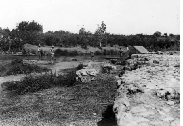

Photos from the village's people
Photos sent in by visitors and published after review.
Add a photo of this village
Log in to add photos of this village.
Other villages from Jaffa
More from the archive
 Download Our Palestine App
The whole archive in the palm of your hand: depopulated villages, the Nakba, the massacres and Al-Aqsa — free, with no ads to erase the story.
Download Our Palestine App
The whole archive in the palm of your hand: depopulated villages, the Nakba, the massacres and Al-Aqsa — free, with no ads to erase the story.



Comments
No comments yet — be the first to write one.
Add your comment
Name and email are optional. Comments appear after review.