
The depopulated village of Ijlil al-Qibliyya / District of Jaffa

Ijlil al-Qibliyya
About the depopulated village of Ijlil al-Qibliyya
- District
- Jaffa
- Date Ijlil al-Qibliyya was occupied
- 03 April 1948
- Population in 1948
- 550
- Brigade that carried it out
- Haganah
- Distance from the governorate centre
- 13 (km) Northeast of Jaffa
- Elevation above sea level
- 25 m
- Cause of displacement
- Fear of Jewish attack, or of being caught in the fighting
- Extent of destruction
- Ijlil al-Qibliya was completely destroyed and defaced.
- Settlements built on the land of Ijlil al-Qibliyya before 1948
- Ramat HaSharon
- Settlements built on the built-up area of Ijlil al-Qibliyya after 1948
- Part of High-Tech and Industry Zone in Herzliya, Military bases, Ramat Hasharon West Neighborhoods , Golan, Neve Rom, Neve Rasko, (HaKfar HaYarok (Ramat Hasharon, Ezorei Hen inTel Aviv
Hover a dot to read the village name, or click to open its card.
Borders of the depopulated village of Ijlil al-Qibliyya
Ijlil al-Qibliyya – A Depopulated Palestinian Village in the Jaffa Subdistrict
Ijlil al-Qibliyya, also known as Jalil al-Qibliyya, was a Palestinian village in the Jaffa Subdistrict, located approximately 13 km northeast of Jaffa on a low hill overlooking the Mediterranean coast to the west and the broad coastal plain to the east, at an average elevation of about 25 meters above sea level.
Ijlil al-Qibliyya stood only about 100 meters southwest of its twin village, Ijlil al-Shamaliyya. The two communities were closely connected socially and geographically, although separate statistical rows were used for them in the final years of the British Mandate.
The Palestinian inhabitants of Ijlil al-Qibliyya left on 3 April 1948, before the end of the British Mandate. Khalidi cites an account stating that the villagers departed out of fear of a Jewish attack. A later Israeli intelligence report published by PalQuest records that Ijlil was completely emptied on the same date, associates the departure with events at al-Shaykh Muwannis, and states that residents went mainly toward Qalqiliya and al-Tira.
- Subdistrict
- Jaffa
- Distance from Jaffa
- Approximately 13 km northeast
- Elevation
- Approximately 25 m above sea level
- Distance from Ijlil al-Shamaliyya
- Approximately 100 m southwest
- Palestinian population, 1944/45
- 470
- Total population in the official 1944/45 statistical row
- 680: 470 Arabs and 210 Jews
- Estimated Palestinian population, 1948
- 545
- Total land area
- 15,207 dunums
- Date of depopulation and military control
- 3 April 1948
- Cause in Khalidi's principal account
- Fear of a Jewish attack; a different explanation appears in the History of the Haganah
- Military organization
- Haganah; the principal village source does not conclusively identify a specific assault brigade or battalion
- Military operation
- No formal operation name is securely established in the principal village source
- Israeli settlements founded on village lands
- Khalidi does not identify an Israeli settlement as having been established on Ijlil al-Qibliyya's lands
Location and Geography of Ijlil al-Qibliyya
Ijlil al-Qibliyya stood on a low hill in Palestine's coastal plain, overlooking the Mediterranean Sea to the west and a broad expanse of level land to the east.
Its twin village, Ijlil al-Shamaliyya, lay only about 100 meters to the northeast, making the two communities an exceptionally close geographical pair.
The village's proximity to the coast and to the main Jaffa–Haifa road facilitated travel to surrounding villages and access to the markets of Jaffa.
Neighboring Villages and Localities
Palestinian maps and local documentation indicate the following approximate geographical relationships:
- North: al-Haram, or Sayyidna 'Ali, and immediately nearby Ijlil al-Shamaliyya.
- Northeast: the encampments of 'Arab al-Shubaki.
- East: Abu Kishk.
- Southeast: Jarisha and areas associated with 'Arab al-Sawalima.
- South: al-Shaykh Muwannis.
- West: the Mediterranean Sea.
These are approximate geographical relationships rather than substitutes for detailed cadastral and land-registry boundaries.
Name of Ijlil al-Qibliyya
Khalidi considers it probable that Ijlil was named after Shaykh Salih 'Abd al-Jalil, whose shrine or tomb stood at the village site.
The designation “al-Qibliyya” distinguished the southern village from neighboring Ijlil al-Shamaliyya; in this context, the Arabic term refers to its southern position.
The village also appears in sources as Jalil al-Qibliyya and simply Ijlil.
Ijlil in the Late Ottoman Period
Ijlil al-Qibliyya can be documented cartographically from at least the late nineteenth century, when Ijlil appeared on the maps of the Survey of Western Palestine.
Travelers and surveyors sometimes described the northern and southern settlements as a single Ijlil community. Their administrative and statistical distinction became clearer during the British Mandate.
The inhabitants were Muslims, and houses were constructed from adobe and later from concrete and other masonry materials.
Built Form of Ijlil al-Qibliyya
The layout of Ijlil al-Qibliyya was relatively dispersed compared with its northern twin.
Its houses were grouped into three loosely connected quarters separated by open spaces that gradually filled with newer construction during the final decades of the Mandate.
In the 1944/45 Village Statistics, only 6 dunums were classified as built-up Arab land.
Population of Ijlil al-Qibliyya
Population figures for Ijlil require careful distinction between the northern and southern villages because the earlier censuses combined them.
The official 1922 Census of Palestine recorded 154 inhabitants in the two Ijlil villages together, all Muslims. This was not a standalone population figure for Ijlil al-Qibliyya.
In the 1931 census, Ijlil al-Qibliyya and Ijlil al-Shamaliyya were again combined, with 305 inhabitants, all Muslims.
By 1944/45, Ijlil al-Qibliyya had its own statistical row. It recorded 470 Arabs and 210 Jews, for a total of 680. The Palestinian village population itself was therefore 470.
Palestine Remembered later estimates the Palestinian population at 545 in 1948 and the number of refugees and their descendants at 3,348 in 1998. These are retrospective estimates rather than official British Mandate census counts.
- 1922154Official combined census figure for Ijlil al-Qibliyya and Ijlil al-Shamaliyya; all Muslims
- 1931305Official combined figure for both Ijlil villages; all Muslims
- 1944/45470 ArabsPalestinian population of Ijlil al-Qibliyya; the full statistical row also records 210 Jews, for a total of 680
- 1948545Later estimate of the Palestinian population, not an official census
- 19983,348 refugeesLater estimate of refugees and their descendants
Number of Houses
The 1931 census combined Ijlil al-Qibliyya and Ijlil al-Shamaliyya, so it does not provide a separate house count for the southern village.
- 193196 occupied housesCombined official count for both Ijlil villages; not Ijlil al-Qibliyya alone
The principal sources used here do not provide a securely documented independent house count for Ijlil al-Qibliyya alone in 1931 or an official 1948 house estimate.
Education
Ijlil al-Qibliyya did not have a separate school during the final years of the Mandate. Its children attended the school in nearby Ijlil al-Shamaliyya.
The school in Ijlil al-Shamaliyya was established in 1945 and served both villages. Approximately 64 pupils from the two communities were enrolled in its founding year.
The school should therefore be described as a shared institution rather than as a separate school belonging to Ijlil al-Qibliyya.
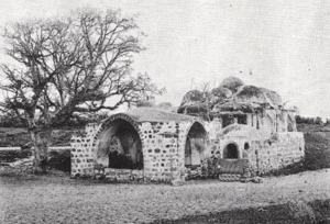
Shrine of Shaykh Salih 'Abd al-Jalil
A shrine or tomb associated with Shaykh Salih 'Abd al-Jalil stood at the village site, and Khalidi considers his name the probable origin of the name Ijlil.
The principal source does not provide enough evidence for a detailed construction history or architectural description of the shrine.
Land Ownership in Ijlil al-Qibliyya
The 1944/45 statistical row for Ijlil al-Qibliyya covered a total of 15,207 dunums.
Palestine Remembered presents the simplified ownership categories as follows:
- Palestinian8,692 dunums57%
- Transferred to Zionists5,980 dunums39%
- Communal/Public535 dunums4%
The official Village Statistics use the original categories Arab, Jewish, and Public: 8,692 dunums were Arab, 5,980 Jewish, and 535 public.
Land-ownership categories should not be confused with settlement locations. The presence of land in the Jewish category does not by itself establish that a particular settlement was founded on the built-up site or cadastral lands of Ijlil al-Qibliyya. Khalidi's village entry identifies no Israeli settlement as having been founded on its land.
Land Use in 1944/45
- Arab
- Jewish
- Public
- Citrus and bananas1,496 dunums
- Plantations and irrigable land178 dunums
- Cereals10,851 dunums
- Built-up land6 dunums
- Non-cultivable land2,676 dunums
Cultivable land totaled 12,525 dunums, approximately 82 percent of the entire statistical unit: 8,095 Arab, 4,387 Jewish, and 43 public dunums.
Built-up and non-cultivable land totaled 2,682 dunums.
This detailed table corrects simplified versions that place 7,130 dunums of cereal land entirely in the Palestinian category. The official Arab cereal figure is 7,087 dunums, with an additional 43 public dunums.
Likewise, the 1,083 dunums sometimes shown as Palestinian non-cultivable land actually consist of 591 Arab and 492 public dunums.
Economic Life
Agriculture was the principal source of livelihood, with citrus fruit forming an especially important commercial crop alongside cereals and orchards.
The sandy soil was well suited to fruit cultivation, and irrigation wells used in the citrus groves were central to the agricultural economy.
In 1944/45, 923 Arab dunums were devoted to citrus and bananas, 7,087 to cereals, and 85 to plantations and irrigable land.
Villagers also engaged in Mediterranean fishing in addition to agricultural work.
Water and Wells
The agricultural landscape around the two Ijlil villages depended heavily on wells, particularly those serving citrus orchards.
Historical descriptions of the combined Ijlil settlement record wells to both the north and south, while later village documentation also preserves memories of privately owned and agricultural wells.
Tall Makmish and Archaeology
Tall Makmish lay approximately one kilometer northwest of Ijlil al-Qibliyya.
Khalidi reports that excavations conducted between 1977 and 1980 identified occupation phases extending from the seventeenth century BCE through the eighth century CE, interrupted by several periods of abandonment.
The existence of this archaeological site should not be taken as proof of uninterrupted demographic continuity between ancient settlement phases and the modern Palestinian village without additional archaeological evidence.
Contacts before Depopulation
Khalidi, citing the History of the Haganah, records a meeting held in Petah Tikva in late 1947 or early 1948 between Haganah representatives and the mukhtars of several nearby Palestinian villages.
The mukhtar of Ijlil reportedly participated, and the village representatives expressed a desire to avoid conflict and preserve peace in the area.
These contacts ultimately did not prevent the depopulation of the Palestinian communities between Tel Aviv and Herzliya.
Depopulation on 3 April 1948
Khalidi gives 3 April 1948 as the date on which the inhabitants of Ijlil al-Qibliyya left.
He cites Israeli historian Benny Morris as stating that the villagers departed out of fear of a Jewish attack. The History of the Haganah presents a different claim, attributing their departure to pressure from Arab militiamen.
The sources therefore differ concerning the immediate cause, and the latter explanation should not be presented as uncontested fact.
An Israeli intelligence report dated 30 June 1948 and published by PalQuest provides further detail. It records “Jlil” as completely emptied on 3 April, attributes the departure to the effect of events at al-Shaykh Muwannis, lists Qalqiliya and al-Tira as destinations, and states that Jewish forces had taken control of the site.
This article therefore uses 3 April 1948 as the date of complete depopulation and military control.
Military Organization and Operation
The events occurred in April 1948, before the establishment of the State of Israel. The historically appropriate military designation is therefore the Haganah and other pre-state Zionist organizations operating in the region.
Khalidi's village-specific entry does not identify a particular brigade or battalion as the unit that entered Ijlil al-Qibliyya.
The principal source likewise does not establish a formal named military operation specifically for the village. It is therefore more accurate not to assign the occupation conclusively to a particular brigade or operation simply because that force was active in the wider coastal area.
- Late 1947 – early 1948
Contacts with Haganah
Village mukhtars, including Ijlil's, met Haganah representatives and expressed a desire for peace
- March 1948
Growing insecurity north of Jaffa
Palestinian communities between Tel Aviv and Herzliya increasingly emptied
- 3 April 1948
Depopulation of Ijlil al-Qibliyya
Entire population departed; Khalidi cites fear of Jewish attack as the cause
- 3 April 1948
Military control
Later intelligence report records the locality as occupied by Jewish forces
- April 1948
Destinations of some residents
Qalqiliya and al-Tira according to the report published by PalQuest
- Not established
Specific assault unit
Haganah is the documented military organization; no village-specific brigade is securely identified
Prisoner-of-War Camp at Ijlil
Later in the 1948 war, the area of Ijlil al-Qibliyya was used as a camp for Arab prisoners.
A New York Times correspondent reported in October 1948 that roughly half of approximately five thousand Arab prisoners were being held in a camp established on sandy ground near the former village, with more than two hundred large tents.
The detainees reportedly included approximately 250 Palestinians captured after the occupation of their villages.
This episode marked a major transformation of the village site from a Palestinian agricultural community into a military detention location during the war.
Zionist and Israeli Settlements and Ijlil al-Qibliyya's Lands
A distinction must be maintained between Ijlil al-Qibliyya and Ijlil al-Shamaliyya.
Glil Yam: Khalidi places its 1943 establishment on land traditionally belonging to Ijlil al-Shamaliyya, east of the northern village site.
By contrast, Khalidi's entry for Ijlil al-Qibliyya explicitly states that no Israeli settlements were established on the village's lands.
At the same time, the 1944/45 statistical row for Ijlil al-Qibliyya records 5,980 dunums under Jewish ownership and 210 Jews in the population row. These figures demonstrate substantial land transfer but should not be used to relocate Glil Yam from the northern village to the southern one without explicit cadastral evidence.
Ijlil al-Qibliyya Today
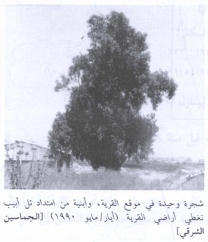
According to Walid Khalidi's field description in All That Remains, the village site was being used as a garbage dump and the original settlement had become difficult to identify.
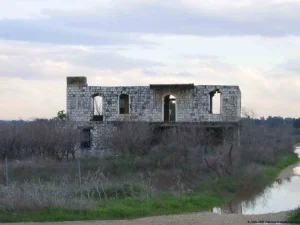
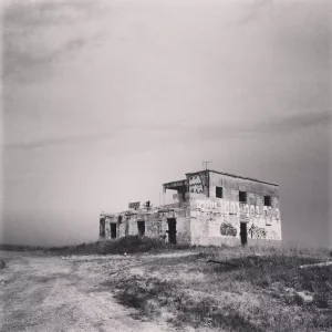
On a small portion of the hill not fully covered by waste, remnants of stone houses survived near a fuel-storage tank, together with wild vegetation and cactus.
Khalidi also recorded an abandoned house approximately 100 meters east of the tank beside the remains of a structure that had been almost completely demolished.
This description comes from fieldwork conducted before the publication of All That Remains in 1992 and does not constitute direct field verification of conditions in 2026.
Palestine Remembered contains later community photographs, oral-history materials, and documents, including items uploaded in 2025 and 2026. Upload dates do not necessarily establish when every photograph was taken, and these materials do not constitute a comprehensive current archaeological or architectural survey.
Later Palestinian local sources describe the wider lands of the two Ijlil villages as having been absorbed into the modern urban and infrastructure landscape around Herzliya, Ramat ha-Sharon, and Glil Yam. This later land use should remain distinct from the narrower historical question of whether a new settlement was originally founded specifically on Ijlil al-Qibliyya's village lands.
Sources
- PalQuestPalQuest – Interactive Encyclopedia of the Palestine Question: Ijlil al-Qibliyya
- PalQuestPalQuest – Israeli Intelligence Report on the Depopulation of Palestine, 30 June 1948
- Palestine RememberedPalestine Remembered – Ijlil al-Qibliyya, Jaffa
- Palestine RememberedPalestine Remembered – Ijlil al-Qibliyya entry from All That Remains
- Institute for Palestine StudiesInstitute for Palestine Studies – Walid Khalidi, All That Remains
- pcbs.gov.psGovernment of Palestine – Census of Palestine 1922
- fada.birzeit.eduBirzeit University Repository – Census of Palestine 1931
- maktabatsabil.comGovernment of Palestine – Village Statistics 1945: Jaffa Sub-District, Population and Land Ownership
- maktabatsabil.comGovernment of Palestine – Village Statistics 1945: Jaffa Sub-District, Cultivable Land
- maktabatsabil.comGovernment of Palestine – Village Statistics 1945: Jaffa Sub-District, Built-up and Non-Cultivable Land
- palqura.comPalestinian Villages Encyclopedia – Ijlil al-Qibliyya: local boundaries and documentation
Photo gallery


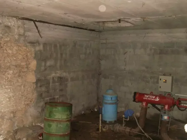

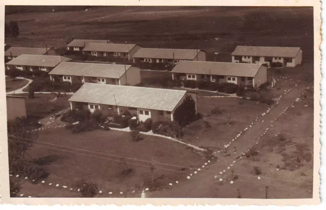


Photos from the village's people
Photos sent in by visitors and published after review.
Add a photo of this village
Log in to add photos of this village.
Other villages from Jaffa
More from the archive
 Download Our Palestine App
The whole archive in the palm of your hand: depopulated villages, the Nakba, the massacres and Al-Aqsa — free, with no ads to erase the story.
Download Our Palestine App
The whole archive in the palm of your hand: depopulated villages, the Nakba, the massacres and Al-Aqsa — free, with no ads to erase the story.



Comments
No comments yet — be the first to write one.
Add your comment
Name and email are optional. Comments appear after review.