
The depopulated village of Al-Sumayriyya / District of Akka (Acre)

Al-Sumayriyya
About the depopulated village of Al-Sumayriyya
- District
- Akka (Acre)
- Date Al-Sumayriyya was occupied
- 14 May 1948
- Population in 1948
- 882
- Military operation
- Operation Ben-Ami
- Brigade that carried it out
- The Carmeli Brigade
- Distance from the governorate centre
- 6 km north of Acre
- Elevation above sea level
- 25 m
- Cause of displacement
- Direct military assault and mortar fire by Zionist forces; most of the women and children had been evacuated to Acre and neighbouring villages before the attack
- Extent of destruction
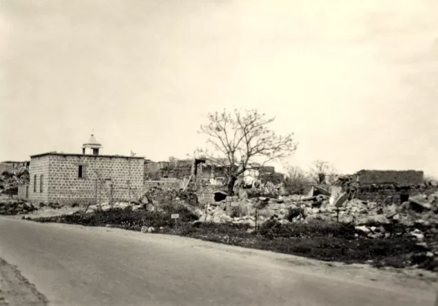
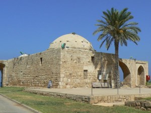
- al-Sumayriyya was mostly destroyed with the exception of its mosque.
- Ethnic cleansing
- al-Sumayriyya inhabitants were completely ethnically cleansed.
- Settlements built on the built-up area of Al-Sumayriyya after 1948
- Shamrat, founded in 1948 on village lands; and Kibbutz Lochamey ha-Geta'ot, established on the ruins of the village on 27 January 1949. Shavey Tziyon and Regba stand on the lands of the village of al-Mazra'a, not on al-Sumayriyya's lands
Hover a dot to read the village name, or click to open its card.
Borders of the depopulated village of Al-Sumayriyya
al-Sumayriyya: A Depopulated Palestinian Village in the Acre District
Al-Sumayriyya was a depopulated Palestinian village in the Acre District, located approximately 6 kilometers north of Acre on a sandstone hill near the Mediterranean coast, at an average elevation of about 25 meters above sea level.
- Subdistrict
- Acre
- Distance from district center
- 6 km north of Acre
- Average Elevation
- 25 m above sea level
- Population in 1931
- 392
- Number of Houses in 1931
- 92
- Population in 1944/1945
- 760
- Estimated Population in 1948
- About 882 – a later demographic estimate, not an official census
- Total Land Area in 1945
- 8,542 dunams
- Attack and Depopulation
- The Carmeli Brigade attacked the village from the northwest and south on the morning of 14 May 1948, during Operation Ben-Ami, and occupied it. According to Morris as cited by Khalidi, its eastern side was left open for the inhabitants to escape as the units mortared the site and closed in, whereas Palestinian historian Aref al-Aref states that it fell after heavy fighting in which all its young defenders were killed when their ammunition ran out; most of the village was then demolished within less than two weeks.
- Final Israeli Control
- Morning of 14 May 1948
- Military Operation
- Operation Ben-Ami
- Military Unit
- Carmeli Brigade
- Cause of Depopulation
- Direct military assault and mortar fire by Zionist forces; most of the women and children had been evacuated to Acre and neighbouring villages before the attack
- Settlements Documented on Village Lands
- Shamrat, founded in 1948 on village lands; and Kibbutz Lochamey ha-Geta'ot, established on the ruins of the village on 27 January 1949. Shavey Tziyon and Regba stand on the lands of the village of al-Mazra'a, not on al-Sumayriyya's lands
The Government of Palestine's 1944/1945 statistics recorded 760 inhabitants, all Arab Muslims, and a total land area of 8,542 dunums. During the Nakba and the occupation of Palestine in 1948, the Carmeli Brigade attacked al-Sumayriyya on the morning of 14 May as part of Operation Ben-Ami. The village was captured, its Palestinian inhabitants were displaced, and most of its built-up area was subsequently destroyed.
Location of al-Sumayriyya
- Al-Sumayriyya was located approximately 6 kilometers north of Acre.
- Its average elevation was about 25 meters above sea level.
- The village stood on a sandstone hill near the Mediterranean coast.
- The coastal highway linked it with Acre and Ra's al-Naqura and, farther north, Beirut.
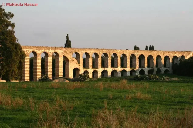
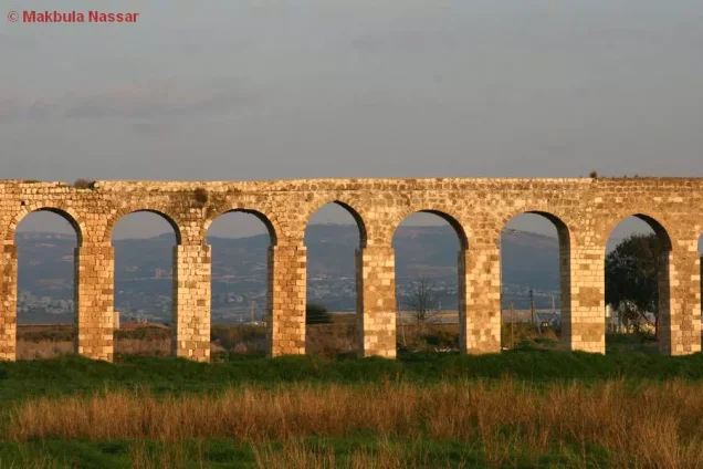
- One of the historic al-Kabri aqueducts passed west of the village on its way to Acre.
- The ancient al-Kabri aqueduct system lay south of the village around Wadi al-Majnuna and Tall al-Zuhur.
The Name and History of al-Sumayriyya
Al-Sumayriyya may have been associated with a locality known as Katasir in the Canaanite period. Walid Khalidi also records a possible connection between the later village name and the Samaritans who once lived in the Acre region before members of the community moved to Nablus. These explanations remain possibilities rather than firmly established historical identifications.
During the Crusader period, the village was known as Someleria.
By the late nineteenth century, al-Sumayriyya was described as a village situated on a plain surrounded by clusters of olive and fig trees, with an estimated population of approximately 200–400.
The Built Environment of al-Sumayriyya
Many of the village houses were built of sandstone, while a smaller number were constructed of adobe.
The inhabitants were overwhelmingly Muslim during the Mandate period, and the village contained a mosque and an elementary school.
The built-up area covered approximately 28 dunums according to the 1944/1945 statistics.
Population of al-Sumayriyya
The 1922 Census of Palestine recorded 307 inhabitants in al-Sumayriyya: 300 Muslims and 7 Maronite Christians.
In the 1931 census, the population increased to 392, consisting of 390 Muslims, one Christian, and one Jew, living in 92 houses.
The Government of Palestine's 1944/1945 statistics recorded 760 inhabitants, all Arab Muslims.
The figures of 882 inhabitants for 1948 and 5,414 refugees for 1998 published by Palestine Remembered are later estimates rather than official Government of Palestine censuses.
Population of al-Sumayriyya
- Late 19th centuryApproximately 200–400Historical estimate
- 1922307Official census: 300 Muslims and 7 Christians
- 1931392Official census: 390 Muslims, one Christian, and one Jew
- 1944/1945760Government of Palestine statistics; all Arab Muslims
- 1948882Later estimate published by Palestine Remembered
- 19985,414Later refugee-population estimate published by Palestine Remembered
Number of Houses in al-Sumayriyya
The 1931 census recorded 92 houses in al-Sumayriyya.
The figure of 207 houses for 1948 published by Palestine Remembered is a later estimate rather than an official census figure.
Number of Houses in al-Sumayriyya
- 193192Official census
- 1948207Later estimate published by Palestine Remembered
Education in al-Sumayriyya
An elementary school for boys was established in al-Sumayriyya in 1943.
By the mid-1940s, approximately 60 pupils were enrolled in the school.
The Mosque of al-Sumayriyya
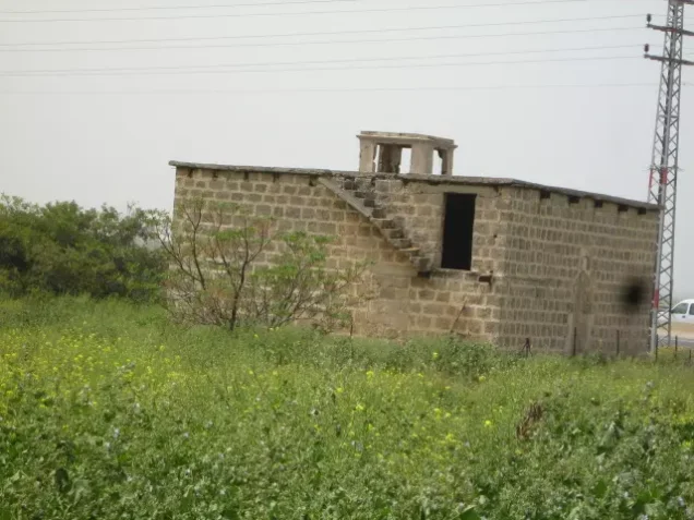
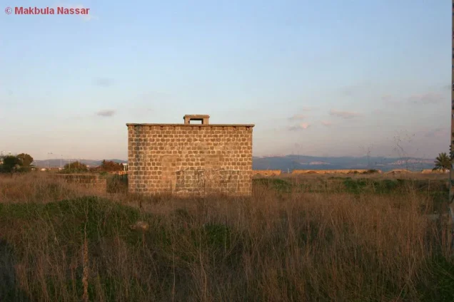
Al-Sumayriyya had a village mosque. Most of the village was destroyed after its occupation, but part of the mosque remained standing according to the field survey recorded by Walid Khalidi.
Land Ownership in al-Sumayriyya
The total land area recorded for al-Sumayriyya in the 1944/1945 statistics was 8,542 dunums.
The Arabic Palestine Remembered table uses the categories “Palestinian,” “Transferred to Zionists,” and “Masha'.” These terms are preserved below to reflect that source's terminology. The official Government of Palestine statistics use the categories “Arab,” “Jewish,” and “Public.”
Land Ownership in al-Sumayriyya, 1944/1945, Using the Terminology of Palestine Remembered
- Palestinian7,935 dunums93%
- Transferred to Zionists0 dunums0%
- Masha' (source terminology)607 dunums7%
Land Use in al-Sumayriyya in 1944/1945
A total of 7,856 dunums was cultivated or classified as cultivable land, consisting of 7,840 dunums of Arab land and 16 dunums of public land.
Cereals covered 6,870 dunums, including 6,854 dunums of Arab land and 16 dunums of public land. Citrus and bananas occupied 632 dunums, while plantations and irrigable land covered another 354 dunums, all of them Arab land.
Land Use in al-Sumayriyya According to the 1944/1945 Statistics
- Arab
- Jewish
- Public
- Citrus and Bananas632 dunums
- Plantations and Irrigable Land354 dunums
- Cereals6,870 dunums
- Built-up Area28 dunums
- Non-Cultivable Land658 dunums
Palestine Remembered separately records approximately 200 dunums planted with olive trees. This figure does not appear as an independent additive category in the official land-use table and is therefore presented as supplementary agricultural information rather than added again to the total.
Economic Life in al-Sumayriyya
Most inhabitants of al-Sumayriyya worked in agriculture, while some villagers were employed in local stone quarries.
The main crops included citrus, bananas, cucumbers, melons, wheat, sesame, and other agricultural produce. Cereals occupied the largest share of cultivated land.
The village's proximity to Acre and its position along the coastal route toward Ra's al-Naqura and Beirut facilitated access to nearby markets and communities.
Archaeological Sites in al-Sumayriyya
Two principal archaeological sites were recorded on the lands of al-Sumayriyya.
Tall al-Sumayriyya contained carved stones, a mosaic floor, tombs, columns, and stone capitals.
The second site, Abu 'Ataba, contained an Islamic shrine and ceramic fragments.
Operation Ben-Ami
The occupation of al-Sumayriyya was associated with Operation Ben-Ami, carried out by the Carmeli Brigade in western Galilee during the final days of the British Mandate.
The operation began on 13 May 1948 and continued until 21 May. Its objective was to seize the coastal villages extending northward from Acre toward the Lebanese border.
Other Palestinian villages affected by the operation included al-Bassa, al-Birwa, al-Ghabisiyya, al-Kabri, al-Manshiyya, al-Nahr, al-Tall, al-Zib, and Umm al-Faraj.
The Occupation of al-Sumayriyya on 14 May 1948
Al-Sumayriyya was occupied on the morning of 14 May 1948 when Carmeli Brigade forces attacked from the northwest and south during Operation Ben-Ami.
Accounts differ regarding the precise circumstances of the village's fall. Walid Khalidi, citing Israeli historian Benny Morris, records an account in which the attacking units shelled al-Sumayriyya with mortars while advancing, leaving its eastern side open for the inhabitants to leave.
Palestinian historian 'Arif al-'Arif, by contrast, states that the village fell after severe fighting and that its defenders continued resisting until their ammunition was exhausted.
Khalidi also cites the History of the Haganah as stating that a force landed by sea near the village and advanced toward al-Sumayriyya. This account is presented through the Palestinian intermediary source Khalidi/PalQuest rather than through independent reliance on the Israeli source.
Eyewitness Accounts of the Assault
Testimonies from villagers provide additional details that differ in some respects from the military accounts.
Approximately 35 men were defending al-Sumayriyya. One eyewitness recalled that an armored unit approached unexpectedly from the south and that one defender initially mistook it for an Arab Liberation Army unit, firing into the air in welcome before being shot and killed.
Most women and children had already been evacuated to Acre and nearby villages, while the men attempted to resist the attack from the northwest.
As the fighting intensified, the defenders withdrew, leaving a number of killed and wounded behind. Some villagers later returned in an attempt to bury the dead, but one testimony records that they were able to recover only one body from the southern part of the village.
Occupation and Depopulation Chronology
- Before the attack (the sources give no date)
Beginning of the exodus
According to eyewitnesses, most of the women and children had been evacuated to Acre and neighbouring villages before the attack, while the village's men stayed to defend it.
- 13–14 May 1948
Beginning of the military operation
The Haganah launched Operation Ben-Ami, carried out by the Carmeli Brigade, to capture all the coastal villages from Acre northwards to the Lebanese border; al-Sumayriyya was among the villages attacked and occupied.
- Morning of 14 May 1948
Ground assault
The Carmeli Brigade attacked the village from the northwest and south, and forces landed by sea at a nearby point and proceeded to take it, according to the History of the Haganah as cited by Khalidi. According to eyewitnesses, an armored unit approaching from the south took the village militia of about thirty-five men by surprise, and one man was killed as he fired in the air to welcome what he thought was an Arab Liberation Army unit.
- Morning of 14 May 1948
Final occupation
According to Morris as cited by Khalidi, the villagers escaped through the eastern side, which had been left open, as the units mortared the site and closed in, whereas Aref al-Aref states that the village fell after heavy fighting in which all its young defenders were killed when their ammunition ran out. Eyewitnesses said the men attempted to repel the attack from the northwest before withdrawing, 'leaving behind many killed and injured.'
- May 1948, within less than two weeks of the occupation
Destruction of the village
Some villagers later returned to bury their dead but could recover only one body, and one of those who returned reported that 'most of the village was destroyed.' This is corroborated by an Associated Press photograph published in the New York Times less than two weeks after the occupation, showing extensive wreckage caused by 'Jewish demolition squads.'
- By June 1948
Levelling of the remaining village
The Jewish National Fund initiated the levelling of al-Sumayriyya, with authorization from Israel's prime minister David Ben-Gurion.
- 1948
Settlement on village lands
The settlement of Shamrat was founded on village lands.
- 27 January 1949
Settlement on village lands
Kibbutz Lochamey ha-Geta'ot was established on the ruins of the village, some seven months after its levelling began.
The Destruction of al-Sumayriyya
One villager who briefly returned after the occupation reported that most of al-Sumayriyya had already been destroyed.
An Associated Press photograph published in The New York Times less than two weeks after the occupation also documented extensive destruction resulting from demolition operations.
By June 1948, the Jewish National Fund had begun leveling the remaining village structures after receiving authorization from David Ben-Gurion.
Settlements Established on the Lands of al-Sumayriyya
Walid Khalidi and PalQuest identify two Israeli settlements as being situated on the lands of al-Sumayriyya:
- Shamrat: established in 1948 on al-Sumayriyya's lands.
- Lohamei HaGeta'ot: established on 27 January 1949 on the ruins of the Palestinian village.
Shavei Tziyon and Regba lie near the northern boundaries of al-Sumayriyya's lands but were established on land belonging to the Palestinian village of al-Mazra'a, not on al-Sumayriyya's lands.
The Site of al-Sumayriyya After the Nakba
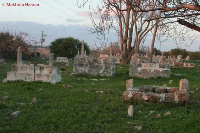
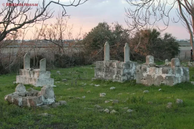
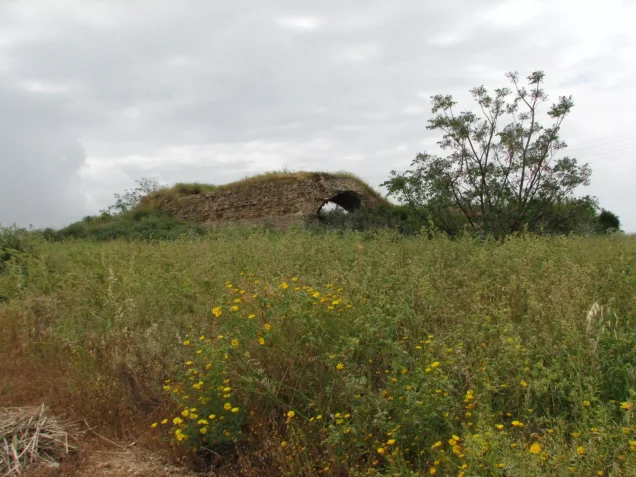
According to Walid Khalidi's field description, one room of the village mosque remained, along with parts of another building, sections of walls and arches from ruined houses, and several graves.
The surviving section of the mosque was a square stone structure with a flat roof and an arched entrance.
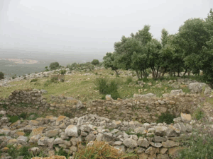
Most of the site was covered by eucalyptus trees, bushes, wild grass, and other vegetation. A cowshed stood in the northern part of the site at the time of the field survey.
The surrounding land was cultivated by residents of Regba, although Regba itself was not established on al-Sumayriyya's lands.
This description is based on fieldwork conducted for Walid Khalidi's All That Remains and should not necessarily be treated as an updated field survey of the site today.
Sources
- PalQuestPalQuest – Interactive Encyclopedia of the Palestine Question: al-Sumayriyya
- PalQuestPalQuest – Interactive Encyclopedia of the Palestine Question: Operation Ben-Ami
- Institute for Palestine StudiesInstitute for Palestine Studies: Walid Khalidi, All That Remains
- Palestine RememberedPalestine Remembered: al-Sumayriyya – Acre District
- pcbs.gov.psPalestinian Central Bureau of Statistics: Historical Censuses of Palestine
Photo gallery




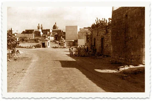
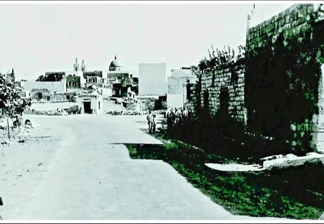
Photos from the village's people
Photos sent in by visitors and published after review.
Add a photo of this village
Log in to add photos of this village.
Other villages from Akka (Acre)
More from the archive



 Download Our Palestine App
The whole archive in the palm of your hand: depopulated villages, the Nakba, the massacres and Al-Aqsa — free, with no ads to erase the story.
Download Our Palestine App
The whole archive in the palm of your hand: depopulated villages, the Nakba, the massacres and Al-Aqsa — free, with no ads to erase the story.



Comments
No comments yet — be the first to write one.
Add your comment
Name and email are optional. Comments appear after review.