
The depopulated village of Al-Zeeb / District of Akka (Acre)

About the depopulated village of Al-Zeeb
- District
- Akka (Acre)
- Date Al-Zeeb was occupied
- 14 May 1948
- Military operation
- Operation Ben-Ami
- Brigade that carried it out
- The Carmeli Brigade
- Distance from the governorate centre
- 13.5 km north of Acre
- Elevation above sea level
- 25 m
- Cause of displacement
- Direct military assault by Zionist forces, accompanied by a mortar barrage; the inhabitants who remained were later moved to the village of al-Mazra'a
- Extent of destruction
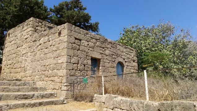
- In December 1948, al-Zeeb was mostly destroyed with the exception of the village mosque and one house only.
- Ethnic cleansing
- al-Zeeb inhabitants were completely ethnically cleansed.
- Settlements built on the built-up area of Al-Zeeb after 1948
- Sa'ar (1948, south of the village site); Gesher ha-Ziv (established as Beyt ha-Arava on the ruins of the village on 27 January 1949)
Hover a dot to read the village name, or click to open its card.
Borders of the depopulated village of Al-Zeeb
al-Zib: A Depopulated Palestinian Village in the Acre District
Al-Zib was a depopulated Palestinian village in the Acre District, located approximately 13.5 kilometers north of Acre on a dome-shaped hill along the Mediterranean coast, at an average elevation of about 25 meters above sea level. The village stood east of the coastal highway and railway and occupied an important historic position on the route linking Acre with Ra's al-Naqura and Tyre.
- Subdistrict
- Acre
- Distance from district center
- 13.5 km north of Acre
- Average Elevation
- 25 m above sea level
- Population in 1931
- 1,059 – joint figure including Manawat, not the village alone
- Number of Houses in 1931
- 251 – joint figure including Manawat, not the village alone
- Population in 1944/1945
- 1,910 – joint figure including Manawat, not the village alone
- Total Land Area in 1945
- 12,607 dunams – joint figure including the lands of Manawat, of which 12,438 dunams Arab-owned and 169 dunams public land
- Attack and Depopulation
- The Haganah's Carmeli Brigade attacked the village in Operation Ben-Ami, which began on 13–14 May 1948 with al-Zib among its main targets; according to Khalidi, most of the inhabitants fled during a mortar barrage that was part of the assault, and the attacking force overwhelmed the village's thirty-five to forty militiamen. Those unable to flee were later moved to the village of al-Mazra'a, and the operation's commander, Moshe Carmel, ordered the village razed to the ground to prevent its people from returning.
- Final Israeli Control
- Probably 13–14 May 1948, in the first stage of Operation Ben-Ami: the Carmeli Brigade began its offensive on 13–14 May with al-Zib among its main targets, and PalQuest records its occupation at the start of the operation, before mentioning the attack on Acre on 16 May; the available sources do not give the exact day of the occupation
- Military Operation
- Operation Ben-Ami
- Military Unit
- The Haganah's Carmeli Brigade
- Cause of Depopulation
- Direct military assault by Zionist forces, accompanied by a mortar barrage; the inhabitants who remained were later moved to the village of al-Mazra'a
- Settlements Documented on Village Lands
- Sa'ar, established in 1948 south of the village site; and Kibbutz Beyt ha-Arava, established on the ruins of the village on 27 January 1949 and later renamed Gesher ha-Ziv, which is on village lands close to the village site. Leman, nearby, is on lands that belonged to the village of al-Bassa
The Government of Palestine's 1944/1945 statistics recorded 1,910 inhabitants for al-Zib together with Manawat and a total land area of 12,607 dunums. During the Nakba and the occupation of Palestine in 1948, the Haganah's Carmeli Brigade attacked al-Zib during Operation Ben-Ami and occupied the village on 14 May 1948 following bombardment and fighting with local defenders. Most inhabitants were displaced, those who remained were subsequently transferred to al-Mazra'a, and most of the village was demolished to prevent the Palestinian population from returning.
Location of al-Zib
- Al-Zib was located approximately 13.5 kilometers north of Acre.
- Its average elevation was about 25 meters above sea level.
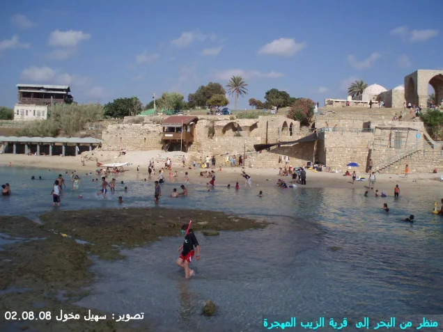
- The village occupied a dome-shaped hill immediately beside the Mediterranean coast.
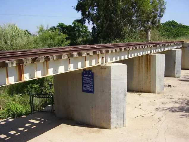
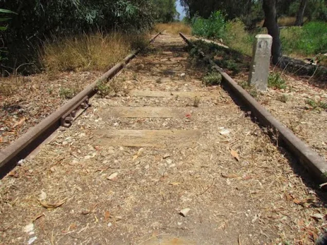
- It stood east of both the coastal highway and the railway line.
- It was situated a few kilometers south of Ra's al-Naqura.
- Al-Bassa lay to the north, al-Kabri to the east, and al-Mazra'a and Umm al-Faraj to the south and southeast.
- Wadi al-Qarn reached the Mediterranean north of the village, while Wadi al-Sa'alik lay to its south.
al-Zib Through History
Al-Zib stood on the site of an ancient town known as Akzib. Archaeological evidence summarized by Walid Khalidi indicates that settlement at the site extended back at least to the eighteenth century BCE and that a walled town existed there by the tenth century BCE.
Akzib fell to the Assyrians in 701 BCE. During the Roman period the locality was known as Ecdippa, while Crusader sources referred to it by names including Casal Lambertie and Imbert.
The Arab traveler Ibn Jubayr, who passed through the area between 1182 and 1184, mentioned al-Zib as a village between Acre and Tyre. In the thirteenth century, the geographer Yaqut al-Hamawi described it as a large coastal village near Acre.
In 1596, al-Zib was part of the nahiya of Acre within the liwa' of Safad and had an estimated population of approximately 875. Its inhabitants paid taxes on wheat, barley, summer crops, fruit, cotton, goats, beehives, and water buffalo.
The eighteenth-century Muslim scholar and judge Abu 'Ali al-Zibi was also associated with the village.
The Built Environment of al-Zib
At the beginning of the nineteenth century, British traveler James Silk Buckingham described al-Zib as a small town built on a hill beside the sea, with a few palm trees rising above its houses.
By the late nineteenth century, it was described as a stone-built coastal village whose inhabitants cultivated olives, figs, mulberries, and pomegranates.
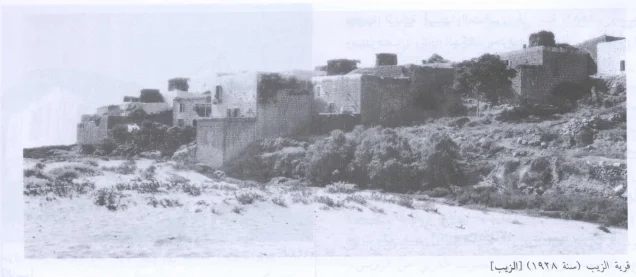
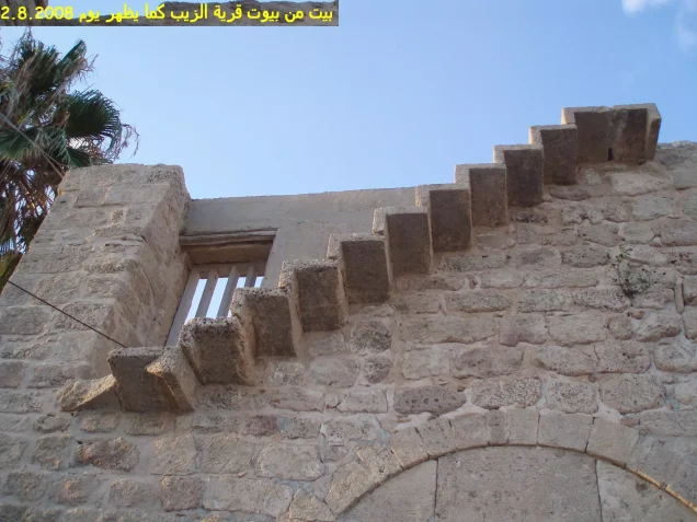
During the later Mandate period, al-Zib had a roughly square and compact layout. Houses were constructed of stone and mud, stone and cement, or reinforced concrete. Wood, reeds, and mud were also used to roof some buildings.
The official 1944/1945 land-use table records a built-up area of approximately 62 dunums, while the Palestinian Encyclopedia gives a rounded figure of 63 dunums.
Population of al-Zib
The 1922 Census of Palestine recorded 804 inhabitants in al-Zib: 803 Muslims and one Christian.
In the 1931 census, al-Zib and Manawat together had 1,059 inhabitants, all Muslims, living in 251 houses. Manawat alone had 66 inhabitants that year.
The Government of Palestine's 1944/1945 statistics recorded a combined population of 1,910 for al-Zib and Manawat.
The figures of 2,216 inhabitants for 1948 and 13,606 refugees for 1998 published by Palestine Remembered are later demographic estimates rather than official censuses conducted in those years.
Population of al-Zib
- 1596About 875Historical estimate based on Ottoman records
- Late 19th centuryAbout 400Historical estimate
- 1922804Official census: 803 Muslims and one Christian
- 19311,059Official census including Manawat; all Muslims
- 1944/19451,910Government of Palestine statistics including Manawat
- 19482,216Later estimate published by Palestine Remembered
- 199813,606Later refugee-population estimate published by Palestine Remembered
Number of Houses in al-Zib
The 1931 census recorded 251 houses in the statistical unit comprising al-Zib and Manawat.
The figure of 525 houses for 1948 published by Palestine Remembered is a later estimate rather than the result of an official census conducted that year.
Number of Houses in al-Zib
- 1931251Official census including Manawat
- 1948525Later estimate published by Palestine Remembered
Public Facilities in al-Zib
Al-Zib had a mosque, an elementary school, and a clinic, together with shops, cafés, and facilities connected with its agricultural and maritime economy.
Palestinian local documentation identifies Sahat al-Manzul as one of the central public spaces of the village, surrounded by cafés, shops, a butcher's shop, the mosque, the school, and several houses.
Education in al-Zib
An elementary school was established in al-Zib by the Ottoman authorities in 1882 and became one of the village's principal institutions.
Palestinian local memory describes it as an official elementary school for boys, with a five-year primary course.
Local documentation also preserves a morning chant remembered from the school:
“Bayd sana'i'una, khudr mara'ina, sud waqa'i'una, humr mawadhina.”
This is included as part of the local Palestinian memory of the school rather than as an item documented in official educational statistics.
The Mosque of al-Zib
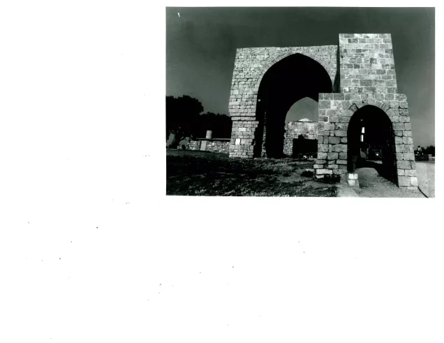
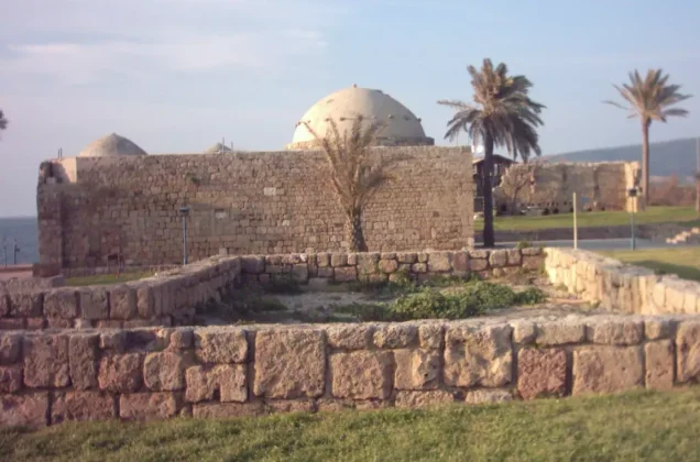
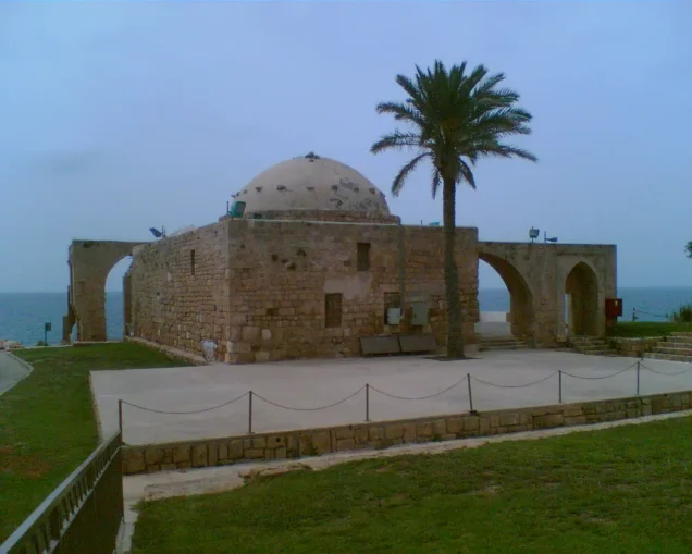
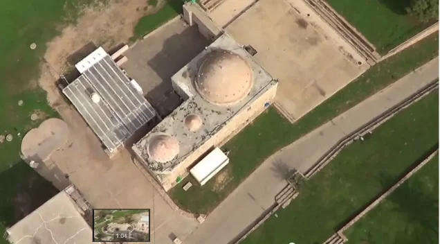
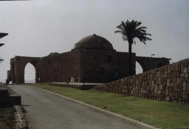
The village mosque was one of al-Zib's principal landmarks and remained standing after the Nakba.
According to the Palestinian Villages Encyclopedia, the mosque occupied approximately 179.5 square meters. It consisted of a roughly square prayer hall and a rectangular annex, with stone façades arranged in horizontal courses.
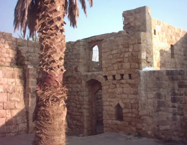
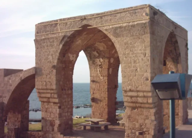
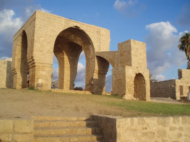
Walid Khalidi describes the surviving stone mosque as having a dome, a large decorative arch on its front façade, and a side annex formed by two monumental arches.
Land Ownership in al-Zib
The total land area recorded for al-Zib and Manawat in the 1944/1945 statistics was 12,607 dunums. The official statistics recorded no Jewish land ownership.
The Arabic Palestine Remembered table uses the categories “Palestinian,” “Transferred to Zionists,” and “Masha'.” These terms are preserved below to reflect the source's terminology. The Government of Palestine used the official categories “Arab,” “Jewish,” and “Public.”
Land Ownership in al-Zib, 1944/1945, Using Palestine Remembered Terminology
- Palestinian12,438 dunums99%
- Transferred to Zionists0 dunums0%
- Masha' (source terminology)169 dunums1%
These figures include Manawat under the statistical classification used in the 1944/1945 data.
Land Use in al-Zib in 1944/1945
Agriculture occupied most of al-Zib's productive land. Adding the detailed official categories gives 9,386 dunums of cultivated or cultivable land.
Citrus and bananas covered 2,972 dunums, plantations and irrigable land 1,989 dunums, and cereals 4,425 dunums. All three categories were recorded as Arab land.
Land Use in al-Zib According to the 1944/1945 Statistics
- Arab
- Jewish
- Public
- Citrus and Bananas2,972 dunums
- Plantations and Irrigable Land1,989 dunums
- Cereals4,425 dunums
- Built-up Area62 dunums
- Non-Cultivable Land3,159 dunums
Palestine Remembered separately records approximately 2,000 dunums planted with olive trees. This is presented as supplementary agricultural information and is not added again to the land-use total, since olive cultivation overlaps with the broader plantation categories.
Economic Life in al-Zib
Al-Zib's economy combined agriculture with fishing, reflecting its position directly on the Mediterranean coast.
The villagers cultivated citrus, bananas, cereals, olives, figs, mulberries, pomegranates, and other fruit crops.
Between 1927 and 1945, the village's annual fish catch averaged more than 16 metric tons.
Al-Zib also had four olive presses: two operated by animal power and two mechanized presses, demonstrating the importance of olive cultivation and oil production to the local economy.
Manawat and Its Relationship to al-Zib
Manawat was a small Palestinian community east of al-Zib that was recorded separately in some early censuses and later incorporated statistically into al-Zib.
Manawat had 16 inhabitants in 1922 and 66 in 1931. By the 1944/1945 statistics, its population and lands were included in the figures for al-Zib.
This is important when comparing population, housing, and land statistics for al-Zib across different years.
Archaeological Remains in al-Zib
Al-Zib stood within an exceptionally rich archaeological landscape, reflecting the long history of settlement at the site.
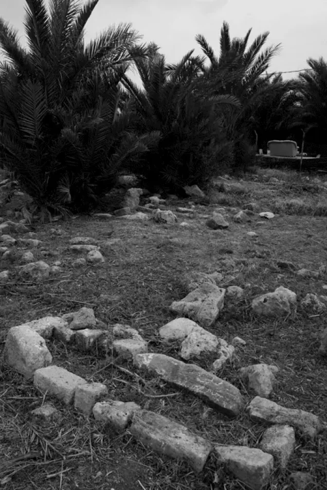
The archaeological site in the village contained building foundations, floors, a cistern, and rock-cut tombs.
Walid Khalidi records six khirbas within a radius of approximately four kilometers, while the Palestinian Encyclopedia and local Palestinian documentation provide a broader list of sites in the surrounding area.
- Khirbat al-Shaqf, east of al-Zib.
- Khirbat Humsin, containing stone remains, columns, foundations, olive presses, and rock-cut burials.
- Khirbat al-'Amud, containing foundations and press remains; some sources tentatively associate it with an ancient locality called 'Am'ad.
- Khirbat al-Manawat, one of the inhabited localities associated with the al-Zib area.
- Bi'r al-Khazna, containing remains of a structure and rock-cut cisterns.
- Khirbat 'Abda.
- Khirbat al-Suwayjira.
- Khirbat Taybiriyya.
- Khirbat Bayt 'Abra.
- Khirbat al-Shumariyya.
Operation Ben-Ami
The occupation of al-Zib was associated with Operation Ben-Ami, carried out by the Haganah's Carmeli Brigade in western Galilee between 13 and 21 May 1948.
It was the Haganah's last major offensive before the end of the British Mandate in Palestine and was intended to capture the coastal villages extending north from Acre to the Lebanese border.
Other Palestinian villages affected by the operation included al-Bassa, al-Sumayriyya, al-Birwa, al-Ghabisiyya, al-Kabri, al-Manshiyya, al-Nahr, al-Tall, and Umm al-Faraj.
The Occupation of al-Zib on 14 May 1948
The Carmeli Brigade began its offensive into northwestern Palestine during the night of 13–14 May 1948, with al-Zib among its principal targets.
Several Palestinian sources record 14 May 1948 as the date on which the village was occupied.
Accounts differ over the circumstances of al-Zib's fall. The History of the Haganah, as cited by Walid Khalidi, claims that the inhabitants left when the attacking forces appeared.
Khalidi also cites Israeli historian Benny Morris, however, as stating that most inhabitants fled during a mortar barrage that formed part of the assault. This version is more consistent with testimonies collected from displaced villagers by Palestinian historian Nafez Nazzal, which describe an actual battle and a surprise attack.
The Israeli account is presented here through the Palestinian intermediary source Khalidi/PalQuest rather than through independent reliance on Israeli sources.
Local Resistance and Villagers' Testimonies
Palestinian historian Nafez Nazzal interviewed displaced inhabitants of al-Zib and recorded a more detailed account of the opening stages of the assault.
The villagers recalled initially mistaking the advancing Zionist forces for Arab reinforcements because some of the attackers wore red-and-white Arab keffiyehs.
The local village militia numbered approximately 35 to 40 men but was overwhelmed by the surprise, bombardment, and superior attacking force.
Most inhabitants left during the fighting. Those who were unable to escape remained temporarily and were later transferred to the Palestinian village of al-Mazra'a, which became a gathering point for Palestinians who remained in western Galilee after the occupation of their villages.
Occupation and Depopulation Chronology
- 13–14 May 1948
Beginning of the military operation
The Haganah's Carmeli Brigade launched an invasion of the northwest corner of Palestine in Operation Ben-Ami, and al-Zib was one of the main villages targeted in the offensive.
- Probably 13–14 May 1948
Ground assault and shelling of the village
According to Israeli historian Benny Morris as cited by Khalidi, most of the villagers fled during a mortar barrage unleashed as part of the assault on the village. The villagers told Palestinian historian Nafez Nazzal that they first mistook the Zionist forces for Arab reinforcements because they wore Arab headdresses, and that these forces overwhelmed the thirty-five to forty men of the village militia.
- Probably 13–14 May 1948 (before 16 May)
Final occupation
PalQuest records that the Haganah attacked and occupied al-Sumayriyya, al-Zib and al-Bassa at the start of Operation Ben-Ami, and then mentions the attack on Acre on 16 May; the available sources do not give the exact day al-Zib was occupied. The History of the Haganah, as cited by Khalidi, claims that the inhabitants fled at the appearance of the forces and that the Haganah command decided to hold onto the village.
- After the occupation (date not specified)
Transfer of the remaining inhabitants
The inhabitants who had been unable to flee during the battle were later moved to the village of al-Mazra'a, which became the collection point for Arab 'remainders' in Western Galilee.
- Between May and December 1948
Destruction of the village
The operation's commander, Moshe Carmel, ordered the village to be razed to the ground in order to 'punish' the villagers and make sure they 'could and would never return.' When Yosef Weitz, director of the Jewish National Fund's Lands Department, visited it in December 1948, he noted that it had been 'completely levelled.'
- 1948
Settlement on village lands
The settlement of Sa'ar was established south of the village site.
- 27 January 1949
Settlement on village lands
A kibbutz named Beyt ha-Arava was established on the ruins of the village and later renamed Gesher ha-Ziv; Jewish immigrants from England, the United States and South Africa were settled there. It is on village lands, close to the village site.
The Destruction of al-Zib
The occupation and depopulation of al-Zib were followed by a deliberate decision to destroy the village's built environment.
Walid Khalidi records that Operation Ben-Ami commander Moshe Carmel ordered al-Zib to be razed in order to punish its inhabitants and prevent their return.
When Jewish National Fund Lands Department director Yosef Weitz visited the site in December 1948, he recorded that the village had effectively been leveled.
These details are presented through Walid Khalidi and PalQuest as Palestinian intermediary sources rather than through independent reliance on the Israeli sources they cite.
Israeli Settlements on the Lands of al-Zib
Israeli settlements were established on al-Zib's lands or immediately around its former site after the displacement of its Palestinian inhabitants.
- Gesher ha-Ziv: a kibbutz was established on the village ruins on 27 January 1949 under the name Beyt ha-Arava and was subsequently renamed Gesher ha-Ziv. Walid Khalidi explicitly identifies Gesher ha-Ziv as being on al-Zib's lands close to the village site.
- Sa'ar: established in 1948 south of the former village site and identified by Palestinian sources as a settlement on al-Zib's lands.
Liman, although nearby, is identified by Khalidi as standing on land that belonged to the Palestinian village of al-Bassa and is therefore not included in the principal list of settlements on al-Zib's land.
Some Palestinian local sources use a broader land-boundary classification that also associates parts of Liman and northern Nahariya neighborhoods with al-Zib. Because this differs from Khalidi's classification, it is treated here as a source discrepancy rather than a settled conclusion.
The Site of al-Zib After the Nakba
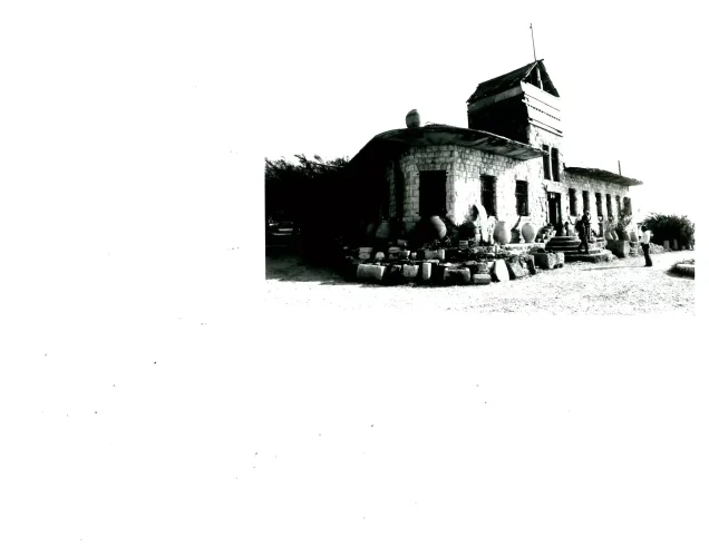
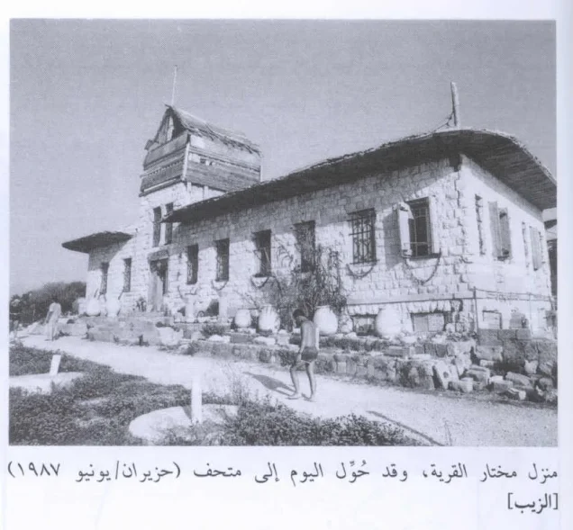
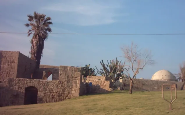
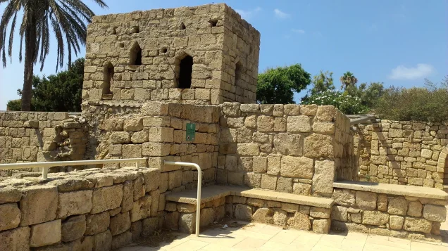
According to Walid Khalidi's field description, the village mosque and the house of mukhtar Husayn 'Ataya remained among the principal surviving structures.
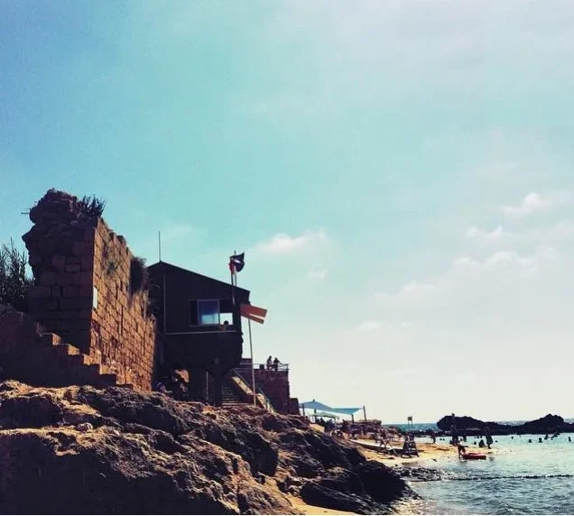
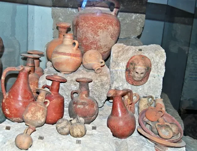
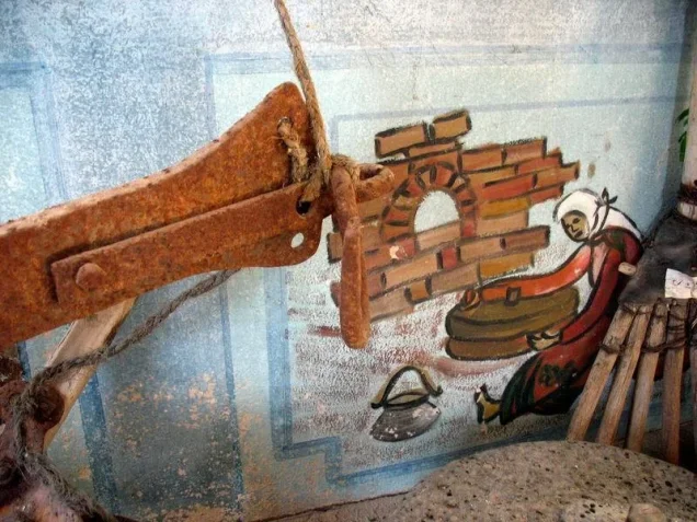
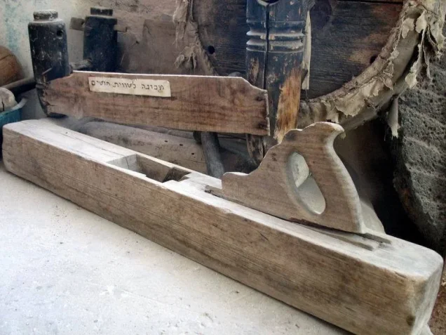
The mosque was restored for tourism, while the mukhtar's relatively large stone house was converted into a museum.
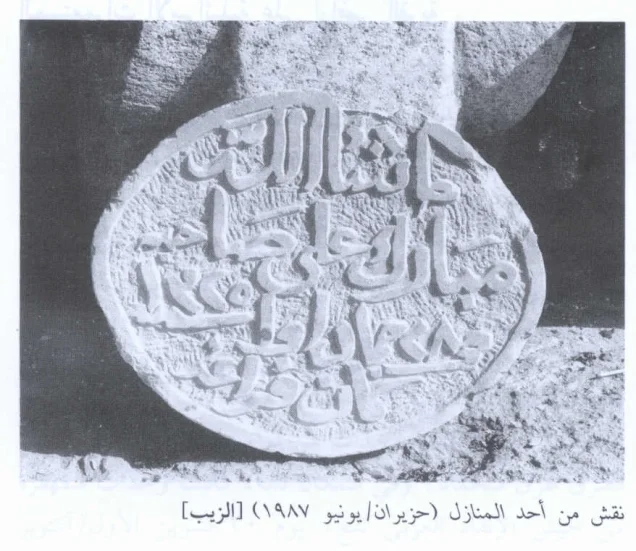
The museum contained inscribed gravestones, including one identifying Ahmad al-Musa and recording his death on 14 September 1938. Remains of stone arches and other archaeological features were also visible near the mosque.
The former village site and adjacent land were used as a recreation area and tourist attraction.
This description is based on fieldwork conducted for Walid Khalidi's All That Remains and should not necessarily be treated as an updated field survey of the site today.
Sources
- PalQuestPalQuest – Interactive Encyclopedia of the Palestine Question: al-Zib
- PalQuestPalQuest – Interactive Encyclopedia of the Palestine Question: Operation Ben-Ami
- Palestine RememberedPalestine Remembered: al-Zib – Acre District
- Palestine RememberedPalestine Remembered: al-Zib in Walid Khalidi's All That Remains
- palestinapedia.psPalestinian Encyclopedia: al-Zib
- palqura.comPalestinian Villages Encyclopedia: al-Zib
- ac-ap.orgArab Center for Alternative Planning: al-Zib – Acre District
- pal48.psFilastunna: The Depopulated Village of al-Zib
Photo gallery


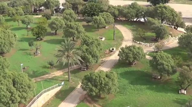


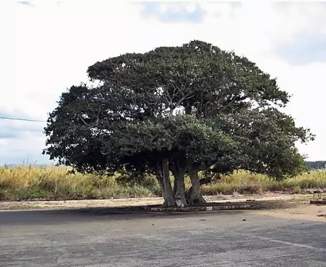

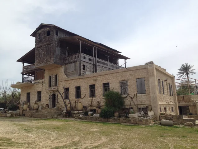
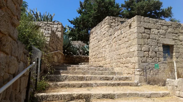








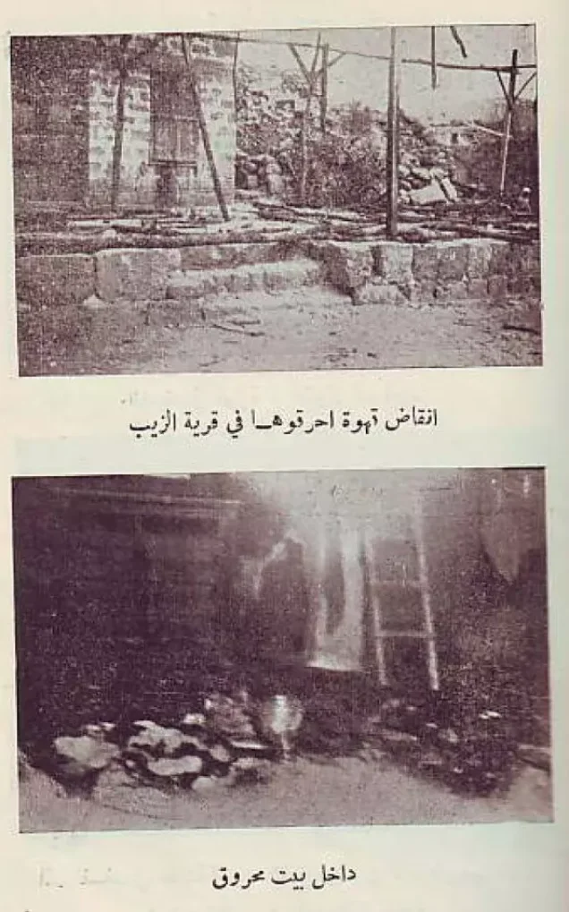

Photos from the village's people
Photos sent in by visitors and published after review.
Add a photo of this village
Log in to add photos of this village.
Other villages from Akka (Acre)

More from the archive



 Download Our Palestine App
The whole archive in the palm of your hand: depopulated villages, the Nakba, the massacres and Al-Aqsa — free, with no ads to erase the story.
Download Our Palestine App
The whole archive in the palm of your hand: depopulated villages, the Nakba, the massacres and Al-Aqsa — free, with no ads to erase the story.



Comments
No comments yet — be the first to write one.
Add your comment
Name and email are optional. Comments appear after review.