
The depopulated village of Suhmata / District of Akka (Acre)
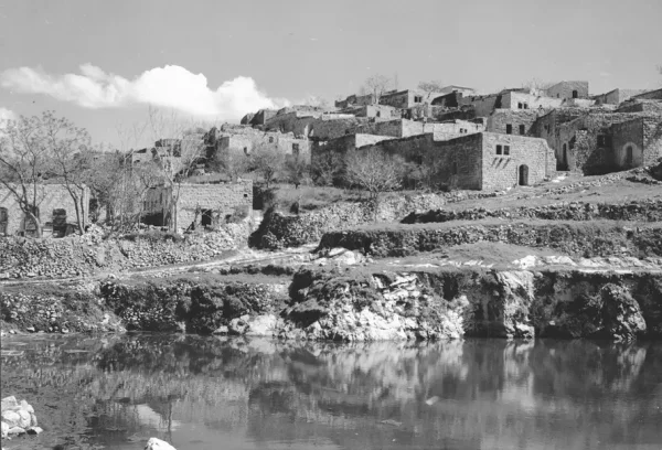
About the depopulated village of Suhmata
- District
- Akka (Acre)
- Date Suhmata was occupied
- 30 October 1948
- Population in 1948
- 1,311
- Military operation
- Operation Hiram
- Brigade that carried it out
- Not named for the village itself; the Golani Brigade's First Battalion met Oded Brigade units at the Suhmata junction during Operation Hiram
- Who defended the village
- Arab Liberation Army
- Distance from the governorate centre
- 25 km from Acre
- Elevation above sea level
- 600 m
- Cause of displacement
- Direct military assault by Israeli occupation forces during Operation Hiram; the official Israeli military account makes no mention of what happened to the inhabitants
- Extent of destruction
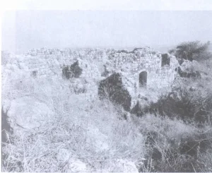
- Suhmata was mostly destroyed with the exception of the nearby Crusaders castle.
- Ethnic cleansing
- Suhmata inhabitants were completely ethnically cleansed.
- Settlements built on the built-up area of Suhmata after 1948
- Tzuri'el, the name given to the village, which was being readied for Jewish immigrants by 27 May 1949, with the main part of the settlement northeast of the village site; and Chosen (Hosen), established on village land in 1949 by Jewish immigrants from Romania
Hover a dot to read the village name, or click to open its card.
Borders of the depopulated village of Suhmata
Suhmata: A Depopulated Palestinian Village in the Acre District
Suhmata was a depopulated Palestinian village located about 25 kilometers northeast of the city of Acre, in the Galilee, at an elevation of approximately 600 meters above sea level. During the late Ottoman period, it belonged to the Safad District, while the British Mandate authorities later incorporated it into the Acre District.
- Subdistrict
- Acre
- Distance from district center
- 25 km from Acre
- Average Elevation
- 600 m above sea level
- Population in 1931
- 796
- Number of Houses in 1931
- 175
- Population in 1944/1945
- 1,130
- Estimated Population in 1948
- About 1,311 – a later demographic estimate, not an official census
- Total Land Area in 1945
- 17,056 dunams
- Attack and Depopulation
- Israeli occupation forces took the village during Operation Hiram in late October 1948; at the Suhmata junction the Golani Brigade's First Battalion met units of the Oded Brigade. According to the History of the War of Independence as cited by Khalidi, the village showed some resistance 'but it was occupied after being encircled by an infantry platoon'; that source makes no mention of the inhabitants.
- Final Israeli Control
- Probably 30 October 1948, during Operation Hiram (28–31 October 1948); PalQuest does not give the day the village itself was taken, and dates to 30 October the capture by Israeli forces of the vehicles and equipment of retreating Arab Liberation Army units at the Suhmata junction
- Military Operation
- Operation Hiram
- Military Unit
- PalQuest does not name the unit that took the village itself; at the Suhmata junction the Golani Brigade's First Battalion, advancing on the southern front of Operation Hiram, met units of the Oded Brigade moving eastwards
- Cause of Depopulation
- Direct military assault by Israeli occupation forces during Operation Hiram; the official Israeli military account makes no mention of what happened to the inhabitants
- Settlements Documented on Village Lands
- Tzuri'el, the name given to the village, which was being readied for Jewish immigrants by 27 May 1949, with the main part of the settlement northeast of the village site; and Chosen (Hosen), established on village land in 1949 by Jewish immigrants from Romania
The village stood on the summits of two hills overlooking lower-lying land in most directions. A road passing through Suhmata connected it with Safad, the coastal road, and nearby villages. During the Nakba and the occupation of Palestine in 1948, Zionist forces occupied Suhmata in the course of Operation Hiram, displaced its inhabitants, and subsequently destroyed most of the village buildings.
Location of Suhmata
- Suhmata was located approximately 25 kilometers northeast of Acre.
- The village stood at an average elevation of about 600 meters above sea level.
- It was built on the summits of two hills overlooking lower-lying land in nearly every direction except the north.
- A road passing through the village connected it with Safad, the road leading toward the coast, and several neighboring villages in the Galilee.
The Built Environment of Suhmata
Most of Suhmata's houses were built of stone. The village was divided into two principal quarters: the western quarter, known as al-Hara al-Tahta, or the Lower Quarter, and the eastern quarter, known as al-Hara al-Fawqa, or the Upper Quarter.
According to accounts by people from Suhmata, the village ponds and the spacious central square known as al-Rahba separated the two quarters. The mosque, church, and elementary school were located in the western quarter, while the historic fortress stood in the elevated eastern section of the village.
The figure of 135 dunums does not represent the total area of Suhmata's lands, as stated in the earlier draft. Rather, it refers to the built-up area according to the 1944/1945 statistics. The total area of the village lands was 17,056 dunums.
Education in Suhmata
Suhmata had an elementary school for boys established by the Ottoman authorities in 1886. An agricultural school was also established in the village during the British Mandate period.
According to documentation by the Association of the People of Suhmata and accounts by former villagers, the agricultural school was located near the eastern quarter. It was surrounded by a garden of approximately ten dunums that was used to train students in practical farming methods, poultry raising, and modern beekeeping.
Land Ownership in Suhmata
The total area recorded for Suhmata in the Government of Palestine's 1944/1945 statistics was approximately 17,056 dunums. Of this area, 9,572 dunums were recorded as Palestinian-owned, no land was recorded as having been transferred to Zionists, and 7,484 dunums were classified as public land.
Land Ownership in Suhmata, 1944/1945
- Palestinian9,572 dunums56%
- Transferred to Zionists0 dunums0%
- Public Land7,484 dunums44%
Land Use in Suhmata in 1944/1945
Agriculture formed a major part of Suhmata's economy. A total of 3,290 dunums was allocated to cereals, while 1,901 dunums were irrigated or used for orchards. The built-up area covered 135 dunums, while 11,730 dunums were classified as uncultivable land.
Land Use in Suhmata According to the 1944/1945 Statistics
- Orchards and Irrigated Land1,901 dunums11%
- Cultivated with Cereals3,290 dunums19%
- Built-up Area135 dunums<1%
- Uncultivable Land11,730 dunums69%
Palestine Remembered also gives an additional figure of 2,110 dunums planted with olive trees. This figure specifically concerns olive cultivation and should not be added again to the land-use categories in the table above.
Economic Life in Suhmata
The inhabitants of Suhmata cultivated wheat, barley, maize, tobacco, vegetables, olives, and figs. The village's tobacco was particularly known for its quality.
A substantial part of the village lands was rocky and uncultivated and was covered with oak trees and wild pear trees, while farming was concentrated on cultivable land around the village.
The inhabitants obtained drinking water from five springs as well as household wells used to collect rainwater. The village also had two ponds that collected rainwater and supplied water for irrigation. The larger pond had a capacity of approximately 5,000 cubic meters, while the second had a capacity of about half that amount.
Religious Landmarks in Suhmata
Suhmata had both a mosque and a church, reflecting the presence of Muslim and Christian inhabitants in the village before the Nakba.
The 1945 statistics record a total population of 1,130 people, consisting of 1,060 Muslims and 70 Christians.
Population of Suhmata
Suhmata had 632 inhabitants in the 1922 census. The population increased to 796 in the 1931 census, and the official 1945 statistics recorded 1,130 inhabitants.
It should be noted that the narrative text in PalQuest's entry on Suhmata contains an apparent error, stating that the population consisted of 1,130 Muslims and 70 Christians. PalQuest's own statistical table and the Government of Palestine statistics show that the correct figures were 1,060 Muslims and 70 Christians, for a total of 1,130 inhabitants.
The figure of 1,311 inhabitants for 1948 and the estimate of 8,050 refugees in 1998 were published by Palestine Remembered and are not official censuses issued by the Government of Palestine.
Population of Suhmata
- Late 19th centuryAbout 400Historical estimate
- 1922632Official census under the British Mandate
- 1931796Official census under the British Mandate
- 19451,130Government of Palestine statistics: 1,060 Muslims and 70 Christians
- 19481,311Estimate published by Palestine Remembered
- 19988,050Estimated number of refugees published by Palestine Remembered
Number of Houses in Suhmata
The 1931 census recorded 175 houses in Suhmata. Palestinian sources differ, however, regarding the number of houses immediately before the Nakba. Palestine Remembered gives a figure of 288 houses for 1948, while the Association of the People of Suhmata gives a figure of 224 houses. Neither figure represents an official census comparable to that of 1931.
Number of Houses in Suhmata
- 1931175Official census
- 1948288Estimate published by Palestine Remembered
- 1948224Figure reported by the Association of the People of Suhmata
Archaeological Remains in Suhmata
Settlement at the site of Suhmata dates back to ancient periods. The Crusaders built a fortress at the site and referred to it as “Samueth.” In the eighteenth century, Zahir al-Umar repaired some of the structures that had been damaged there.
In 1932, a Byzantine church was discovered on a hill near the village. A mosaic inscription on its floor dated the building to 555 CE. Khirbat al-Duwayr and Khirbat al-Ballu'a were also located near Suhmata.
The Occupation of Suhmata and the Displacement of Its Inhabitants During the Nakba
Suhmata was occupied during the Nakba in the course of Operation Hiram, a Zionist military operation carried out in the Galilee between 28 and 31 October 1948.
According to the entry on Suhmata in Walid Khalidi's All That Remains, as published by PalQuest, the First Battalion of the Golani Brigade advanced on the southern front of the operation and met units of the Oded Brigade at the Suhmata junction as those units moved eastward. On 30 October 1948, units of the Arab Liberation Army were retreating in the area, and the attacking forces seized their vehicles and equipment.
PalQuest also cites the official Israeli military account as stating that Suhmata resisted and was occupied after being encircled by an infantry force. This account is included here only because it is cited and discussed by the Palestinian source PalQuest, and not because an Israeli source was used independently.
PalQuest and Palestine Remembered date the occupation of Suhmata to 30 October 1948. Accounts and testimonies from people of Suhmata, however, state that the village was bombed from the air on 28 October and that the forces entered it on 29 October. Because of this discrepancy, the different dates should be presented clearly rather than treated as a single undisputed date.
Palestine Remembered identifies the First Battalion of the Golani Brigade as the force that attacked the village, while PalQuest also documents the presence of Oded Brigade units at the Suhmata junction as part of Operation Hiram.
Testimonies from people of Suhmata and Palestinian local sources state that 16 villagers were killed during the bombing, occupation, and related events. This figure does not appear in Walid Khalidi's PalQuest entry on Suhmata and is therefore presented as a figure documented in Palestinian local accounts and oral testimony rather than one confirmed by all of the sources used.
The occupation resulted in the displacement of Suhmata's inhabitants. Many fled toward Lebanon, while some became internally displaced Palestinians and were not permitted to return to their homes. Most of the village buildings were subsequently destroyed.
Occupation and Depopulation Chronology
- 28 October 1948
Beginning of the military operation
Israeli forces launched Operation Hiram with units from the Sheva', Carmeli, Golani and Oded Brigades to eliminate the last pocket of Arab resistance in Galilee; PalQuest lists Suhmata among the villages affected.
- Probably 30 October 1948
Final occupation
At the Suhmata junction the Golani Brigade's First Battalion met units of the Oded Brigade, and on 30 October retreating units of the Arab Liberation Army narrowly escaped falling into the hands of Israeli forces, which captured their vehicles and equipment, according to Morris as cited by Khalidi. According to the History of the War of Independence, the village showed some resistance but was occupied after being encircled by an infantry platoon; PalQuest does not give the day it was taken.
- By 27 May 1949
Settlement on village lands
The village, which had been renamed Tzuri'el, was being readied for the arrival of Jewish immigrants; the main part of the settlement lies northeast of the village site.
- 1949
Settlement on village lands
Jewish immigrants from Romania established the settlement of Chosen (Hosen) on village land.
Zionist Settlements Established on the Lands of Suhmata
By 27 May 1949, the site of Suhmata had been prepared to receive Jewish immigrants in the settlement named Tzuriel, whose main section was located northeast of the village site.
In 1949, the settlement of Hosen was established on the lands of Suhmata by Jewish immigrants from Romania.
- Tzuriel: established on the site and lands of Suhmata in 1949.
- Hosen: established on the lands of Suhmata in 1949.
Later Palestinian local sources also state that the eastern parts of Ma'alot expanded onto portions of Suhmata's lands. Walid Khalidi, however, does not include Ma'alot in his original list of settlements established on the village lands. It is therefore important to distinguish between settlements established directly on the village lands after the Nakba and later urban expansion.
The Site of Suhmata After the Nakba
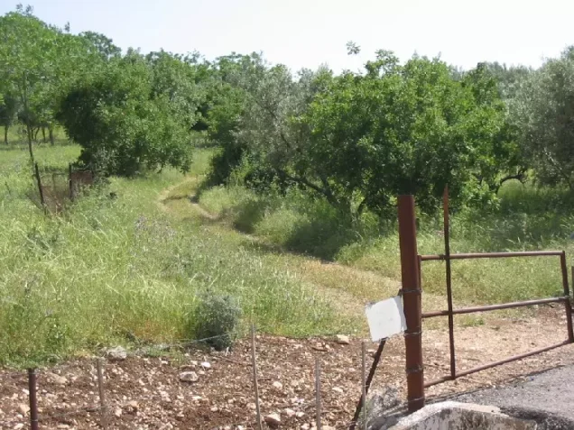
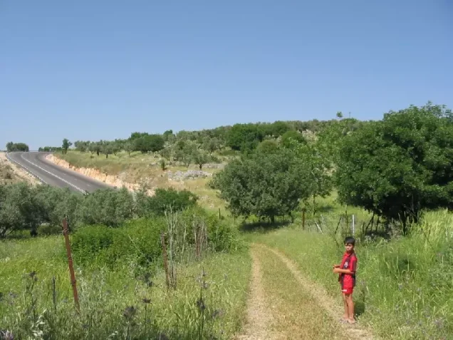
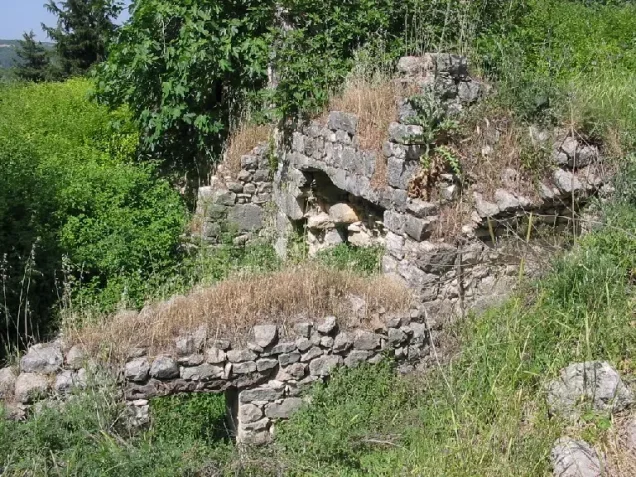
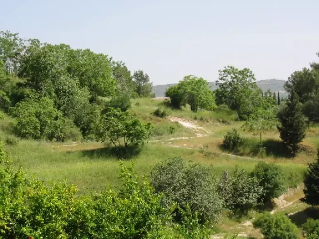
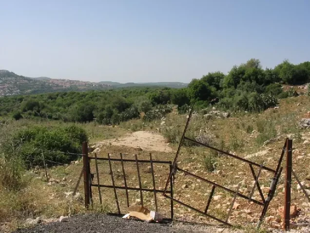
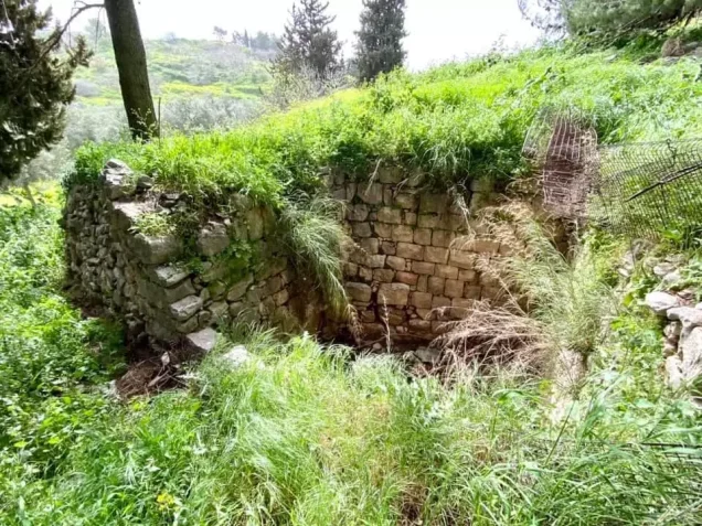
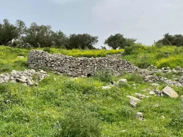
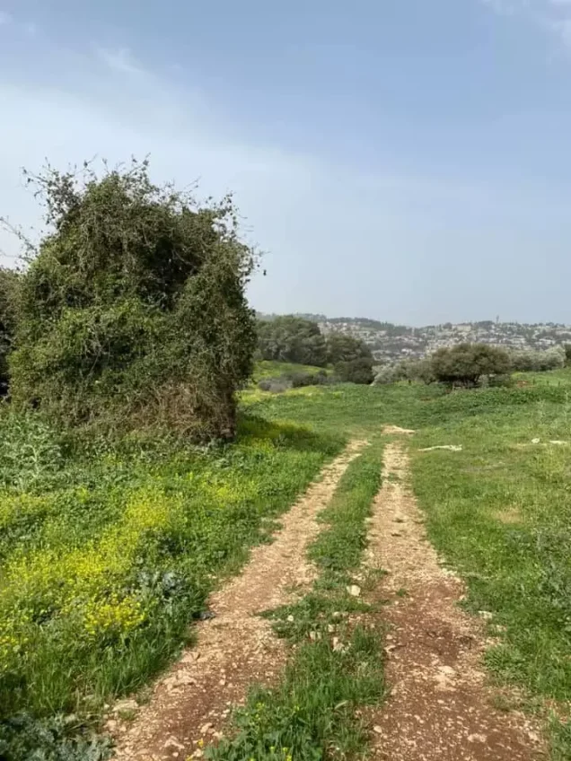
According to the field description recorded by Walid Khalidi, rubble and the remains of stone house walls covered the village site, while stones were scattered among olive trees that continued to grow there.
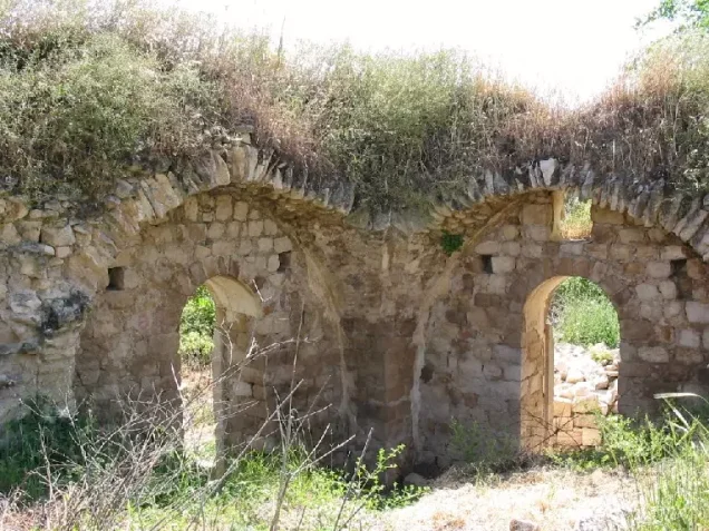
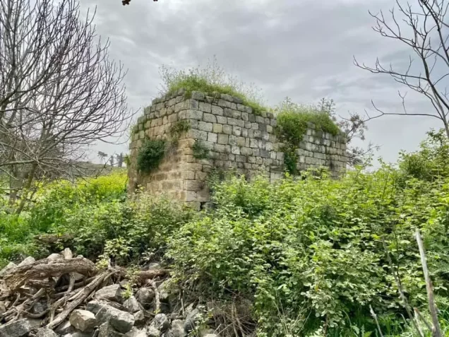
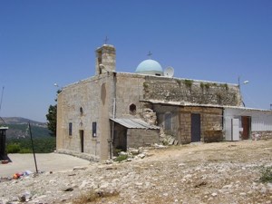
The fortress and a wall believed to date from the Crusader period remained standing. The fortress occupied an elevated position on the eastern side of the site, while the wall surrounded the western quarter. The surrounding lands became partly covered with trees, and some areas were used for grazing.
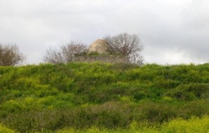
Later Palestinian reports indicate that parts of the village buildings and religious landmarks remained and that portions of the site were used for livestock grazing. These descriptions, however, were recorded at different times and should not be treated as a field survey updated to the present day.
Sources
- PalQuestPalQuest – Interactive Encyclopedia of the Palestine Question: Suhmata
- PalQuestPalQuest – Interactive Encyclopedia of the Palestine Question: Operation Hiram
- Institute for Palestine StudiesInstitute for Palestine Studies: Walid Khalidi, All That Remains: The Palestinian Villages Occupied and Depopulated by Israel in 1948
- Palestine RememberedPalestine Remembered: Suhmata – Acre District
- maktabatsabil.comVillage Statistics of 1945: Land Ownership and Population in the Acre District, based on Government of Palestine statistics
- maktabatsabil.comVillage Statistics of 1945: Land Use in the Acre District, based on Government of Palestine statistics
- suhmata.comAssociation of the People of Suhmata: Historical Documentation and Accounts by Villagers
- info.wafa.psWAFA – Palestine News and Information Agency: The Nakba of Suhmata and Testimonies of Its People
Photo gallery

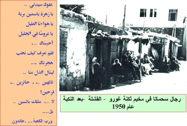
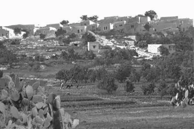

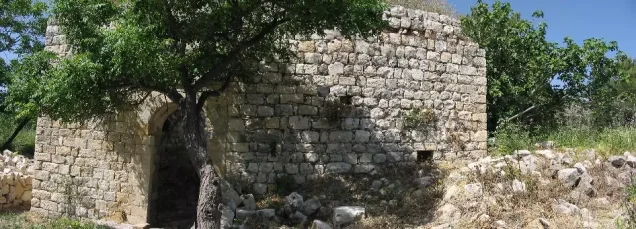



Photos from the village's people
Photos sent in by visitors and published after review.
Add a photo of this village
Log in to add photos of this village.
Other villages from Akka (Acre)
More from the archive



 Download Our Palestine App
The whole archive in the palm of your hand: depopulated villages, the Nakba, the massacres and Al-Aqsa — free, with no ads to erase the story.
Download Our Palestine App
The whole archive in the palm of your hand: depopulated villages, the Nakba, the massacres and Al-Aqsa — free, with no ads to erase the story.



Comments
No comments yet — be the first to write one.
Add your comment
Name and email are optional. Comments appear after review.