
The depopulated village of Khirbat Jiddin / District of Akka (Acre)
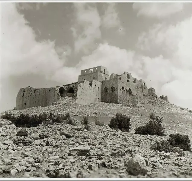
Khirbat Jiddin
About the depopulated village of Khirbat Jiddin
- District
- Akka (Acre)
- Population in 1948
- 1,740
- Military operation
- Operation Dekel
- Brigade that carried it out
- Not identified in the sources; Khalidi notes that villages in the area were attacked by units of the Seventh (Sheva') and Carmeli brigades
- Distance from the governorate centre
- 16 km northeast of Acre
- Elevation above sea level
- 375 m
- Extent of destruction
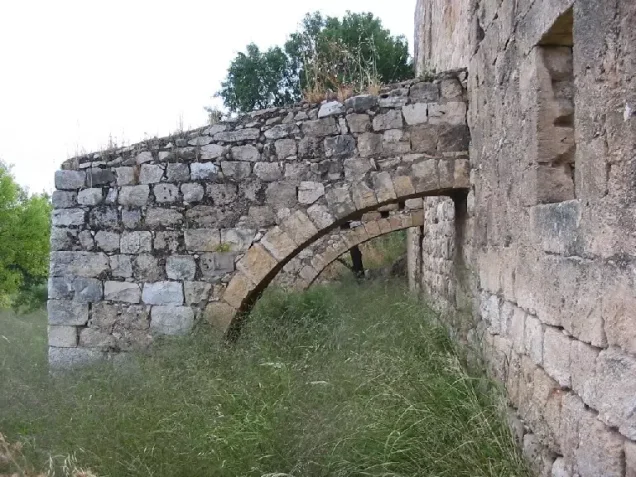
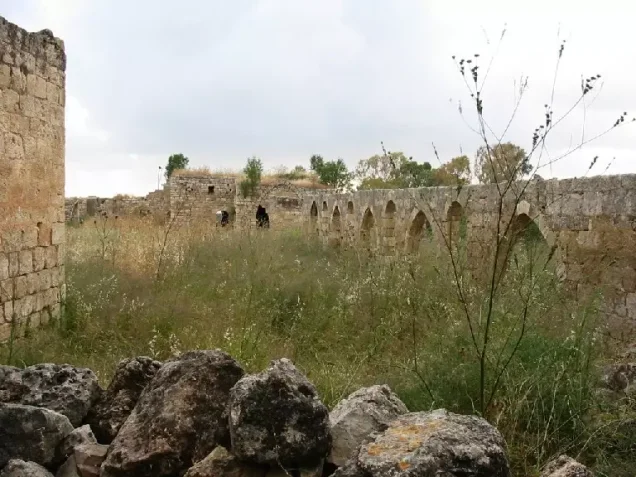
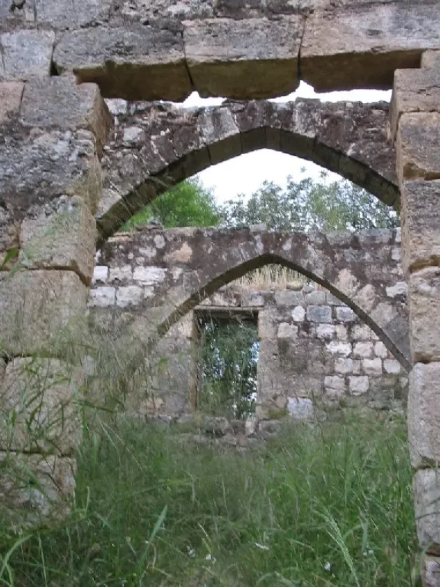
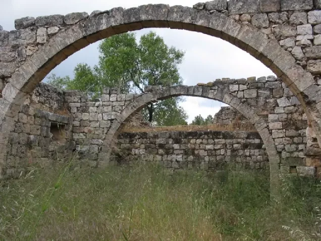
- Khirbat Jiddina was mostly destroyed with the exception of the Crusades fortress, which has been preserved as a tourist attraction.
- Ethnic cleansing
- Jiddin, Khirbat inhabitants were completely ethnically cleansed.
- Settlements built on the land of Khirbat Jiddin before 1948
- Yechi'am (November 1947, on village land north of the site)
- Settlements built on the built-up area of Khirbat Jiddin after 1948
- Ga'ton (October 1948, on village land northwest of the site)
Hover a dot to read the village name, or click to open its card.
Borders of the depopulated village of Khirbat Jiddin
Khirbat Jiddin: A Depopulated Palestinian Village in the Acre District
Khirbat Jiddin was a depopulated Palestinian village in the Acre District, located approximately 16 kilometers northeast of Acre on a hill overlooking the Mediterranean to the west. Its average elevation was approximately 375 meters above sea level.
- Subdistrict
- Acre
- Distance from district center
- 16 km northeast of Acre
- Average Elevation
- 375 m above sea level
- Population in 1944/1945
- 1,500 – figure includes 'Arab al-Suwaytat, the Bedouin who lived in the ruined fortress and pitched their tents around it
- Estimated Population in 1948
- About 1,740 – a later demographic estimate, not an official census, based on the 1944/45 figure that includes 'Arab al-Suwaytat
- Total Land Area in 1945
- 7,587 dunams – of which 4,238 dunams Arab-owned and 3,349 dunams Jewish-owned
- Attack and Depopulation
- The available sources give no details of an attack on the village itself; Khalidi considers it probable that it was seized shortly after the fall of 'Amqa on 10–11 July 1948, during Operation Dekel, and that it remained on the front lines between July and October 1948. He notes that many villages in the area were heavily bombarded before being attacked by units of the Seventh (Sheva') and Carmeli brigades.
- Final Israeli Control
- Probably shortly after 10–11 July 1948, during Operation Dekel, according to Khalidi's inference from the fall of neighbouring 'Amqa on 10–11 July and from the establishment of the settlement of Ga'ton northwest of the village early in October 1948; the available sources do not give the day of the occupation. PalQuest also lists the village among those affected by Operation Hiram (28–31 October 1948)
- Military Operation
- Probably Operation Dekel; PalQuest also lists the village among those affected by Operation Hiram
- Military Unit
- The available sources do not identify the unit that occupied the village; Khalidi notes that villages in the area were attacked by units of the Seventh (Sheva') and Carmeli brigades
- Settlements Documented on Village Lands
- Yechi'am, built in November 1947 on village land north of the site (its settlement organization had been formed in 1946 by members of Qiryat Chayyim); and Ga'ton, built on village land northwest of the site in October 1948
The community developed around the ruins of a historic fortress of Crusader origin. The Palestinian Arab al-Suwaytat lived within the ruined fortress, converting parts of its structures into dwellings and pitching tents around it. The Government of Palestine's 1944/1945 statistics recorded a population of approximately 1,500, a figure explicitly stated to include Arab al-Suwaytat. During the Nakba and the occupation of Palestine in 1948, Khirbat Jiddin was probably occupied shortly after the fall of nearby 'Amqa on 10–11 July, during the first phase of Operation Dekel.
Key Facts About Khirbat Jiddin
- Subdistrict: Acre.
- Distance from Acre: approximately 16 kilometers northeast.
- Average elevation: approximately 375 meters above sea level.
- Population in 1944/1945: approximately 1,500, including Arab al-Suwaytat.
- Estimated population in 1948: approximately 1,740 according to Palestine Remembered.
- Total land area: 7,587 dunums.
- Date of occupation: not conclusively established; Walid Khalidi considers it probable that the village was seized shortly after 'Amqa fell on 10–11 July 1948.
- Military operation: Operation Dekel.
- Forces associated with attacks in the area: the Sheva' (Seventh) and Carmeli Brigades.
Location of Khirbat Jiddin
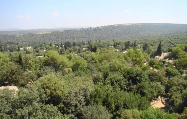
Khirbat Jiddin stood on a high hill northeast of Acre, overlooking the Acre plain and the Mediterranean coast to the west.
Wadi Jiddin, a deep valley, passed south of the village through a heavily wooded area.
Much of the surrounding landscape was hilly and wooded, with extensive natural vegetation and oak and other Mediterranean woodland species.
Neighboring Palestinian Villages
Khirbat Jiddin lay among a number of Palestinian communities in western Galilee, including:
- Tarshiha to the north and northeast.
- Suhmata to the east.
- Yanuh to the southeast.
- Abu Sinan to the south.
- 'Amqa to the southwest.
- Al-Ghabisiyya to the west and northwest.
Jiddin Fortress and the History of the Site
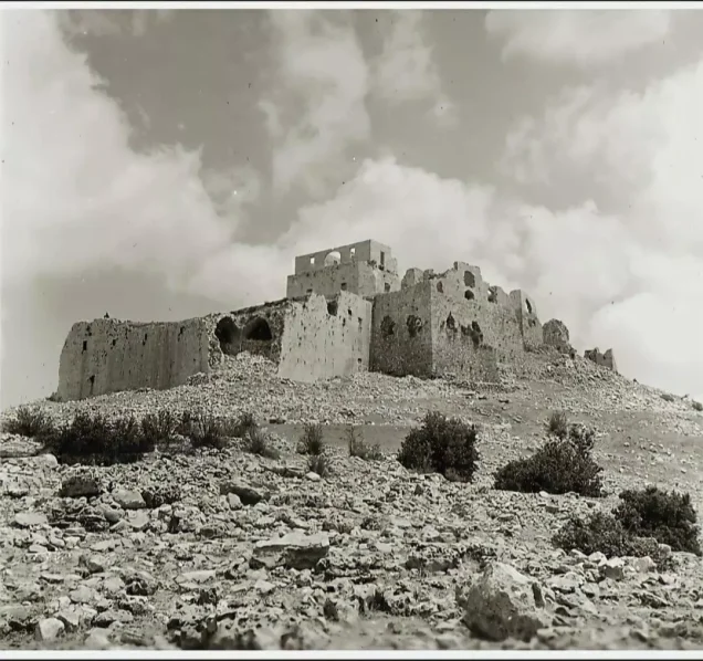
The history of Khirbat Jiddin was closely connected with the fortress that formed the architectural and historical core of the site.
The Crusaders constructed the fortress toward the end of the twelfth century and called it Judyn. Its hilltop position made it an important fortified site.
In 1288, Muslim armies destroyed the fortress in order to prevent the Crusaders from making further military use of it.
The fortress remained unused for a long period before Zahir al-'Umar restored and fortified it during the eighteenth century as part of the network of strongholds through which he consolidated his position in northern Palestine.
It was damaged or razed again under Ahmad Pasha al-Jazzar in the late 1770s, leaving substantial ruins at the site.
Arab al-Suwaytat later settled among these remains, and the inhabited community surrounding the fortress became known as Khirbat Jiddin.
Arab al-Suwaytat and the Population of Khirbat Jiddin
The inhabitants of Khirbat Jiddin belonged to Arab al-Suwaytat, a Muslim Palestinian Bedouin community of western Galilee.
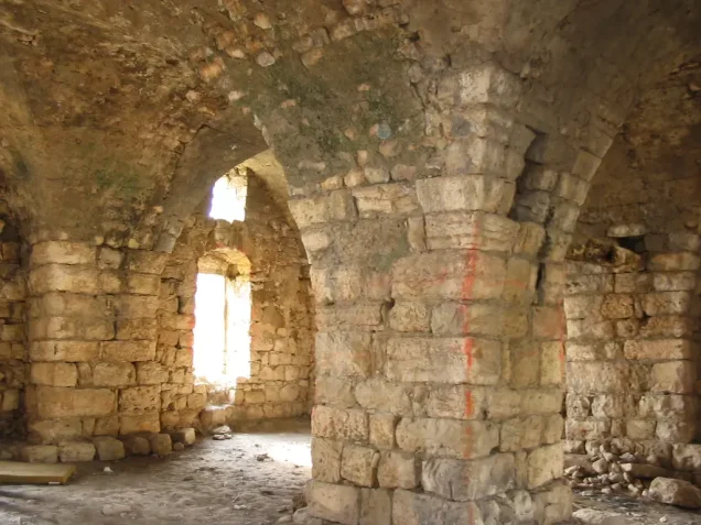
They used portions of the old fortress as dwellings and also pitched tents around the ruins.
Khirbat Jiddin differs from many other Palestinian villages in that the 1944/1945 population figure of 1,500 is explicitly marked as including Arab al-Suwaytat. It should therefore be understood as a figure for the wider population associated with the community rather than necessarily the number residing within the fortress structures alone.
The figures of 1,740 inhabitants for 1948 and 10,685 refugees for 1998 published by Palestine Remembered are later demographic estimates rather than official censuses.
Population of Khirbat Jiddin
- 1944/19451,500Government of Palestine statistics; includes Arab al-Suwaytat
- 19481,740Later estimate published by Palestine Remembered
- 199810,685Later refugee-population estimate published by Palestine Remembered
Economic Life in Khirbat Jiddin
Arab al-Suwaytat depended primarily on animal husbandry and grazing, activities well suited to the hilly and extensively wooded landscape surrounding Khirbat Jiddin.
Agriculture was exceptionally limited relative to the total land area. Only 54 dunums were classified as cultivable in the 1944/1945 statistics.
Walid Khalidi records that the inhabitants cultivated barley and tobacco on a small area, while the Palestinian Encyclopedia additionally mentions wheat.
Woodland and grazing land therefore formed a central part of the local economy.
Land Ownership in Khirbat Jiddin
The Government of Palestine's 1944/1945 statistics recorded a total land area of 7,587 dunums for Khirbat Jiddin.
Of this total, 4,238 dunums were classified as Arab-owned and 3,349 dunums as Jewish-owned, with no public land recorded.
The Arabic Palestine Remembered table uses the categories “Palestinian,” “Transferred to Zionists,” and “Masha'.” These terms are preserved below as the terminology of that source.
Land Ownership in Khirbat Jiddin, 1944/1945, Using Palestine Remembered Terminology
- Palestinian4,238 dunums56%
- Transferred to Zionists3,349 dunums44%
- Masha' (source terminology)0 dunums0%
Land Use in Khirbat Jiddin in 1944/1945
The land-use statistics reflect the hilly and wooded character of Khirbat Jiddin. Only 54 dunums out of the total 7,587 were classified as cultivable.
Of this cultivable area, 22 dunums were Arab-owned and 32 dunums Jewish-owned, all recorded under cereal cultivation.
Non-cultivable land totaled 7,533 dunums, consisting of 4,216 dunums of Arab land and 3,317 dunums of Jewish land.
Land Use in Khirbat Jiddin According to the 1944/1945 Statistics
- Arab
- Jewish
- Public
- Cereals / Cultivable Land54 dunums
- Non-Cultivable Land7,533 dunums
Operation Dekel
The occupation of Khirbat Jiddin was associated with Operation Dekel, an Israeli military offensive carried out between 8 and 18 July 1948 during the fighting between the two truces.
The first phase of the operation aimed to capture a chain of Palestinian villages through the western Galilee hills, extending from the al-Kabri area in the north through al-Birwa and toward Shafa 'Amr in the south.
The attacking forces in this phase included units from the Sheva' Brigade, also known as the Seventh Brigade, and the First Battalion of the Carmeli Brigade.
PalQuest lists Khirbat Jiddin among the Palestinian villages affected by Operation Dekel.
When Was Khirbat Jiddin Occupied?
Walid Khalidi does not assign a conclusively documented single date to the occupation of Khirbat Jiddin. Instead, he reconstructs the probable date from the sequence of military operations in the surrounding area.
Israeli forces occupied nearby 'Amqa to the southwest on 10–11 July 1948 during Operation Dekel, while they did not reach Yanuh, southeast of Khirbat Jiddin, until the end of October during Operation Hiram.
However, the establishment of Ga'ton northwest of Khirbat Jiddin in early October indicates, in Khalidi's analysis, that the village must have come under Israeli control before then.
Khalidi therefore concludes that Khirbat Jiddin was probably seized shortly after the fall of 'Amqa on 10–11 July 1948 and remained near the front lines between July and October.
The Palestinian Villages Encyclopedia gives 10 July as the occupation date, whereas the Palestine Remembered statistics card gives 1 July. Because 1 July predates Operation Dekel and conflicts with the chronological reconstruction in Khalidi's own account, it is not treated here as a conclusively established date.
Military Forces Associated with the Occupation
Walid Khalidi records that several villages in the area were subjected to heavy bombardment before attacks by units of the Sheva' and Carmeli Brigades during the first phase of Operation Dekel.
The Palestinian Villages Encyclopedia specifically attributes the attack on Khirbat Jiddin to forces from those two brigades.
Khalidi's village entry, however, does not provide a separate operational record conclusively identifying the precise unit that entered Khirbat Jiddin on a specific day. The Sheva' and Carmeli attribution is therefore presented as the strongest available reconstruction of the military context rather than as an uncontested detail.
Information originating in Israeli military records is presented through the Palestinian intermediary sources Walid Khalidi and PalQuest rather than through independent reliance on Israeli sources.
The Displacement of Arab al-Suwaytat
The military occupation of Khirbat Jiddin resulted in the displacement of its Palestinian inhabitants from Arab al-Suwaytat.
Palestine Remembered classifies the cause of depopulation as a military assault, while the Palestinian Encyclopedia states that the inhabitants were forced to leave following the capture of the fortress.
According to the Palestinian Encyclopedia, the displaced residents initially sought refuge in neighboring Palestinian villages, and many later moved to southern Lebanon.
Walid Khalidi does not provide a complete family-by-family reconstruction of the displacement, so this article does not assign a single route of exile or a specific expulsion order to one military unit without further documentation.
Occupation and Depopulation Chronology
- November 1947
Settlement on village lands
The settlement of Yechi'am was built on village land north of the site; its settlement organization had been formed in 1946 by members of the urban settlement of Qiryat Chayyim.
- 8 July 1948
Beginning of the military operation
Operation Dekel began on the night of 8 July; its first phase targeted a string of villages in the western Galilean hills with units from the Seventh (Sheva') Brigade and the First Battalion of the Carmeli Brigade. PalQuest lists Khirbat Jiddin among the villages affected by the operation.
- Probably shortly after 10–11 July 1948
Final occupation
Khalidi infers that the village was probably seized shortly after the capture of 'Amqa, a few kilometres to the southwest, on 10–11 July, because the settlement of Ga'ton was established northwest of the village early in October 1948, whereas Israeli forces did not reach nearby Yanuh until the end of October. In that case, the village remained on the front lines between July and October; the available sources do not give the day of its occupation.
- Early October 1948
Settlement on village lands
The settlement of Ga'ton was built on village land, northwest of the village site.
Israeli Settlements on the Lands of Khirbat Jiddin
Two principal Israeli settlements are identified by Walid Khalidi on the lands of Khirbat Jiddin, one established before the Nakba and the other after the village's depopulation:
- Yechi'am: its settlement organization was formed in 1946, and the settlement itself was established in November 1947 on Khirbat Jiddin's lands north of the village site.
- Ga'ton: established on Khirbat Jiddin's lands in October 1948, northwest of the former village site.
Yechi'am should therefore be distinguished as a pre-1948 settlement, while Ga'ton was established after the Palestinian community had been displaced.
Jiddin Fortress After the Nakba
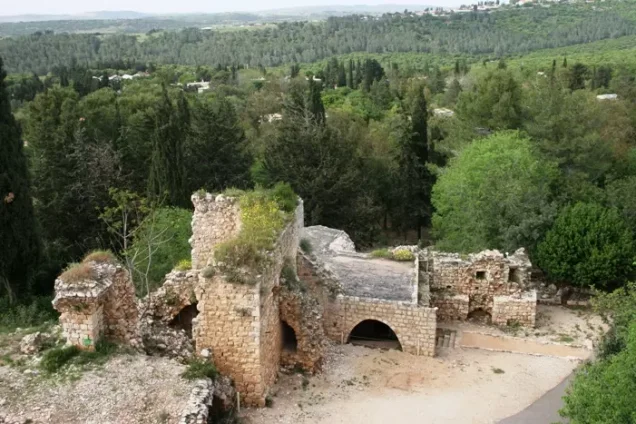
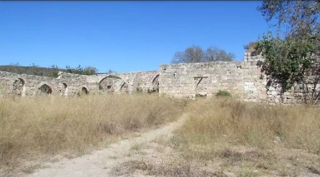
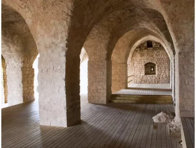
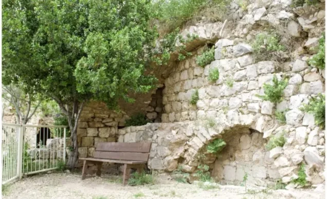
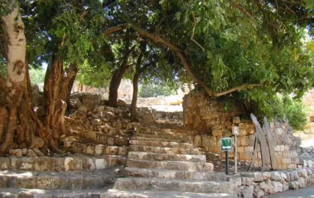
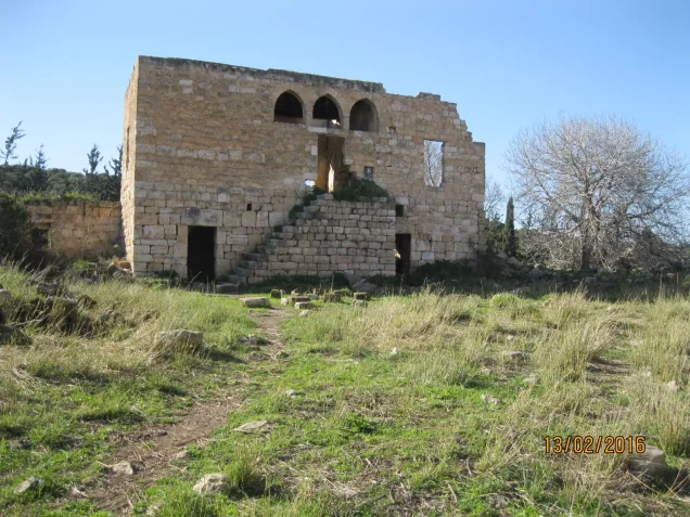
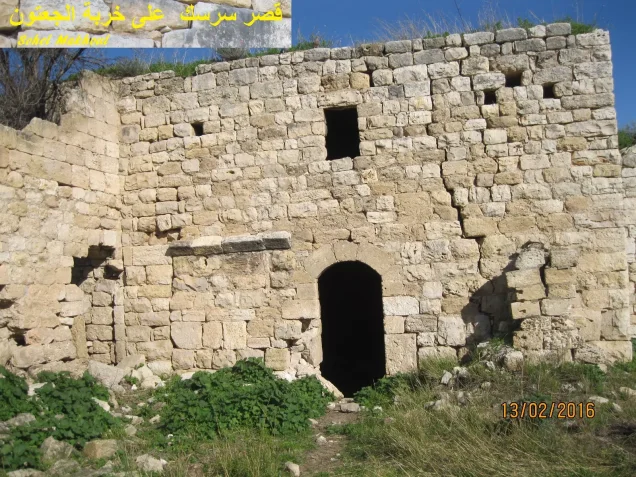
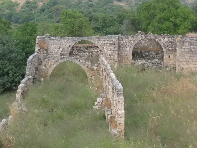
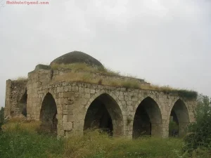
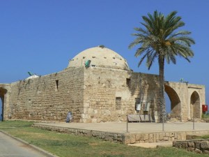
According to Walid Khalidi's field description, the historic fortress at Khirbat Jiddin was preserved and converted into a tourist attraction, while the Palestinian community that had lived in and around the ruins disappeared from the site after its displacement.
Eucalyptus trees, brush, and other vegetation surrounded the fortress.
The fortress remains the most prominent physical landmark associated with the history of Khirbat Jiddin and its Palestinian inhabitants from Arab al-Suwaytat.
Khalidi's description derives from fieldwork conducted for All That Remains and should not necessarily be treated as an updated field survey of the site today.
Sources
- PalQuestPalQuest – Interactive Encyclopedia of the Palestine Question: Khirbat Jiddin
- PalQuestPalQuest – Interactive Encyclopedia of the Palestine Question: Operation Dekel
- Palestine RememberedPalestine Remembered: Khirbat Jiddin in Walid Khalidi's All That Remains
- Palestine RememberedPalestine Remembered: Khirbat Jiddin – Acre District
- palestinapedia.psPalestinian Encyclopedia: Jiddin
- palqura.comPalestinian Villages Encyclopedia: Khirbat Jiddin
- pal48.psFilastunna: The Depopulated Village of Khirbat Jiddin
Photo gallery

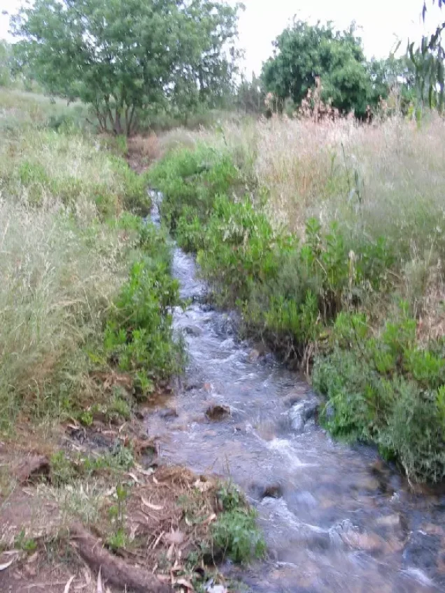
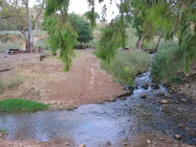

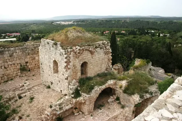
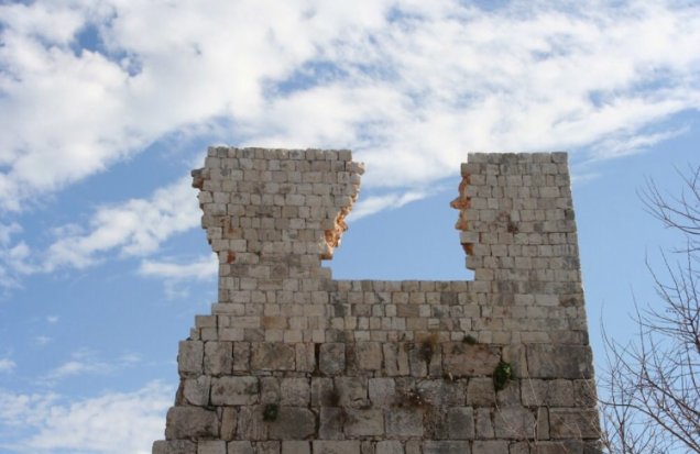
Photos from the village's people
Photos sent in by visitors and published after review.
Add a photo of this village
Log in to add photos of this village.
Other villages from Akka (Acre)
More from the archive



 Download Our Palestine App
The whole archive in the palm of your hand: depopulated villages, the Nakba, the massacres and Al-Aqsa — free, with no ads to erase the story.
Download Our Palestine App
The whole archive in the palm of your hand: depopulated villages, the Nakba, the massacres and Al-Aqsa — free, with no ads to erase the story.



Comments
No comments yet — be the first to write one.
Add your comment
Name and email are optional. Comments appear after review.