
The depopulated village of Tarbikha / District of Akka (Acre)

About the depopulated village of Tarbikha
- District
- Akka (Acre)
- Date Tarbikha was occupied
- 01 November 1948
- Population in 1948
- 1,160
- Military operation
- Operation Hiram
- Brigade that carried it out
- The Oded Brigade
- Distance from the governorate centre
- 27 (km) Northeast of Acre
- Elevation above sea level
- 550 m
- Cause of displacement
- Expulsion by Zionist troops
- Extent of destruction
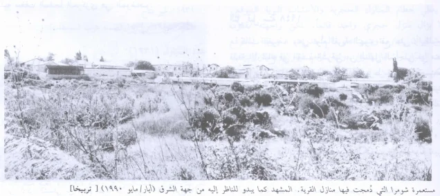
- The village was mostly destroyed with the exception of the 21 stone houses which are being used by Israeli Jewish settlers.
- Ethnic cleansing
- Tarbikha inhabitants were completely ethnically cleansed.
- Settlements built on the built-up area of Tarbikha after 1948
- Zareet
Hover a dot to read the village name, or click to open its card.
Borders of the depopulated village of Tarbikha
Tarbikha: A Depopulated Palestinian Village in the Acre District
Tarbikha, also rendered as Tarbikha or Tarbikha, was a depopulated Palestinian village in the Acre District. It stood approximately 27 kilometers northeast of Acre on the flat part of a plateau that rose gradually toward the west, at an average elevation of about 550 meters above sea level.
Tarbikha was one of the “Seven Villages” whose inhabitants found themselves within the boundaries of Palestine following the demarcation of the Palestine–Lebanon frontier in the 1920s. The Government of Palestine's 1944/1945 statistical unit comprising Tarbikha and its two satellite villages, Suruh and al-Nabi Rubin, recorded a population of 1,000 and a total land area of 18,563 dunums. During the Nakba and the occupation of Palestine in 1948, Tarbikha came under Israeli military control at the end of Operation Hiram, around 31 October–1 November. In the second week of November, the Oded Brigade ordered its Palestinian inhabitants to cross the border into Lebanon.
Key Facts About Tarbikha
- Subdistrict: Acre.
- Distance from Acre: approximately 27 kilometers northeast.
- Average elevation: approximately 550 meters above sea level.
- Population in 1931: 674.
- Population in 1944/1945: 1,000, including Tarbikha, Suruh, and al-Nabi Rubin.
- Estimated population in 1948: 1,160 according to Palestine Remembered.
- Total land area: 18,563 dunums, for the statistical unit including Suruh and al-Nabi Rubin.
- Military takeover: approximately 31 October–1 November 1948, at the end of Operation Hiram.
- Final expulsion: second week of November 1948.
- Military formation associated with the expulsion: Oded Brigade.
Location of Tarbikha
Tarbikha stood on the flat part of a plateau that rose gradually toward the west and was bordered by a broad wadi.
It overlooked two satellite Palestinian villages to its east, Suruh and al-Nabi Rubin, while Lebanese territory lay to the north.
A network of secondary roads connected Tarbikha with Ra's al-Naqura and neighboring Palestinian and Lebanese border villages. During the final years of the Mandate, new construction extended along the Ra's al-Naqura–Banat Ya'qub road.
Fassuta lay to the southeast, Iqrit to the south, and Khirbat 'Iribbin to the west, while Suruh and al-Nabi Rubin lay to the east and northeast.
The Name and Early History of Tarbikha
The principal sources used here do not substantiate the claim that the name Tarbikha meant “sacred mountain” in Canaanite.
Walid Khalidi and PalQuest instead record that the Palestinian village occupied the site known during the Crusader period as Tayerebika and associate the later village name with that historical form.
This article therefore follows the documented Crusader association rather than presenting an unsupported Canaanite etymology as established fact.
Tarbikha During the Ottoman Period
In 1596, Tarbikha was recorded in the nahiya of Tibnin within the liwa' of Safad and had an estimated population of approximately 88.
The villagers paid taxes on wheat, barley, olives, goats, beehives, and a press used for processing olives or grapes.
By the late nineteenth century, Tarbikha was described as a stone-built village on the edge of a ridge, with an estimated population of about 100 who cultivated olive trees.
During the late Ottoman period, the area formed part of the Beirut Province and was associated administratively with the qada' of Tyre.
Tarbikha and the “Seven Villages”
Tarbikha occupies a distinctive place in the history of the Palestine–Lebanon boundary because it was one of the communities collectively known as the “Seven Villages.”
After the First World War, the area initially fell within arrangements connected with the French administration of Greater Lebanon, and inhabitants of these villages were entered in Lebanese census records.
When the Franco-British boundary was finalized under the Paulet–Newcombe Agreement in 1923, inhabitants of seven villages who had been recorded in Lebanese registers found themselves on the Palestinian side of the new frontier.
Tarbikha had been associated with the Ottoman qada' of Tyre, while the other six villages—Abil al-Qamh, Hunin, al-Nabi Yusha', Qadas, al-Malikiyya, and Saliha—had been associated with the Marja'yun area.
In 1926, the Mandate authorities concluded the Good Neighbors Agreement to address some of the practical problems created by the frontier, including the separation of villagers from agricultural lands, grazing areas, and water sources.
For this reason, describing Tarbikha as one of the “Seven Villages” is more precise in this context than categorically calling it one of twenty-four Lebanese villages.
The Built Environment of Tarbikha
Most houses in Tarbikha were constructed of stone, with roofs made of timber and mud, and were originally clustered closely around a watering pool.
During the final years of the British Mandate, reinforced-concrete houses appeared, including several two-storey buildings, and new construction extended along the road between Ra's al-Naqura and Banat Ya'qub.
The built-up area of the statistical unit that included Tarbikha, Suruh, and al-Nabi Rubin covered approximately 112 dunums in 1944/1945.
Population of Tarbikha
The 1931 Census of Palestine recorded 674 inhabitants in Tarbikha living in 149 houses.
The Government of Palestine's 1944/1945 statistics recorded 1,000 inhabitants. Importantly, this figure includes Tarbikha and its satellite villages Suruh and al-Nabi Rubin.
The sources describe Tarbikha's population during the late Mandate period as Muslim.
The figures of 1,160 inhabitants for 1948 and 7,124 refugees for 1998 published by Palestine Remembered are later demographic estimates rather than official censuses.
Population of Tarbikha
- 1596About 88Historical estimate based on Ottoman tax records
- Late 19th centuryAbout 100Historical estimate
- 1931674Official census
- 1944/19451,000Government of Palestine statistics; includes Tarbikha, Suruh, and al-Nabi Rubin
- 19481,160Later estimate published by Palestine Remembered
- 19987,124Later refugee-population estimate published by Palestine Remembered
Number of Houses in Tarbikha
The 1931 Census of Palestine recorded 149 houses in Tarbikha.
The figure of 256 houses for 1948 published by Palestine Remembered is a later estimate rather than an official census figure.
Number of Houses in Tarbikha
- 1931149Official census
- 1948256Later estimate published by Palestine Remembered
Public Institutions in Tarbikha
Tarbikha contained several institutions reflecting both its local importance and its position near the Lebanese border.
- Two mosques serving the village community.
- An elementary school for boys.
- A customs post monitoring movement across the Lebanese border.
- A police station associated with border control.
- The Cultural Reform Association, established in 1945 to improve social, educational, and medical conditions.
Education in Tarbikha
Tarbikha had an elementary school for boys established in the late 1930s.
Palestine Remembered and Palestinian local documentation give 1938 as its founding year, while Walid Khalidi and PalQuest use the more cautious formulation that it was established after 1938.
By the mid-1940s the school enrolled approximately 120 pupils, including some children from the satellite villages of Suruh and al-Nabi Rubin.
Water Sources in Tarbikha
The lands of Tarbikha were mountainous and intersected by several wadis, although they also contained flat agricultural areas. Water was relatively abundant.
Residents depended on springs, reservoirs, and wells for domestic needs, livestock, and limited agricultural irrigation.
Palestinian local documentation names several springs, including 'Ayn Shanna, 'Ayn al-Zuhur, 'Ayn Umm Qays, and 'Ayn Iqrit, as well as reservoirs known as Birkat al-Safarjal, Birkat al-Ramad, Birkat al-Marh, and Birkat Risha.
Old wells were also concentrated in an area locally known as al-Maghara.
Land Ownership in Tarbikha
The Government of Palestine's 1944/1945 figures for the statistical unit comprising Tarbikha, Suruh, and al-Nabi Rubin recorded a total of 18,563 dunums.
Of this area, 12,548 dunums were classified as Arab land and 6,015 dunums as public land. No Jewish land ownership was recorded.
The Arabic Palestine Remembered table uses the categories “Palestinian,” “Transferred to Zionists,” and “Masha'.” These terms are preserved below as that source's terminology.
Land Ownership in Tarbikha, Suruh, and al-Nabi Rubin, 1944/1945, Using Palestine Remembered Terminology
- Palestinian12,548 dunums68%
- Transferred to Zionists0 dunums0%
- Masha' (source terminology)6,015 dunums32%
Land Use in Tarbikha in 1944/1945
The official land-use statistics combine Tarbikha with Suruh and al-Nabi Rubin.
A total of 3,823 dunums was cultivated or classified as cultivable, consisting of 3,819 dunums of Arab land and 4 dunums of public land.
Cereals occupied 3,204 dunums, including 3,200 dunums of Arab land and 4 dunums of public land. Plantations and irrigable land covered 619 dunums, all classified as Arab land.
The built-up area covered 112 dunums of Arab land, while non-cultivable land totaled 14,628 dunums, consisting of 8,617 dunums of Arab land and 6,011 dunums of public land.
Land Use in Tarbikha, Suruh, and al-Nabi Rubin According to the 1944/1945 Statistics
- Arab
- Jewish
- Public
- Plantations and Irrigable Land619 dunums
- Cereals3,204 dunums
- Built-up Area112 dunums
- Non-Cultivable Land14,628 dunums
Palestine Remembered separately records approximately 60 dunums planted with olive trees. This is treated as supplementary agricultural information and is not added again to the official land-use totals.
Economic Life in Tarbikha
Animal husbandry and grazing formed an important part of Tarbikha's economy because much of its territory consisted of mountainous and rough land suitable for pasture.
The villagers also cultivated cereals, olives, orchards, and other crops.
Tobacco production expanded substantially toward the end of the British Mandate, and Walid Khalidi records that the quality of Tarbikha tobacco began to rival Turkish tobacco.
Ottoman tax records also show that wheat, barley, olives, goats, and beehives had formed part of the village economy since at least the sixteenth century.
Archaeological Remains in Tarbikha
Numerous khirbas and archaeological sites on Tarbikha's lands attest to a long history of settlement in the area.
Some contained ancient olive presses, rock-cut tombs, cisterns, and architectural remains.
Palestinian local documentation also records Roman and Byzantine graves in the cemetery area north of the former village site.
Operation Hiram
The occupation of Tarbikha was associated with Operation Hiram, a large-scale Israeli offensive carried out in Upper Galilee between 28 and 31 October 1948.
The operation targeted the last extensive Arab-held area in Upper Galilee and involved forces primarily from the Sheva', Carmeli, Golani, and Oded Brigades.
Within three days, Israeli forces occupied most of Upper Galilee. The inhabitants of numerous Palestinian villages were displaced either during the fighting or in expulsions that continued after the principal battles had ended.
The Military Occupation of Tarbikha
The sources differ slightly on the precise day Tarbikha first came under Israeli military control.
PalQuest's account of Operation Hiram states that the Oded Brigade advanced westward along the Lebanese border and took Iqrit and Tarbikha on 31 October 1948.
Palestine Remembered and the Palestinian Villages Encyclopedia instead give 1 November 1948 as the specific date of occupation.
It is therefore most precise to state that Tarbikha came under Israeli control around 31 October–1 November 1948, during the final hours of Operation Hiram or its immediate aftermath.
The Oded Brigade and the Expulsion of Tarbikha
The fate of Tarbikha was not completed at the moment of its initial military occupation.
According to Walid Khalidi and PalQuest, after Operation Hiram Israeli forces swept through a number of Palestinian villages near the Lebanese border as part of an effort to empty the frontier area of its inhabitants.
During the second week of November, the Oded Brigade entered Tarbikha and ordered its residents to cross the border into Lebanon.
Khalidi, citing Israeli records, notes that the forces encountered no resistance in the village and that the commander of the Israeli Northern Front later justified the expulsions as having been required for what he described as “military reasons.”
Information originating in Israeli documentation is presented here through the Palestinian intermediary sources Walid Khalidi and PalQuest rather than through independent reliance on Israeli sources.
The Displacement of Tarbikha's Inhabitants to Lebanon
The Palestinian inhabitants of Tarbikha were forced from their village and across the border into Lebanon during the November 1948 campaign to empty the frontier villages.
They thus shared the fate of inhabitants of the other “Seven Villages,” many of whom became Palestinian refugees in Lebanon after their villages were occupied and depopulated.
PalQuest records that the people of the Seven Villages were initially treated legally as Palestinian refugees in Lebanon. Lebanese nationality was later extended to substantial numbers of their descendants, particularly through citizenship measures culminating in the 1994 naturalization decree.
Israeli Settlements on Tarbikha's Lands
Several Israeli settlements were subsequently established on the site or lands of Tarbikha:
- Shomera: by 27 May 1949, Jewish immigrants had been settled in a number of Tarbikha's original houses, and the settlement became known as Shomera.
- Even Menachem: established in 1960 very close to the Tarbikha site, along the boundary area between the lands of Tarbikha and Iqrit.
- Netu'a: established in 1966 and identified by Walid Khalidi as being on Tarbikha's lands.
- Kefar Rosenwald: established in 1967 on village land and also associated with the name Zar'it.
- Shetula: established in 1969 on Tarbikha's lands.
Tarbikha After the Nakba
Sources differ in their descriptions of how much of Tarbikha's built environment survived after the Nakba.
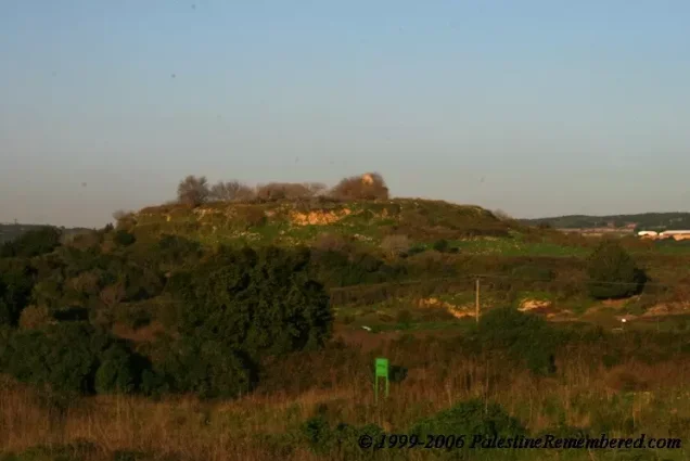
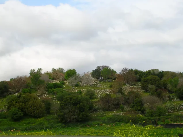
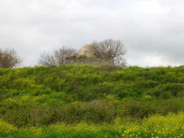
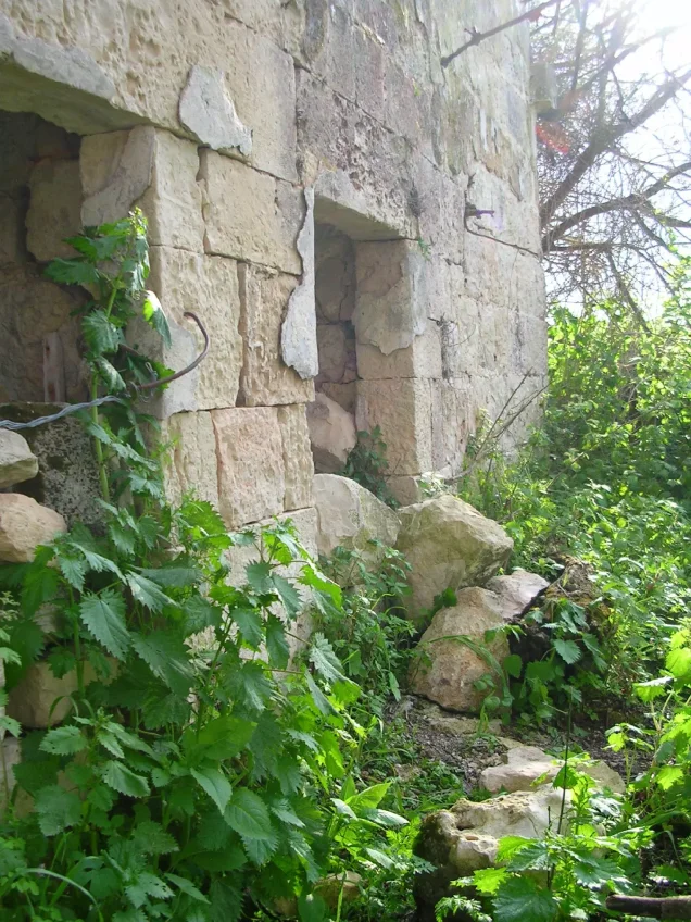
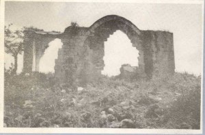
Palestinian local documentation describes extensive stone rubble, remaining archaeological features, cactus plants, fig trees, and sections of the cemetery.
Walid Khalidi's field survey, however, records that approximately twenty original houses of Tarbikha remained standing and had been incorporated into Shomera for use by its residents.
Khalidi notes that some roofs had been remodeled into gabled forms and that stones from the original Palestinian houses were used to decorate the roof of the settlement's central shelter.
Local Palestinian documentation additionally records cactus and fig trees and Roman and Byzantine graves around the former village site.
Khalidi's description derives from historical fieldwork conducted for All That Remains and should not necessarily be treated as an updated survey of the site in 2026.
Sources
- PalQuestPalQuest – Interactive Encyclopedia of the Palestine Question: Tarbikha
- PalQuestPalQuest – Interactive Encyclopedia of the Palestine Question: Operation Hiram
- PalQuestPalQuest – Palestine-Lebanon Border and the Seven Villages
- Palestine RememberedPalestine Remembered: Tarbikha – Acre District
- palestinapedia.psPalestinian Encyclopedia: Tarbikha
- palqura.comPalestinian Villages Encyclopedia: Tarbikha and the Seven Villages
Photo gallery




Photos from the village's people
Photos sent in by visitors and published after review.
Add a photo of this village
Log in to add photos of this village.
Other villages from Akka (Acre)

More from the archive


 Download Our Palestine App
The whole archive in the palm of your hand: depopulated villages, the Nakba, the massacres and Al-Aqsa — free, with no ads to erase the story.
Download Our Palestine App
The whole archive in the palm of your hand: depopulated villages, the Nakba, the massacres and Al-Aqsa — free, with no ads to erase the story.



Comments
No comments yet — be the first to write one.
Add your comment
Name and email are optional. Comments appear after review.