
The depopulated village of Al-Nahr / District of Akka (Acre)
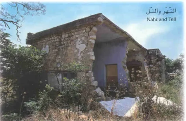
About the depopulated village of Al-Nahr
- District
- Akka (Acre)
- Date Al-Nahr was occupied
- 21 May 1948
- Population in 1948
- 708
- Military operation
- Operation Ben-Ami
- Brigade that carried it out
- The Carmeli Brigade
- Distance from the governorate centre
- 14 km northeast of Acre
- Elevation above sea level
- 65 m
- Cause of displacement
- Direct military assault by Israeli occupation forces (Carmeli Brigade), under orders to kill among the men and to destroy and burn the village
- Extent of destruction
- al-Nahr was mostly destroyed and defaced.
- Ethnic cleansing
- al-Nahr inhabitants were completely ethnically cleansed.
- Settlements built on the built-up area of Al-Nahr after 1948
- Ben Ammi, established in 1949 to replace the village, according to Morris as cited by Khalidi; the settlement of Kabri also makes use of the village lands
Hover a dot to read the village name, or click to open its card.
Borders of the depopulated village of Al-Nahr
al-Nahr: A Depopulated Palestinian Village in the Acre District
al-Nahr was a Palestinian village in the Acre District, situated in the eastern part of the Galilee coastal plain approximately 14 kilometres northeast of the city of Acre, at an average elevation of about 65 metres above sea level. The Carmeli Brigade of the Haganah occupied the village on 20–21 May 1948 during the second phase of Operation Ben-Ami, and its Palestinian inhabitants were displaced during the Nakba and the occupation of Palestine in 1948.
- Subdistrict
- Acre
- Distance from district center
- 14 km northeast of Acre
- Average Elevation
- 65 m above sea level
- Population in 1931
- 522
- Number of Houses in 1931
- 120
- Population in 1944/1945
- 610
- Estimated Population in 1948
- About 708 – a later demographic estimate, not an official census
- Total Land Area in 1945
- 5,261 dunams
- Attack and Depopulation
- The Carmeli Brigade occupied the village on 20–21 May 1948 together with a series of western Galilee villages north of Acre, in the second phase of Operation Ben-Ami, one day after the brigade commander ordered his battalion commanders "to attack in order to conquer, to kill among the men, to destroy and burn the villages of Al Kabri, Umm al Faraj and An Nahr."
- Final Israeli Control
- 20–21 May 1948
- Military Operation
- Operation Ben-Ami (second phase)
- Military Unit
- Carmeli Brigade
- Cause of Depopulation
- Direct military assault by Israeli occupation forces (Carmeli Brigade), under orders to kill among the men and to destroy and burn the village
- Settlements Documented on Village Lands
- Ben Ammi, established in 1949 to replace the village, according to Morris as cited by Khalidi; the settlement of Kabri also makes use of the village lands
Location
al-Nahr stood on a low sandy mound in the eastern part of the Galilee coastal plain, along the main road linking Tarshiha and Nahariyya with Acre.
The village had an average elevation of approximately 65 metres above sea level and lay about 14 kilometres northeast of Acre.
Neighbouring al-Tall was regarded as al-Nahr's twin village, while Wadi al-Mafshukh passed through the surrounding area.
al-Nahr and Tall al-Qahwa
al-Nahr stood on an archaeological site known as Tall al-Qahwa.
The Ottoman Beirut Vilayet Yearbook of 1904 referred to the site in connection with the villages of al-Tall and al-Qahwa.
PalQuest and Walid Khalidi transmit archaeological research indicating that al-Nahr and al-Tall stood over remains of settlement dating to approximately the eighteenth century BCE.
This archaeological dating is included as transmitted through the Palestinian source rather than through direct reliance on the Israeli archaeological study it cites.
Origin of the Name
According to a Palestinian local account published by Palestine Remembered, the name “al-Nahr” was associated with two large water springs surrounding the village.
The first was Birkat al-Fawwara east of the village, while the second was Birkat Tall al-Mafshukh to the west.
The spring waters were used to irrigate orchards and operate grain mills in the area.
These details come from local Palestinian documentation and are not reproduced in full in the principal PalQuest entry.
Architecture
al-Nahr had a rectangular layout extending from southeast to northwest.
Its houses stood close together and were constructed using a range of materials, including stone, cement, mud mortar, and reinforced concrete.
The built-up area covered approximately 28 dunams in the 1944/1945 statistics.
The entire village population was Muslim.
Population
The 1931 census recorded 522 inhabitants in al-Nahr living in 120 houses.
According to the 1944/1945 statistics, the population reached 610, all Arab Muslims.
The estimates of approximately 708 inhabitants in 1948 and 4,345 refugees and descendants in 1998 published by Palestine Remembered are later estimates rather than official British Mandate censuses.
Population of al-Nahr
- 1931522Official census
- 1944/1945610Government of Palestine statistics
- 1948About 708Later estimate
- 19984,345Estimate of refugees and their descendants
Number of Houses
The 1931 census recorded 120 houses in al-Nahr.
The figure of approximately 162 houses for 1948 is a later estimate rather than an official census count.
Land of al-Nahr
According to the 1944/1945 statistics, al-Nahr had a total land area of 5,261 dunams.
Arab ownership amounted to 5,243 dunams, while 18 dunams were classified as public land. No Jewish-owned land was recorded within the village's statistical unit.
Land Ownership in al-Nahr in 1944/1945
- Arab ownership5,243 dunums100%
- Jewish ownership0 dunums0%
- Public land18 dunums<1%
Agriculture and Economic Life
The inhabitants of al-Nahr depended primarily on agriculture and livestock raising.
The village was particularly known for citrus and banana cultivation, alongside cereals, orchards, and fruit trees.
According to the 1944/1945 statistics, 2,066 dunams were devoted to citrus and bananas, 1,937 dunams were irrigated or used for plantations, and 1,094 dunams were devoted to cereals.
The Palestinian sources reviewed differ over the area planted with olives. The Walid Khalidi account reproduced by PalQuest gives approximately 30 dunams, while the Palestine Remembered statistical table and a local village account give 310 dunams.
This article therefore does not present either olive figure as conclusively established. In either case, olive land represents a crop category within cultivated land and should not be added separately to the overall land-use totals.
Land Use in al-Nahr in 1944/1945, in Dunams
- Arab
- Public
- Citrus and bananas2,066 dunums
- Irrigated and plantation land1,937 dunums
- Cereals1,094 dunums
- Built-up area28 dunums
- Uncultivable land136 dunums
The Nakba and Operation Ben-Ami
Operation Ben-Ami
Operation Ben-Ami began on 13 May 1948 and continued until 21 May. It was carried out by the Haganah's Carmeli Brigade with the objective of occupying Palestinian coastal villages from Acre northward to the Lebanese border.
al-Nahr was among the villages targeted during the operation's second phase.
The Occupation and Depopulation of al-Nahr
The Carmeli Brigade occupied al-Nahr on 20–21 May 1948 during the second phase of Operation Ben-Ami.
On 19 May, immediately before this phase of the offensive, Carmeli Brigade units received orders to capture al-Kabri, Umm al-Faraj, and al-Nahr, to kill among the men, and to destroy and burn the villages.
PalQuest transmits these orders through historian Benny Morris. They are therefore included here as mediated by the Palestinian source rather than through direct reliance on the original Israeli material.
The assault resulted in the displacement of al-Nahr's Palestinian population and the destruction of most of the village's built environment. The inhabitants were not permitted to re-establish their community at the site.
Palestine Remembered gives 21 May 1948 as a summary occupation date, which is consistent with the 20–21 May timeframe given by PalQuest and Walid Khalidi.
Occupation and Depopulation Chronology
- 13–14 May 1948
Beginning of the military operation
The Haganah launched Operation Ben-Ami, carried out by the Carmeli Brigade, to capture all the coastal villages from Acre northwards to the Lebanese border; it was its last major offensive before the end of the British Mandate.
- 19 May 1948
Order to attack the village
The day before the incursion, the commander of the Carmeli Brigade ordered his battalion commanders "to attack in order to conquer, to kill among the men, to destroy and burn the villages of Al Kabri, Umm al Faraj and An Nahr," according to Morris as cited by PalQuest.
- 20–21 May 1948
Final occupation
Al-Nahr fell together with a series of other western Galilee villages north of Acre during the second phase of Operation Ben-Ami.
- 1949
Settlement on village lands
According to Morris as cited by Khalidi, the settlement of Ben Ammi replaced the village in 1949; it was named after Haganah commander Ben Ammi Pechter, killed near Nahariyya in March 1948, after whom the operation in which the village fell was also named.
Israeli Settlements on the Lands of al-Nahr
Ben Ammi
According to the account transmitted by Walid Khalidi and PalQuest, the settlement of Ben Ammi was established in 1949 to replace al-Nahr.
It was named after Ben Ammi Pechter, a Haganah commander killed near Nahariyya in March 1948, after whom Operation Ben-Ami was also named.
Kabri
The nearby settlement of Kabri also uses portions of al-Nahr's village lands.
- 1949Ben Ammi
Established to replace the village according to Walid Khalidi and PalQuest
- 1949Kabri
Uses portions of al-Nahr's lands
al-Nahr After the Nakba
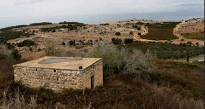
According to the field documentation relied upon by Walid Khalidi, only two village houses remained, one of them partially destroyed.
A tall date palm grew at the village site, together with wild grasses, cactus plants, and fig trees.
The village cemetery stood on the western side of the site, where one identifiable grave remained at the time of documentation.
The nearby al-Fawwara spring had been fenced off and declared private property.
This description reflects the condition of the site during the period of field documentation relied upon by Walid Khalidi and should not necessarily be interpreted as a comprehensive survey updated to 2026.
Sources
- PalQuest – Interactive Encyclopedia of the Palestine Question: al-Nahr.
- PalQuest: al-Nahr.
- PalQuest: Operation Ben-Ami.
- Palestine Remembered: al-Nahr, Acre District.
- Walid Khalidi and local documentation on al-Nahr, as reproduced by Palestine Remembered.
- Walid Khalidi, All That Remains, entry on al-Nahr.
- Nafez Nazzal, The Palestinian Exodus from Galilee, 1948, Institute for Palestine Studies.
- Arif al-Arif, al-Nakba.
- Government of Palestine, Census of Palestine, 1931.
- Government of Palestine, Department of Statistics, Village Statistics, 1945.
Photo gallery
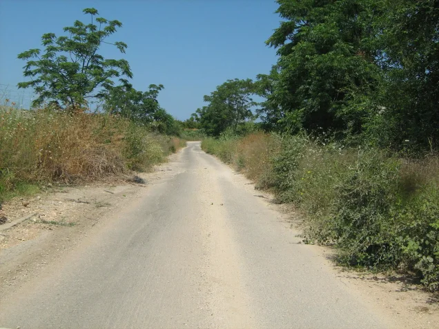
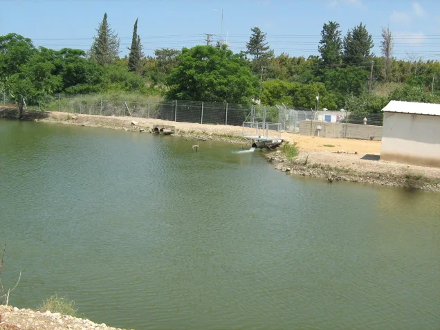
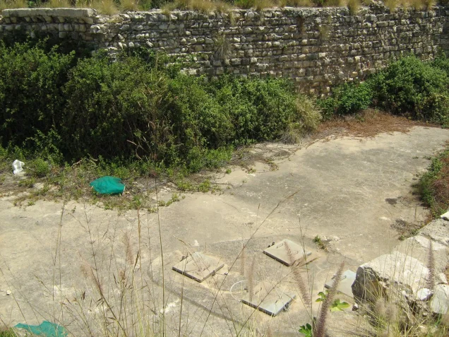
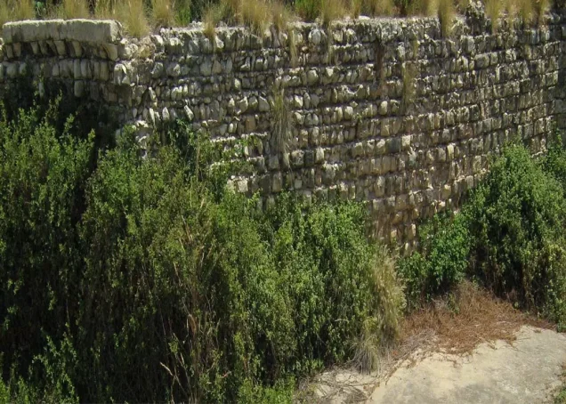

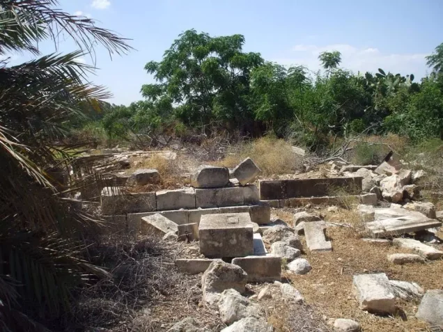
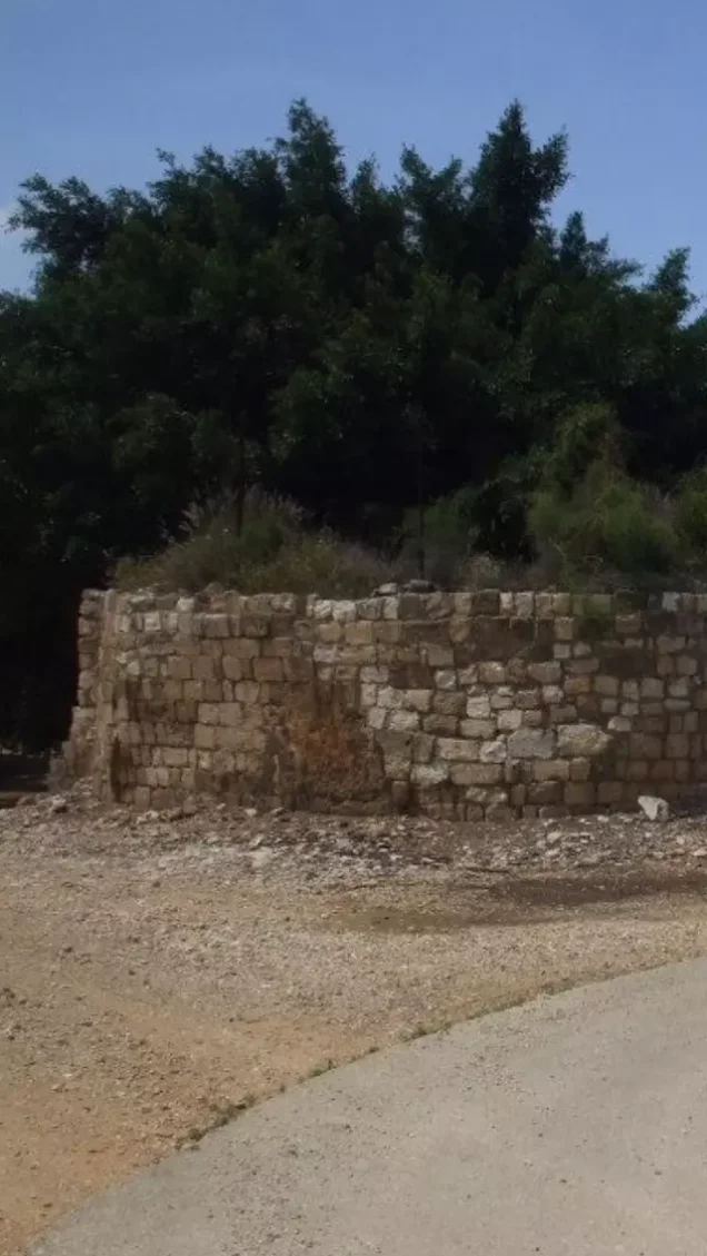
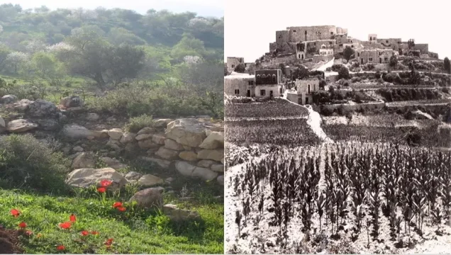
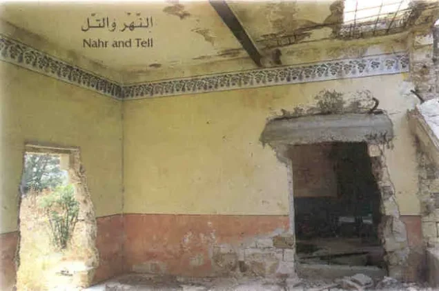
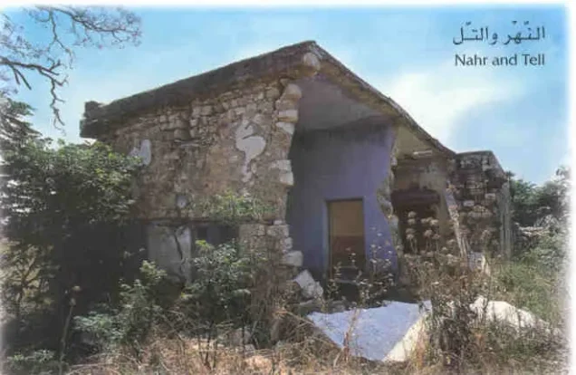
Photos from the village's people
Photos sent in by visitors and published after review.
Add a photo of this village
Log in to add photos of this village.
Other villages from Akka (Acre)
More from the archive



 Download Our Palestine App
The whole archive in the palm of your hand: depopulated villages, the Nakba, the massacres and Al-Aqsa — free, with no ads to erase the story.
Download Our Palestine App
The whole archive in the palm of your hand: depopulated villages, the Nakba, the massacres and Al-Aqsa — free, with no ads to erase the story.



Comments
No comments yet — be the first to write one.
Add your comment
Name and email are optional. Comments appear after review.