
The depopulated village of Al-Bassa / District of Akka (Acre)

About the depopulated village of Al-Bassa
- District
- Akka (Acre)
- Date Al-Bassa was occupied
- 14 May 1948
- Population in 1948
- 4,000
- Military operation
- Operation Ben-Ami
- Brigade that carried it out
- PalQuest's village entry does not name the unit that captured the village; PalQuest states that Operation Ben-Ami was carried out by the Carmeli Brigade
- Who defended the village
- Village militiamen and possibly some ALA.
- Distance from the governorate centre
- 19 km north of Acre
- Elevation above sea level
- 65 m
- Cause of displacement
- Direct military assault by Zionist forces, followed by the expulsion or removal of the remaining inhabitants; many women and children had been evacuated before the attack for fear of fighting
- Extent of destruction
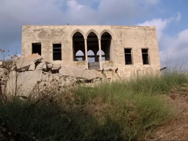
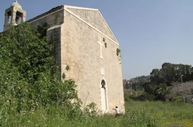
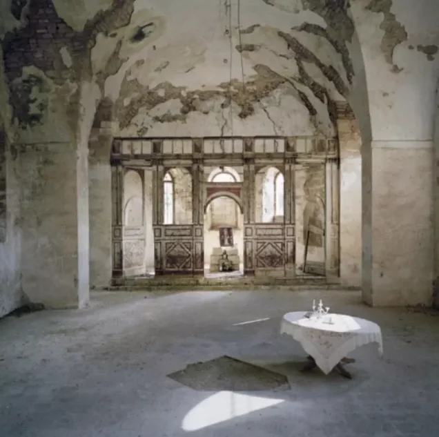
- al-Bassa was mostly destroyed with the exception of few houses, the church, and a Muslim shrine.
- Ethnic cleansing
- All remaining residents of al-Bassa inhabitants were completely ethnically cleansed on May 27th, 1949, who mostly were pushed north towards Lebanon. However, few were ethnically cleansed to Arab Nazareth (see Stories & Memories section for more details).
- Settlements built on the land of Al-Bassa before 1948
- Matzuva, founded in 1940, which has since expanded so that some of its buildings stand on village land
- Settlements built on the built-up area of Al-Bassa after 1948
- Betzet, established in 1949 on the village site; Kefar Ro'sh ha-Niqra, established in 1949 on village lands by settlers from the Palmach's Yiftach Brigade; Leman, established in 1949 on village land east of the site; Shelomi, established in 1950 on village lands slightly south of the site
- Refugees' migration routes
- al-Bassa inhabitants were mostly concentrated in Dbyha refugee camp nearby Junyah, Lebanon. However, at the outbreak of the civil war in 1975, this camp was mostly ethnically cleansed by the Maronites Militias.
Hover a dot to read the village name, or click to open its card.
Borders of the depopulated village of Al-Bassa
al-Bassa: A Depopulated Palestinian Village in the Acre District
Al-Bassa was a depopulated Palestinian village in the Acre District, located near the Lebanese border approximately 19 kilometers north of the city of Acre, at an average elevation of about 65 meters above sea level. The village stood on the slopes of a rocky hill north of Wadi al-Bassa and faced west toward the Mediterranean coast.
- Subdistrict
- Acre
- Distance from district center
- 19 km north of Acre
- Average Elevation
- 65 m above sea level
- Population in 1931
- 1,948 – joint figure including Ra's al-Naqura, not the village alone
- Number of Houses in 1931
- 479 – joint figure including Ra's al-Naqura, not the village alone
- Population in 1944/1945
- 2,950 – joint figure including Khirbat Ma'sub, not the village alone (1,590 Christians and 1,360 Muslims)
- Estimated Population in 1948
- About 4,000 – a 1948 estimate cited by Khalidi, not an official census
- Total Land Area in 1945
- 29,535 dunams – joint figure including Khirbat Ma'sub, not the village alone
- Attack and Depopulation
- Zionist forces captured the village on 14 May 1948 during Operation Ben-Ami, landing there in boats according to the History of the Haganah as cited by Khalidi, whereas Aref al-Aref dates its fall to 11 May. According to eyewitnesses interviewed by Palestinian historian Nafez Nazzal, those who remained were gathered in the village church and several young people, including at least one woman, were shot dead outside it; some inhabitants were then 'ordered or advised' to go north to Lebanon, and about a hundred others were transported to the village of al-Mazra'a, according to Morris.
- Final Israeli Control
- 14 May 1948, according to two Israeli sources and a United Press dispatch as cited by Khalidi; sources differ, as Aref al-Aref dates the village's fall to 11 May 1948
- Military Operation
- Operation Ben-Ami
- Military Unit
- PalQuest's village entry does not name the unit that captured the village; PalQuest states that Operation Ben-Ami was carried out by the Carmeli Brigade
- Cause of Depopulation
- Direct military assault by Zionist forces, followed by the expulsion or removal of the remaining inhabitants; many women and children had been evacuated before the attack for fear of fighting
- Settlements Documented on Village Lands
- Betzet, established in 1949 on the village site; Kefar Ro'sh ha-Niqra, established in 1949 on village lands by settlers from the Palmach's Yiftach Brigade; Leman, established in 1949 on village land east of the site; Shelomi, established in 1950 on village lands slightly south of the site; and Matzuva, founded in 1940, which has since expanded so that some of its buildings stand on village land
Al-Bassa was among the largest and most developed villages in the Acre District in terms of population, services, commerce, and agriculture. During the Nakba and the occupation of Palestine in 1948, Zionist forces captured the village in May in the course of Operation Ben-Ami, carried out by the Carmeli Brigade. Its Palestinian inhabitants were displaced to Lebanon and other Palestinian localities, and most of the village was subsequently demolished.
Location of al-Bassa
- Al-Bassa was located approximately 19 kilometers north of Acre.
- Its average elevation was about 65 meters above sea level.
- The village stood on the slopes of a rocky hill north of Wadi al-Bassa.
- It faced west toward the Mediterranean coast.
- A secondary road connected it with the Acre–Beirut coastal highway.
- The village lay close to the Palestine–Lebanon boundary.
The Name and History of al-Bassa
Walid Khalidi suggests that the name al-Bassa may derive from the Canaanite word “Bissah,” meaning “swamp.” During the Roman period the locality was known as Bezeth. The historian Imad al-Din al-Isfahani, who was associated with Salah al-Din al-Ayyubi, later referred to it as 'Ayn al-Bassa.
In 1596, al-Bassa was a village in the nahiya of Tibnin within the liwa' of Safad and had an estimated population of approximately 572. Its inhabitants paid taxes on wheat, barley, olives, cotton, and fruit, as well as goats, beehives, and pasture land.
During the second half of the eighteenth century, the area was contested between Zahir al-Umar and the chiefs of Jabal Amil. Ahmad Pasha al-Jazzar later made al-Bassa an administrative center of a nahiya.
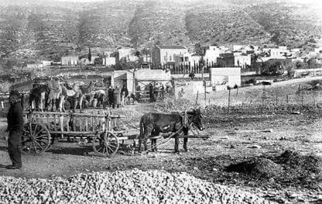
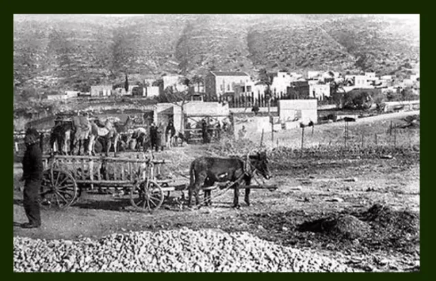
By the late nineteenth century, al-Bassa was a stone-built village of approximately 1,050 inhabitants surrounded by extensive olive groves and gardens of pomegranates, figs, and apples.
Before the First World War, al-Bassa formed part of territory administered with Lebanon under the Ottoman system. It was incorporated into Mandatory Palestine after Britain and France demarcated the postwar boundary between Palestine and Lebanon.
The Built Environment of al-Bassa
During the British Mandate, al-Bassa expanded onto an adjacent hill known as al-Jubayl. By 1948, local historical documentation cited by Walid Khalidi placed the number of village houses at more than 700.
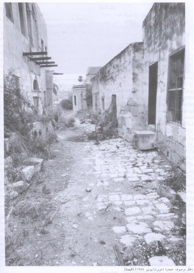
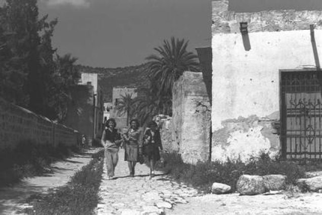
The older houses were built of stone and clustered along stone-paved streets and alleys. A traditional house included a large courtyard, storage rooms for grain and animal fodder, and a cistern for collecting rainwater.
Newer houses built after the First World War were generally more widely spaced and constructed of concrete. Some had two stories and were surrounded by household gardens planted with fruit trees and vegetables.
The Local Council, Water Supply, and Services
A local council was established in al-Bassa in 1922 and administered a range of public and agricultural affairs. It assisted farmers by arranging field guards, providing agricultural guidance, and coordinating harvesting seasons.
Households originally depended on rainwater cisterns. An artesian well was drilled approximately 1.5 kilometers west of the village in the 1940s, and after 1946 a piped water network was built to supply village homes.
Population of al-Bassa
Al-Bassa was one of the largest villages in the Acre District and had substantial Muslim and Christian communities.
The population was approximately 1,384 in the 1922 census. In 1931, the official census recorded 1,948 inhabitants, although PalQuest notes that this figure included Ra's al-Naqura.
In the Government of Palestine's 1944/1945 statistics, al-Bassa and neighboring Khirbat Ma'sub were combined and recorded as having 2,950 Arab inhabitants: 1,590 Christians and 1,360 Muslims.
Palestine Remembered presents a different 1945 figure of 3,100, including 150 Jews. The Government of Palestine figure reproduced by PalQuest, however, records 2,950 Arab inhabitants for al-Bassa and Khirbat Ma'sub, and that figure is therefore used here while acknowledging the discrepancy.
Estimates for 1948 also differ. Palestine Remembered gives approximately 3,422 inhabitants, while local historical documentation cited by Khalidi estimates the population at about 4,000. Neither figure represents a new official census.
Population of al-Bassa
- 1596572Historical estimate based on Ottoman records
- Late 19th centuryAbout 1,050Historical estimate
- 19141,720Historical figure published by Palestine Remembered
- 19221,384Official census under the British Mandate
- 19311,948Official census; includes Ra's al-Naqura according to PalQuest
- 1944/19452,950Government of Palestine statistics; includes al-Bassa and Khirbat Ma'sub: 1,590 Christians and 1,360 Muslims
- 1948Approximately 3,422–4,000Later estimates differing by source and statistical method
- 199821,015Later refugee-population estimate published by Palestine Remembered
Number of Houses in al-Bassa
The 1931 census recorded 479 houses, although PalQuest notes that this figure included Ra's al-Naqura. Local historical documentation cited by Walid Khalidi states that the number of houses exceeded 700 by 1948.
Number of Houses in al-Bassa
- 1931479Official census; includes Ra's al-Naqura
- 1948More than 700Local historical estimate cited by Walid Khalidi
Education in al-Bassa
Al-Bassa had a relatively developed educational system compared with many neighboring villages. Its three principal educational institutions were:
- A government elementary school for boys built by the Ottoman authorities in 1882.
- A government elementary school for girls.
- A private secondary school.
Social and Religious Life in al-Bassa
Al-Bassa had two mosques, two churches, and several shrines and religious sites. Some were associated with Muslims, others with Christians, while two shrines were considered sacred by members of both communities.
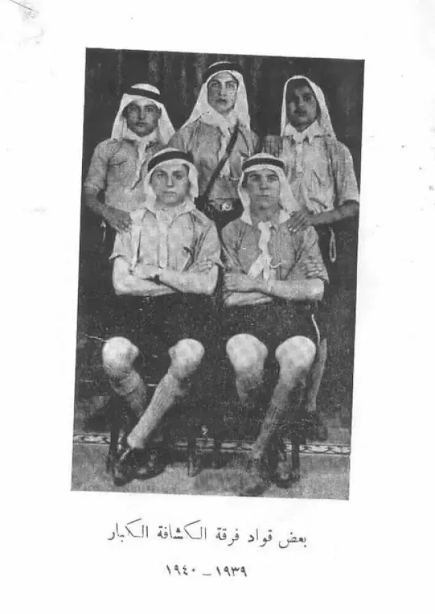
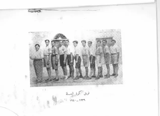
The inhabitants also established two athletic clubs. Workers formed a local branch of the Palestinian national labor union, which defended workers' interests and established a cooperative store.
By the early 1940s, a farmers' cooperative owned agricultural implements, a truck, and a harvesting machine.
Land Ownership in al-Bassa and Khirbat Ma'sub
The total land area recorded for al-Bassa and Khirbat Ma'sub in the 1944/1945 statistics was 29,535 dunums.
The Arabic Palestine Remembered table uses the categories “Palestinian,” “Transferred to Zionists,” and “Masha'.” These terms are preserved below to reflect the terminology used by that source. The Government of Palestine statistics reproduced by PalQuest use the official categories “Arab,” “Jewish,” and “Public.”
Land Ownership in al-Bassa and Khirbat Ma'sub, 1944/1945, Using the Terminology of Palestine Remembered
- Palestinian25,258 dunums86%
- Transferred to Zionists4,178 dunums14%
- Masha' / Communal99 dunums<1%
Land Use in al-Bassa and Khirbat Ma'sub in 1944/1945
A total of 17,023 dunums was cultivated or classified as cultivable land, consisting of 15,750 dunums of Arab land and 1,273 dunums of Jewish land.
Cereals covered 11,634 dunums, including 10,437 dunums of Arab land and 1,197 dunums of Jewish land. Plantations and irrigable land covered 4,775 dunums, including 4,699 dunums of Arab land and 76 dunums of Jewish land. Another 614 dunums of Arab land were devoted to citrus and bananas.
Land Use in al-Bassa and Khirbat Ma'sub According to the 1944/1945 Statistics
- Arab
- Jewish
- Public
- Citrus and Bananas614 dunums
- Plantations and Irrigable Land4,775 dunums
- Cereals11,634 dunums
- Built-up Area132 dunums
- Non-Cultivable Land12,380 dunums
Palestine Remembered additionally records approximately 3,500 dunums of Arab land planted with olive trees. This figure falls within the broader agricultural and plantation categories above and should not be added again as a separate land-use category.
Economic Life in al-Bassa
Agriculture was one of the foundations of al-Bassa's economy. Wheat and other cereals were among the principal crops, alongside vegetables, fruit, olives, citrus, bananas, and nuts.
Some cultivation was rainfed, while fruit trees and vegetables were irrigated. Many orchards were concentrated approximately two kilometers west of the village in an area that also contained parks and coffeehouses.
Al-Bassa had more than twenty shops serving both the village and neighboring communities, as well as a hisba, an open wholesale and retail produce market held in the center of the village on Sundays.
Villagers also worked in crafts, soap production, nearby British military bases, and animal husbandry, including cattle, sheep, and goats.
Archaeological Remains in al-Bassa
Archaeological remains found within and around al-Bassa indicate a long history of settlement. They included remains of an earlier settlement, sections of mosaic flooring, wells, and rock-cut tombs.
In 1932, the Palestine Department of Antiquities uncovered a Christian cemetery containing coins and glass objects dating to the fourth century CE.
More than eighteen khirbas and archaeological sites were also recorded in the surrounding area.
The 1938 al-Bassa Massacre
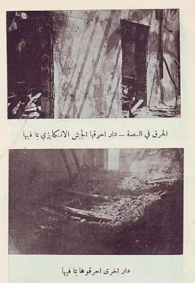
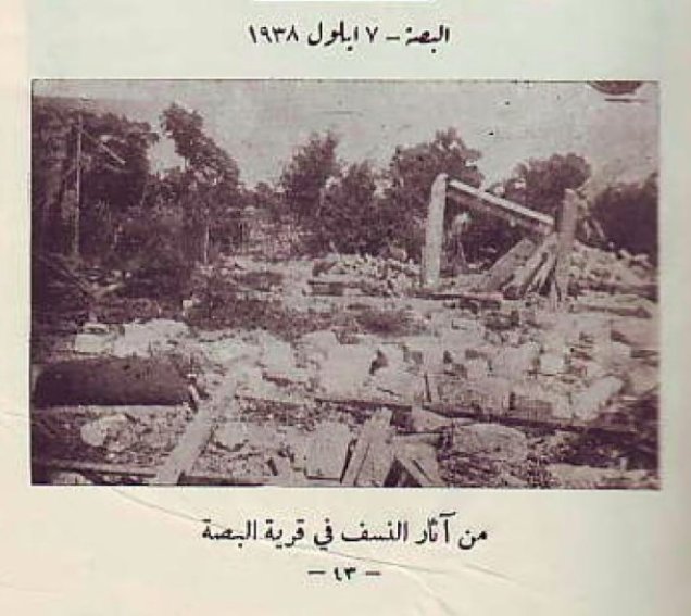
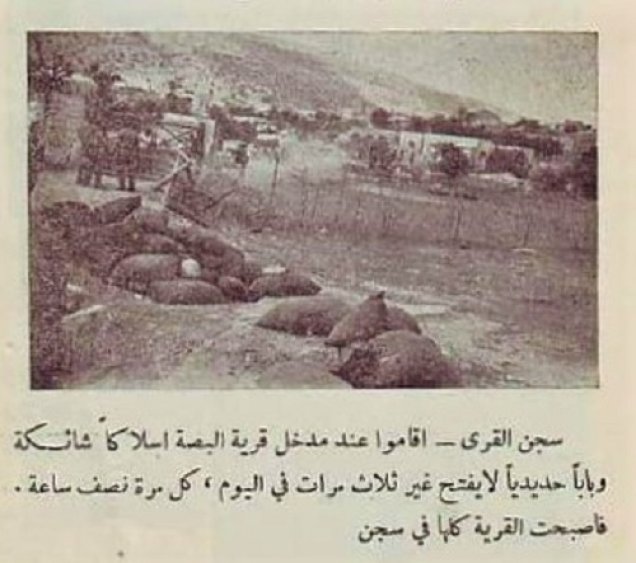
During the Great Palestinian Revolt of 1936–1939, al-Bassa was subjected to a large-scale British reprisal in September 1938.
The reprisal followed the deaths of four British soldiers in a rebel land-mine explosion near the village. Historian Matthew Hughes, writing in the Journal of Palestine Studies, documents that British troops retaliated against al-Bassa within the following twenty-four hours.
The village was burned, and at least twenty villagers were herded onto a bus that was forced to drive over a land mine buried by British soldiers. Other villagers were then forced to dig a pit and bury the bodies.
Hughes places the events at al-Bassa within a broader system of collective punishment and reprisals employed by British forces during the suppression of the Great Palestinian Revolt.
Operation Ben-Ami
The occupation of al-Bassa was associated with Operation Ben-Ami, carried out by the Carmeli Brigade in western Galilee in May 1948.
The operation officially lasted from 13 to 21 May and was intended to seize the coastal villages extending from Acre northward to the Lebanese border within the framework of Plan Dalet.
Al-Bassa was among the Palestinian villages affected by the operation, together with al-Zib, al-Sumayriyya, al-Manshiyya, al-Kabri, al-Nahr, Umm al-Faraj, al-Ghabisiyya, and others.
The Occupation of al-Bassa and the Displacement of Its Inhabitants During the Nakba
The sources differ regarding the exact date on which al-Bassa was occupied. Drawing on two Israeli sources and a United Press report, Walid Khalidi and PalQuest date the village's capture to 14 May 1948 during Operation Ben-Ami.
Palestinian historian 'Arif al-'Arif, however, dates its fall to 11 May, three days earlier. Because Operation Ben-Ami officially began on 13 May, this chronological discrepancy between the sources remains significant.
A military account cited by Khalidi states that Zionist forces landed by boat near the coastal village, an action described in the History of the Haganah as, in a certain sense, an early naval operation.
Eyewitness accounts collected by Palestinian historian Nafez Nazzal provide a different picture from the claim that the entire population fled merely upon seeing the attacking forces. Many women and children had been evacuated earlier because of fears of fighting, while other residents and village fighters remained.
According to these testimonies, the village defenders were taken by surprise and retreated northward. The occupying forces then ordered the remaining inhabitants, mostly elderly people, to gather in one of the village churches.
The witnesses recalled that several younger people, including at least one woman, were taken outside the church and shot. Those who remained were ordered to bury them.
Khalidi also records that some inhabitants were directed or ordered northward toward Lebanon, while approximately one hundred villagers, mostly elderly people and Christians, were transferred to the Palestinian village of al-Mazra'a together with displaced people from other Galilee villages.
The occupation ultimately resulted in the displacement of al-Bassa's Palestinian inhabitants during the Nakba and their prevention from returning, while most of the village's buildings were subsequently demolished.
Occupation and Depopulation Chronology
- Before the attack (the sources give no date)
Beginning of the exodus
According to eyewitnesses interviewed by Palestinian historian Nafez Nazzal, many women and children had been evacuated before the attack for fear of fighting, while others stayed in the village.
- 13–14 May 1948
Beginning of the military operation
The Haganah launched Operation Ben-Ami, carried out by the Carmeli Brigade, as its last major offensive before the end of the British Mandate, to capture all the coastal villages from Acre northwards to the Lebanese border; al-Bassa was among the villages attacked and occupied.
- 14 May 1948, or 11 May 1948 according to al-Aref
Final occupation
The village was captured on 14 May, according to two Israeli sources and a United Press dispatch as cited by Khalidi, while Palestinian historian Aref al-Aref dates its fall three days earlier. According to the History of the Haganah, Zionist forces landed at the village in boats, whereas eyewitnesses said the village militiamen were taken by surprise on the day of the attack and retreated northwards.
- Probably 14 May 1948 (after the occupation)
Execution of several villagers
According to eyewitnesses interviewed by Nazzal, the occupying forces ordered all those who remained, mostly old people, to gather in the village church, then took a few of the younger people, including at least one woman, shot them dead outside the church and ordered the others to bury them. Morris does not mention this incident.
- After the occupation (the sources give no date)
Expulsion of the remaining inhabitants
According to Morris as cited by Khalidi, most of those who remained fled during the assault; some were then 'ordered or advised' to go north to Lebanon, and about a hundred others, mainly old people and Christians, were transported to the village of al-Mazra'a along with other displaced villagers from Galilee.
- After the occupation (the sources give no date)
Killing of villagers trying to return
According to Nazzal, a few villagers were later killed as they tried to return to the village to salvage their belongings.
- 1949
Settlements on village lands
The settlement of Betzet was founded on the village site and populated with Jewish immigrants from Romania and Yugoslavia; settlers from the Palmach's Yiftach Brigade established Kefar Ro'sh ha-Niqra on village lands; and Leman, originally a military base, was established on village land east of the site.
- 1950
Settlement on village lands
Shelomi, a development city, was established on village lands slightly south of the original village site.
Settlements Established on the Lands of al-Bassa
Several Israeli settlements were established on the site and lands of al-Bassa after the Nakba, while an older settlement later expanded onto village land:
- Betzet: established in 1949 on the village site and initially settled by Jewish immigrants from Romania and Yugoslavia.
- Kfar Rosh HaNikra: established in 1949 on al-Bassa's lands.
- Liman: established in 1949 on village land east of the site; it initially served as a military base.
- Shlomi: established in 1950 on village land slightly south of the original site.
- Matzuva: established in 1940 before the Nakba and later expanded so that some of its buildings came to stand on al-Bassa's lands.
The Site of al-Bassa After the Nakba
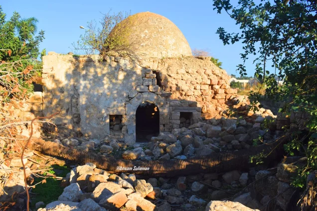
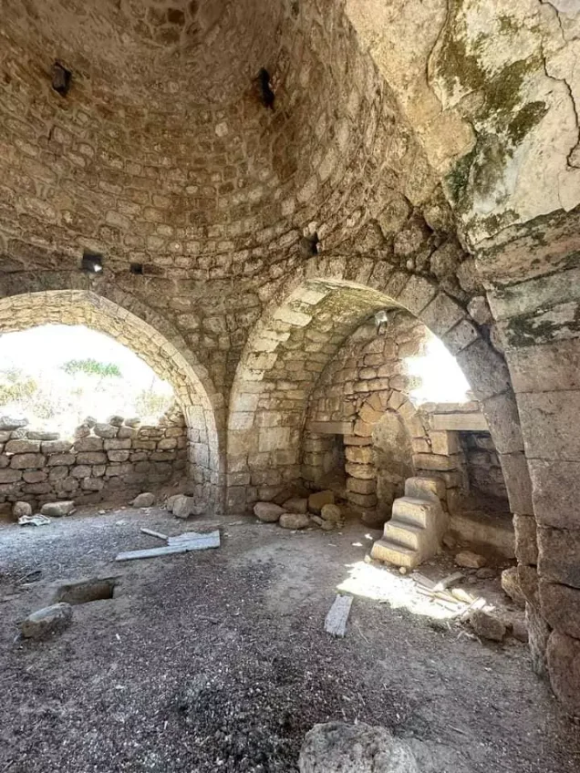
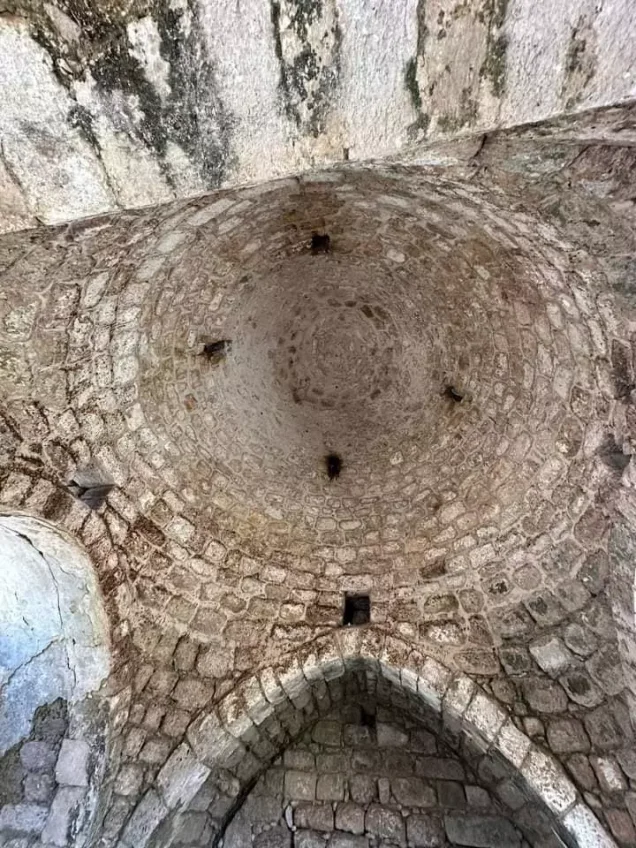
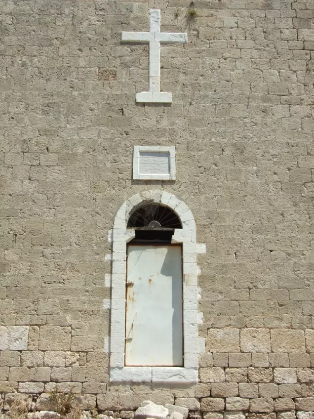
According to Walid Khalidi's field description, two of the most prominent surviving large structures were the Greek Catholic church and a domed Muslim shrine.
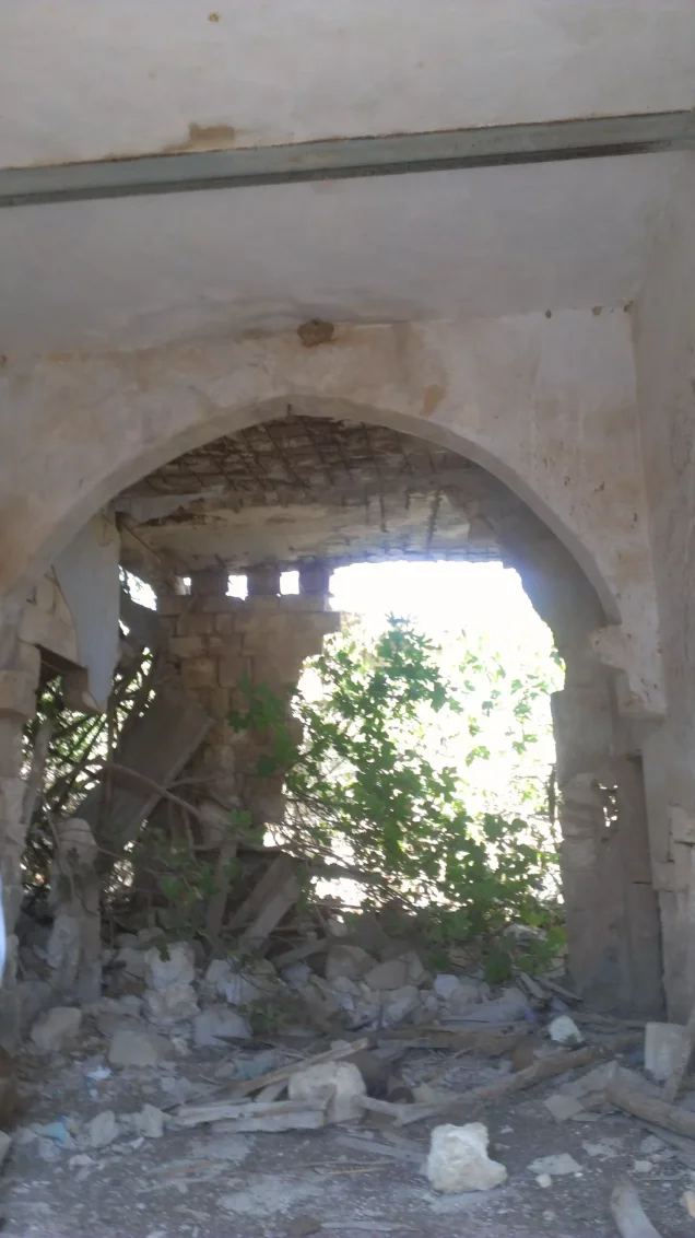
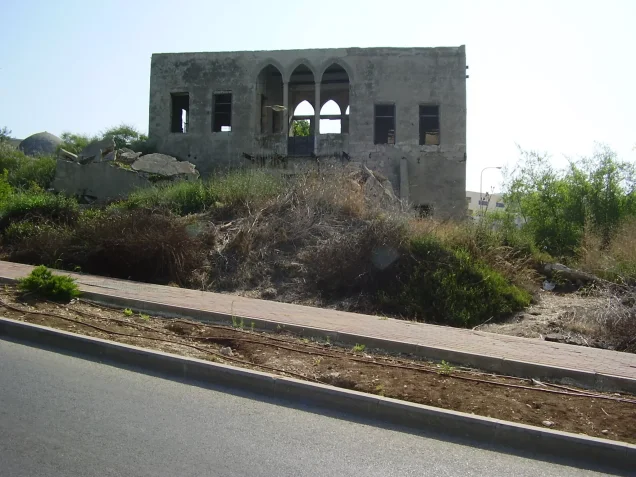
Several village houses also remained standing, some of which were occupied at the time of the field survey. Fig trees, thorny vegetation, cactuses, and stone rubble from demolished houses were scattered across other parts of the site, while the surrounding lands were cultivated.
This description is based on fieldwork conducted for Walid Khalidi's All That Remains and should not necessarily be treated as a field survey updated to the present day.
Sources
- PalQuestPalQuest – Interactive Encyclopedia of the Palestine Question: al-Bassa
- PalQuestPalQuest – Interactive Encyclopedia of the Palestine Question: Operation Ben-Ami
- Institute for Palestine StudiesInstitute for Palestine Studies: Walid Khalidi, All That Remains
- Palestine RememberedPalestine Remembered: al-Bassa – Acre District
- PalQuestMatthew Hughes: Britain's Suppression of the Arab Revolt in Palestine, 1936–39, Journal of Palestine Studies
Photo gallery
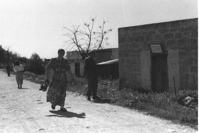
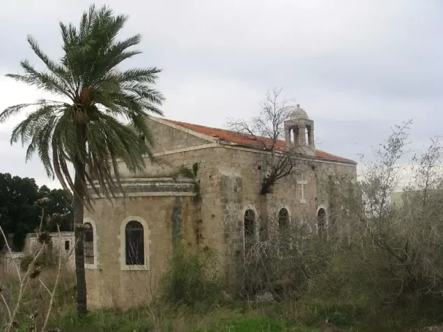
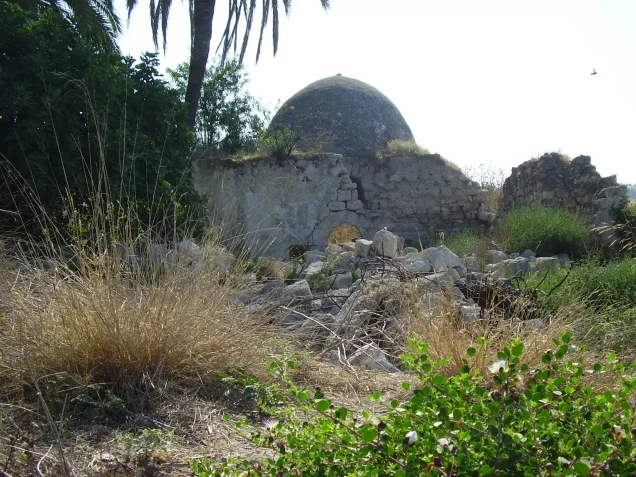
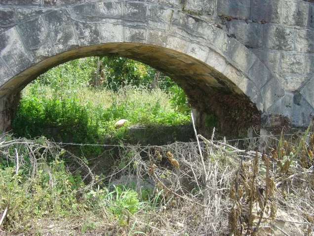




Photos from the village's people
Photos sent in by visitors and published after review.
Add a photo of this village
Log in to add photos of this village.
Other villages from Akka (Acre)

More from the archive



 Download Our Palestine App
The whole archive in the palm of your hand: depopulated villages, the Nakba, the massacres and Al-Aqsa — free, with no ads to erase the story.
Download Our Palestine App
The whole archive in the palm of your hand: depopulated villages, the Nakba, the massacres and Al-Aqsa — free, with no ads to erase the story.



Comments
No comments yet — be the first to write one.
Add your comment
Name and email are optional. Comments appear after review.