
The depopulated village of al-Manshiyya (Acre) / District of Akka (Acre)

al-Manshiyya (Acre)
About the depopulated village of al-Manshiyya (Acre)
- District
- Akka (Acre)
- Date al-Manshiyya (Acre) was occupied
- 14 May 1948
- Population in 1948
- 940
- Military operation
- Operation Ben-Ami
- Brigade that carried it out
- The Haganah's Carmeli Brigade, which carried out Operation Ben-Ami; the available sources do not identify the specific force that entered the village.
- Distance from the governorate centre
- 2 km from Acre according to the PalQuest data table; 3 km northeast of Acre according to Khalidi's text
- Elevation above sea level
- 25 m
- Cause of displacement
- Military occupation of the village by Zionist forces in Operation Ben-Ami
- Extent of destruction
- On June 16th, 1948, al-Manshiyya was completely destroyed with the exception of the Baha'i shrine, the village mosque, the Islamic school for orphans, and a handful of old houses remain intact!
- Ethnic cleansing
- al-Manshiyya inhabitants were completely ethnically cleansed.
- Settlements built on the built-up area of al-Manshiyya (Acre) after 1948
- Shamrat and Bustan ha-Galil, both established in 1948 on village lands north of the village site; the village site itself is now part of the city of Acre
Hover a dot to read the village name, or click to open its card.
Borders of the depopulated village of al-Manshiyya (Acre)
al-Manshiyya: A Depopulated Palestinian Village in the Acre District
al-Manshiyya was a Palestinian village in the Acre District, situated on a sandstone rise in the northwestern part of the Acre Plain approximately 2–3 kilometres northeast of the city of Acre, at an average elevation of about 25 metres above sea level. Its Arab population reached 810 in the 1944/1945 statistics. The village was probably occupied on 14 May 1948 at the beginning of Operation Ben-Ami, carried out by the Carmeli Brigade, and its Palestinian inhabitants were displaced during the Nakba and the occupation of Palestine in 1948.
- Subdistrict
- Acre
- Distance from district center
- 2 km from Acre according to the PalQuest data table; 3 km northeast of Acre according to Khalidi's text
- Average Elevation
- 25 m above sea level
- Population in 1931
- 460
- Number of Houses in 1931
- 132
- Population in 1944/1945
- 810 – Arab population; the same statistical unit also recorded 270 Jews (total 1,080)
- Estimated Population in 1948
- About 940 – a later demographic estimate, not an official census
- Total Land Area in 1945
- 14,886 dunams
- Attack and Depopulation
- Armed Zionist men equipped with automatic weapons and Sten guns attacked the village on 6 February 1948 and were driven back by its defenders, according to the Palestinian daily Filastin as cited by Khalidi. Indirect evidence, without precise details, indicates that it fell on 14 May 1948 at the beginning of Operation Ben-Ami.
- Final Israeli Control
- Probably 14 May 1948, at the beginning of Operation Ben-Ami; Khalidi bases this on indirect evidence, as no precise details of the village's occupation are available.
- Military Operation
- Operation Ben-Ami
- Military Unit
- The Haganah's Carmeli Brigade, which carried out Operation Ben-Ami; the available sources do not identify the specific force that entered the village.
- Cause of Depopulation
- Military occupation of the village by Zionist forces in Operation Ben-Ami
- Settlements Documented on Village Lands
- Shamrat and Bustan ha-Galil, both established in 1948 on village lands north of the village site; the village site itself is now part of the city of Acre
Location
al-Manshiyya stood on a sandstone rise in the northwestern part of the Acre Plain.
PalQuest's summary data place it approximately 2 kilometres from Acre, while the detailed geographical description gives a distance of about 3 kilometres northeast of the city. A range of approximately 2–3 kilometres northeast of Acre therefore best reflects the sources.
The village lay about 2 kilometres north of the al-Na'amin River and approximately half a kilometre east of the al-Basha Canal, which carried water from the springs of al-Kabri to Acre.
A short secondary road connected al-Manshiyya with the coastal highway leading into Acre, allowing the villagers ready access to the city's markets, transportation, and services.
Origins and History
Local village tradition held that al-Manshiyya emerged after the Crusades and that the Mamluks brought some of its earliest inhabitants from North Africa to repopulate the area.
This account is not independently established by contemporary documentation. Al-Manshiyya also does not appear among the villages recorded in the Ottoman tax register of 1596. The post-Crusader origin story should therefore be treated as local tradition rather than conclusively established history.
By the late nineteenth century, al-Manshiyya was inhabited again. It was described as a village on a plain surrounded by cultivated land, with stone-and-mud houses and an estimated population of about 150.
Architecture and Public Facilities
By the early twentieth century, al-Manshiyya had an approximately square layout, and its houses were clustered closely together and constructed of stone, mud, and cement.
The Arab inhabitants of the village were Muslims.
The village contained a mosque, an Islamic orphanage, and a Baha'i shrine associated with Baha'u'llah, founder of the Baha'i faith, who died in the Acre area in 1892.
The Arabic PalQuest entry calls the mosque Masjid Abu 'Atiyya, while local village documentation separately identifies a shrine known as Maqam Abu 'Utba. The two names should therefore not be conflated without additional evidence.
The Arab built-up area covered approximately 27 dunams in the 1944/1945 statistics.
Population
The 1922 census recorded 371 inhabitants in al-Manshiyya.
By the 1931 census, the population had risen to 460 people living in 132 houses.
The 1944/1945 figures require a distinction between the Arab village population and the wider statistical unit. The statistics recorded 810 Arabs and 270 Jews, producing a total statistical-unit population of 1,080.
The figure of 1,080 should therefore not be presented as the population of the Palestinian Arab village alone.
Palestine Remembered gives a later estimate of approximately 940 Arab inhabitants in 1948 and 5,770 refugees and descendants in 1998. These are later demographic estimates rather than official British Mandate censuses.
Population of al-Manshiyya
- Late nineteenth centuryAbout 150Historical estimate
- 1922371Official census
- 1931460Official census
- 1944/1945810 ArabsArab village population
- 1944/19451,080Statistical-unit total: 810 Arabs + 270 Jews
- 1948About 940 ArabsLater estimate
- 19985,770Estimate of refugees and their descendants
Number of Houses
The 1931 census recorded 132 houses in al-Manshiyya.
The figure of approximately 269 houses for 1948 is a later estimate rather than an official census count.
Land of al-Manshiyya
According to the 1944/1945 statistics, al-Manshiyya had a total land area of 14,886 dunams.
Arab ownership amounted to 12,522 dunams, Jewish ownership to 1,895 dunams, while 469 dunams were classified as public land.
Land Ownership in al-Manshiyya in 1944/1945
- Arab ownership12,522 dunums84%
- Jewish ownership1,895 dunums13%
- Public land469 dunums3%
Agriculture and Economic Life
The economy of al-Manshiyya depended primarily on agriculture, especially cereal cultivation, together with livestock raising.
According to the 1944/1945 statistics, 253 dunams were devoted to citrus and bananas, all Arab-owned.
Irrigated and plantation land covered 621 dunams: 619 Arab-owned dunams and 2 Jewish-owned dunams.
Cereal cultivation covered a total of 12,616 dunams: 10,818 Arab-owned dunams, 1,793 Jewish-owned dunams, and 5 dunams of public land.
Palestine Remembered records two dunams planted with olive trees. This represents a crop category within cultivated land and should not be added separately to the overall land-use total.
Land Use in al-Manshiyya in 1944/1945, in Dunams
- Arab
- Jewish
- Public
- Citrus and bananas253 dunums
- Irrigated and plantation land621 dunums
- Cereals12,616 dunums
- Built-up area27 dunums
- Uncultivable land1,369 dunums
Archaeology
The lands of al-Manshiyya were closely connected with the ancient history of Acre. Tall al-Fukhkhar lay approximately one kilometre south of the village site.
Excavations beginning at Tall al-Fukhkhar in 1973 uncovered foundations associated with ancient Acre, and the tell served as an important site of the city during the Greek and Roman periods.
Archaeological evidence indicates the presence of a small farming settlement near the foot of the tell by the middle of the fourth millennium BCE, with settlement later expanding westward toward the coast.
Excavations conducted in al-Manshiyya in 1955–1956 uncovered five graves, the earliest dating to approximately the thirteenth century BCE.
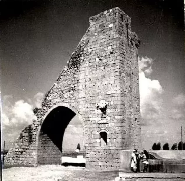
Remains of the al-Basha Canal and associated waterworks linking the al-Kabri springs with Acre also form part of the area's historical landscape.
The February 1948 Attack
The first documented attack on al-Manshiyya took place on 6 February 1948.
According to the Palestinian newspaper Filastin, as transmitted by Walid Khalidi and PalQuest, armed Zionist men equipped with automatic weapons and Sten guns attacked the village.
The village defenders repelled the assault, and the newspaper reported no casualties.
Because this attack occurred before the establishment of Israel on 14 May 1948, the attackers are more accurately described as Zionist armed forces rather than Israeli troops at this stage.
Operation Ben-Ami
Operation Ben-Ami began on 13–14 May 1948 and continued until 21 May. It was carried out by the Carmeli Brigade of the Haganah.
The operation aimed primarily to occupy Palestinian coastal villages extending northward from Acre toward the Lebanese border and to consolidate control around the city.
al-Manshiyya is listed among the villages directly affected by the operation.
The Occupation and Depopulation of al-Manshiyya
The principal sources do not provide a detailed independent account of the final battle inside al-Manshiyya.
However, the evidence assembled by Walid Khalidi and PalQuest indicates that the village probably fell on 14 May 1948 at the beginning of Operation Ben-Ami.
Since Operation Ben-Ami was conducted by the Carmeli Brigade, al-Manshiyya's capture can be attributed to Carmeli forces within that operation. The sources reviewed do not identify a specific battalion as the unit that directly entered the village.
The military assault led to the depopulation of al-Manshiyya, and its Palestinian inhabitants were dispersed within Palestine and abroad.
Local Palestinian documentation records families settling in al-Makr, Acre, al-Jadeida, Kafr Yasif, Tarshiha, and other Galilee communities, while others became refugees in Lebanon, including in Ayn al-Hilwa camp, as well as in Syria, Iraq, and other countries.
By 16 June 1948, the destruction of al-Manshiyya was already underway.
Israeli military information is cited here only as transmitted through Walid Khalidi and PalQuest and not through direct reliance on the original Israeli sources.
Occupation and Depopulation Chronology
- 6 February 1948
First attack on the village
A number of armed Zionist men equipped with automatic weapons and Sten guns attacked the village and were driven back by its defenders, according to the Palestinian daily Filastin as cited by Khalidi; the paper made no mention of casualties.
- 13–14 May 1948
Beginning of the military operation
The Haganah launched Operation Ben-Ami, its last major offensive before the end of the British Mandate, to capture all the coastal villages from Acre northwards to the Lebanese border; it was carried out by the Carmeli Brigade and lasted until 21 May 1948.
- 14 May 1948
Final occupation
According to Khalidi, indirect evidence indicates that al-Manshiyya was one of the villages that fell at the beginning of Operation Ben-Ami; no precise details of its occupation are available.
- 16 June 1948
Destruction of the village
A month after the village's occupation, Israeli prime minister David Ben-Gurion reported that the destruction of al-Manshiyya was already underway, as cited by Khalidi.
- 1948
Settlement on village lands
The settlements of Shamrat and Bustan ha-Galil were established on village lands north of the village site; Shamrat had first been founded in 1946 as ha-Yotzerim, 2 km further north, and was moved to its present location in May 1948.
Israeli Settlements on the Lands of al-Manshiyya
Shamrat
Shamrat was established at its present location on al-Manshiyya's lands in 1948, north of the village site.
The group that established it had previously founded a settlement called ha-Yotzerim in 1946 on land belonging to German Templars and moved to the present Shamrat site in May 1948.
Bustan ha-Galil
Bustan ha-Galil was established in 1948 on al-Manshiyya's lands north of the village site.
Expansion of Acre
The original al-Manshiyya village site later became part of the urban expansion of the city of Acre.
Local Palestinian documentation also associates part of the historical al-Dabuya area with the present Western Galilee College site. This modern identification derives mainly from local village documentation rather than from the principal Walid Khalidi entry.
| Name | Year | Relationship to Village Lands |
|---|---|---|
| Shamrat | 1948 | Moved to a site on al-Manshiyya's lands north of the village |
| Bustan ha-Galil | 1948 | Established on al-Manshiyya's lands north of the site |
| Modern Acre | After 1948 | Urban expansion incorporated the village site and portions of its lands |
al-Manshiyya After the Nakba
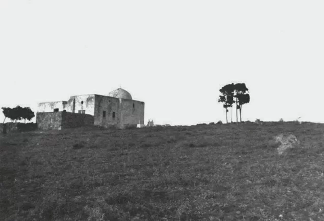
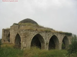
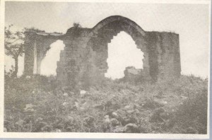
According to the field documentation relied upon by Walid Khalidi, a Baha'i shrine, the mosque, the Islamic orphanage, and a few houses survived, while most of the village disappeared.
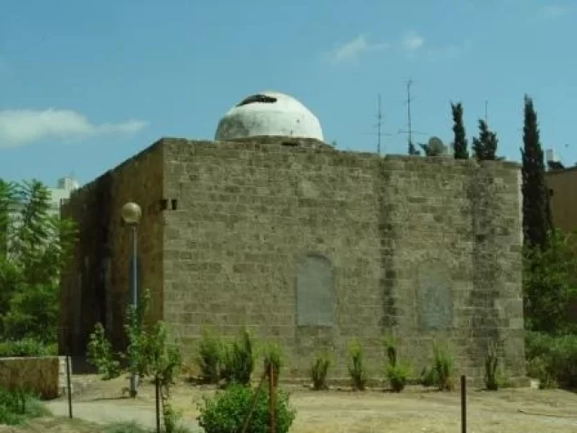
The Baha'i shrine was a domed structure with an arched entrance framed by prominent stone columns, with several graves in a nearby courtyard.
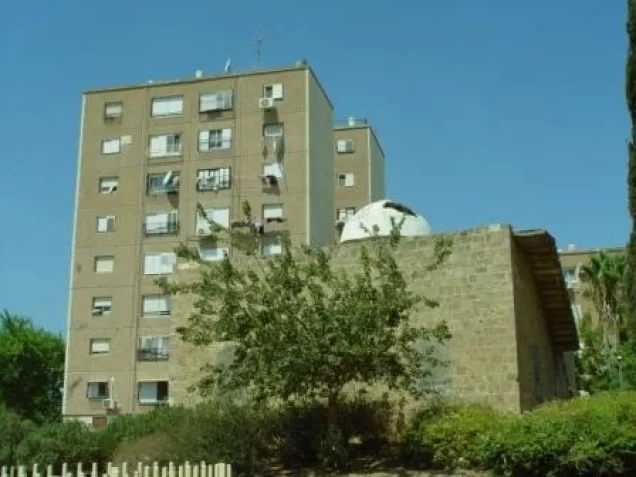
The mosque was a stone building with a dome and vaulted ceilings. At the time of Khalidi's field documentation, it was being used as a residence.
The Islamic orphanage building also remained, and the Palestinian cemetery was still visible.
The cemetery contained a tombstone with an eighteenth-century Turkish inscription. The principal source does not provide sufficient evidence to identify it as the grave of Zahir al-'Umar, and this attribution should therefore not be presented as established fact.
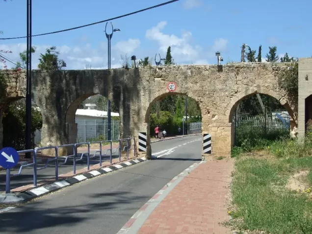
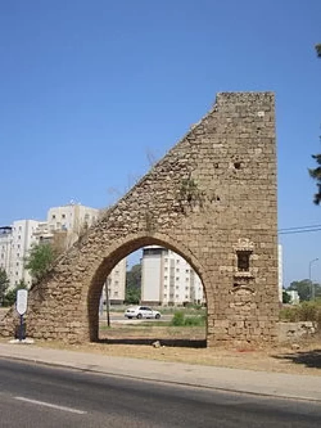
Parts of the old al-Basha Canal and other water-conveyance structures also survived according to the historical field documentation.
Local Palestinian sources additionally document surviving structures associated with the Baydun estate, also known in local accounts as the palace of Sulayman Pasha, and buildings in the historical al-Dabuya area.
Khalidi's description reflects the condition of the site at the time of his field documentation and should not necessarily be interpreted as a comprehensive survey updated to 2026, since the use and condition of individual buildings may have changed.
Sources
- PalQuest – Interactive Encyclopedia of the Palestine Question: al-Manshiyya, Acre.
- PalQuest: Operation Ben-Ami.
- Palestine Remembered: al-Manshiyya, Acre District.
- Walid Khalidi, All That Remains, entry on al-Manshiyya.
- Local Palestinian oral history and documentation from al-Manshiyya published by Palestine Remembered.
- Filastin, February 1948, as transmitted by Walid Khalidi and PalQuest.
- Government of Palestine, censuses of 1922 and 1931.
- Government of Palestine, Department of Statistics, Village Statistics, 1945.
Photo gallery




Photos from the village's people
Photos sent in by visitors and published after review.
Add a photo of this village
Log in to add photos of this village.
Other villages from Akka (Acre)



More from the archive


 Download Our Palestine App
The whole archive in the palm of your hand: depopulated villages, the Nakba, the massacres and Al-Aqsa — free, with no ads to erase the story.
Download Our Palestine App
The whole archive in the palm of your hand: depopulated villages, the Nakba, the massacres and Al-Aqsa — free, with no ads to erase the story.



Comments
No comments yet — be the first to write one.
Add your comment
Name and email are optional. Comments appear after review.