
The depopulated village of Khirbat al-Tannur - Allar al-Sifla / District of Al-Quds (Jerusalem)

Khirbat al-Tannur - Allar al-Sifla
About the depopulated village of Khirbat al-Tannur - Allar al-Sifla
- District
- Al-Quds (Jerusalem)
- Date Khirbat al-Tannur - Allar al-Sifla was occupied
- 22 October 1948
- Military operation
- Operation Ha-Har
- Brigade that carried it out
- Harel Brigade
- Elevation above sea level
- 575 m
- Cause of displacement
- Military assault by Zionist troops
- Extent of destruction
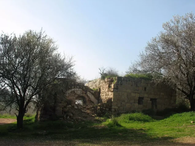
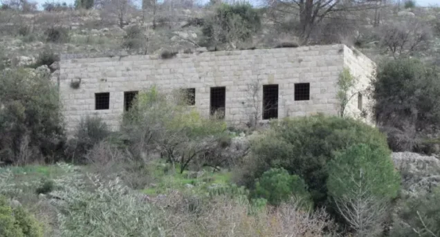
- Khirbat al-Tannur was mostly destroyed with the exception of few deserted and partially destroyed houses.
- Ethnic cleansing
- al-Tannur, Khirbat inhabitants were completely ethnically cleansed.
Hover a dot to read the village name, or click to open its card.
Borders of the depopulated village of Khirbat al-Tannur - Allar al-Sifla
Khirbat al-Tannur ('Allar al-Sufla) – Depopulated Palestinian Village in Jerusalem Subdistrict
Khirbat al-Tannur, historically known as 'Allar al-Sufla or 'Allar al-Tahta (“Lower 'Allar”), was a Palestinian village in the Jerusalem subdistrict. It lay approximately 18.5 kilometers west of Jerusalem at an average elevation of about 575 meters above sea level.
The village stood on the northern side of a wadi that ran from north to south before turning westward, with its houses concentrated at this bend. Historically, Lower 'Allar was the sister village of nearby 'Allar al-Fawqa, or Upper 'Allar.
No independent 1944/45 population, land-ownership, or land-use statistics are provided for Khirbat al-Tannur in the principal sources reviewed. Walid Khalidi considers it highly probable that the village was occupied during Operation ha-Har, most likely around 21–22 October 1948.
Key Facts about Khirbat al-Tannur
| Field | Information |
|---|---|
| Name | Khirbat al-Tannur |
| Historical name | 'Allar al-Sufla / 'Allar al-Tahta |
| Subdistrict | Jerusalem |
| Status | Depopulated Palestinian village/hamlet; classified as a small settlement during the Mandate |
| Distance from Jerusalem | Approximately 18.5 km west |
| Average elevation | Approximately 575 m above sea level |
| Population, 1944/45 | No independently documented official figure in the principal sources reviewed |
| Land area | No independent official land table is provided for the village |
| Probable occupation date | 21–22 October 1948 |
| Military operation | Operation ha-Har |
| Unit specifically entering the village | Not independently documented; Har'el, Etzioni, and Giv'ati participated in the operation at the broader operational level |
| Cause of depopulation | Military attack and occupation; Khalidi provides no independent detailed account of the residents' departure |
| Extent of destruction | A substantial part of the village was destroyed, while several houses survived in Khalidi's field documentation |
| Nearest settlement on the amalgamated lands | Matta', established in 1950 |
Location of Khirbat al-Tannur
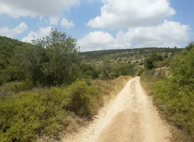
Khirbat al-Tannur lay in the hill country west of Jerusalem on the northern side of a wadi that initially ran north–south and then bent westward. The village houses were concentrated around this western bend.
The site stood north of a secondary road leading eastward toward Bethlehem and was closely linked geographically and historically with 'Allar al-Fawqa. Other Palestinian communities in the wider area included Bayt 'Itab, Jarash, Wadi Fukin, Bayt Nattif, Surif, and al-Jab'a.
The Name and Relationship with 'Allar
During the early Ottoman period, the village was known as 'Allar al-Sufla, or Lower 'Allar, in contrast with neighboring 'Allar al-Fawqa. The form 'Allar al-Tahta was also used in nineteenth-century sources.
Khirbat al-Tannur and Lower 'Allar should therefore not be treated as two separate villages in this context; they are names associated with the same site during different periods.
Khirbat al-Tannur in the Ottoman and Nineteenth-Century Periods
In 1596, 'Allar al-Sufla was a village in the nahiya and liwa' of Jerusalem. The source summarized by Walid Khalidi gives its population as 39 and records taxes on wheat, barley, and olives.
When Edward Robinson visited the area in 1838, ruins of a church were still visible at the village site.
In 1875, a settlement in the same area known as 'Allar al-Tahta was reported to have approximately 400 inhabitants. The site appears to have been abandoned for a period afterward before Khirbat al-Tannur was inhabited again during the British Mandate.
The 1596 and 1875 figures should therefore not be read as part of a continuous demographic series extending directly to 1948.
Population before the Nakba
PalQuest and Khalidi's village entry do not provide an independent official population for Khirbat al-Tannur in the 1944/45 Village Statistics.
| Year | Population | Nature of Figure |
|---|---|---|
| 1596 | 39 | Ottoman-era historical figure, not a British Mandate statistic |
| 1875 | About 400 | Nineteenth-century historical estimate |
| 1944/45 | Not independently available | No separate official figure is provided in the principal sources reviewed |
Palestine Remembered places a general reference to British Village Statistics beneath the 1596 and nineteenth-century figures, but those figures clearly predate the Mandate statistical compilations and should not be attributed to them.
Number of Houses
Palestine Remembered lists “at least ten houses” shortly before occupation, but it does not present this as an official Government of Palestine census count.
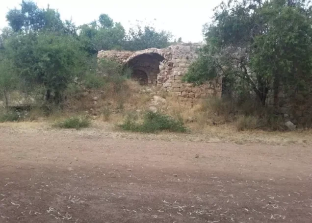
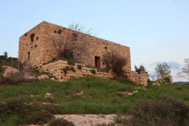
Walid Khalidi's later field description records the ruins of six demolished houses and four houses that were still standing. The figure of ten should therefore not be treated as a formal pre-1948 house census.
Village Lands
PalQuest does not provide an independent 1944/45 land-ownership or land-use table for Khirbat al-Tannur. The article therefore does not transfer the official land figures of neighboring 'Allar al-Fawqa to Lower 'Allar.
After 1948, the lands of Khirbat al-Tannur were amalgamated with those of neighboring 'Allar. This later administrative merging does not justify retrospectively treating 'Allar's pre-1948 land statistics as those of Khirbat al-Tannur.
Economic Life and Agriculture
The 1596 records show that the inhabitants of Lower 'Allar paid taxes on wheat, barley, and olives, documenting agricultural production involving these crops in the early Ottoman period.
No independent Mandate-era crop or acreage tables for Khirbat al-Tannur are available in the principal sources used here. Consequently, the cereal and orchard figures recorded for 'Allar al-Fawqa have not been transferred to Lower 'Allar.
Water and 'Ayn al-Tannur
Khalidi's field description records a spring flowing north of the ruins of a stone house at the village site.
The entry for neighboring 'Allar also identifies 'Ayn al-Tannur among the springs of the surrounding area, while Palestine Remembered contains later community documentation labeled as 'Ayn al-Tannur. The documented spring should be distinguished from additional local details supplied by later community material.
Archaeological Remains and the Old Church
When Edward Robinson visited the village in 1838, the ruins of a church were still visible. This establishes the presence of an older Christian architectural remain at the site but does not, by itself, establish the church's precise date, denomination, or historical function.
Education and Institutions
The principal sources reviewed do not document an independent school, mosque, or comparable public institution in Khirbat al-Tannur during the Mandate period.
No founding date, enrollment figure, or institutional detail has therefore been inferred without a specific source.
Operation ha-Har
Operation ha-Har began on 19 October 1948 and continued until 24 October, following the second truce. Its objective was to widen the Israeli-held corridor to Jerusalem and connect it with areas occupied in the Hebron hills.
PalQuest states that the offensive was launched principally by the Har'el and Etzioni brigades and also lists Giv'ati among the units participating at the operational level.
Villages affected by Operation ha-Har included Khirbat al-Tannur, 'Allar, Bayt 'Itab, Bayt Nattif, Sufla, Jarash, Dayr al-Shaykh, Dayr al-Hawa, al-Qabu, and other communities southwest of Jerusalem.
The broader order of battle does not, however, establish which brigade or battalion specifically entered Khirbat al-Tannur.
Occupation and Depopulation of Khirbat al-Tannur
Walid Khalidi states that direct information about the occupation of Khirbat al-Tannur itself is unavailable, but that its geographical location makes it almost certain that it was captured during Operation ha-Har.
He considers 21–22 October 1948 the most probable period of occupation, approximately when neighboring 'Allar and Bayt 'Itab fell. Palestine Remembered gives 21 October as its summary date.
Because the principal source uses qualified language, 21–22 October is retained as a probable range rather than turning 21 October alone into a definitive date.
Palestine Remembered classifies the cause of depopulation as direct military assault and describes the village as completely depopulated. Khalidi's village entry, however, does not provide an independent account of an expulsion order or the precise route taken by the inhabitants.
The most securely supportable description is therefore that Khirbat al-Tannur lost its Palestinian community during the military occupation of the area in Operation ha-Har, while the precise mechanism of departure remains insufficiently documented at village level.
Occupation Chronology
- 19 October 1948
Beginning of Operation ha-Har
Israeli forces began an offensive to widen the Jerusalem corridor and connect it with the Hebron hills.
- 19–21 October 1948
Advance through the southern Jerusalem corridor
Israeli forces advanced through villages in the sector while engaging Egyptian forces deployed in the area.
- 21 October 1948
Occupation of Bayt 'Itab
Bayt 'Itab fell during the same operation and is one of the neighboring events used to frame the probable date of Al-Tannur's capture.
- 21–22 October 1948
Probable occupation of Khirbat al-Tannur
Khalidi's estimated range; no independent village-specific battle account is available.
- 22 October 1948
Occupation of 'Allar
Neighboring 'Allar was occupied during Operation ha-Har.
- In the context of occupation
Depopulation
The village lost its Palestinian population; the specific mechanism of departure is not independently documented in Khalidi's entry.
- 24 October 1948
End of Operation ha-Har
The operation concluded after the occupation of a series of villages southwest of Jerusalem.
- Precise date not documented
Destruction
Several houses were demolished, while a number of village houses survived into later field documentation.
Israeli Settlements on the Amalgamated Lands
After 1948, the lands of Khirbat al-Tannur were amalgamated with those of neighboring 'Allar. Khalidi states that two Israeli settlements stood on these combined lands, with Matta' being the closest to the Al-Tannur site.
| Settlement | Established | Relationship to Khirbat al-Tannur |
|---|---|---|
| Matta' | 1950 | The closest settlement to Khirbat al-Tannur, located on the lands amalgamated with 'Allar |
| Bar-Giyyora | 1950 | Documented by the 'Allar entry as being on 'Allar lands; because Al-Tannur's lands were later amalgamated with 'Allar, the source alone does not establish whether it lies within the original pre-1948 Al-Tannur parcel |
Matta' is therefore the settlement most clearly connected with the immediate Khirbat al-Tannur site. A precise cadastral attribution of Bar-Giyyora to the original Lower 'Allar lands would require additional land-record or map evidence.
Khirbat al-Tannur Today
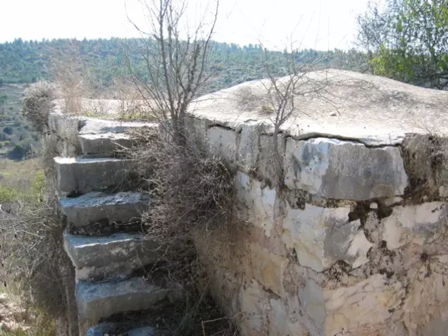
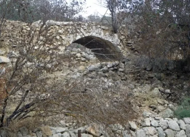
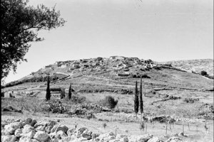
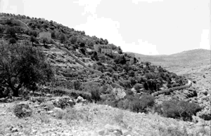
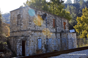
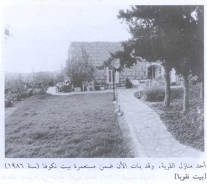
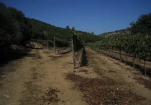
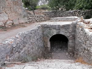
In Walid Khalidi's field description, the rubble of six destroyed houses was scattered across the site, while four additional houses were still standing. Groups of trees grew along terraces in the valley bottom.
Almond, olive, and cypress trees grew along the northern edge of the site, while eucalyptus trees stood to the east around the ruins of a stone house. A spring flowed north of the ruined structure.
This account derives from field research undertaken before the publication of All That Remains in 1992 and is therefore a historical site description rather than direct field verification of conditions in 2026.
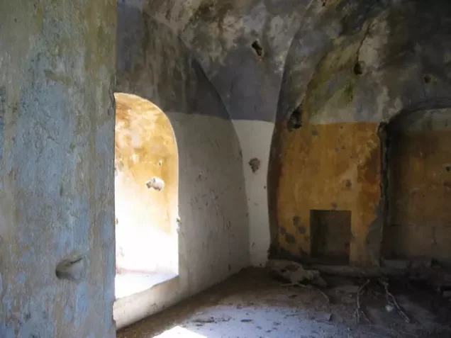
Palestine Remembered contains later community documentation, including photographs taken in autumn 2006 inside houses that were still standing and material labeled 2023 documenting 'Ayn al-Tannur. These materials indicate that some architectural and water-related remains continued to be documented at later dates, but they do not constitute a comprehensive present-day survey of all village lands.
Sources
- PalQuest – Interactive Encyclopedia of the Palestine Question: Khirbat al-Tannur
- PalQuest – Operation ha-Har
- Palestine Remembered – Khirbat al-Tannur, Jerusalem District
- Walid Khalidi – All That Remains: Khirbat al-Tannur
- PalQuest – 'Allar, for its historical relationship with Khirbat al-Tannur and settlements on the amalgamated lands
- Institute for Palestine Studies – All That Remains, Walid Khalidi
Photo gallery





Photos from the village's people
Photos sent in by visitors and published after review.
Add a photo of this village
Log in to add photos of this village.
Other villages from Al-Quds (Jerusalem)
More from the archive

 Download Our Palestine App
The whole archive in the palm of your hand: depopulated villages, the Nakba, the massacres and Al-Aqsa — free, with no ads to erase the story.
Download Our Palestine App
The whole archive in the palm of your hand: depopulated villages, the Nakba, the massacres and Al-Aqsa — free, with no ads to erase the story.



Comments
No comments yet — be the first to write one.
Add your comment
Name and email are optional. Comments appear after review.