
The depopulated village of Bayt Umm al-Mays / District of Al-Quds (Jerusalem)

Bayt Umm al-Mays
About the depopulated village of Bayt Umm al-Mays
- District
- Al-Quds (Jerusalem)
- Date Bayt Umm al-Mays was occupied
- 21 October 1948
- Population in 1948
- 80
- Military operation
- Operation Ha-Har
- Brigade that carried it out
- Harel Brigade
- Who defended the village
- Arab Liberation Army volunteers, Jordanian Army, and some local Palestinian militia.
- Distance from the governorate centre
- 14 (km) West of Jerusalem
- Elevation above sea level
- 650 m
- Cause of displacement
- Military assault by Zionist troops
- Extent of destruction
- Bayt Umm al-Mays was completely destroyed and defaced, and only house rubble left behind.
- Ethnic cleansing
- Bayt Umm al-Mays inhabitants were completely ethnically cleansed.
- Settlements built on the built-up area of Bayt Umm al-Mays after 1948
- A part of Ramat Raziel
Hover a dot to read the village name, or click to open its card.
Borders of the depopulated village of Bayt Umm al-Mays
Bayt Umm al-Mays – Depopulated Palestinian Village in Jerusalem Subdistrict
Bayt Umm al-Mays, also known as Khirbat Umm al-Mays, was a Palestinian village in the Jerusalem subdistrict. It stood approximately 14 kilometers west of Jerusalem in mountainous terrain at an average elevation of about 650 meters above sea level.
The village occupied a northwest-facing mountain site bounded by two deep wadis to the northeast and southwest, which met northwest of the settlement. High ground and deep valleys on three sides gave Bayt Umm al-Mays a degree of natural defensive and strategic importance.
The official 1944/45 statistics recorded 70 Arab Muslim inhabitants and a registered land area of 1,013 dunums.
The precise circumstances of its occupation are not independently documented in detail. Walid Khalidi nevertheless considers it almost certain that Bayt Umm al-Mays was captured during Operation Ha-Har and cites 21 October 1948 as the probable occupation date, most likely by the Har'el Brigade.
Key Facts about Bayt Umm al-Mays
| Field | Information |
|---|---|
| Name | Bayt Umm al-Mays |
| Alternative name | Khirbat Umm al-Mays |
| Subdistrict | Jerusalem |
| Mandate classification | Hamlet |
| Distance from Jerusalem | Approximately 14 km west |
| Average elevation | Approximately 650 m above sea level |
| Population, 1944/45 | 70 Arab Muslims |
| Registered land area | 1,013 dunums |
| Probable occupation date | 21 October 1948 |
| Military operation | Operation Ha-Har |
| Military unit | Probably the Har'el Brigade |
| Cause of depopulation | Military occupation during Operation Ha-Har; Palestine Remembered classifies it as direct military assault |
| Extent of destruction | Most buildings were destroyed; portions of two houses, terraces, caves, and other remains survived in later field documentation |
| Israeli settlements on village land | None documented by Khalidi or PalQuest |
Location
Bayt Umm al-Mays stood in the Jerusalem hills west of the city and faced northwest.
Two deep wadis bordered the village to the northeast and southwest and joined northwest of the site.
The combination of steep high ground and deep valleys on three sides gave the locality a naturally defensible position.
A secondary road linked Bayt Umm al-Mays with the Jerusalem–Jaffa highway and with the villages of Suba and al-Qastal.
Village lands adjoined those associated with Khirbat al-'Umur, Dayr 'Amr, 'Aqqur, and Kasla.
The Name Bayt Umm al-Mays
The village was also known as Khirbat Umm al-Mays.
Mustafa Murad al-Dabbagh explains “mays” as the name of a woodland tree bearing small dark fruit and suggests that the place name carries the sense of “the house where the mays tree grows.”
During the Crusader period the locality was known as Beittelamus.
The Arabic etymology should be understood as al-Dabbagh's linguistic interpretation rather than as conclusive evidence for the exact historical origin of the name.
Bayt Umm al-Mays before the Nakba
Bayt Umm al-Mays was a very small community and was classified as a hamlet in the Palestine Index Gazetteer.
Its layout was roughly trapezoidal. Older stone houses were tightly clustered, while newer buildings extended southeast toward the mountain overlooking the village from the south.
Only about 2 dunums were classified as built-up land in the 1944/45 statistics.
Population
The principal sources reviewed do not provide a separate documented population figure for Bayt Umm al-Mays in the 1922 or 1931 censuses.
- 1944/4570Official Village Statistics; all Arab Muslims
- 194881Later Palestine Remembered estimate, not an official census
- 1998499 refugeesLater Palestine Remembered estimate of refugees and descendants
The 1948 and 1998 figures are later estimates and should not be attributed to British Mandatory census statistics despite the generic source label appearing beneath the Palestine Remembered table.
Number of Houses
No reliable independent official house count for Bayt Umm al-Mays in 1931 or 1948 was identified in the principal sources reviewed.
No estimate has therefore been inferred from population or built-up acreage.
Land Ownership
The registered village land area in 1944/45 totaled 1,013 dunums.
- Palestinian / Arab1,013 dunums100%
- Transferred to Zionists0 dunums0%
- Communal/Public0 dunums0%
The figures balance exactly, with all 1,013 dunums recorded in the Arab category.
Land Use in 1944/45
- Cereals273 dunums27%
- Plantations and irrigable land51 dunums5%
- Built-up land2 dunums<1%
- Non-cultivable land687 dunums68%
The land-use figures balance exactly: 273 + 51 + 2 + 687 = 1,013 dunums.
A total of 324 dunums was therefore cultivated or cultivable, approximately 32 percent of the village land, while 689 dunums were built-up or classified as non-cultivable.
Economic Life
Agriculture formed the basis of village life.
Residents cultivated cereals and fruit, with grapes especially important. Vineyards and fruit orchards covered parts of the mountain slopes.
Some crops depended on rainfall while other plots were irrigated with spring water.
Part of the village land was used as grazing ground for sheep and goats.
Most cultivated land lay south of the built-up village.
Water Resources
The inhabitants obtained drinking water from two springs southwest of the village.
Spring water was also used to irrigate part of the orchards.
Khalidi's later site description also records a well near the southern end of the former village, close to the ruins of one of the surviving houses.
Education and Institutions
No independently documented village school, founding date, or pupil enrollment was identified in the principal sources reviewed.
Khalidi's entry likewise does not provide a clear record of a functioning village mosque immediately before the Nakba. No educational or religious institution has therefore been added without direct supporting evidence.
Archaeology and Nearby Khirbas
Several archaeological khirbas lay around Bayt Umm al-Mays.
Sources record ruins, foundations, and collapsed walls in the surrounding area.
The nineteenth-century Survey of Western Palestine also noted ruined walls at the site without establishing their date.
These remains indicate earlier occupation, although their precise chronology requires specialist archaeological evidence.
Operation Ha-Har
Operation Ha-Har began on 19 October 1948 and continued until 24 October.
Launched after the second truce, it targeted the southern part of the Jerusalem corridor and sought to widen Israeli-held territory there and link it with positions farther south toward the Hebron hills.
The Har'el, Etzioni, and Giv'ati brigades participated in the broader operation, while Egyptian forces defended several sectors.
Among the Palestinian villages affected were Bayt Umm al-Mays, 'Allar, Bayt 'Itab, Dayr al-Hawa, Dayr al-Shaykh, Khirbat al-'Umur, and Khirbat al-Tannur.
Occupation and Depopulation
Walid Khalidi does not provide an independent detailed account of a battle inside Bayt Umm al-Mays or of the precise manner in which the villagers left.
He nevertheless considers it almost certain that the village was occupied during Operation Ha-Har.
Khalidi cites Israeli historian Benny Morris as indicating that Bayt Umm al-Mays fell on 21 October 1948, probably to the Har'el Brigade.
This makes 21 October the better-supported date in the principal village source, rather than 1 July 1948 as displayed in some secondary databases.
Palestine Remembered classifies the cause of depopulation as direct military assault.
Because Khalidi explicitly states that the detailed circumstances are unknown, no village-specific expulsion order or evacuation route has been added without independent evidence.
Ethnic Cleansing
Palestine Remembered describes the final outcome at Bayt Umm al-Mays as complete ethnic cleansing.
Khalidi establishes the disappearance of the Palestinian community following the village's occupation during Operation Ha-Har but does not provide a detailed account of how every resident was removed.
The term “ethnic cleansing” is therefore retained as an attributed characterization used by Palestine Remembered, while the directly established fact is the complete depopulation of the Palestinian village.
Occupation Chronology
- Before October 1948
Second truce
The southern Jerusalem corridor remained a contested military sector.
- 19 October 1948
Beginning of Operation Ha-Har
Har'el, Etzioni, and Giv'ati formations began the offensive in the southern Jerusalem corridor.
- 21 October 1948
Probable occupation of Bayt Umm al-Mays
Khalidi cites a source placing the village's fall on this date, probably to the Har'el Brigade.
- In the course of occupation
Depopulation
Palestine Remembered classifies the cause as direct military assault; Khalidi does not detail the precise mechanism of departure.
- 24 October 1948
End of Operation Ha-Har
The operation ended after the occupation of numerous villages southwest of Jerusalem.
- Precise date not documented
Destruction
Most village buildings were demolished, while fragments of two houses, terraces, caves, and other remains survived.
Israeli Settlements on Bayt Umm al-Mays Lands
Khalidi and PalQuest explicitly state that no Israeli settlement was established on Bayt Umm al-Mays village lands.
Some secondary database headers state that part of Ramat Raziel lies on village land, but the detailed text reproduced from Khalidi on the same sites contradicts this claim, while other sources describe Ramat Raziel as merely near Bayt Umm al-Mays.
Ramat Raziel has therefore not been classified here as a settlement on Bayt Umm al-Mays lands without independent cadastral evidence.
Bayt Umm al-Mays Today
According to Walid Khalidi's field description, wild grass covered the site and grew around the remains of stone terraces.
Almond, olive, and fig trees grew along the terraces, while dried grapevine stems remained visible among the vegetation.
At the northern end stood the remains of a demolished house, including fragments of an arched entrance.
The ruins of another house remained near a well close to the southern end of the former village.
Two caves were visible to the west, while two large flat stone slabs surrounded by shrubs marked the southern edge of the site.
This account derives from fieldwork undertaken before the publication of All That Remains in 1992 and should therefore be treated as a documented historical site description rather than comprehensive direct field verification of conditions in 2026.
Sources
- PalQuest – Interactive Encyclopedia of the Palestine Question: Bayt Umm al-Mays
- PalQuest – Operation Ha-Har
- Palestine Remembered – Bayt Umm al-Mays, Jerusalem District
- Institute for Palestine Studies – All That Remains, Walid Khalidi
- Palestinian Villages Encyclopedia – Bayt Umm al-Mays / Khirbat Umm al-Mays, drawing on Khalidi and Mustafa Murad al-Dabbagh
Photo gallery
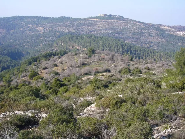
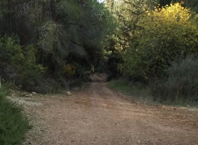
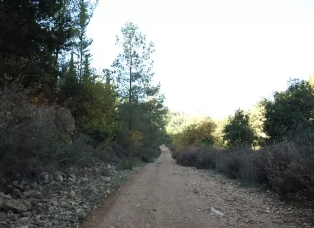
Photos from the village's people
Photos sent in by visitors and published after review.
Add a photo of this village
Log in to add photos of this village.
Other villages from Al-Quds (Jerusalem)
More from the archive
 Al-Quds (Jerusalem)
The depopulated village of Khirbat al-Tannur - Allar al-Sifla / District of Al-Quds (Jerusalem)
 Al-Quds (Jerusalem)
The depopulated village of Jarash / District of Al-Quds (Jerusalem)
 Al-Quds (Jerusalem)
The depopulated village of al-Burayj (Bayarat Burayj) / District of Al-Quds (Jerusalem)
 Download Our Palestine App
The whole archive in the palm of your hand: depopulated villages, the Nakba, the massacres and Al-Aqsa — free, with no ads to erase the story.
Download Our Palestine App
The whole archive in the palm of your hand: depopulated villages, the Nakba, the massacres and Al-Aqsa — free, with no ads to erase the story.



Comments
No comments yet — be the first to write one.
Add your comment
Name and email are optional. Comments appear after review.