
The depopulated village of Khirbat al-'Umur / District of Al-Quds (Jerusalem)

Khirbat al-'Umur
About the depopulated village of Khirbat al-'Umur
- District
- Al-Quds (Jerusalem)
- Date Khirbat al-'Umur was occupied
- 21 October 1948
- Population in 1948
- 310
- Military operation
- Operation Ha-Har
- Brigade that carried it out
- Harel Brigade
- Who defended the village
- Local militia and Egyptian Army/Muslim Brotherhood Battalion
- Distance from the governorate centre
- 12 (km) West of Jerusalem
- Elevation above sea level
- 625 m
- Cause of displacement
- Military assault by Zionist troops
- Extent of destruction
- Khirbat al-'Umur was completely obliterated, and only house rubble left behind.
- Ethnic cleansing
- al-'Umur, Khirbat inhabitants were completely ethnically cleansed.
- Settlements built on the built-up area of Khirbat al-'Umur after 1948
- Giv'at Ye'arim
Hover a dot to read the village name, or click to open its card.
Borders of the depopulated village of Khirbat al-'Umur
Khirbat al-'Umur – Depopulated Palestinian Village in Jerusalem Subdistrict
Khirbat al-'Umur was a Palestinian village in the Jerusalem subdistrict. It stood approximately 12 kilometers west of Jerusalem at an average elevation of about 625 meters above sea level.
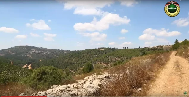
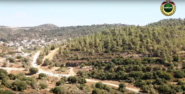
The village occupied a small plateau on the southern slope of a mountain and faced south. Wadi al-Ghadir ran east to west at the foot of the mountain, while a ridge to the south separated the village lands from those of Dayr 'Amr.
Khirbat al-'Umur had 270 Arab Muslim inhabitants in the official 1944/45 statistics and a registered land area of 4,163 dunums.
Israeli forces occupied the village on 21 October 1948 during Operation Ha-Har. Walid Khalidi concludes from the timing of its fall that Khirbat al-'Umur was taken by the Har'el Brigade, although no independent detailed account of the village's capture is available.
Key Facts about Khirbat al-'Umur
| Field | Information |
|---|---|
| Name | Khirbat al-'Umur |
| Subdistrict | Jerusalem |
| Distance from Jerusalem | Approximately 12 km west |
| Average elevation | Approximately 625 m above sea level |
| Population, 1931 | 187 in 45 houses |
| Population, 1944/45 | 270 |
| Registered land area | 4,163 dunums |
| Occupation date | 21 October 1948 |
| Military operation | Operation Ha-Har |
| Military unit | Har'el Brigade, inferred by Khalidi from the date and operational sequence |
| Cause of depopulation | Military pressure and assault; Palestine Remembered classifies it as direct military assault, while Khalidi describes the wider pattern as flight under pressure or expulsion |
| Extent of destruction | The village was largely destroyed; rubble, door and window frames, terraces, the cemetery, and 'Ayn al-'Umur survived in later documentation |
| Settlement on village land | Giv'at Ye'arim – 1950 |
Location
Khirbat al-'Umur stood on a small plateau on the southern slope of a mountain west of Jerusalem and faced south.
Wadi al-Ghadir ran east to west at the foot of the mountain, while a ridge to the south separated Khirbat al-'Umur's lands from those of Dayr 'Amr.
Dirt tracks connected the village with the Jerusalem–Jaffa highway, which passed a short distance to the north, and with neighboring villages.
Nearby communities included Saris, Abu Ghosh, Bayt Naqquba, Suba, Dayr 'Amr, Bayt Umm al-Mays, and Bayt Thul.
Palestine Remembered's boundary information specifically identifies the lands of Abu Ghosh, Dayr 'Amr, Suba, and Saris as adjoining the wider village lands.
Name and Historical Site
The term “Khirbat” reflects the village's location beside an older ruined site.
Walid Khalidi states that archaeological remains there probably dated to the Byzantine period, although the identification should remain qualified in the absence of specialist excavation evidence.
The late nineteenth-century Survey of Western Palestine described Al-'Umur as a small hamlet on a slope above a deep valley, with a perennial spring and olive trees below the village.
Late Ottoman lists also record a small population and a limited number of houses, although such nineteenth-century lists were not comprehensive modern censuses and sometimes counted males only.
Village Layout and Buildings
Khirbat al-'Umur had a rectangular plan, and its houses were built primarily of stone.
Two principal streets intersected in the center and divided the built-up village into four sections.
The official 1944/45 statistics recorded approximately 10 dunums as built-up land.
Agricultural plots and orchards extended south of the village and along Wadi al-Ghadir, while stone terraces covered portions of the surrounding slopes.
Population
- 1922137Official British Mandate census; all Muslims
- 1931187Official census; all Muslims
- 1944/45270Official Village Statistics; all Arab Muslims
- 1948313Later Palestine Remembered estimate, not an official census
- 19981,923Later estimate of refugees and descendants reported by Palestine Remembered
The 1948 and 1998 figures are later estimates and should not be attributed to British Mandatory census statistics.
Number of Houses
- 193145Official Census of Palestine figure
- 194875Later Palestine Remembered estimate, not an official census count
Land Ownership in Khirbat al-'Umur
The total registered village land area in 1944/45 was 4,163 dunums.
- Palestinian3,725 dunums89%
- Transferred to Zionists436 dunums10%
- Communal/Public2 dunums<1%
The figures balance exactly: 3,725 + 436 + 2 = 4,163 dunums.
The original official categories were 3,725 Arab dunums, 436 Jewish dunums, and 2 Public dunums.
Land Use in 1944/45
- Arab
- Jewish
- Public
- Cereals1,451 dunums
- Plantations and irrigable land511 dunums
- Built-up land10 dunums
- Non-cultivable land2,191 dunums
The figures balance exactly: 1,451 + 511 + 10 + 2,191 = 4,163 dunums.
Palestine Remembered's simplified table places 1,941 dunums of non-cultivable land in the Palestinian column. The official breakdown is 1,939 Arab dunums plus 2 Public dunums, so the Public category has been retained separately.
Olive Acreage
Approximately 98 dunums were planted with olives.
This acreage was part of the 497 Arab dunums classified as plantations and irrigable land and should not be added again to the land-use total.
Economic Life
Agriculture and orchards formed the foundation of village life.
Residents cultivated cereals, olives, and other fruit trees and irrigated some agricultural plots, particularly those in Wadi al-Ghadir and along the strip of land bordering the southern side of the village.
In 1944/45, 1,279 Arab dunums were devoted to cereals and 497 Arab dunums to plantations and irrigable cultivation.
Olives occupied approximately 98 dunums within the latter category.
Water and 'Ayn al-'Umur
The villagers obtained drinking and irrigation water from several nearby springs.
One of the principal springs was 'Ayn al-'Umur, which carried the same name as the village.
Nineteenth-century descriptions also mention a perennial spring below the village to the south.
'Ayn al-'Umur and the stone structure surrounding it remained visible in Khalidi's later field documentation.
Education
Khalidi and PalQuest do not document an independent school inside Khirbat al-'Umur.
A local historical account of education in Suba states, however, that children from Khirbat al-'Umur attended instruction in Suba.
The same account describes the local kuttab tradition there. It is therefore reasonable to state that at least some children from Khirbat al-'Umur received their education in Suba, without claiming that a separate village school existed at Khirbat al-'Umur.
Archaeological Remains
The village stood beside an older ruined locality whose remains Khalidi considers probably Byzantine.
Stone terraces and older structural remains around the locality further indicate a long history of human occupation.
The remains should not all be assigned definitively to the Byzantine period without specialist archaeological evidence.
Operation Ha-Har
Operation Ha-Har began on 19 October 1948 and continued until 24 October.
The operation targeted the southern part of the Jerusalem corridor and sought to widen Israeli-held territory around the corridor and connect it with areas farther south toward the Hebron hills.
The Har'el, Etzioni, and Giv'ati brigades participated in the broader operation, while Egyptian forces opposed them in several sectors.
Khirbat al-'Umur was among the Palestinian villages affected, together with 'Allar, Bayt 'Itab, Bayt Umm al-Mays, Dayr al-Hawa, Dayr al-Shaykh, Khirbat al-Tannur, and others.
Occupation and Depopulation
Khirbat al-'Umur was occupied on 21 October 1948.
Walid Khalidi concludes from this date and the operational sequence that the village fell to the Har'el Brigade during Operation Ha-Har, although he does not provide a separate detailed battle account for Khirbat al-'Umur itself.
Khalidi reports, through the source he cites, that the broader pattern in the area was for villagers either to flee under military pressure or to be expelled by forces entering their villages.
Thousands were displaced during the operation, and some remained for weeks in surrounding valleys before being forced to move again.
Palestine Remembered classifies the immediate cause of Khirbat al-'Umur's depopulation as direct military assault.
Because there is no independent village-specific account of the moment of occupation, no particular expulsion order or precise evacuation route has been added without further evidence.
Ethnic Cleansing
Palestine Remembered describes the final outcome at Khirbat al-'Umur as complete ethnic cleansing.
Khalidi's more detailed narrative establishes the complete depopulation of the village during Operation Ha-Har and places it within a broader pattern of flight under military pressure and direct expulsion.
The term “ethnic cleansing” is therefore retained as an attributed characterization used by Palestine Remembered, while the directly established descriptive fact is the complete displacement of Khirbat al-'Umur's Palestinian community.
Occupation Chronology
- 19 October 1948
Beginning of Operation Ha-Har
The offensive began in the southern Jerusalem corridor, involving Har'el, Etzioni, and Giv'ati formations.
- 21 October 1948
Occupation of Khirbat al-'Umur
The village fell during Operation Ha-Har; Khalidi identifies the Har'el Brigade as the likely occupying formation.
- During the occupation
Depopulation
Khalidi describes the wider pattern as flight under military pressure or expulsion; Palestine Remembered classifies the village-specific cause as direct military assault.
- 24 October 1948
End of Operation Ha-Har
The operation ended after numerous villages in the southern Jerusalem corridor had been occupied.
- Precise date not documented
Destruction
Most of the built-up village disappeared, leaving rubble, door and window frames, terraces, the cemetery, and the village spring.
Israeli Settlement on Khirbat al-'Umur's Lands
| Settlement | Established | Relationship to Khirbat al-'Umur |
|---|---|---|
| Giv'at Ye'arim | 1950 | Established on village lands |
Khirbat al-'Umur Today
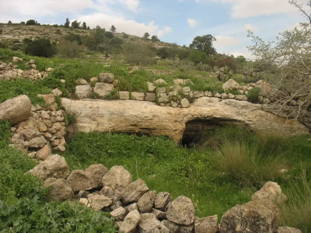
According to Walid Khalidi's field description, stone rubble and door and window frames were scattered across the village site and partly obscured by wild grass.
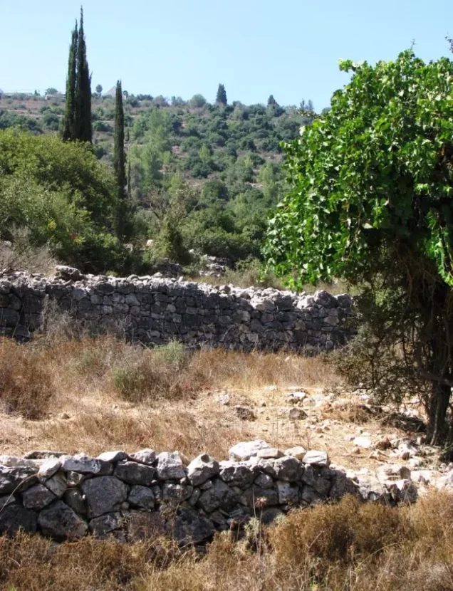
Several stone terraces remained visible.
Cactus grew along the eastern and northern sides of the site, while almond, olive, fig, and cypress trees survived within the former village and on lands extending southward.
The cemetery south of the village was partly covered by soil and grass, although numerous graves and tombstones remained visible.
'Ayn al-'Umur and the stone structure surrounding it also survived.
This description derives from fieldwork undertaken before the publication of All That Remains in 1992 and is therefore a documented historical site description rather than comprehensive direct field verification of conditions in 2026.
Palestine Remembered also contains much more recent community documentation, including visits and videos uploaded in August 2026 showing Khirbat al-'Umur and its spring. These provide useful recent community documentation of particular features but do not constitute a comprehensive independent archaeological or cadastral survey of the village lands.
Sources
- PalQuest – Interactive Encyclopedia of the Palestine Question: Khirbat al-'Umur
- PalQuest – Operation Ha-Har
- Palestine Remembered – Khirbat al-'Umur, Jerusalem District
- Walid Khalidi – All That Remains: Khirbat al-'Umur
- Palestine Remembered – Education and Culture in Suba, including children from Khirbat al-'Umur
- Government of Palestine – Census of Palestine 1922, PCBS reproduction
- Government of Palestine – Census of Palestine 1931, PCBS reproduction
- Institute for Palestine Studies – All That Remains, Walid Khalidi
Photo gallery


Photos from the village's people
Photos sent in by visitors and published after review.
Add a photo of this village
Log in to add photos of this village.
Other villages from Al-Quds (Jerusalem)
More from the archive
 Al-Quds (Jerusalem)
The depopulated village of Khirbat al-Tannur - Allar al-Sifla / District of Al-Quds (Jerusalem)
 Al-Quds (Jerusalem)
The depopulated village of Jarash / District of Al-Quds (Jerusalem)
 Al-Quds (Jerusalem)
The depopulated village of al-Burayj (Bayarat Burayj) / District of Al-Quds (Jerusalem)
 Download Our Palestine App
The whole archive in the palm of your hand: depopulated villages, the Nakba, the massacres and Al-Aqsa — free, with no ads to erase the story.
Download Our Palestine App
The whole archive in the palm of your hand: depopulated villages, the Nakba, the massacres and Al-Aqsa — free, with no ads to erase the story.



Comments
No comments yet — be the first to write one.
Add your comment
Name and email are optional. Comments appear after review.