
The depopulated village of Bayt Naqquba / District of Al-Quds (Jerusalem)
Bayt Naqquba
About the depopulated village of Bayt Naqquba
- District
- Al-Quds (Jerusalem)
- Date Bayt Naqquba was occupied
- 01 April 1948
- Population in 1948
- 280
- Military operation
- Operation Nachshon
- Brigade that carried it out
- Palmach
- Who defended the village
- Arab Liberation Army volunteers and some local Palestinian militia.
- Distance from the governorate centre
- 9.5 (km) West of Jerusalem
- Elevation above sea level
- 660 m
- Cause of displacement
- Military assault by Zionist troops
- Extent of destruction
- Bayt Naqquba was mostly destroyed with the exception of a few houses remain standing.
- Ethnic cleansing
- Bayt Naqquba inhabitants were completely ethnically cleansed.
Hover a dot to read the village name, or click to open its card.
Borders of the depopulated village of Bayt Naqquba
Bayt Naqquba – A Depopulated Palestinian Village in the Jerusalem Subdistrict
Bayt Naqquba, also transliterated Bayt Naquba or Bayt Naqouba, was a Palestinian village in the Jerusalem Subdistrict, located approximately 9.5 km west of Jerusalem on a long north–south hill, at an average elevation of about 660 meters above sea level.
Wadis surrounded the village on nearly every side except the north. It faced the village of Suba to the south and stood north of the main Jerusalem–Jaffa road. Secondary roads linked Bayt Naqquba with several neighboring villages, including Bayt Surik, al-Qastal, Abu Ghosh, and Suba.
An important distinction must be made between historic Bayt Naqquba, which was depopulated in 1948, and 'Ayn Naqquba, a later Palestinian village established south of the original site in 1962 for some of Bayt Naqquba's displaced inhabitants.
- Subdistrict
- Jerusalem
- Historical village name
- Bayt Naqquba / Bayt Naquba
- Later Palestinian village
- 'Ayn Naqquba, established south of the old site in 1962
- Distance from Jerusalem
- Approximately 9.5 km west
- Average elevation
- Approximately 660 m above sea level
- Population, 1944/45
- 240 Arabs
- Estimated population, 1948
- 278
- Total land area
- 2,979 dunums
- Occupation and depopulation
- Early April 1948; precise day uncertain in the principal source
- Military operation
- Operation Nachshon
- Military force
- Haganah/Palmach within Operation Nachshon; the village-specific assault unit is not securely identified
- Israeli settlement on the old village site
- Beit Nekofa, established in 1949
Bayt Naqquba and 'Ayn Naqquba: The Distinction
Bayt Naqquba was the historical Palestinian village that existed until the Nakba and its depopulation in 1948.
'Ayn Naqquba, by contrast, is a later Palestinian village established south of the old site in 1962, where some refugees from historic Bayt Naqquba were permitted to live.
The combined label “Bayt Naqquba / Naquba / 'Ayn Naqquba” used in some Palestinian village documentation therefore reflects historical and community continuity, not an identical pre- and post-1948 built-up location.
Location and Geography
Bayt Naqquba stood on a long hill extending from north to south and was surrounded by wadis on virtually all sides except the north.
The village stood north of the Jerusalem–Jaffa highway and faced Suba to the south.
Its position close to the main road gave it relatively easy access to Jerusalem and neighboring western Jerusalem villages.
Neighboring Villages
Palestinian maps and local documentation indicate the following approximate geographical relationships:
- Northwest: Qatanna.
- Northeast: Bayt Surik.
- West: Abu Ghosh / Qaryat al-'Inab.
- South: Suba.
- Southeast: al-Qastal.
- South of the old site in the post-1948 period: the later Palestinian village of 'Ayn Naqquba.
These relationships are approximate and do not substitute for historical cadastral boundary maps.
Name and Terminology
The historical village appears in Arabic and English sources under several spellings, including Bayt Naqquba, Bayt Naquba, and Beit Nakuba.
The name 'Ayn Naqquba refers to the later Palestinian village established by members of the displaced community south of the old village site.
Khalidi's principal village entry does not provide a definitive etymology of Naqquba, so this article does not adopt an unsupported linguistic derivation.
Bayt Naqquba in the Nineteenth Century
Edward Robinson recorded Bayt Naqquba in 1838 as a Muslim village in the Bani Malik district west of Jerusalem.
In 1863, French traveler Victor Guérin estimated the population at about 200 and described the village as standing among cultivated slopes.
The Survey of Western Palestine later described Bayt Naqquba as a village built on a slope, with a spring to the south.
Built Form
The village had a rectangular plan and most houses and small shops were built of stone.
The 1944/45 Village Statistics classified 9 dunums as Arab built-up land.
The official statistical unit also contained 296 dunums classified as Jewish built-up land. This should not be confused with Beit Nekofa, which was established only after the Nakba in 1949.
Population of Bayt Naqquba
The official 1922 Census of Palestine recorded 120 inhabitants in Bayt Naqquba, all Muslims.
In the 1931 census, the population had increased to 177 Muslims living in 41 occupied houses.
The 1944/45 Village Statistics recorded 240 Arabs.
Palestine Remembered later estimated the population at 278 in 1948 and the number of refugees and their descendants at 1,710 in 1998. These are retrospective estimates rather than official British Mandate census counts.
- 1863Approximately 200Victor Guérin's estimate
- 1922120Official census; all Muslims
- 1931177Official census; all Muslims
- 1944/45240Official Village Statistics; all Arabs
- 1948278Later estimate, not an official census
- 19981,710 refugeesLater estimate of refugees and their descendants
Number of Houses
- 193141Occupied houses recorded in the official census
- 194864Later Palestine Remembered estimate, not an official census count
Education and Public Institutions
Khalidi's principal village entry and the core PalQuest data do not document a separate formal school in Bayt Naqquba before the Nakba.
The same core sources do not provide sufficient documentation for a village mosque or a formal educational institution. This article therefore does not add such institutions without a secure source.
Khalidi does, however, record the presence of small shops within the village.
Land Ownership
The total land area recorded for Bayt Naqquba in the 1944/45 Village Statistics was 2,979 dunums.
Using Palestine Remembered's simplified terminology:
- Palestinian1,958 dunums66%
- Transferred to Zionists951 dunums32%
- Communal/Public70 dunums2%
The official Village Statistics use the original categories Arab, Jewish, and Public: 1,958 dunums were Arab, 951 Jewish, and 70 public.
Some English versions of Palestine Remembered display only 3 dunums of public land. That figure is arithmetically inconsistent with the 2,979-dunum total; the official statistics, PalQuest, and the Arabic Palestine Remembered page give 70 dunums, which is the figure used here.
Land Use in 1944/45
- Arab
- Jewish
- Public
- Cereals753 dunums
- Plantations and irrigable land334 dunums
- Built-up land305 dunums
- Non-cultivable land1,587 dunums
Cultivable land totaled 1,087 dunums, approximately 36 percent of the statistical unit: 818 Arab and 269 Jewish dunums.
Built-up and non-cultivable land totaled 1,892 dunums, approximately 64 percent.
Approximately 194 Arab dunums were planted with olive trees. This was a crop-specific subset of the 303 Arab dunums classified as plantations and irrigable land and should not be added separately.
Economic Life
Agriculture was the principal basis of village life.
Olive trees and vineyards were among the most important crops and were concentrated west of the village and on the valley floors.
The inhabitants also cultivated cereals, while some orchards were irrigated from local springs.
In 1944/45, 515 Arab dunums were devoted to cereals and 303 Arab dunums to plantations and irrigable land, including approximately 194 dunums of olives.
Water and Springs
Local springs supplied both drinking and irrigation water.
Khalidi records a spring on the eastern edge of the village as the principal drinking-water source, while the Survey of Western Palestine also described a spring south of the settlement.
Later Palestinian community documentation identifies additional springs in the wider village landscape, including 'Ayn Jamil and 'Ayn Hamad / 'Ayn Mahraj in the Wadi Kaslun area.
These later names are presented as local geographical documentation; the principal source securely establishes the general importance of village springs.
Archaeological Sites
Khirbat al-Khanazir and Khirbat al-Ra's lay near Bayt Naqquba.
The wider village landscape also contained historical routes and built remains associated with the old Jaffa–Jerusalem corridor.
Khalidi does not provide a detailed archaeological chronology for the two khirbas, so no specific historical period has been assigned without independent archaeological evidence.
Operation Nachshon
Operation Nachshon ran from 3 to 15 April 1948.
It was the Haganah's first large-scale offensive under Plan Dalet and aimed to open and secure the Tel Aviv–Jerusalem road and seize Palestinian villages along the route.
Approximately 1,500 Haganah and Palmach troops were mobilized. PalQuest lists the Har'el and Giv'ati brigades among the Zionist formations participating at the operation level.
PalQuest explicitly lists Bayt Naqquba among the villages affected by Operation Nachshon.
Occupation and Depopulation
Khalidi states that available information about Bayt Naqquba's capture is limited and that the village was occupied in early April 1948.
Its location indicates that its occupation occurred in the context of Operation Nachshon, probably around the same general period in which al-Qastal and Qalunya were captured.
Palestine Remembered's statistical header gives 1 April as the occupation date. Since PalQuest dates the opening of Operation Nachshon to 3 April, this article does not treat 1 April as a securely established village-specific date.
The most careful formulation is: Haganah forces occupied Bayt Naqquba in early April 1948 in the context of Operation Nachshon; the principal source does not establish the exact day or a village-specific assault unit.
- 3 April 1948
Beginning of Operation Nachshon
Large-scale Haganah offensive begins along the Tel Aviv–Jerusalem corridor
- Early April 1948
Occupation of Bayt Naqquba
Precise day remains uncertain in Khalidi's principal account
- April 1948
General military force
Haganah and Palmach within Operation Nachshon
- 3–15 April 1948
Operation-level brigades
Har'el and Giv'ati; no village-specific assault brigade securely established
- 15 April 1948
End of Operation Nachshon
End of the principal offensive along the Jerusalem road
Israeli Settlement on the Old Village Site
Beit Nekofa: Established in 1949 on the remains and site of historic Bayt Naqquba.
The Israeli settlement should not be confused with the original Palestinian village despite the direct similarity in name and location.
Establishment of the Palestinian Village of 'Ayn Naqquba
In 1962, a new Palestinian village was established south of the original Bayt Naqquba site.
The later village became known as 'Ayn Naqquba.
Some refugees from historic Bayt Naqquba were permitted to settle there, in a case Khalidi describes as possibly unique among the Palestinian villages occupied and depopulated in 1948.
The present Palestinian community therefore represents social and family continuity with historic Bayt Naqquba, but 'Ayn Naqquba is not built on precisely the same village center that existed before the Nakba.
Bayt Naqquba Today
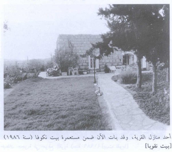
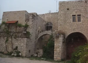
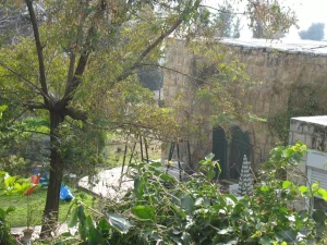
According to Walid Khalidi's field description in All That Remains, a few Palestinian houses survived at the old village site and were being used either as dwellings or as livestock shelters.
The surviving structures were built of stone, and many had vaulted or domed roofs.
Stones taken from the ruins of Palestinian houses had been reused as entrance steps for newer houses.
Almond and olive trees and cactus continued to grow across parts of the site.
The old Palestinian cemetery lies approximately half a kilometer south of the historic village site and was being maintained by residents of the later Palestinian village.
This description derives from fieldwork conducted before the publication of All That Remains in 1992. A published photograph of stone walls at the village site is dated 1986. It should therefore not be treated as direct field verification of every surviving structure in 2026.
Palestine Remembered contains later community documentation of the area, including material on springs and historical sites uploaded in 2025, some of which identifies earlier photography dates. Upload dates therefore should not automatically be treated as dates of field observation, and this material does not constitute a comprehensive current archaeological or architectural survey.
Sources
- PalQuestPalQuest – Interactive Encyclopedia of the Palestine Question: Bayt Naqquba
- PalQuestPalQuest – Operation Nachshon
- Palestine RememberedPalestine Remembered – Bayt Naqquba, Jerusalem
- Institute for Palestine StudiesInstitute for Palestine Studies – Walid Khalidi, All That Remains
- pcbs.gov.psGovernment of Palestine – Census of Palestine 1922
- pcbs.gov.psGovernment of Palestine – Census of Palestine 1931: Jerusalem Sub-District
- sabil.meGovernment of Palestine – Village Statistics 1945: Jerusalem Sub-District
- palqura.comPalestinian Villages Encyclopedia – Bayt Naqquba / Naquba / 'Ayn Naqquba
Photo gallery

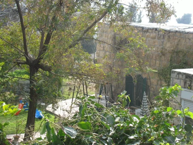
Photos from the village's people
Photos sent in by visitors and published after review.
Add a photo of this village
Log in to add photos of this village.
Other villages from Al-Quds (Jerusalem)

More from the archive


 Download Our Palestine App
The whole archive in the palm of your hand: depopulated villages, the Nakba, the massacres and Al-Aqsa — free, with no ads to erase the story.
Download Our Palestine App
The whole archive in the palm of your hand: depopulated villages, the Nakba, the massacres and Al-Aqsa — free, with no ads to erase the story.



Comments
No comments yet — be the first to write one.
Add your comment
Name and email are optional. Comments appear after review.