
The depopulated village of 'Artuf / District of Al-Quds (Jerusalem)

About the depopulated village of 'Artuf
- District
- Al-Quds (Jerusalem)
- Date 'Artuf was occupied
- 18 July 1948
- Population in 1948
- 410
- Military operation
- Operation Dani
- Brigade that carried it out
- Harel Brigade
- Who defended the village
- Egyptian Muslim Brotherhoods, some Arab Liberation Army volunteers, and some local Palestinian militia.
- Distance from the governorate centre
- 21.5 (km) West of Jerusalem
- Elevation above sea level
- 250 m
- Cause of displacement
- Military assault by Zionist troops
- Extent of destruction
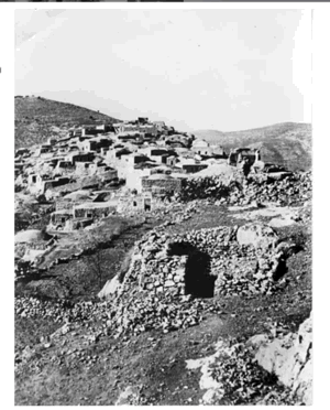
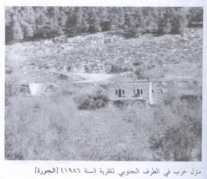
- Artuf was mostly destroyed and defaced with the exception of two village houses and the village cemetery.
- Ethnic cleansing
- 'Artuf inhabitants were completely ethnically cleansed.
- Settlements built on the land of 'Artuf before 1948
- Hartuv
Hover a dot to read the village name, or click to open its card.
Borders of the depopulated village of 'Artuf
'Artuf – Jerusalem Subdistrict
'Artuf, also rendered 'Artuf or 'Artouf in varying transliterations and written in Arabic as عرتوف or عرطوف, was a depopulated Palestinian village in the Jerusalem subdistrict and one of the villages of the 'Arqub region. It stood approximately 21.5 km west of Jerusalem at an average elevation of about 250 meters.
The village occupied a moderately elevated plateau surrounded by plains to the south, east, and west. A secondary road connected it with the main road toward Jerusalem.
The official 1931 Census of Palestine recorded 253 inhabitants, and the 1944/45 statistics recorded 350. The registered land unit of 'Artuf covered 403 dunums in 1945.
The villagers were temporarily evacuated during a British punitive action in March 1948 but soon returned. Their final displacement occurred during the night of 17–18 July 1948, when the Fourth Battalion of the Har'el Brigade captured 'Artuf during the second phase of Operation Dani.
'Artuf, 'Artuf, or Bayt al-Shams?
The village name documented by Walid Khalidi, PalQuest, and the Mandate-era records is 'Artuf. The Arabic spelling عرطوف also appears in Palestinian sources and in some census transcriptions.
Some recent Palestinian community references use the compound title “'Artuf / 'Artuf / Bayt al-Shams.” Their own historical discussion, however, describes Bayt Shams / Tall al-Rumayla as an ancient Canaanite locality in the vicinity of 'Artuf rather than as the administrative name of the Palestinian village itself.
The modern town of Beit Shemesh was established nearby in 1950 on land belonging to the depopulated Palestinian village of Dayr Aban.
Accordingly, this article does not treat Bayt al-Shams as a securely documented historical alternative name for 'Artuf itself.
Location of 'Artuf
'Artuf stood on a moderately elevated plateau, with open plains extending to its south, east, and west. Cultivated land stretched westward, while the Jerusalem highlands rose progressively to the east.
The village occupied a strategic position near Bab al-Wad, the Bab al-Wad–Bayt Jibrin road, and the Jaffa–Jerusalem railway.
During the British Mandate, the authorities built a fortified police station approximately one kilometer west of the village, with a railway station immediately beyond it.
Boundaries and Neighboring Villages
Palestinian local documentation describes the immediate surroundings of 'Artuf approximately as follows:
| Direction | Neighboring village / land |
|---|---|
| North | 'Islin |
| West | Sar'a |
| South | Dayr Aban |
| East | Dayr al-Hawa |
| Northeast | Dayr al-Hawa according to the local source |
Ishwa', Kasla, and al-Burayj also appear among the nearby localities on Palestinian village maps. Original cadastral maps remain the strongest source for distinguishing exact land boundaries from general geographical proximity.
'Artuf and the 'Arqub Region
'Artuf belonged to the group of villages known as the 'Arqub villages west of Jerusalem, situated across the mountainous and transitional zone between the Jerusalem highlands and the coastal plain.
Its proximity to Bab al-Wad, Wadi al-Sarar, and the railway gave it important economic and strategic connections with Jerusalem, Ramla, and neighboring villages.
'Artuf in the Ottoman Period
In 1596, 'Artuf belonged to the nahiya of Ramla in the liwa' of Gaza and had an estimated population of approximately 110.
The villagers paid taxes on wheat, barley, fruit, vineyards, goats, and beehives, indicating a mixed agricultural and pastoral economy.
'Artuf in the Late Nineteenth Century
Late nineteenth-century descriptions portrayed 'Artuf as a small village situated on a low hill overlooking a valley.
The inhabitants obtained water from a pool in the valley. Most houses were built of stone and mud, while a smaller number were constructed of stone and cement and had domed roofs.
Population of 'Artuf
- 1596About 110Estimate derived from an Ottoman tax register
- 1922181Muslim population of 'Artuf within the combined census row “'Artuf (Har-tuv)”; the same row separately recorded 124 Jews associated with Har Tuv, giving a combined total of 305
- 1931253Official census: 252 Muslims and 1 Jew
- 1944/45350Official Mandate-era statistics; the population was recorded as Arab and Muslim
- 1948406Later Palestine Remembered estimate; not an official census
- 19982,493 refugees and descendantsLater demographic estimate published by Palestine Remembered
The 1922 figure requires particular clarification. The official census used one combined row labeled “'Artuf (Har-tuv),” recording 181 Muslims and 124 Jews for a total of 305.
The frequently repeated figure of 305 therefore combines the Palestinian village population with the neighboring Jewish settlement. The more accurate population figure for Palestinian 'Artuf itself is 181.
Number of Houses
- 193158 occupied housesOfficial Census of Palestine
- 194893Later Palestine Remembered estimate; not an official census figure
Land Ownership in 1944/45
The land unit officially registered under 'Artuf covered 403 dunums in 1944/45.
Using Palestine Remembered's simplified terminology:
- Palestinian401 dunums100%
- Transferred to Zionists0 dunums0%
- Communal/Public2 dunums<1%
The official categories record 401 dunums as Arab, none as Jewish, and 2 dunums as Public.
Why Does the 1945 'Artuf Table Show No Jewish Land despite the Presence of Har Tuv?
By 1945, Har Tuv had become a separate statistical and cadastral unit rather than being included within the 403-dunum 'Artuf entry.
The 1945 statistics recorded Har Tuv separately with 4,749 dunums, including 4,547 dunums in the Jewish ownership category.
There is therefore no contradiction between Khalidi's statement that the settlement developed on land historically associated with 'Artuf and the fact that the remaining 'Artuf land unit in 1945 recorded no Jewish-owned land.
Land Use in 1944/45
- Arab
- Public
- Cereals279 dunums
- Plantations and irrigable land61 dunums
- Built-up land18 dunums
- Non-cultivable land45 dunums
The categories balance exactly with the official ownership totals.
Khalidi also records approximately 20 dunums of olive groves. This is a crop-specific figure within the agricultural land and should not be added again to the overall land-use total.
Economic Life in 'Artuf
The economy of 'Artuf combined agriculture with railway employment.
Khalidi records that approximately half the villagers worked in agriculture, while the other half worked at the nearby Bab al-Wad railway station on the Jaffa–Jerusalem line.
Agricultural land extended west of the village and was planted with cereals, fruit trees, almonds, and olives.
In 1944/45, 279 dunums were devoted to cereals and 61 dunums were classified as plantations or irrigable land, including approximately 20 dunums of olive groves.
Water
In the late nineteenth century the villagers obtained water from a pool located in the valley below the settlement.
The principal Khalidi entry does not provide a comprehensive list of named wells or springs used during the Mandate period, so individual water sources have not been added without further documentation.
Education
'Artuf had an elementary school during the British Mandate.
The core source reviewed does not establish a founding year or enrollment figure, so neither has been inferred.
The government school at neighboring Ishwa' later served pupils from several surrounding villages, including 'Artuf, but this does not negate Khalidi's documentation of an elementary school within 'Artuf itself.
The Mosque and Shrine
The Muslim villagers worshipped at a mosque known as the al-'Umari Mosque, possibly named after the caliph 'Umar ibn al-Khattab.
A tomb or shrine belonging to a local Muslim religious figure, Shaykh 'Ali al-Ghimadi, stood on the outskirts of the village.
The core sources reviewed do not establish a church in the Palestinian village.
Police Station and Railway
The British authorities built a fortified police station approximately one kilometer west of 'Artuf.
A railway station stood immediately beyond it on the Jaffa–Jerusalem line and employed a substantial proportion of the village workforce.
These installations, together with the village's proximity to Bab al-Wad, gave 'Artuf considerable strategic importance in 1948.
Archaeological Sites
The village itself stood over an earlier inhabited site.
Khalidi identifies two principal archaeological localities nearby: Khirbat Marmita, approximately one kilometer east of the village, and Khirbat al-Burj on the site of Har Tuv southwest of 'Artuf.
Palestinian local documentation also records foundations, tombs, caves, presses, carved rock, and other archaeological features in the area.
The same local source identifies Bayt Shams / Tall al-Rumayla as an ancient Canaanite site in the vicinity, reinforcing the distinction between that historical locality and the village name 'Artuf.
Har Tuv before the Nakba
A small settlement known as Har Tuv stood southwest of the Palestinian village.
The first project began in 1883 under the London Society for Promoting Christianity Amongst the Jews, which attempted to establish an agricultural settlement linked to missionary activity. The project failed in 1886 and its residents left.
Har Tuv was revived in 1895 by Zionist settlers from Bulgaria who were Ottoman citizens.
Khalidi notes that relations between the villagers and Har Tuv were, despite concerns over land, at times less confrontational than in many other settlement zones. Har Tuv settlers sometimes leased land to Arab cultivators and employed local Palestinian labor.
Temporary British Evacuation in March 1948
'Artuf experienced an important military episode several months before its final depopulation.
Following an Arab attack on neighboring Har Tuv, approximately 600 British soldiers moved into 'Artuf, Ishwa', and Bayt Mahsir on 23 March 1948.
A contemporary press report stated that almost all residents had been evacuated before the British troops entered the villages.
This evacuation was temporary, however, and the residents of 'Artuf soon returned to their homes.
Operation Dani
Operation Dani began on 9 July 1948 and ended on 18 July. It was the largest Israeli offensive during the “Ten Days” between the two truces.
During its first phase, from 9 to 12 July, Israeli forces captured Lydda and Ramla. The second phase, from 13 to 18 July, shifted eastward toward the Ramallah–Latrun road and the Jerusalem corridor.
'Artuf was captured during this second phase.
Occupation and Depopulation of 'Artuf
'Artuf was captured during the night of 17–18 July 1948.
The village-specific attacking force was the Fourth Battalion of the Har'el Brigade.
According to the detailed account relayed by Khalidi, the Second Platoon of B Company in the Fourth Battalion, equipped with mortars and machine guns, first moved against neighboring Ishwa' and 'Islin and then advanced toward 'Artuf.
Mortar fire was directed at the police station west of the village and at the village itself.
The overnight bombardment caused most inhabitants to flee on foot toward Dayr al-Hawa to the southeast. The small number who remained when Israeli troops entered were expelled.
Khalidi further records that a platoon commanded by Rafael Eitan was among the first Israeli forces to enter the village on the day following its depopulation.
Military Unit
In the case of 'Artuf, the attacking force can be identified unusually precisely:
the Fourth Battalion of the Har'el Brigade, with the Second Platoon of B Company carrying out the direct assault described in the village account.
This village-specific identification should be distinguished from the much broader list of brigades that participated in Operation Dani as a whole.
Occupation Chronology
- March 1948
Attack on Har Tuv
An Arab attack on the neighboring settlement triggered a major British punitive action in 'Artuf, Ishwa', and Bayt Mahsir.
- 23 March 1948
British entry
Approximately 600 British troops moved into the three villages after most residents had been temporarily evacuated.
- After 23 March 1948
Return of the villagers
The inhabitants returned, meaning the March evacuation was not the final depopulation.
- 9 July 1948
Beginning of Operation Dani
The large Israeli offensive began in the Lydda–Ramla region and Jerusalem corridor.
- 13 July 1948
Second phase of Operation Dani
Operations shifted eastward toward al-Latrun and the Jerusalem corridor.
- Night of 17–18 July 1948
Assault on Ishwa' and 'Islin
The Second Platoon of B Company, Fourth Battalion, Har'el Brigade, moved through neighboring villages before advancing on 'Artuf.
- Night of 17–18 July 1948
Bombardment and depopulation of 'Artuf
Mortar fire struck the village and police station. Most villagers fled toward Dayr al-Hawa, while those remaining were expelled.
- 18 July 1948
Entry of Israeli troops
Israeli troops entered after the village had been depopulated; Khalidi records that a platoon commanded by Rafael Eitan was among the first to enter.
- 18 July 1948
End of Operation Dani
The operation ended with the beginning of the second truce.
- Later; exact date not established
Destruction of most of the village
Most buildings were subsequently destroyed, although several structures survived.
Refugees from 'Artuf
Palestine Remembered estimates the village population in 1948 at approximately 406. This is a later demographic estimate rather than an official Government of Palestine census figure.
The same source estimates that refugees from 'Artuf and their descendants numbered approximately 2,493 in 1998.
The principal direction of flight during the final assault was toward Dayr al-Hawa southeast of the village, although the core sources do not provide a comprehensive later distribution of every refugee family.
Israeli Settlements on or near 'Artuf Village Lands
| Settlement | Established | Relationship to 'Artuf |
|---|---|---|
| Har Tuv | Revived in 1895 | A pre-Nakba settlement established in an area historically associated with 'Artuf; by 1945 it was recorded as a separate statistical and land unit |
| Nacham | 1950 | Established on the ruins of the Palestinian village of 'Artuf and the former Har Tuv settlement |
| Beit Shemesh | 1950 | Established near the site but on land belonging to Dayr Aban, not on the registered lands of 'Artuf |
'Artuf Today
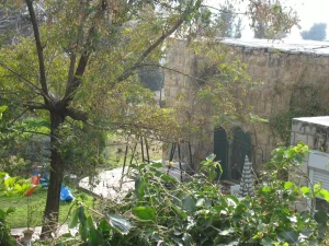
In Walid Khalidi's field description, one stone house outside Nacham had been enlarged and was inhabited.
A small stone house near the former mosque site remained inside the settlement and was being used as a warehouse.
On the western slope stood a roofless circular lime kiln formerly used to burn limestone into powder for whitewashing.
The village cemetery west of the site had been largely levelled, with only one or two graves visible on its eastern edge during the survey.
Part of the former British police headquarters also remained, while stone rubble was scattered elsewhere across the site. Olive, fig, and cypress trees grew particularly on its western and northern sides.
This description does not constitute direct field verification of conditions in 2026. It derives from the fieldwork undertaken for All That Remains before the book was published in 1992.
Later Palestinian oral-history interviews and filmed visits preserve additional community memory of 'Artuf, but they do not by themselves constitute a comprehensive contemporary field or cadastral survey of all former village lands.
Sources
- PalQuestPalQuest – 'Artuf
- PalQuestPalQuest – Operation Dani
- Palestine RememberedPalestine Remembered – 'Artuf, Jerusalem District
- Palestine RememberedPalestine Remembered – 'Artuf entry from Walid Khalidi's All That Remains
- Institute for Palestine StudiesInstitute for Palestine Studies – Walid Khalidi, All That Remains
- users.cecs.anu.edu.auGovernment of Palestine – Census of Palestine 1922
- content.ecf.org.ilGovernment of Palestine – Census of Palestine 1931
- sabil.meVillage Statistics 1945 – Official population and land statistics
- palqura.comPalestinian Villages Encyclopedia – 'Artuf / 'Artuf; supplementary local documentation on boundaries and archaeology
- PalQuestPalQuest – All That Remains: Methodology and Field Research
Photo gallery


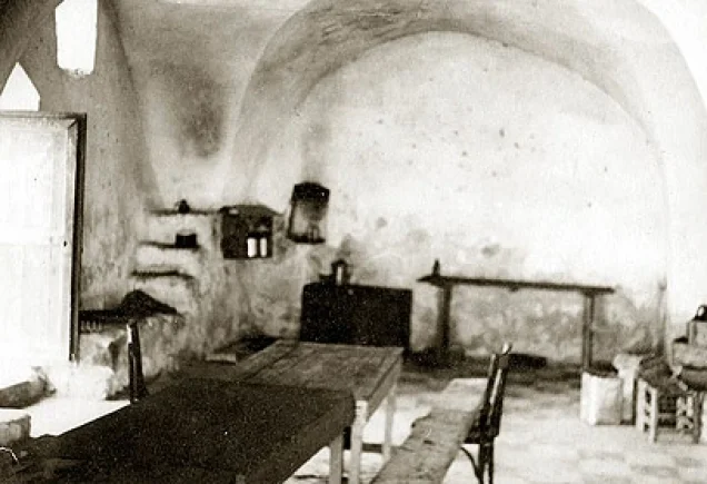

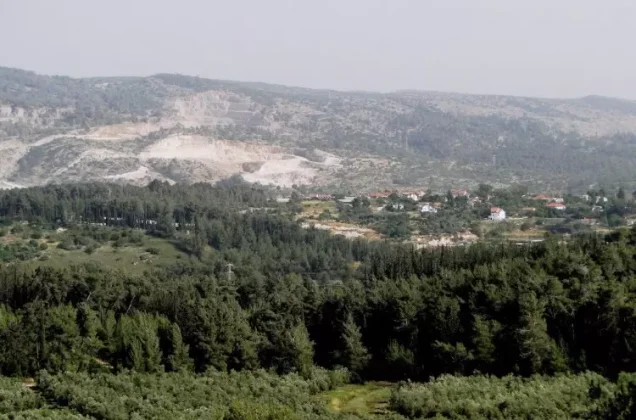

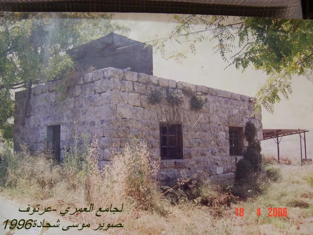
Photos from the village's people
Photos sent in by visitors and published after review.
Add a photo of this village
Log in to add photos of this village.
Other villages from Al-Quds (Jerusalem)
More from the archive
 Al-Quds (Jerusalem)
The depopulated village of Khirbat al-Tannur - Allar al-Sifla / District of Al-Quds (Jerusalem)
 Al-Quds (Jerusalem)
The depopulated village of Jarash / District of Al-Quds (Jerusalem)
 Al-Quds (Jerusalem)
The depopulated village of al-Burayj (Bayarat Burayj) / District of Al-Quds (Jerusalem)
 Download Our Palestine App
The whole archive in the palm of your hand: depopulated villages, the Nakba, the massacres and Al-Aqsa — free, with no ads to erase the story.
Download Our Palestine App
The whole archive in the palm of your hand: depopulated villages, the Nakba, the massacres and Al-Aqsa — free, with no ads to erase the story.



Comments
No comments yet — be the first to write one.
Add your comment
Name and email are optional. Comments appear after review.