
The depopulated village of Mughallis / District of Hebron
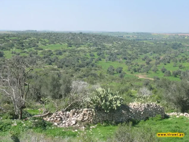
Mughallis
About the depopulated village of Mughallis
- District
- Hebron
- Date Mughallis was occupied
- 09 July 1948
- Population in 1948
- 630
- Military operation
- Operation An-Far
- Who defended the village
- Egyptian Muslim Brotherhoods, local Palestinian militias and some Arab Liberation Army volunteers
- Distance from the governorate centre
- 30.5 (km) Northwest of Hebron
- Elevation above sea level
- 200 m
- Cause of displacement
- Influence of fall of, or exoduce from, neighboring town
- Extent of destruction
- Mughallis was completely destroyed, and only house rubble left behind.
- Ethnic cleansing
- Mughallis inhabitants were completely ethnically cleansed.
- Settlements built on the built-up area of Mughallis after 1948
- Gefen
Hover a dot to read the village name, or click to open its card.
Borders of the depopulated village of Mughallis
Mughallis – Depopulated Palestinian Village of the Hebron District
Mughallis was a depopulated Palestinian village in the Hebron District, located in the extreme northwestern part of the subdistrict approximately 30.5 kilometers northwest of Hebron, at an average elevation of about 200 meters above sea level.
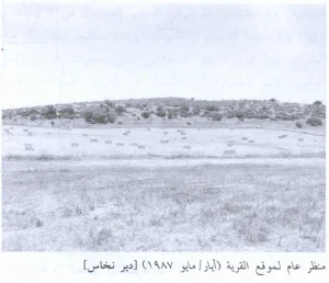
The village stood on the summit of a long east–west hill surrounded by a shallow wadi. It overlooked the coastal plain to the west and faced the broad range of the Jerusalem hills to the east.
The Giv'ati Brigade occupied Mughallis on 9–10 July 1948 during the first stage of Operation An-Far, the offensive that targeted villages around the junction of the Hebron, Ramla, and Gaza districts and displaced the inhabitants of a large number of communities.
Location and Geography
Mughallis stood on an elongated hill running east to west and surrounded by rolling land and a shallow wadi.
It lay approximately 30.5 kilometers northwest of Hebron at an average elevation of about 200 meters above sea level.
The village overlooked the coastal plain to the west and faced the western slopes of the Jerusalem hills to the east, placing it in a transitional zone between the Palestinian highlands and the coastal plain.
A secondary road passed near Mughallis. It had formerly formed part of the caravan route between Bayt Jibrin and Ramla and gave the village access to both centers.
Nearby lands and villages included 'Ajjur and Tall al-Safi in the Hebron District and Idnibba and Jilya in the Ramla District, along with Qazaza and other rural localities in the surrounding area.
Name
The historical origin of the name Mughallis is not securely established.
Palestinian oral tradition relates the name to ghalas, the darkness at the end of the night as dawn begins, and associates it with a story about the army of 'Amr ibn al-'As passing through the site.
This account is a local oral tradition and is not independently established by historical evidence.
Supporting Palestinian documentation cites historian Mustafa Murad al-Dabbagh as stating that Mughallis is a proper name whose precise origin could not be determined. This article therefore retains the more cautious formulation rather than presenting the oral tradition as established fact.
Ottoman Period
In 1596, Mughallis belonged to the nahiya of Gaza in the liwa' of Gaza and had an estimated population of approximately 424.
The inhabitants paid taxes on wheat, barley, fruit, goats, beehives, and other forms of agricultural production.
In the later nineteenth century, Mughallis was described as a moderately sized village approached by an old road, with houses constructed largely of stone.
Built Environment
The houses of Mughallis extended across the elongated hill in a pattern adapted to its east–west axis.
The official 1944/45 statistics classified approximately 23 dunams as built-up land.
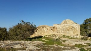
The village itself stood on an archaeological site, and older stone material was incorporated into the built landscape over time.
Population and Houses
The inhabitants of Mughallis were Muslims.
- 1596About 424Historical estimate based on Ottoman records
- 1922311Official Mandate census; all inhabitants were Muslims
- 1931447Official census; all inhabitants were Muslims
- 1945540Official statistics; all inhabitants were Palestinian Arab Muslims
- 1948About 626Later demographic estimate, not an official Mandate census
- 1998About 3,847 refugees and descendantsLater estimate published by Palestine Remembered
The official 1931 census recorded 93 houses in Mughallis.
The estimate of approximately 130 houses for 1948 is a later calculation rather than an official Government of Palestine census figure.
Mosque and Shrines
Walid Khalidi's short village entry does not detail the religious buildings, but Palestinian local documentation records one mosque in the center of the village known as the Mosque of Shaykh Mansur.
The mosque was described as a large single room without a minaret. Daily prayers, Friday prayers, and the two Eid prayers were held there, and the building was also used at various times for elementary religious instruction and communal gatherings.
The same local documentation records several shrines: Shaykh Mansur, associated with the mosque; Shaykh Dawud northwest of the village near Idnibba; Shaykh 'Abd Allah west of the village; Shaykh Muhammad al-Asmar; and Shaykh 'Ammar, described as a cave shrine.
These details are presented as supporting Palestinian community documentation because they are not described in the same detail in Khalidi's principal entry.
Education
According to Palestinian local documentation, the villagers established a school at their own expense in 1925 near the mosque. It initially developed from the traditional kuttab system.
In 1940, the school became associated with the Department of Education in Hebron. It was subsequently closed in 1942.
The local account states that teaching resumed in 1945 and that instruction reached the fourth elementary grade. A small number of girls were also taught at the school.
Pupils wishing to continue beyond the fourth grade reportedly attended the school in Tall al-Safi.
Because these details derive from local Palestinian documentation rather than Khalidi's short statistical entry, they are identified as supporting community evidence rather than as an independent official statistical series.
Water Resources
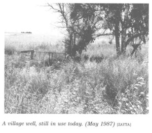
Mughallis was known for a well that supplied water to the village and attracted residents of neighboring communities.
Walid Khalidi records that local people believed the well's water helped dissolve kidney stones and consequently came to Mughallis to obtain it.
This is documented as a historical local belief and is not presented as a medically established property of the water.
Economic Life and Agriculture
The economy of Mughallis was based primarily on rainfed agriculture.
Cereals were the principal crop, while villagers also cultivated vegetables, fruit, and olives.
Goat raising and beekeeping were recorded as early as the Ottoman period, and Palestinian community documentation indicates that beekeeping, honey production, butter, and clarified butter remained part of village life in later periods.
The village's location near the old caravan road and routes toward Ramla and Bayt Jibrin facilitated contact with surrounding markets.
Land Ownership, 1944/45
The total land area of Mughallis was 11,459 dunams. Under the official Government of Palestine classification, ownership was distributed as follows:
- Arab11,286 dunums98%
- Jewish0 dunums0%
- Public173 dunums2%
The figures balance exactly: 11,286 + 173 = 11,459 dunams.
Palestine Remembered presents the same ownership totals using its simplified terminology: 11,286 dunams “Palestinian,” 0 dunams “Transferred to Zionists,” and 173 dunams “Communal/Public.”
The phrase “Transferred to Zionists” should be preserved when reproducing that source's terminology.
Land Use, 1944/45
- Arab
- Public
- Cereals7,277 dunums
- Plantations and irrigable land88 dunums
- Total cultivable/cultivated land7,365 dunums
- Non-cultivable land4,071 dunums
- Built-up land23 dunums
- Total non-cultivable and built-up4,094 dunums
The official table balances exactly: 7,365 dunams of cultivated or cultivable land plus 4,094 dunams of built-up and non-cultivable land equal the total village area of 11,459 dunams.
Of the 88 dunams classified as plantations and irrigable land, approximately 55 dunams were planted with olives. This is a crop-specific subset and should not be added again to the total land-use figure.
Palestine Remembered's simplified “non-arable” figure of 4,071 dunams should also be read carefully: the official table divides it into 3,898 Arab dunams and 173 Public dunams.
Archaeological Sites
Mughallis itself stood on an archaeological site.
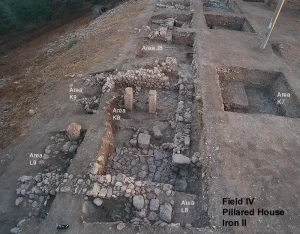
Walid Khalidi also specifically identifies two additional archaeological localities, Khirbat Ghallus and Khirbat Samra, both of which contained archaeological artifacts.
Palestinian local documentation lists additional khirbas and sites, but the principal sources reviewed do not provide enough specialist evidence to date or classify all of them securely.
Operation An-Far
Operation An-Far began on 8 July and officially ended on 15 July 1948.
The Giv'ati Brigade launched the offensive on the southern front during the Ten Days between the two truces.
The operation was intended to expand Giv'ati's area of control eastward and southward, connect Israeli-held coastal territory with Jewish settlements in the Negev, and remove Palestinian civilian communities from the brigade's rear area.
The First Battalion of the Giv'ati Brigade served as the spearhead of Operation An-Far at the operation-wide level.
PalQuest explicitly lists Mughallis among the villages affected by the operation.
Occupation and Depopulation
According to Walid Khalidi, citing Benny Morris through his own account, Mughallis was occupied on 9–10 July 1948 during the first phase of Operation An-Far.
Palestine Remembered and WAFA index 9 July as the village's depopulation date, consistent with Khalidi's broader 9–10 July dating.
Palestine Remembered identifies the collapse or depopulation of neighboring communities as an important factor in the villagers' departure as Israeli forces advanced across the area.
The Palestinian Villages Encyclopedia and Our Palestine instead index 17 July. That date falls after the official end of Operation An-Far on 15 July and conflicts with Khalidi's village-specific chronology.
This article therefore uses 9–10 July 1948 as the best-supported occupation date, while recording 17 July as a conflicting date found in later Palestinian secondary indexes.
Military Unit
The military formation associated with the occupation of Mughallis was the Giv'ati Brigade during Operation An-Far.
The operation page identifies Giv'ati's First Battalion as the principal spearhead of Operation An-Far as a whole.
The Mughallis village entry itself does not explicitly state that the First Battalion was the unit that physically entered the village. The distinction between operation-level participation and village-level attribution is therefore retained.
Occupation Chronology
- 8 July 1948
End of the First Truce
Large-scale fighting resumed on the southern front.
- 8 July 1948
Beginning of Operation An-Far
The Giv'ati Brigade began its eastward and southward offensive, with its First Battalion spearheading the operation.
- 9–10 July 1948
Occupation of Mughallis
Khalidi, citing Morris, places the village's capture during the first stage of Operation An-Far.
- 9 July 1948
Palestinian indexed depopulation date
Used by Palestine Remembered and WAFA.
- Until 15 July 1948
Continuation of Operation An-Far
Giv'ati continued occupying and depopulating other Palestinian villages in the area.
- 17 July 1948
Conflicting secondary date
Used by the Palestinian Villages Encyclopedia and Our Palestine, but it falls after An-Far's official end date and conflicts with the principal village account.
- After occupation; exact date not documented
Destruction of the village
The houses were subsequently demolished and the rubble leveled, although some structural remains remained visible.
Israeli Settlements on Village Lands
Gefen was established in 1955 on Mughallis village land, north of the former village site.
Some later Palestinian secondary sources also list Tirosh as having been established on Mughallis land.
Walid Khalidi and PalQuest, however, list only Gefen in the Mughallis entry, while their entry for neighboring 'Ajjur identifies Tirosh, established in 1955, as a settlement on 'Ajjur's lands.
Tirosh is therefore not listed here as an Israeli settlement established on Mughallis village land.
Mughallis Today
According to the field description published in Walid Khalidi's All That Remains, the village site and surrounding area were fenced.
The rubble of the houses had been leveled, although some building components remained visible.
On the eastern side, the remains of one house were surrounded by stone markers that had once defined the boundaries of its garden.
Olive, carob, and other trees grew throughout the site, while cactuses were found along its northern and southern edges.
PalQuest includes field photographs of Mughallis dated June 1990. This description therefore derives from the 1987–1990 fieldwork associated with All That Remains and should not be treated as a comprehensive field verification of conditions in 2026.
Sources
- PalQuest – Interactive Encyclopedia of the Palestine Question: Mughallis
- PalQuest – Operation An-Far
- Palestine Remembered – Mughallis, Hebron District
- Palestine Remembered – Walid Khalidi's account of Mughallis
- Palestinian Villages Encyclopedia – Mughallis; supporting Palestinian local documentation on education, mosque, and shrines
- WAFA – Palestinian towns and villages occupied and depopulated in 1948
- PalQuest – 'Ajjur; used to distinguish Tirosh as a settlement established on 'Ajjur's lands
- Government of Palestine – Census of Palestine 1922
- Institute for Palestine Studies – Walid Khalidi, All That Remains
- PalQuest – All That Remains: Methodology
Photo gallery


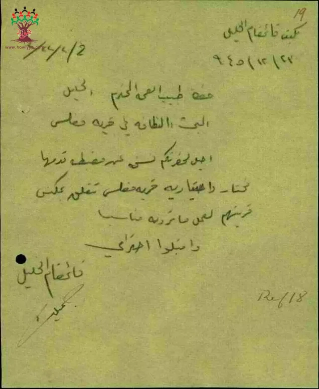
Photos from the village's people
Photos sent in by visitors and published after review.
Add a photo of this village
Log in to add photos of this village.
Other villages from Hebron
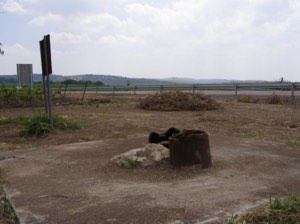

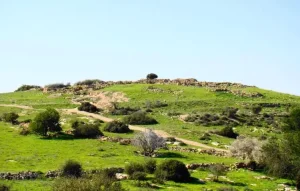
More from the archive
 Download Our Palestine App
The whole archive in the palm of your hand: depopulated villages, the Nakba, the massacres and Al-Aqsa — free, with no ads to erase the story.
Download Our Palestine App
The whole archive in the palm of your hand: depopulated villages, the Nakba, the massacres and Al-Aqsa — free, with no ads to erase the story.



Comments
No comments yet — be the first to write one.
Add your comment
Name and email are optional. Comments appear after review.