
The depopulated village of Al-Qubayba (Hebron) / District of Hebron
Al-Qubayba (Hebron)
About the depopulated village of Al-Qubayba (Hebron)
- District
- Hebron
- Date Al-Qubayba (Hebron) was occupied
- 28 October 1948
- Population in 1948
- 1,230
- Military operation
- Operation Yoav
- Brigade that carried it out
- Probably units of the Givati Brigade or the Harel Brigade – the sources do not identify the unit with certainty
- Who defended the village
- Egyptian Army
- Distance from the governorate centre
- 24 km northwest of Hebron
- Elevation above sea level
- 250 m
- Cause of displacement
- Direct military assault by Israeli occupation forces, according to Benny Morris as cited by Khalidi
- Extent of destruction
- The village was completely defaced
- Ethnic cleansing
- Some refugees were sheltered in al-Dawayima's caves, and some of them were killed during the al-Dawayima's massacre.
- Settlements built on the built-up area of Al-Qubayba (Hebron) after 1948
- Lakhish, established in 1955 southwest of the village site, on village lands
Hover a dot to read the village name, or click to open its card.
Borders of the depopulated village of Al-Qubayba (Hebron)
al-Qubayba: A Depopulated Palestinian Village in the Hebron District
al-Qubayba was a Palestinian village in the Hebron District, situated on a hilltop in the western foothills of the Hebron Mountains approximately 24 kilometres northwest of Hebron, at an average elevation of about 250 metres above sea level. Its population reached 1,060 in the 1944/1945 statistics. The village was occupied on 28–29 October 1948 during the third stage of Operation Yoav, probably by units of either the Giv'ati or Harel Brigade, and its inhabitants were displaced during the Nakba and the occupation of Palestine in 1948.
- Subdistrict
- Hebron
- Distance from district center
- 24 km northwest of Hebron
- Average Elevation
- 250 m above sea level
- Population in 1931
- 800
- Number of Houses in 1931
- 141
- Population in 1944/1945
- 1,060
- Estimated Population in 1948
- About 1,230 – a later demographic estimate, not an official census
- Total Land Area in 1945
- 11,912 dunams
- Attack and Depopulation
- Al-Qubayba was occupied in the third stage of Operation Yoav, around the same time as the massacre in nearby al-Dawayima, probably by units of the Givati Brigade or the Harel Brigade. Benny Morris, as cited by Khalidi, speaks of a “panic flight” from the village around the time of its occupation and attributes its depopulation to the military assault on it.
- Final Israeli Control
- 28 October 1948 according to the English text of Khalidi's entry on PalQuest, and 29 October 1948 according to the Arabic PalQuest text.
- Military Operation
- Operation Yoav
- Military Unit
- Probably units of the Givati Brigade or the Harel Brigade – the sources do not identify the unit with certainty
- Cause of Depopulation
- Direct military assault by Israeli occupation forces, according to Benny Morris as cited by Khalidi
- Settlements Documented on Village Lands
- Lakhish, established in 1955 southwest of the village site, on village lands
Location
al-Qubayba stood on a hilltop in the western foothills of the Hebron Mountains, approximately 24 kilometres northwest of Hebron and at an average elevation of about 250 metres above sea level.
Wadi Ghufr ran along the western foot of the hill.
A secondary road connected the village with the Hebron–Bayt Jibrin–al-Majdal highway, which passed to the northeast, while other roads linked al-Qubayba with surrounding Palestinian villages.
The lands of al-Dawayima, Bayt Jibrin, and areas associated with the Bedouin communities of the Beersheba district bordered or lay near the village lands.
al-Qubayba Through History
al-Qubayba has been identified with a village referred to during the Crusader period by a name rendered as Deirelcobebe.
In 1596, al-Qubayba was a village in the nahiya of Gaza in the Gaza district, with an estimated population of approximately 182.
The villagers paid taxes on wheat, barley, sesame, fruit trees, goats, and beehives.
In the late nineteenth century, al-Qubayba was described as a large adobe-built village situated on rolling hills near a plain and surrounded by barren and rocky land.
Architecture and Public Facilities
The inhabitants of al-Qubayba were Muslims, and most village houses were constructed of stone, mud, and adobe brick.
The houses stood along narrow streets that radiated from the centre of the village.
Local accounts describe the built-up area as being divided into several quarters, including northern, southern, eastern, and western sections.
The village contained a mosque, a school, and several small shops.
The built-up area covered approximately 35 dunams in the 1944/1945 statistics.
Water Supply
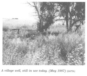
The inhabitants obtained their drinking water from two wells, one located northwest of the village and the other southwest of it.
Agriculture was primarily dependent on rainfall.
Population
The 1922 census recorded 646 inhabitants in al-Qubayba.
By the 1931 census, the population had increased to 800 people living in 141 houses.
According to the 1944/1945 statistics, the village population reached 1,060, all Arab Muslims.
The estimate of approximately 1,230 inhabitants in 1948 is a later figure rather than an official British Mandate census count.
Palestine Remembered estimates the number of refugees and their descendants at 7,551 in 1998.
Population of al-Qubayba
- 1596About 182Historical estimate based on Ottoman records
- 1922646Official census
- 1931800Official census
- 1944/19451,060Government of Palestine statistics
- 1948About 1,230Later estimate
- 19987,551Estimate of refugees and their descendants
Number of Houses
The 1931 census recorded 141 houses in al-Qubayba.
The figure of approximately 216 houses for 1948 is a later estimate rather than an official census figure.
Land of al-Qubayba
According to the 1944/1945 statistics, al-Qubayba had a total land area of 11,912 dunams.
Arab ownership amounted to 11,801 dunams, while 111 dunams were classified as public land. No Jewish-owned land was recorded within the village's statistical unit.
Land Ownership in al-Qubayba in 1944/1945
- Arab ownership11,801 dunums99%
- Jewish ownership0 dunums0%
- Public land111 dunums<1%
Agriculture and Economic Life
The inhabitants of al-Qubayba depended primarily on agriculture and livestock raising.
Cereals were the principal crop, alongside olives and other fruit trees.
According to the 1944/1945 statistics, 8,109 dunams were devoted to cereal cultivation.
Palestine Remembered records approximately 44 dunams planted with olive trees. This represents a crop category within cultivated land and should not be added separately to the overall land-use total.
Uncultivable land covered 3,768 dunams, including 3,657 Arab-owned dunams and 111 dunams of public land.
Land Use in al-Qubayba in 1944/1945, in Dunams
- Arab
- Public
- Cereals8,109 dunums
- Built-up area35 dunums
- Uncultivable land3,768 dunums
The 1947 UN Partition Plan
al-Qubayba lay in the western Hebron highlands, within the area allocated to the proposed Arab state under United Nations General Assembly Resolution 181 of 1947.
The partition plan was never implemented on the ground as proposed, and Israeli forces occupied al-Qubayba in October 1948.
Archaeology and Tall al-Duwayr
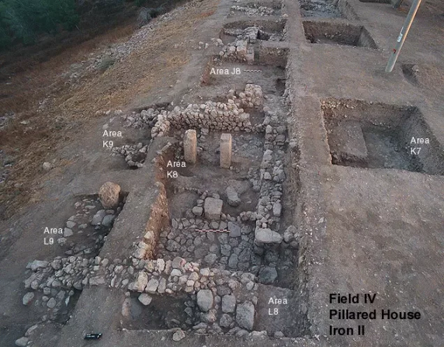
The al-Qubayba area was rich in archaeological remains, and the village site itself included caves, rock-cut installations, and other ancient remains.
Local Palestinian documentation also identifies several archaeological sites and khirbas in the surrounding area, including al-Saqifa al-Mudawwara, Qarqara, and Fara. These particular names derive mainly from local documentation.
The best-documented archaeological site associated with the village lands was Tall al-Duwayr, southwest of al-Qubayba, identified as the site of the ancient Canaanite city of Lachish.
Tall al-Duwayr was intermittently occupied from the Chalcolithic period in the fifth millennium BCE through the Persian period in the late fourth century BCE.
Lachish is mentioned in the fourteenth-century BCE Amarna letters.
British archaeological excavations were conducted at Tall al-Duwayr between 1932 and 1938, followed by later excavation campaigns.
In addition to Tall al-Duwayr and the village site itself, at least fifteen archaeological sites were documented across the village lands and surrounding area.
Operation Yoav
Operation Yoav began on 15 October 1948 and continued until 4 November.
Its principal objective was to break through Egyptian military lines and connect Israeli forces in the Negev with territory under Israeli control farther north.
The operation involved the Giv'ati, Yiftach, Negev, and Harel Brigades, while Egyptian forces constituted the principal Arab military force opposing the offensive.
Following the successes of the first two stages, Israeli forces expanded their advance during the third stage to seize additional Palestinian villages and territory. al-Qubayba was among the villages directly affected.
The Occupation and Depopulation of al-Qubayba
al-Qubayba was occupied during the third stage of Operation Yoav in late October 1948.
The sources differ slightly on the precise date. Palestine Remembered's summary table gives 28 October 1948, while the detailed Walid Khalidi and PalQuest narrative places the capture on 29 October.
The most cautious formulation is therefore that al-Qubayba was occupied on 28–29 October 1948.
The capture took place at approximately the same time as the occupation of nearby al-Dawayima and the massacre there.
The precise unit that directly entered al-Qubayba is not conclusively established. Walid Khalidi and PalQuest consider it probable that units of either the Giv'ati Brigade or the Harel Brigade were responsible.
This article therefore does not assign the occupation to a specific battalion without additional evidence.
The available account indicates that the inhabitants left amid the military assault and the fear accompanying the advancing forces, but the sources do not provide enough detail to reconstruct the circumstances of every family's displacement.
The Israeli account concerning the villagers' departure is cited here only as transmitted through Walid Khalidi and PalQuest and not through direct reliance on the original Israeli source.
Occupation and Depopulation Chronology
- 15 October 1948
Beginning of the military operation
Operation Yoav, involving the Givati, Yiftach, Negev and Harel brigades, began as soon as the second truce ended, with the aim of linking Israeli forces in the Negev with those positioned to the north of them. PalQuest lists al-Qubayba among the villages affected by the operation.
- 28 or 29 October 1948
Final occupation
Al-Qubayba was occupied in the third stage of Operation Yoav, around the same time as the massacre in nearby al-Dawayima, probably by units of the Givati Brigade or the Harel Brigade; the English text of Khalidi's entry on PalQuest gives 28 October, the Arabic text 29 October. Benny Morris, as cited by Khalidi, speaks of a “panic flight” from the village around the time of its occupation and attributes its depopulation to the military assault on it.
- 1955
Settlement on village lands
The settlement of Lakhish was established southwest of the al-Qubayba village site, on village lands.
Lakhish Settlement on al-Qubayba's Lands
In 1955, the settlement of Lakhish was established southwest of the al-Qubayba village site on village lands.
Its name was taken from ancient Lachish, associated with nearby Tall al-Duwayr.
- 1955Lakhish
Established southwest of al-Qubayba on village lands
al-Qubayba After the Nakba
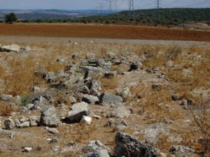
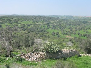
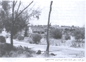
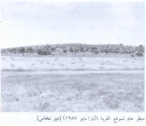
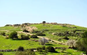
According to the field documentation relied upon by Walid Khalidi, the village buildings disappeared and the site was marked mainly by cactus plants and a few olive trees.
A neglected olive grove also remained enclosed, with its old stone terraces still intact.
This description reflects the condition of the site during the field documentation relied upon by Walid Khalidi and should not necessarily be interpreted as a comprehensive survey updated to 2026.
Sources
- PalQuest – Interactive Encyclopedia of the Palestine Question: al-Qubayba.
- PalQuest: al-Qubayba – Hebron.
- PalQuest: Operation Yoav.
- Palestine Remembered: al-Qubayba, Hebron District.
- Walid Khalidi, All That Remains: al-Qubayba, as reproduced by Palestine Remembered.
- PalQuest: The 1947 UN Partition Plan.
- Walid Khalidi, All That Remains, entry on al-Qubayba.
- Government of Palestine, censuses of 1922 and 1931.
- Government of Palestine, Department of Statistics, Village Statistics, 1945.
Photo gallery


Photos from the village's people
Photos sent in by visitors and published after review.
Add a photo of this village
Log in to add photos of this village.
Other villages from Hebron

More from the archive
 Download Our Palestine App
The whole archive in the palm of your hand: depopulated villages, the Nakba, the massacres and Al-Aqsa — free, with no ads to erase the story.
Download Our Palestine App
The whole archive in the palm of your hand: depopulated villages, the Nakba, the massacres and Al-Aqsa — free, with no ads to erase the story.



Comments
No comments yet — be the first to write one.
Add your comment
Name and email are optional. Comments appear after review.