
The depopulated village of Bayt Thul / District of Al-Quds (Jerusalem)

About the depopulated village of Bayt Thul
- District
- Al-Quds (Jerusalem)
- Date Bayt Thul was occupied
- 01 April 1948
- Population in 1948
- 300
- Military operation
- Operation Nachshon
- Distance from the governorate centre
- 15.5 (km) West of Jerusalem
- Elevation above sea level
- 825 m
- Extent of destruction
- Bayt Thul was completely destroyed, and only house rubble left behind.
- Ethnic cleansing
- Bayt Thul was NOT completely ethnically cleansed, few of the villagers were allowed to live in the village to this date.
Hover a dot to read the village name, or click to open its card.
Borders of the depopulated village of Bayt Thul
Bayt Thul – Jerusalem Subdistrict
Bayt Thul was a depopulated Palestinian village in the Jerusalem subdistrict, located approximately 15.5 km west of Jerusalem at an average elevation of about 825 meters. It stood on the western summit of an east–west mountain ridge overlooking the coastal plain.
The official 1931 Census of Palestine recorded 182 inhabitants, while the 1944/45 statistics recorded 260. The registered village lands covered 4,629 dunums. Bayt Thul passed through a complicated series of military developments during the fighting over the Jerusalem–Jaffa road and the Latrun area in 1948. The core sources do not establish one exact date for its initial or final occupation, although it was firmly under Israeli control by mid-July 1948.
Location of Bayt Thul
Bayt Thul stood on the western summit of a mountain ridge running from east to west and overlooked the coastal plain. Two deep wadis ran northwest along the northern and southern sides of the village.
The village lay approximately 2 km north of the Jerusalem–Jaffa highway and was connected to it by a secondary road. Similar roads linked it with several surrounding villages.
Palestinian sources identify Nitaf, Qatanna, Abu Ghawsh/Qaryat al-'Inab, Saris, and Yalu among the villages whose lands bordered or surrounded Bayt Thul, while local geographical diagrams also place Bayt 'Inan, 'Imwas, Dayr Ayyub, and Bayt Mahsir in its wider surroundings.
Because geographical proximity is not identical to a cadastral boundary, these surrounding localities should not all be treated as exact land borders without reference to detailed Mandate-era land maps.
Name and Early History
The village appears in the Ottoman tax registers of 1596 under the name Bayt Tun. At the time it belonged to the nahiya and liwa' of Jerusalem and had an estimated population of approximately 66.
The inhabitants paid taxes on wheat, barley, olive trees, pasture, goats, and beehives, reflecting the agricultural and pastoral character of the village economy in the late sixteenth century.
Some later Palestinian sources connect the name Bayt Thul with an Aramaic word said to mean “shade.” The principal sources used here, however, do not establish this etymology conclusively, and it is therefore treated as a reported interpretation rather than a proven linguistic fact.
Built Environment
Bayt Thul had a rectangular layout divided into eastern and western sections. Between them lay the village center, where shops, a mosque, and a shrine stood.
Most houses were built of stone, and some reused stones and columns taken from earlier structures or sites.
The built-up area covered approximately 13 dunums in the 1944/45 statistics, illustrating the relatively compact size of the settlement itself.
Population of Bayt Thul
- 159666Estimate derived from an Ottoman tax register; not a modern census
- 1922133Official Census of Palestine; the inhabitants were Muslims
- 1931182Official Census of Palestine
- 1944/45260Official Mandate-era statistics; all recorded inhabitants were Arab Muslims
- 1948302Later estimate published by Palestine Remembered; not an official census
- 19981,852 refugees and descendantsLater estimate published by Palestine Remembered
Some local websites repeat figures of 233 for 1922 and 282 for 1931. These conflict with the better-supported census figures of 133 and 182 and have therefore not been used.
Number of Houses
- 193143Official Census of Palestine
- 194871Later estimate published by Palestine Remembered; not an official census figure
Land Ownership
Bayt Thul's registered lands totaled 4,629 dunums in 1944/45. Palestine Remembered presents the simplified ownership categories as follows:
- Palestinian4,205 dunums91%
- Transferred to Zionists421 dunums9%
- Communal/Public3 dunums<1%
PalQuest preserves the official categories: 4,205 dunums Arab, 421 dunums Jewish, and 3 dunums Public.
Land Use in 1944/45
- Arab
- Jewish
- Public
- Cereals977 dunums
- Plantations and irrigable land55 dunums
- Built-up land13 dunums
- Non-cultivable land3,584 dunums
This table corrects a presentation issue in Palestine Remembered, where 3,353 dunums of non-arable land appear under the Palestinian category. PalQuest's official breakdown shows that this consists of 3,350 Arab dunums and 3 Public dunums.
Economic Life in Bayt Thul
Agriculture was the principal livelihood of most villagers. They cultivated cereals, vegetables, olives, and fruit trees, with agricultural land extending mainly north, east, and south of the village.
Most farming was rain-fed, although some orchards south of the village were irrigated by a spring.
In 1944/45, 787 Arab dunums were planted with cereals and 55 dunums were used as plantations or irrigable land. Khalidi also records a limited area devoted to olive trees.
Water
Agriculture depended primarily on rainfall, although a spring south of Bayt Thul irrigated some orchards. The Palestinian Encyclopedia identifies 'Ayn Shumal as a water source used for this purpose.
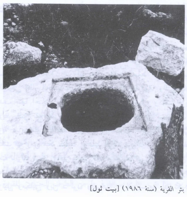
Khalidi's later field description also records two rock-cut wells that were still being used by Palestinians remaining in the surrounding area at the time of the field survey.
Palestinian local sources additionally mention Bir al-Marah approximately one kilometer west of the village, although the core sources do not provide a comprehensive inventory of every well and spring associated with Bayt Thul.
The Mosque and Education
A mosque stood in the center of Bayt Thul beside a shrine and several shops. The principal statistical and historical sources identify the villagers as Muslims.
Khalidi's village entry does not record a separate formal school. Palestinian local documentation, however, states that the mosque also served an educational function during the Mandate period, particularly for Qur'anic and religious instruction.
This should be understood as traditional local education rather than evidence of a formally registered government school, and no unsupported founding date or enrollment figure has been assigned.
The Shrine and Archaeological Remains
A shrine stood in the village center beside the mosque. Archaeological remains in and around Bayt Thul included columns and foundations of earlier buildings, and older stone material was reused in some village houses.
Four khirbas in the surrounding area contained caves formerly used for habitation, cisterns, and building foundations. Palestinian reference works also preserve local names including Mismar, Ziyud, al-Jaraya, and al-Qasr.
These remains demonstrate earlier occupation of the area, but the evidence reviewed here is insufficient to assign every site a precise date or archaeological function.
Bayt Thul before Its Occupation in 1948
Bayt Thul's location near the Jerusalem–Jaffa road, Bab al-Wad, and the Latrun area gave it growing military importance during the spring and summer of 1948. Villages on both sides of the road became targets of repeated offensives intended to open the route to Jerusalem and control the surrounding heights.
The fall of al-Qastal and the Deir Yasin massacre in April 1948 had a major impact on Palestinian communities west of Jerusalem. Khalidi considers it possible that the Deir Yasin massacre also affected the inhabitants of Bayt Thul psychologically, although he does not state that the village was immediately emptied as a direct result.
Operation Nachshon
Operation Nachshon began on 3 April 1948 and continued until 15 April. Its objective was to open the road between Tel Aviv and Jerusalem and gain control of villages and strategic positions along the route. PalQuest lists Bayt Thul among the villages affected by the operation.
This does not establish that Bayt Thul itself fell during the first days of Nachshon. Khalidi's detailed village entry instead states that the village probably fell several weeks later during the smaller operations that followed Nachshon.
Later Operations: Har'el, Makkabi, and Ben-Nun
Following Operation Nachshon, fighting continued throughout the Jerusalem corridor and Latrun region in a succession of operations including Har'el, Makkabi, and Ben-Nun.
Operation Makkabi lasted from 8 to 31 May 1948, and PalQuest specifically lists Bayt Thul among the villages affected by it. The operation involved the Har'el, Giv'ati, and Sheva' / Seventh brigades.
However, the Bayt Thul village entry does not independently identify which one of these formations entered the village itself. It would therefore be inaccurate to name one brigade as the village's specific occupying unit without additional evidence.
Occupation and Depopulation of Bayt Thul
The exact date of Bayt Thul's occupation and depopulation is not known.
Palestine Remembered gives 1 April 1948 in its page header, but this does not fit the detailed chronology in Khalidi's account: Operation Nachshon itself began only on 3 April, and Khalidi considers it more likely that Bayt Thul fell several weeks later in the operations following Nachshon.
Khalidi also does not exclude the possibility that control of the village changed hands more than once in May and June, as happened at nearby Dayr Ayyub during the fighting around Latrun.
What is firmly established is that Israeli occupation forces had consolidated control over Bayt Thul by mid-July 1948. On 18 July the village was used as a launching point for an unsuccessful attempt to capture the Palestinian village of Safa in the final hours before the second truce.
18 July should therefore be treated as evidence of confirmed Israeli control rather than automatically as the exact date of the village's first capture.
Occupation Chronology
- 3 April 1948
Beginning of Operation Nachshon
The large-scale offensive to open the Jerusalem–Jaffa road began. PalQuest lists Bayt Thul among the affected villages, but this does not establish that it fell during the first stage.
- 9 April 1948
Deir Yasin massacre
Khalidi considers it possible that the massacre affected Bayt Thul's inhabitants psychologically, although he does not document the immediate depopulation of Bayt Thul.
- Late April–May 1948
Operations following Nachshon
Khalidi considers it probable that Bayt Thul fell during one of the subsequent operations, including Har'el, Makkabi, and Ben-Nun.
- 8–31 May 1948
Operation Makkabi
PalQuest specifically lists Bayt Thul among the villages affected by the offensive in the Latrun and Jerusalem corridor area.
- May–June 1948
Possible changes of control
Khalidi does not exclude the possibility that Bayt Thul changed hands more than once. The available sources do not permit each stage to be dated precisely.
- By mid-July 1948
Confirmed Israeli control
Khalidi states that Israeli forces had firmly consolidated their hold on the village by this time.
- 18 July 1948
Village used as a military base
Israeli occupation forces used Bayt Thul as a launching point for an unsuccessful attempt to capture Safa immediately before the second truce.
- Later; exact date not established by the core sources used here
Destruction of the village
Most of the village was destroyed, leaving rubble and sections of walls. Khalidi's village entry does not establish one exact date for the demolition of all houses.
Military Units
Bayt Thul is associated with Operation Nachshon, in which Har'el and Giv'ati forces operated, and with Operation Makkabi, which involved the Har'el, Giv'ati, and Sheva' / Seventh brigades.
These identifications apply to the wider operations. Khalidi's village-specific entry does not independently establish the brigade or battalion responsible for the village's final capture.
It is therefore more accurate not to assign the occupation of Bayt Thul to a single unit merely because that unit participated in one of the operations in the surrounding area.
Israeli Settlements on or near Bayt Thul Village Lands
| Settlement | Established | Relationship to Bayt Thul |
|---|---|---|
| Nataf | 1982 | Established on Bayt Thul village land |
| Neve Ilan | 1946 | Located nearby to the southeast, but established on land traditionally belonging to Abu Ghawsh rather than Bayt Thul |
This distinction is important: geographical proximity does not in itself establish that a settlement was built on the lands of a particular Palestinian village.
Bayt Thul Today
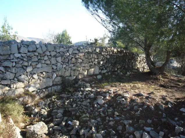
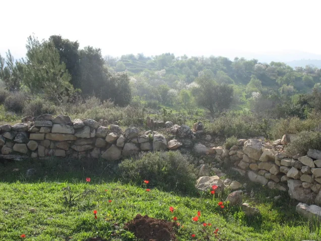
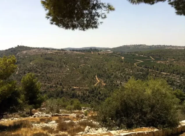
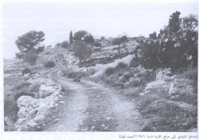
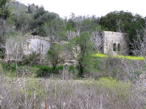
In the field description published by Walid Khalidi, piles of rubble were spread across a large area of the village hill, with sections of walls still visible among dense wild vegetation.
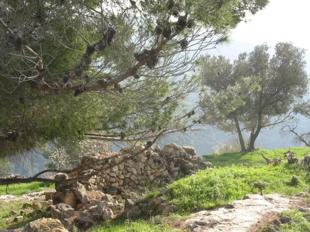
Carob trees, cactuses, olive trees, and almond trees covered terraces on the western and northern sides of the site. On the eastern side stood the remains of a large house surrounded by a deteriorating wall.
Two rock-cut wells were still being used by Palestinians remaining in the surrounding area when the field survey was carried out, while graves at the southern edge of the village were overgrown with weeds.
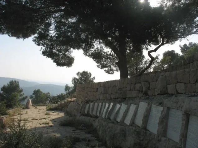
Memorial structures and forests were also subsequently established at the site.
This description does not constitute direct field verification of conditions in 2026. Fieldwork for All That Remains was conducted between 1987 and 1990, before the book's publication in 1992, and the description should therefore be understood as a documented record of the site during that period.
Sources
- PalQuestPalQuest – Bayt Thul
- PalQuestPalQuest – Operation Nachshon
- PalQuestPalQuest – Operation Makkabi
- Palestine RememberedPalestine Remembered – Bayt Thul, Jerusalem District
- Palestine RememberedPalestine Remembered – Bayt Thul entry from Walid Khalidi's All That Remains
- palestinapedia.psPalestinian Encyclopedia – Bayt Thul
- palqura.comPalestinian Villages Encyclopedia – Bayt Thul; local material on the mosque and traditional education
- PalQuestPalQuest – All That Remains: Field Research Methodology
- Institute for Palestine StudiesInstitute for Palestine Studies – Walid Khalidi, All That Remains
Photo gallery

Photos from the village's people
Photos sent in by visitors and published after review.
Add a photo of this village
Log in to add photos of this village.
Other villages from Al-Quds (Jerusalem)

More from the archive
 Al-Quds (Jerusalem)
The depopulated village of Khirbat al-Tannur - Allar al-Sifla / District of Al-Quds (Jerusalem)
 Al-Quds (Jerusalem)
The depopulated village of al-Burayj (Bayarat Burayj) / District of Al-Quds (Jerusalem)
 Al-Quds (Jerusalem)
The depopulated village of Sufla / District of Al-Quds (Jerusalem)
 Download Our Palestine App
The whole archive in the palm of your hand: depopulated villages, the Nakba, the massacres and Al-Aqsa — free, with no ads to erase the story.
Download Our Palestine App
The whole archive in the palm of your hand: depopulated villages, the Nakba, the massacres and Al-Aqsa — free, with no ads to erase the story.



Comments
No comments yet — be the first to write one.
Add your comment
Name and email are optional. Comments appear after review.