
The depopulated village of Imwas / District of Ramla
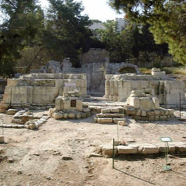
Subdistrict: al-Ramla
Date of occupation: 6 June 1967. The systematic demolition of the village began as early as 7 June 1967.
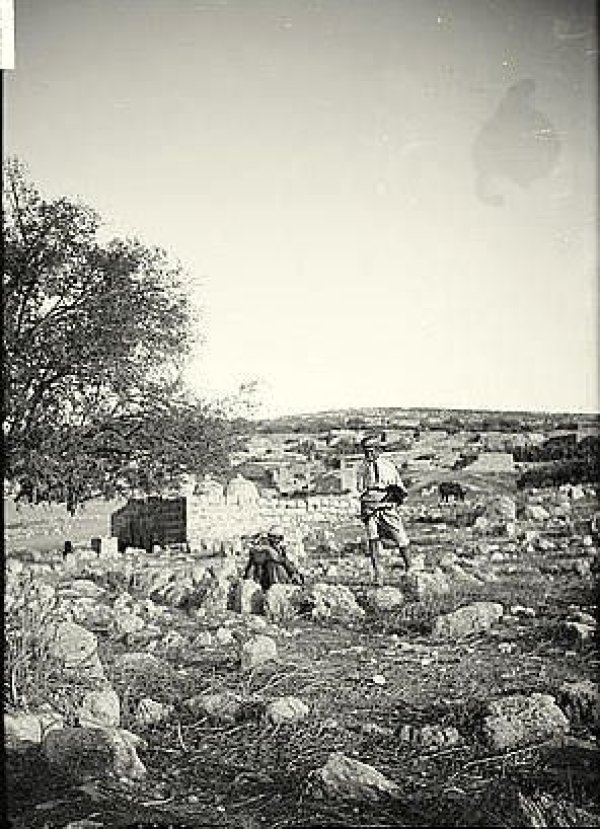
Imwas was located approximately 25 kilometres northwest of Jerusalem, 12 kilometres southeast of al-Ramla, and about 28 kilometres from Jaffa.
- Imwas was a Palestinian village in the al-Ramla Subdistrict. Following the 1948 Nakba, it came under Jordanian administration and was associated administratively with the Ramallah area. The 1961 Jordanian census recorded 1,955 inhabitants. Israeli forces expelled its residents and demolished the village during the June 1967 war.
- Before 1948, Imwas formed part of the al-Ramla Subdistrict. It remained within the West Bank after the 1949 armistice and was administered by Jordan until its occupation in June 1967.
- The village occupied a strategically important position overlooking the Jaffa–Jerusalem road. The Latrun area formed the western gateway to Jerusalem and was therefore significant for controlling access between the coastal plain and the city.
- During the 1948 war, residents of Imwas and the surrounding Latrun villages participated in defending the area and the approaches to Jerusalem. Although Palestinian forces commanded by Abd al-Qadir al-Husayni operated in the wider Jerusalem corridor before his death in April 1948, the later Battles of Latrun were fought principally between the Arab Legion and Israeli forces.
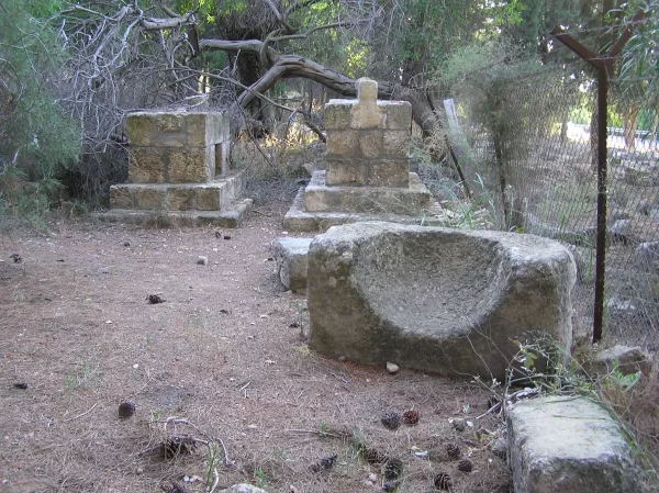
Imwas became closely associated with the Plague of Amwas, which affected the armies and population of Greater Syria in 638 or 639 CE. Historical accounts commonly estimate that the epidemic caused approximately 25,000 deaths across the wider region, rather than within the village alone. Among the prominent early Muslims who died during the epidemic were Abu Ubayda Amir ibn al-Jarrah, Muadh ibn Jabal, Yazid ibn Abi Sufyan, and Shurahbil ibn Hasana. Shrines traditionally associated with Abu Ubayda and Muadh ibn Jabal survived the village’s destruction.
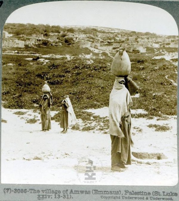
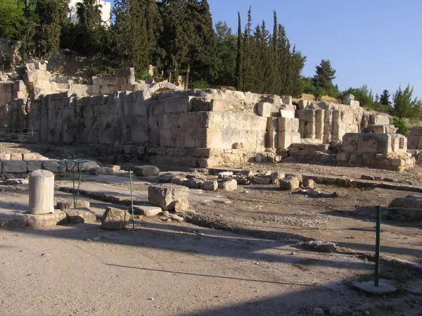
Imwas is also identified by a longstanding Christian tradition with Emmaus-Nicopolis. According to the Gospel of Luke, the resurrected Jesus appeared to two disciples on the road to Emmaus. The precise location of the biblical Emmaus has been debated, and several sites have been proposed. Archaeological remains near Imwas include the ruins of a Byzantine church later rebuilt during the Crusader period. A modern religious complex and monastery also stand in the adjoining Latrun area.
Historical and Religious Significance of Imwas
Imwas holds considerable significance in both Islamic and Christian history. During the early Islamic conquest of Palestine, Muslim forces used the area as a military encampment. The village subsequently developed a Muslim population, and a mosque remained standing there until the village was demolished in 1967.
The village gave its name to the Plague of Amwas, which occurred in 638 or 639 CE during the caliphate of Umar ibn al-Khattab. Historical chronicles report that the epidemic spread across Greater Syria and caused between 20,000 and 25,000 deaths among soldiers, their families, and the wider population. This was a regional death toll and should not be interpreted as the population of Imwas itself. Abu Ubayda ibn al-Jarrah, Muadh ibn Jabal, Yazid ibn Abi Sufyan, and Shurahbil ibn Hasana were among the prominent figures reported to have died during the epidemic.
In Christian tradition, Imwas has long been identified with ancient Emmaus or Emmaus-Nicopolis, although the location of the Emmaus mentioned in the Gospel of Luke remains a matter of scholarly debate. Archaeological remains at the site include a Byzantine church that was reconstructed during the Crusader period.
The nearby Latrun monastery was established by Trappist monks in 1890. The Trappists are a Roman Catholic monastic order whose name is derived from La Trappe Abbey in France.
Boundaries of Imwas
Imwas was bordered by the following villages and localities:
- North: Salbit
- Northwest: al-Qubab
- West: al-Khalayil
- Southwest: al-Latrun
- South: Bayt Susin
- Southeast: Dayr Ayyub
- East: Yalu
- Northeast: Ajanjul

The Lands of Imwas
According to the British Mandate Village Statistics for 1944/45, the officially recorded village lands covered 5,167 dunams. Palestinian village accounts sometimes describe a much larger historical territory extending westward into the coastal plain. Estimates therefore vary according to whether they refer to the registered village boundary in 1945 or to the broader lands traditionally used by the community before the 1949 armistice lines were established.
The residents cultivated cereals, legumes, almonds, figs, grapes, cactus fruit, and olives. Imwas and its surroundings also contained numerous springs and wells used for drinking, irrigation, and domestic purposes. One of the best known was Bir al-Hilwa, located near the Latrun monastery.
Land Ownership in Imwas
| Ownership category | Area (dunams)* |
|---|---|
| Palestinian ownership | 5,151 |
| Jewish ownership | 0 |
| Public land | 16 |
| Total | 5,167 |
* One dunam equals approximately 1,000 square metres.
Land Use in Imwas
| Land-use category | Area (dunams)* |
|---|---|
| Irrigated land and orchards | 606 |
| Olive cultivation | 15 |
| Cereal cultivation | 3,612 |
| Built-up area | 148 |
| Cultivable land | 4,218 |
| Uncultivated land | 785 |
* One dunam equals approximately 1,000 square metres. Olive cultivation formed part of the irrigated-land and orchard category and should not be added to it as a separate component of the total area.
Population of Imwas
The 1922 British Mandate census recorded 824 residents in Imwas. By 1931, the population had increased to 1,021 people living in 224 houses. The official population estimate for 1945 was 1,450. The Jordanian census conducted on 18 November 1961 recorded 1,955 inhabitants.
Historical Population of Imwas
| Year | Population* |
|---|---|
| 1922 | 824 |
| 1931 | 1,021 |
| 1945 | 1,450 |
| 1961 | 1,955 |
* The 1922 and 1931 figures are British Mandate census totals. The 1945 figure is an official estimate, while the 1961 figure comes from the Jordanian Population and Housing Census.
Education in Imwas
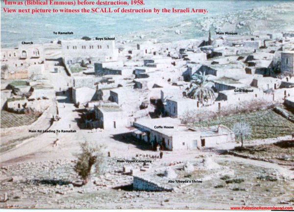
Imwas had two mosques and a boys’ school established in 1919 with one teacher. By 1947, it had developed into a full elementary school staffed by six teachers and attended by 187 pupils. After the Nakba, educational facilities expanded to include separate schools for boys and girls. In 1967, the boys’ school had 304 pupils and a library containing 376 books, while the girls’ school had 172 pupils.
Economic Life in Imwas
Imwas lost access to much of the broader agricultural land traditionally used by its residents following the 1948 war and the establishment of the armistice lines. Agriculture nevertheless remained an important part of village life. Residents also increasingly pursued education, skilled trades, and professional employment. The community included doctors, engineers, and teachers, while many residents worked in construction. Approximately forty villagers were employed at the nearby Latrun monastery.
Before its destruction, Imwas had thirteen grocery shops, two bakeries, two barbershops, a butcher’s shop, a vegetable shop, and a hand-weaving workshop associated with a local development initiative.
Occupation and Depopulation of Imwas
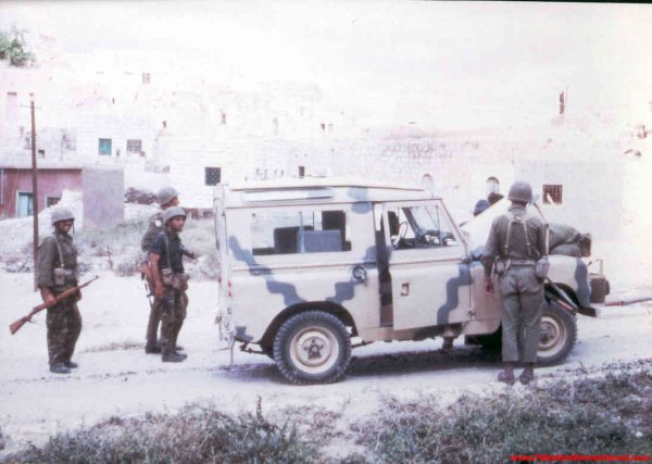
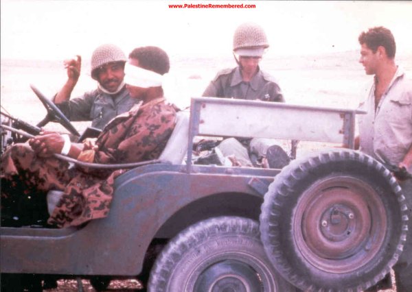
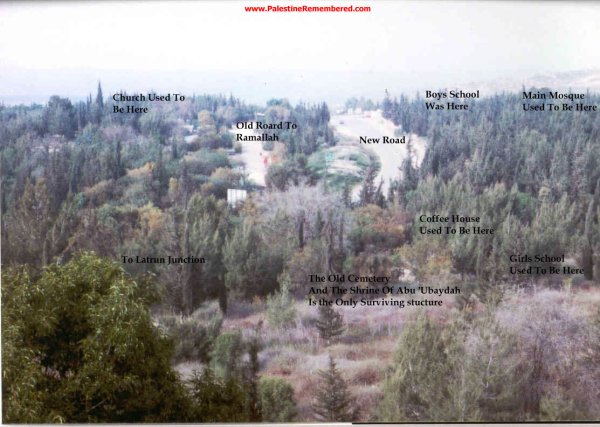
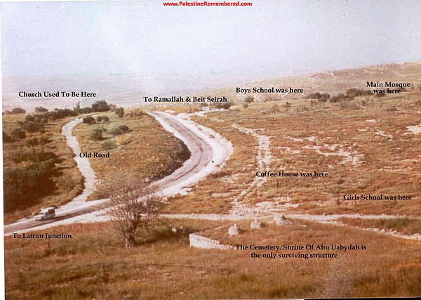
Israeli forces occupied Imwas on 6 June 1967 and ordered its residents to leave. Al-Haq’s documentation indicates that bulldozers began demolishing houses in Imwas, Yalu, and Bayt Nuba as early as 7 June. Homes, schools, mosques, wells, public buildings, and archaeological remains were subsequently destroyed, and residents were prevented from returning.
The claim that 3,200 houses were destroyed in Imwas alone is not supported by the available demographic and housing records. The village had only 224 houses in 1931 and a population of 1,955 in 1961. The precise number of buildings demolished in 1967 varies between accounts, but the village’s residential and public structures were almost entirely destroyed.
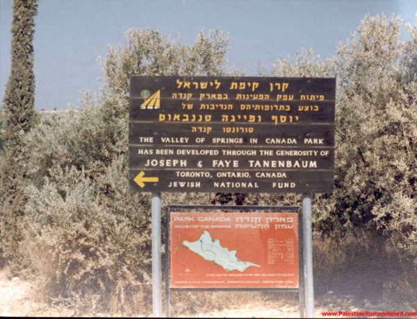
Canada Park, also known as Ayalon Park, was subsequently developed over extensive portions of the lands of Imwas and Yalu. Palestinian human rights sources date its establishment to the 1970s and document the financial involvement of the Canadian branch of the Jewish National Fund. The park covers approximately 7,000 dunams across the area of the destroyed Latrun villages.
After the village had been destroyed, British journalist Michael Adams travelled through the area and described what he saw in an account published by The Sunday Times:
“The road along which we were travelling was the road to Imwas. But when we drove from Bayt Nuba and reached the bend where Imwas had stood, we found that Imwas had disappeared and had been completely erased.”
In another account reproduced by Al-Ahram on 19 June 1968, Adams wrote:
“Imwas appeared on the pilgrims’ map that I carried with me, but it would not appear on any map issued by Israel, because every trace of it had been erased.”
The surviving sites associated with the former village include shrines traditionally attributed to Abu Ubayda ibn al-Jarrah and Muadh ibn Jabal, together with archaeological and religious remains in the adjoining Emmaus-Nicopolis and Latrun area.
Sources
- Palestine Remembered – Imwas
- Al-Haq – Where Villages Stood: Israel’s Continuing Violations of International Law in Occupied Latroun
- Al-Haq – The Ghost of the Latroun Area: 46 Years of Occupation
- BADIL – Imwas: Canada Park’s Concealed Crime
- United Nations – Protection of Civilians and Persons Displaced by the June 1967 War
- Jordan Department of Statistics – Population and Housing Censuses
- University of Jordan Library – First Population and Housing Census, 18 November 1961
- Fordham University – Historical Sources on the Plague of Amwas
Photo gallery

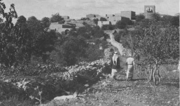


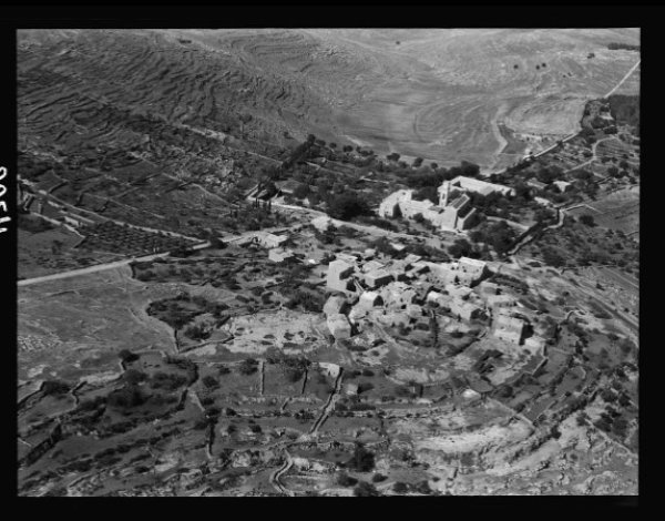
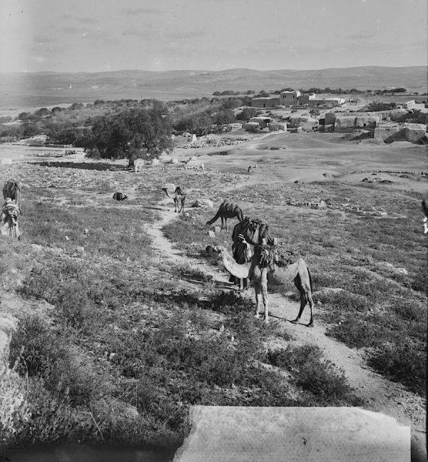

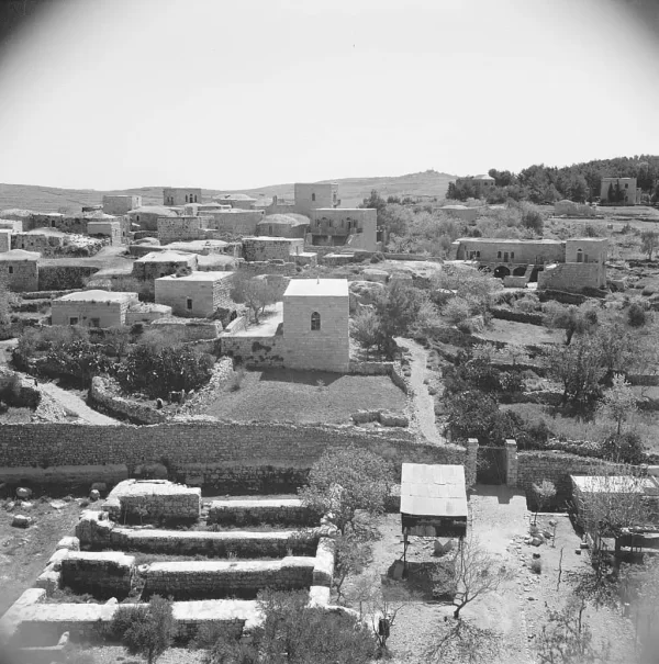








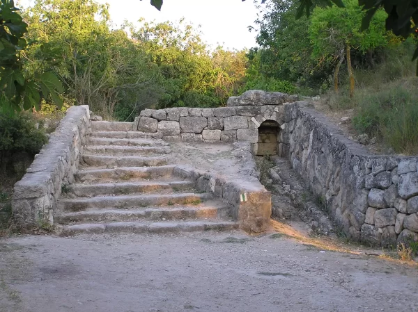

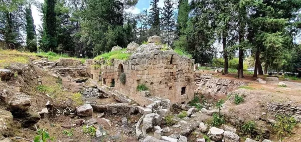
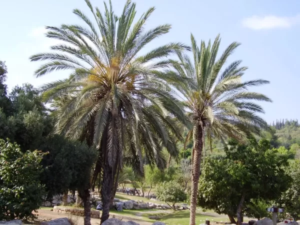
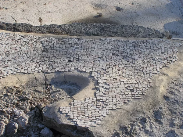

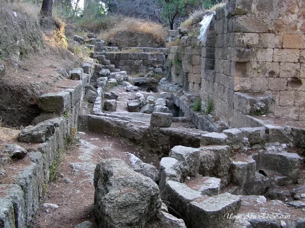
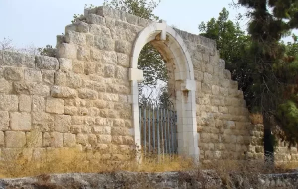
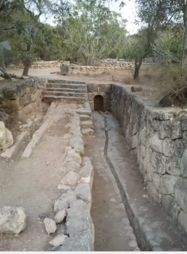
Photos from the village's people
Photos sent in by visitors and published after review.
Add a photo of this village
Log in to add photos of this village.
Other villages from Ramla
 Download Our Palestine App
The whole archive in the palm of your hand: depopulated villages, the Nakba, the massacres and Al-Aqsa — free, with no ads to erase the story.
Download Our Palestine App
The whole archive in the palm of your hand: depopulated villages, the Nakba, the massacres and Al-Aqsa — free, with no ads to erase the story.



Comments
No comments yet — be the first to write one.
Add your comment
Name and email are optional. Comments appear after review.