
The depopulated village of Dayr al-Hawa / District of Al-Quds (Jerusalem)

Dayr al-Hawa
About the depopulated village of Dayr al-Hawa
- District
- Al-Quds (Jerusalem)
- Date Dayr al-Hawa was occupied
- 19 October 1948
- Population in 1948
- 70
- Military operation
- Operation Ha-Har
- Brigade that carried it out
- Harel Brigade
- Who defended the village
- Local militia and Egyptian Army/Muslim Brotherhood Battalion
- Distance from the governorate centre
- 18.5 (km) West of Jerusalem
- Elevation above sea level
- 650 m
- Cause of displacement
- Military assault by Zionist troops
- Extent of destruction
- Deir al-Hawa was completely obliterated. Currently the Jewish National Fund owns your village, and you're more than welcome to sue them in U.S. courts if you wish, see 'Imwas, al-Ramla for more details.
- Ethnic cleansing
- Dayr al-Hawa inhabitants were completely ethnically cleansed.
Hover a dot to read the village name, or click to open its card.
Borders of the depopulated village of Dayr al-Hawa
Dayr al-Hawa – Depopulated Palestinian Village of the Jerusalem District
Dayr al-Hawa was a depopulated Palestinian village in the Jerusalem District. It stood on a high mountain summit in the western part of the district, approximately 18.5 kilometers west of Jerusalem, at an average elevation of about 650 meters above sea level.
Israeli occupation forces captured Dayr al-Hawa during the opening stage of Operation Ha-Har in October 1948. Walid Khalidi places its capture on the night of 18–19 October, or possibly the following night, by the Fourth Battalion of the Har'el Brigade.
Location and Geography
Dayr al-Hawa stood on a high mountain top overlooking extensive areas to the west, north, and south.
The village lay approximately 18.5 kilometers west of Jerusalem at an average elevation of about 650 meters above sea level.
A secondary road linked Dayr al-Hawa with another road leading toward Bethlehem several kilometers to the southeast, while dirt tracks connected it with neighboring Palestinian villages.
Its surrounding lands bordered those of Dayr Aban to the west, Dayr al-Shaykh to the east, Sufla to the south, Bayt 'Itab to the southeast, and Kasla to the northeast, with 'Artuf and Bayt Mahsir farther north and northwest.
In the late nineteenth century, Dayr al-Hawa was described as standing on a knoll along a high ridge overlooking a deep valley to the north, with only a few tall houses at the time.
Name
The name Dayr al-Hawa may literally be rendered as “Monastery of the Air” or “Monastery of the Wind,” a name consistent with the village's high and exposed location.
Nineteenth-century visitors associated the name with the elevated, windswept site. The principal Palestinian sources, however, do not provide conclusive historical evidence identifying a particular monastery as the origin of the name.
The interpretation should therefore remain tentative.
Built Environment
Dayr al-Hawa had a generally rectangular layout, with newer construction extending along a northwest–southeast axis that followed the mountainous topography.
The houses were constructed of stone or mud, stood close together, and were separated by narrow lanes.
The official 1944/45 statistics classified approximately 4 dunams as built-up land.
Population and Houses
The inhabitants of Dayr al-Hawa were Muslims.
- 192238Official Census of Palestine: 18 males and 20 females, all Muslims
- 193147Official census; all inhabitants were Muslims
- 194560Official statistics; all inhabitants were Palestinian Arab Muslims
- 1948About 70Later demographic estimate, not an official Mandate census
- 1998About 427 refugees and descendantsLater estimate published by Palestinian sources
The official 1931 census recorded 11 houses in Dayr al-Hawa.
The estimate of approximately 16 houses for 1948 is a later calculation rather than an official Government of Palestine census figure.
Palestine Remembered currently displays 18 inhabitants for 1922. The official census table shows that 18 was the number of males; together with 20 females, the correct total was 38.
Mosque and Maqam of Shaykh Sulayman
A mosque stood in the western part of Dayr al-Hawa and served the village's Muslim population.
The villagers also maintained a shrine dedicated to Shaykh Sulayman, a locally revered figure.
Education
Walid Khalidi and PalQuest do not document an independent formal school in Dayr al-Hawa before the Nakba.
No school, enrollment figure, or grade level is therefore attributed to the village without clearer Palestinian village-specific evidence.
Water Resources
The villagers obtained drinking water from two principal wells.
One was situated southeast of the village center and the other to the west.
The western water source is consistent with historical descriptions of a good water source on that side of the high village site.
Economic Life and Agriculture
Most of Dayr al-Hawa's agricultural land was mountainous, so cereals were cultivated primarily on the valley floors and less steep ground.
Apple, olive, fig, and almond trees were planted on the slopes, and agriculture was primarily rainfed.
In 1944/45, 1,565 dunams were allocated to cereals and 58 dunams were classified as plantations or irrigable land.
Palestine Remembered separately reports 501 dunams of olive groves. This figure cannot be combined directly with the official land-use table, whose plantation and irrigable category totals only 58 dunams. Olive cultivation is therefore documented without adding the 501-dunam figure to the official arithmetic.
Land Ownership, 1944/45
The total land area of Dayr al-Hawa was 5,907 dunams. Under the official Government of Palestine classification, ownership was distributed as follows:
- Arab4,660 dunums79%
- Jewish0 dunums0%
- Public1,247 dunums21%
The official table balances exactly: 4,660 + 1,247 = 5,907 dunams.
Palestine Remembered currently displays 1,347 dunams as Public land, a figure that does not reconcile with the total village area. This article therefore uses the official PalQuest figure of 1,247 dunams.
When reproducing Palestine Remembered's terminology, the ownership categories are “Palestinian,” “Transferred to Zionists,” and “Communal/Public.” No land in Dayr al-Hawa was recorded as “Transferred to Zionists” in these figures.
Land Use, 1944/45
- Arab
- Public
- Cereals1,565 dunums
- Plantations and irrigable land58 dunums
- Total cultivable/cultivated land1,623 dunums
- Non-cultivable land4,280 dunums
- Built-up land4 dunums
- Total non-cultivable and built-up4,284 dunums
The official table balances exactly: 1,623 dunams of cultivated or cultivable land plus 4,284 dunams of built-up and non-cultivable land equal the total village area of 5,907 dunams.
Archaeological Site
Dayr al-Hawa stood on an older archaeological site.
Some ancient building stones and columns were reused by villagers in the construction of their houses.
Khalidi does not conclusively date all of these remains, so the site's archaeological material should not collectively be assigned to the Roman, Byzantine, or any other single period without additional specialist evidence.
Operation Ha-Har
Operation Ha-Har, meaning “the Mountain,” began at the end of the second truce. PalQuest formally dates the operation from 19 to 24 October 1948, although its opening assault began during the night of 18–19 October.
The operation aimed to widen the Israeli-held corridor to Jerusalem and link it with areas being conquered toward the Hebron hills.
The Har'el, Etzioni, and Giv'ati brigades participated in the operation at the broader operational level, while Egyptian forces defended several sectors.
At Dayr al-Hawa itself, the village-specific formation was the Fourth Battalion of the Har'el Brigade.
Occupation of Dayr al-Hawa
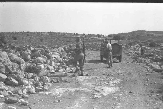
Dayr al-Hawa was among the first villages captured during Operation Ha-Har.
After Israeli units seized Dayr Aban from Egyptian forces, they turned toward nearby Dayr al-Hawa.
The villages were only about two kilometers apart, but Dayr al-Hawa stood approximately 300 meters higher than Dayr Aban, making the ascent militarily difficult.
Walid Khalidi places the capture of Dayr al-Hawa by the Fourth Battalion of the Har'el Brigade on the night of 18–19 October 1948, or possibly the following night.
The safest dating is therefore 18–20 October rather than treating 20 October or the later 29 October date found in one secondary index as an uncontested single-day occupation date.
Depopulation
The village-specific account does not provide a detailed description of what happened to the civilian population during the assault.
Khalidi records that the defending troops withdrew after the position was shelled.
He also cites Benny Morris's assessment that Operation Ha-Har commander Yigal Allon probably communicated to his officers that Arab civilian communities should not remain in the territory captured during the operation.
Because this is an inference rather than a documented written expulsion order specifically for Dayr al-Hawa, it is not presented as such. What is securely established is that the village was depopulated in the course of the military assault and Operation Ha-Har.
Military Unit
The village-specific military formation responsible for the capture of Dayr al-Hawa was the Fourth Battalion of the Har'el Brigade.
Other brigades participated in Operation Ha-Har more broadly, but they should not be transferred to the village-level attribution when the principal source explicitly identifies Har'el's Fourth Battalion.
Occupation Chronology
- October 1948
End of the second truce and renewed fighting
Large-scale military operations resumed on the southern front and around the Jerusalem corridor.
- Night of 18–19 October 1948
Opening assault of Operation Ha-Har
Israeli forces attacked Egyptian positions west of Dayr Aban.
- Around 18–19 October 1948
Capture of Dayr Aban
Israeli forces seized Dayr Aban and then turned toward the much higher position at Dayr al-Hawa.
- Night of 18–19 October or the following night
Occupation of Dayr al-Hawa
The Fourth Battalion of the Har'el Brigade captured the village after shelling and the withdrawal of the defenders.
- During and immediately after the occupation
Depopulation
The source does not detail the civilians' route of departure, but the village was emptied during the operation.
- Until 24 October 1948
Continuation of Operation Ha-Har
Israeli forces continued occupying villages southwest of Jerusalem and expanding toward the Hebron hills.
- Exact date not documented
Destruction of the village
The village structures were later destroyed and parts of the site were leveled and bulldozed.
Israeli Settlements on Village Lands
According to Walid Khalidi and PalQuest, no Israeli settlement was established on Dayr al-Hawa's village lands.
Nes Harim was established in 1950 close to the northeastern edge of the former village site, but it does not stand on Dayr al-Hawa's land.
The village-specific record for neighboring Bayt 'Itab identifies Nes Harim as having been established on Bayt 'Itab's lands. It should therefore not be listed as a settlement on Dayr al-Hawa.
Dayr al-Hawa Today
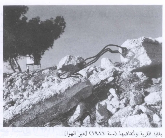
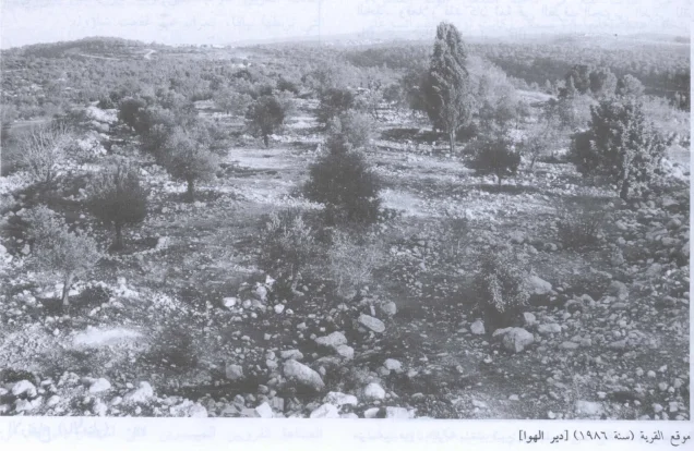
According to the field description published in Walid Khalidi's All That Remains, rubble from the village houses was mixed with ruined agricultural terrace walls across the site.
Parts of the location had been leveled and bulldozed, with debris gathered into a large pile near one edge of the site.
Carob groves and olive trees covered terraces to the north, south, and west, while cactuses grew along the southern edge.
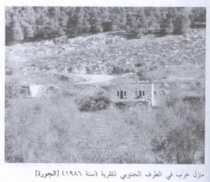
Ruined walls and large reinforced-concrete blocks remained in the western part of the site, together with a lookout tower erected in the bulldozed area.
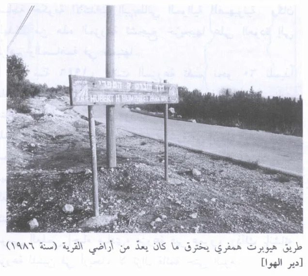
The Jewish National Fund also developed the “Bicentennial Park” across parts of Dayr al-Hawa's lands and those of neighboring Palestinian villages. The tree-lined Hubert H. Humphrey Road passes through the park on former village land.
This account should not be treated as a comprehensive field verification of conditions in 2026. The principal description derives from the historical field survey associated with All That Remains and documents the site during that survey period rather than providing a complete current assessment.
Sources
- PalQuest – Interactive Encyclopedia of the Palestine Question: Dayr al-Hawa
- PalQuest – Operation Ha-Har
- Palestine Remembered – Dayr al-Hawa, Jerusalem District
- Palestine Remembered – Walid Khalidi's account of Dayr al-Hawa
- Palestinian Villages Encyclopedia – Dayr al-Hawa; supporting Palestinian documentation
- Government of Palestine – Census of Palestine 1922: Dayr al-Hawa, 38 inhabitants
- Institute for Palestine Studies – Walid Khalidi, All That Remains
- PalQuest – All That Remains: Methodology
Photo gallery
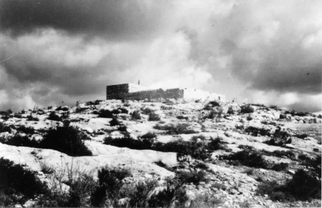
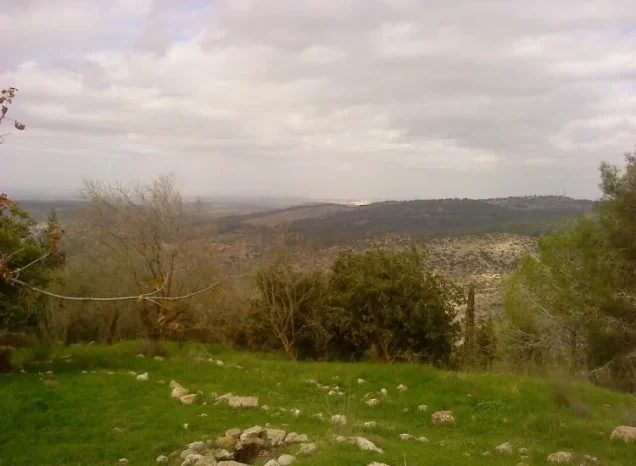
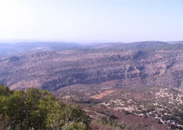
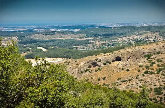

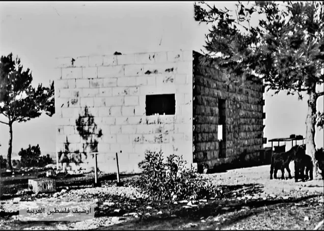
Photos from the village's people
Photos sent in by visitors and published after review.
Add a photo of this village
Log in to add photos of this village.
Other villages from Al-Quds (Jerusalem)
More from the archive
 Al-Quds (Jerusalem)
The depopulated village of Khirbat al-Tannur - Allar al-Sifla / District of Al-Quds (Jerusalem)
 Al-Quds (Jerusalem)
The depopulated village of Jarash / District of Al-Quds (Jerusalem)
 Al-Quds (Jerusalem)
The depopulated village of al-Burayj (Bayarat Burayj) / District of Al-Quds (Jerusalem)
 Download Our Palestine App
The whole archive in the palm of your hand: depopulated villages, the Nakba, the massacres and Al-Aqsa — free, with no ads to erase the story.
Download Our Palestine App
The whole archive in the palm of your hand: depopulated villages, the Nakba, the massacres and Al-Aqsa — free, with no ads to erase the story.



Comments
No comments yet — be the first to write one.
Add your comment
Name and email are optional. Comments appear after review.