
The depopulated village of Al-'Ubaydiyya / District of Tiberias
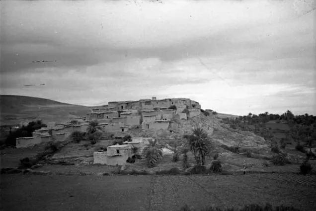
Al-'Ubaydiyya
About the depopulated village of Al-'Ubaydiyya
- District
- Tiberias
- Date Al-'Ubaydiyya was occupied
- 03 March 1948
- Population in 1948
- 1,009
- Distance from the governorate centre
- 11 km south of Tiberias
- Elevation above sea level
- -225 m
- Cause of displacement
- Fear of an anticipated Zionist attack and a sense of isolation – according to Benny Morris as cited by Khalidi; Khalidi does not rule out a direct attack on the village
- Extent of destruction
- al-'Ubaydiyya was completely destroyed, and only house rubble and the watermill left behind.
- Ethnic cleansing
- On March 3rd 1948, the inhabitants of al-'Ubaydiyya were intimidated into fleeing their homes and farms by the Haganah to Nazareth.
- Settlements built on the built-up area of Al-'Ubaydiyya after 1948
- None on village lands, according to Khalidi
Hover a dot to read the village name, or click to open its card.
Borders of the depopulated village of Al-'Ubaydiyya
al-'Ubaydiyya: A Depopulated Palestinian Village in the Tiberias District
al-'Ubaydiyya was a Palestinian village in the Tiberias District, located approximately 11 kilometres south of the city of Tiberias on the western bank of the Jordan River, at an average elevation of about 225 metres below sea level. Its inhabitants left the village for the Nazareth area on 3 March 1948 amid growing fear of military attacks on nearby Palestinian villages. They were not able to return, and the village was depopulated during the Nakba and the occupation of Palestine in 1948.
- Subdistrict
- Tiberias
- Distance from district center
- 11 km south of Tiberias
- Average Elevation
- 225 m below sea level
- Population in 1931
- 625
- Number of Houses in 1931
- 137
- Population in 1944/1945
- 870
- Estimated Population in 1948
- About 1,009 – a later demographic estimate, not an official census
- Total Land Area in 1945
- 5,173 dunams
- Attack and Depopulation
- Benny Morris, as cited by Khalidi, writes that the inhabitants of al-'Ubaydiyya left for the Nazareth area on 3 March 1948 because of a feeling of isolation and a sense of vulnerability to an anticipated Zionist attack. Khalidi considers that the village may have been attacked directly or may have anticipated an attack like the Haganah raids of March 1948, which included an assault on the nearby village of al-Manara early that month.
- Final Israeli Control
- Not documented in the sources: the inhabitants left the village on 3 March 1948, and the sources record neither the date on which Zionist forces entered it nor which force took control of it; by early May 1948 the village was empty of its Arab inhabitants, according to Morris as cited by Khalidi.
- Cause of Depopulation
- Fear of an anticipated Zionist attack and a sense of isolation – according to Benny Morris as cited by Khalidi; Khalidi does not rule out a direct attack on the village
- Settlements Documented on Village Lands
- None on village lands, according to Khalidi
Location
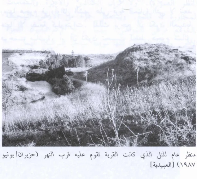
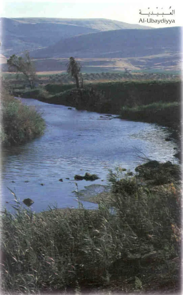
al-'Ubaydiyya stood on a small, rounded hill on the western bank of the Jordan River, approximately 2.5 kilometres south of Lake Tiberias and about 1 kilometre south of the point where Wadi al-Fajjas emptied into the Jordan River.
A secondary road connected the village with Samakh at the southern end of Lake Tiberias.
Because al-'Ubaydiyya stood at a sharp bend in the Jordan River, the layout of the village reflected its topography. It extended along a north–south axis parallel to the western bank of the river and had a narrow rectangular form toward its southern end.
al-'Ubaydiyya Through History
Walid Khalidi suggests that al-'Ubaydiyya may have been built over the ruins of the ancient Canaanite town of Bayt Shamash, which should not be confused with the village of Bayt Shamash in the Jerusalem area.
This identification should be treated as a historical and archaeological possibility rather than as a conclusively established fact.
In 1881, the authors of the Survey of Western Palestine described al-'Ubaydiyya as a village of approximately 200 Muslim inhabitants situated on a rounded hill close to the Jordan River.
The Prehistoric Archaeological Site
The al-'Ubaydiyya area is also associated with a major Lower Paleolithic archaeological site containing geological layers and evidence of ancient human and animal presence dating to the Lower Pleistocene.
The age of these prehistoric deposits should not be confused with the age of the historical Palestinian village. Statements claiming that “the village of al-'Ubaydiyya dates back 790,000 years” or 1.4 million years are therefore misleading. Such dates concern the prehistoric archaeological site rather than the history of the Palestinian village as a historical settlement.
Architecture
Most houses in al-'Ubaydiyya were built of mud brick, and their roofs were made of reeds covered with a layer of mud.
The layout of the village followed the bend of the Jordan River, with buildings extending primarily along a north–south axis parallel to the riverbank.
The built-up area amounted to approximately 26 dunams according to the 1944/1945 statistics, including 24 dunams of Arab-owned land and 2 dunams of Jewish-owned land.
Education
An elementary school was established in al-'Ubaydiyya during the Ottoman period and continued to operate under the British Mandate.
All of the village inhabitants were Muslims according to the official statistics immediately before the Nakba.
Population
In 1881, the population of al-'Ubaydiyya was estimated at approximately 200 Muslims.
According to the official 1922 Census of Palestine, al-'Ubaydiyya had a population of 336 Muslims. This differs from the figure of 436 published in the Palestine Remembered statistical table, which appears to be a transcription error.
In the 1931 census, the population increased to 625, living in 137 houses.
According to the 1944/1945 Village Statistics, the population reached 870, all of whom were Muslims.
The estimate of approximately 1,009 inhabitants for 1948 and the estimate of 6,198 refugees and descendants in 1998, published by Palestine Remembered, are later estimates rather than official censuses of the Government of Palestine.
Population of al-'Ubaydiyya
- 1881About 200Historical estimate
- 1922336Official Government of Palestine census
- 1931625Official census
- 1944/1945870Government of Palestine statistics
- 1948About 1,009Later estimate
- 19986,198Estimate of refugees and their descendants
Number of Houses
The 1931 census recorded 137 houses in al-'Ubaydiyya. The figure of approximately 221 houses for 1948, published by Palestine Remembered, is a later estimate.
Number of Houses in al-'Ubaydiyya
- 1931137Official census
- 1948About 221Later estimate
Land of al-'Ubaydiyya
According to the 1944/1945 statistics, the lands of al-'Ubaydiyya covered a total of 5,173 dunams.
Arab ownership amounted to 4,031 dunams, Jewish ownership to 1,139 dunams, while 3 dunams were classified as public land.
Land Ownership in al-'Ubaydiyya in 1944/1945
- Arab ownership4,031 dunums78%
- Jewish ownership1,139 dunums22%
- Public land3 dunums<1%
Agriculture and Economic Life
Agriculture formed the basis of the economy of al-'Ubaydiyya. The village's agricultural lands extended between the village site and the road connecting it with Samakh.
The inhabitants cultivated cereals and vegetables, while date palms were particularly common north of the village.
al-'Ubaydiyya also had a water-powered mill supplied by water through an elevated canal.
According to the 1944/1945 statistics, a total of 1,961 dunams were devoted to cereals, including 1,349 dunams of Arab-owned land and 612 dunams of Jewish-owned land.
A total of 1,539 dunams were irrigated or used for plantations, including 1,014 Arab-owned dunams and 525 Jewish-owned dunams. An additional 3 Arab-owned dunams were classified as citrus and banana land.
Palestine Remembered separately records 4 dunams planted with olives. Because the official PalQuest land-use table does not list olives as a separate category, this figure has not been added again to the total in order to avoid double counting.
Land Use in al-'Ubaydiyya in 1944/1945, in Dunams
- Arab
- Jewish
- Public
- Cereals1,961 dunums
- Irrigated and plantation land1,539 dunums
- Citrus and bananas3 dunums
- Built-up area26 dunums
- Uncultivable land1,644 dunums
The Nakba and the Displacement of al-'Ubaydiyya
3 March 1948
Walid Khalidi's account, as reproduced by PalQuest, states that the inhabitants of al-'Ubaydiyya left their village for the Nazareth area on 3 March 1948.
PalQuest reproduces Khalidi's account, which in turn cites Israeli historian Benny Morris, attributing the departure to the villagers' sense of isolation and fear that they would be harmed in an anticipated Jewish attack.
This interpretation is included here only as transmitted through the Palestinian source and not through direct reliance on the original Israeli source.
Was al-'Ubaydiyya Directly Attacked?
During March 1948, Haganah forces carried out raids against Palestinian villages in the surrounding region, including an attack on the nearby village of al-Manara.
Walid Khalidi does not establish conclusively that al-'Ubaydiyya itself was directly attacked before its inhabitants left. He presents two possibilities: either the village was attacked directly or its inhabitants left in anticipation of a similar attack.
For this reason, 3 March 1948 should not be described with certainty as the date of a documented military occupation of al-'Ubaydiyya. It is more accurately identified as the documented date of the inhabitants' departure, while the precise circumstances of the subsequent military takeover of the village site remain insufficiently documented in the principal Palestinian sources.
Military Operation and Unit
The principal Palestinian sources reviewed do not identify a specific named military operation associated with the occupation of al-'Ubaydiyya, nor do they identify a particular brigade or battalion as having entered the village.
Palestine Remembered lists 3 March 1948 as the occupation and depopulation date. Walid Khalidi's more detailed account, however, primarily identifies that date as the villagers' departure and leaves open the question of whether a direct assault occurred.
Occupation and Depopulation Chronology
- 3 March 1948
Depopulation of the village
Benny Morris, as cited by Khalidi, writes that the inhabitants of al-'Ubaydiyya left for the Nazareth area on this date because of a feeling of isolation and a sense of vulnerability to an anticipated Zionist attack. Khalidi considers that the village may have been attacked directly or may have anticipated an attack like the Haganah raids of March 1948, which included an assault on al-Manara, a village only a few kilometres away.
- Early May 1948
Village reported empty; push for settlements nearby
According to Morris as cited by Khalidi, Jewish settlers near the southern shore of Lake Tiberias sent representatives to a Jewish National Fund official, told him that al-'Ubaydiyya had been emptied of its Arab inhabitants, and proposed settlements at two sites in its vicinity.
Fate of the Population and Buildings
The inhabitants of al-'Ubaydiyya left for the Nazareth area, and the Palestinian village became depopulated during the Nakba.
By early May 1948, al-'Ubaydiyya was empty of its Palestinian inhabitants, and pressure had begun for the establishment of new settlements in the vicinity of the village site.
The village houses were subsequently demolished, and the original Palestinian community was not permitted to return and re-establish the village.
Israeli Settlements and the Lands of al-'Ubaydiyya
According to Walid Khalidi and PalQuest, no Israeli settlement was established directly on the lands of al-'Ubaydiyya.
Beit Zera
Beit Zera is the closest settlement to the site of al-'Ubaydiyya. It was established in 1926 and lies approximately 1 kilometre east of the former village site, but according to the principal source it was not established on al-'Ubaydiyya's lands.
- 1926Beit Zera
Located about 1 kilometre east of the village site; not established on al-'Ubaydiyya's lands according to Walid Khalidi and PalQuest
The Site of al-'Ubaydiyya After the Nakba
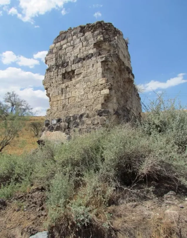
According to the field documentation used by Walid Khalidi, the most prominent surviving evidence of the village was a remaining section of the walls of the elevated canal that had supplied water to the village mill.
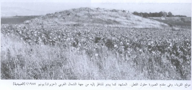
Ruins of houses, piles of stones, wall foundations, terraces, and several date palms could also be seen at the site.
At the time of that documentation, most of the surrounding lands were being used for cotton cultivation.
This description reflects the condition of the site at the time of the field documentation relied upon by Walid Khalidi and should not necessarily be interpreted as a comprehensive field survey updated to 2026.
Sources
- PalQuest – Interactive Encyclopedia of the Palestine Question: al-'Ubaydiyya.
- PalQuest: al-'Ubaydiyya.
- Palestine Remembered: al-'Ubaydiyya, Tiberias District.
- Walid Khalidi, All That Remains: al-'Ubaydiyya, as reproduced by Palestine Remembered.
- Government of Palestine: Census of Palestine, 1922.
- Government of Palestine, Census of Palestine, 1931.
- Government of Palestine, Department of Statistics, Village Statistics, 1945.
- Walid Khalidi, All That Remains, entry on al-'Ubaydiyya.
Photo gallery

Photos from the village's people
Photos sent in by visitors and published after review.
Add a photo of this village
Log in to add photos of this village.
Other villages from Tiberias
More from the archive


 Download Our Palestine App
The whole archive in the palm of your hand: depopulated villages, the Nakba, the massacres and Al-Aqsa — free, with no ads to erase the story.
Download Our Palestine App
The whole archive in the palm of your hand: depopulated villages, the Nakba, the massacres and Al-Aqsa — free, with no ads to erase the story.



Comments
No comments yet — be the first to write one.
Add your comment
Name and email are optional. Comments appear after review.