
The depopulated village of Kafr Sabt / District of Tiberias
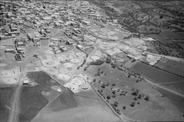
Kafr Sabt
About the depopulated village of Kafr Sabt
- District
- Tiberias
- Date Kafr Sabt was occupied
- 22 April 1948
- Population in 1948
- 557
- Distance from the governorate centre
- 10.5 km southwest of Tiberias
- Elevation above sea level
- 225 m
- Cause of displacement
- Flight of the inhabitants as a direct result of the fall of Tiberias to the Haganah on 18 April 1948, according to Israeli sources cited by Khalidi
- Extent of destruction
- Kafr Sabt was completely destroyed, and only house rubble left behind.
- Ethnic cleansing
- Kafr Sabt inhabitants were completely ethnically cleansed.
- Settlements built on the land of Kafr Sabt before 1948
- Ilaniyya (allocated 350 dunams of village land in 1949)
- Settlements built on the built-up area of Kafr Sabt after 1948
- No new settlement on village land according to Khalidi; Sde Ilan (1949) lies west of the village site, not on its land
Hover a dot to read the village name, or click to open its card.
Borders of the depopulated village of Kafr Sabt
Kafr Sabt: A Depopulated Palestinian Village in the Tiberias District
Kafr Sabt was a Palestinian village in the Tiberias District, located approximately 10.5 km southwest of Tiberias on a gradually sloping plain in the eastern Lower Galilee, at an average elevation of about 225 metres above sea level. Its inhabitants were displaced during the Nakba and the occupation of Palestine in 1948. Walid Khalidi's account states that the villagers left on 22 April 1948 as a direct consequence of the Haganah's occupation of Tiberias four days earlier.
- Subdistrict
- Tiberias
- Distance from district center
- 10.5 km southwest of Tiberias
- Average Elevation
- 225 m above sea level
- Population in 1931
- 340 – figure including Umm al-'Alaq and 'Arab al-Mashariqa (Khirbat Umm al-'Alaq was an extension of the village, and members of the Bedouin 'Arab al-Mashariqa tribe lived there in tents)
- Number of Houses in 1931
- 71 – figure including Umm al-'Alaq and 'Arab al-Mashariqa
- Population in 1944/1945
- 480
- Estimated Population in 1948
- About 557 – a later demographic estimate, not an official census
- Total Land Area in 1945
- 9,850 dunams – of which 4,295 dunams Arab-owned, 5,110 dunams Jewish-owned and 445 dunams public land
- Attack and Depopulation
- The available sources document no military attack on the village itself; according to Israeli sources cited by Khalidi, its inhabitants fled on 22 April 1948 as a direct result of the Haganah's occupation of Tiberias on 18 April 1948.
- Final Israeli Control
- The available sources do not give the date on which Israeli forces took control of the village; its inhabitants fled on 22 April 1948, according to Israeli sources cited by Khalidi
- Cause of Depopulation
- Flight of the inhabitants as a direct result of the fall of Tiberias to the Haganah on 18 April 1948, according to Israeli sources cited by Khalidi
- Settlements Documented on Village Lands
- Khalidi mentions no settlement established on village land, and states that Sde Ilan, established in 1949 to the west of the village site, is not on village land. In 1949, 350 dunams of village land were allocated to the neighbouring settlement of Ilaniyya, and farmers from the settlement of Sharona took over the land by force until the Israeli Agriculture Ministry ordered them off it
Location of Kafr Sabt
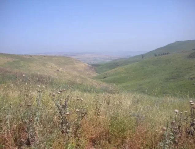
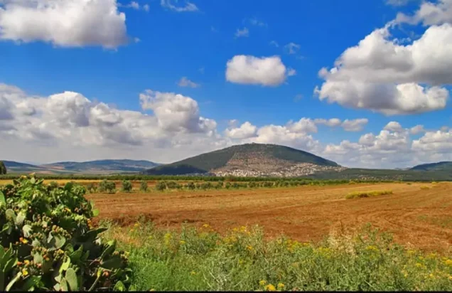
Kafr Sabt stood on a gradually sloping plain in the eastern Lower Galilee. It overlooked a wadi to the north, while relatively level terrain extended on its other sides.
The village was approximately 10.5 km southwest of Tiberias and stood at an average elevation of about 225 metres above sea level.
A secondary road connected Kafr Sabt with the Palestinian village of Kafr Kama and, from there, with the main Tiberias–Nazareth highway.
More detailed claims concerning the exact course of Wadi Damiya and the location of Ayn Kafr Sabt are not included because they are not documented in this form in the principal approved sources used for this article.
Name and History of Kafr Sabt
During the Roman period, Kafr Sabt was known as Kefar Shabtay.
The Arab geographer al-Maqdisi mentioned the village in the tenth century among the villages of Qisarya, or Caesarea, describing it as a large and inhabited village with a mosque on its main street.
The geographer Yaqut al-Hamawi later referred to it as a village near Tiberias. The Crusaders called it Cafarsset.
In 1596, Kafr Sabt was a village in the nahiya of Tiberias within the liwa of Safad, with an estimated population of approximately 160. It paid taxes on wheat, barley, cotton, goats, beehives, and other forms of production.
Architecture of Kafr Sabt
In the late nineteenth century, Kafr Sabt was described as a stone-built village surrounded by level agricultural land, with a population of approximately 300.
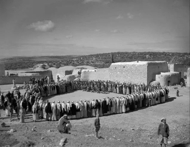
The village had a long, narrow rectangular layout running from east to west. Its houses stood close together and were constructed from several materials, including stone, mud, and cement.
Members of the Bedouin Arab al-Mashariqa tribe also stayed in the village area and pitched their tents there.
The inhabitants of Kafr Sabt were Muslim.
Economic Life in Kafr Sabt
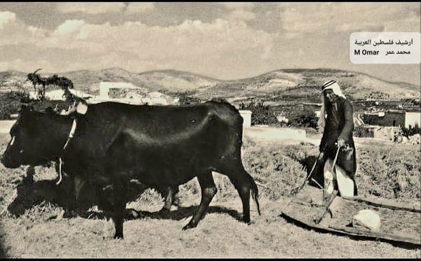
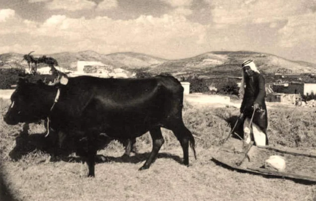
The villagers depended primarily on agriculture and livestock raising for their livelihood.
Cereals and fruit were among their principal crops, with cultivation concentrated particularly southeast of the village.
According to the 1944/45 statistics, 4,258 dunums of Palestinian land were devoted to cereals. Another 5,110 dunums recorded in the ownership data as having been transferred to Zionists were also used for cereal cultivation. Seven dunums of Palestinian land were irrigated or used for plantations.
Palestine Remembered separately records four dunums of olive groves. This olive area forms part of the plantation category and should not be added again when calculating the total cultivable land.
Land Ownership in Kafr Sabt
The total land area of Kafr Sabt was 9,850 dunums according to the 1944/45 statistics.
Land ownership in Kafr Sabt, 1944/45, using the terminology of Palestine Remembered
- Palestinian4,295 dunums44%
- Transferred to Zionists5,110 dunums52%
- Communal445 dunums5%
The land recorded as “Transferred to Zionists” represented approximately 51.9 percent of Kafr Sabt's total registered lands.
Land Use in Kafr Sabt, 1944/45
Land use in Kafr Sabt based on the detailed PalQuest statistics
- Palestinian
- Land transferred to Zionists
- Communal/Public
- Plantations and irrigable land7 dunums
- Cereals9,368 dunums
- Built-up area30 dunums
- Non-cultivable land445 dunums
A total of 9,375 dunums, approximately 95 percent of the village lands, was cultivated or cultivable. Built-up and non-cultivable land together amounted to 475 dunums, or about 5 percent.
Palestine Remembered places the 445 dunums of non-arable land in its Palestinian column, whereas PalQuest's detailed table classifies those 445 dunums as public land. The latter breakdown is used here while preserving the ownership terminology requested above.
Population of Kafr Sabt
Population of Kafr Sabt in selected years
- 1596160Estimate derived from Ottoman records
- Late nineteenth centuryAbout 300Historical survey estimate
- 1922247Official British Mandate census
- 1931340Official census; includes Umm al-Alaq and Arab al-Mashariqa
- 1944/45480Official statistics
- 1948557Later estimate published by Palestine Remembered
- Estimated refugees in 19983,419Later estimate published by Palestine Remembered
Number of Houses in Kafr Sabt
| Year | Number of occupied houses | Notes |
|---|---|---|
| 1931 | 71 | Includes Umm al-Alaq and Arab al-Mashariqa |
No later estimated 1948 house figure is presented here as an official Mandate statistic.
Archaeological Sites around Kafr Sabt
Several archaeological sites and khirbas lay around Kafr Sabt, most notably Khirbat Umm al-Alaq and Khirbat Damiya.
Khirbat Umm al-Alaq formed an extension of the village and contained the ruins of houses, a fortress, a mosque, cisterns, presses, and fragments of columns.
Khirbat Damiya, northeast of Kafr Sabt, contained extensive building foundations and olive presses.
Depopulation of Kafr Sabt during the Nakba
According to the account reproduced by Walid Khalidi, the inhabitants of Kafr Sabt left their village on 22 April 1948, four days after the Haganah occupied Tiberias on 18 April.
The source directly associates the villagers' departure with the fall of Tiberias and the resulting fear and collapse of security in the surrounding area.
Khalidi's PalQuest entry does not document a separate battle fought inside Kafr Sabt on 22 April. The date is therefore best understood as the date of the village's depopulation rather than as a documented date of a distinct military assault on the village itself.
The underlying account is attributed by Khalidi to Israeli sources. Those sources are not used independently here; the information is included only because it is reproduced in the approved Palestinian reference.
- Occupation of Tiberias by the Haganah: 18 April 1948.
- Departure of Kafr Sabt's inhabitants: 22 April 1948.
- Cause cited in the source: the direct impact of the fall of Tiberias.
- The village entry does not document a separate battle in Kafr Sabt on 22 April.
- Fate of the inhabitants: the Palestinian population was displaced during the Nakba.
- Fate of the village: it was subsequently destroyed, leaving stone terraces and rubble as the principal visible remains.
Occupation and Depopulation Chronology
- 18 April 1948
Occupation of Tiberias
The Haganah occupied the town of Tiberias, the district centre; the Israeli sources cited by Khalidi attribute the flight of the inhabitants of Kafr Sabt directly to this event.
- 22 April 1948
Depopulation of the village
The villagers fled as a direct result of the Haganah's occupation of Tiberias, according to Israeli sources cited by Khalidi. The available sources document neither an attack on the village itself nor the date on which Israeli forces took control of it.
- 1949
Seizure of village lands
The village lands became the subject of a dispute between the neighbouring settlements of Ilaniyya and Sharona: Ilaniyya, which had demanded compensation for Arab attacks in the early months of the war, was allocated 350 dunams of the lands of Kafr Sabt, but the farmers of Sharona took the land over by force until the Agriculture Ministry ordered them off it.
Kafr Sabt's Lands after the Nakba
In 1949, the lands of Kafr Sabt became the subject of a dispute between the neighbouring settlements of Ilaniyya and Sharona.
Khalidi records that Ilaniyya sought compensation in land for attacks it said it had suffered earlier in 1948 and was allocated 350 dunums of Kafr Sabt's lands.
Farmers from Sharona also attempted to take control of village land, but the Agriculture Ministry intervened and ordered them to leave the disputed area.
These details derive from an Israeli source quoted by Khalidi and are not independently sourced from that Israeli material in this article.
Settlements on the Lands of Kafr Sabt
Walid Khalidi does not identify a new Israeli settlement established directly on the village site itself after the Nakba.
Sde Ilan was established west of Kafr Sabt in 1949, but Khalidi explicitly states that it was not built on village land.
Ilaniyya and Sharona were already located near Kafr Sabt and later became involved in disputes over portions of the village's lands after its Palestinian inhabitants had been displaced.
Kafr Sabt Today
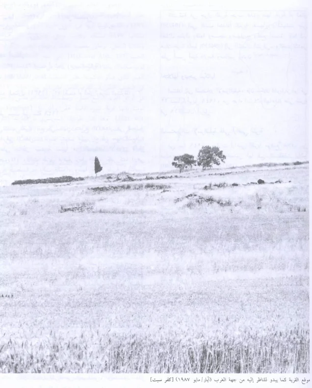
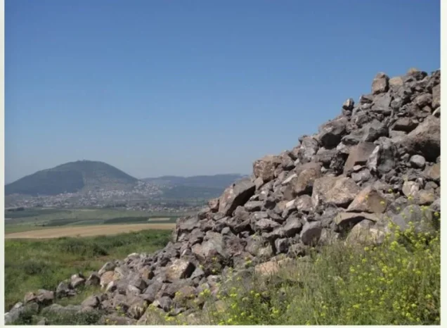
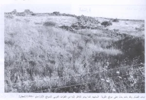
According to the field description published by Walid Khalidi in All That Remains, stone terraces and piles of stone were the principal indications that a village had once occupied the site.
A few scattered trees and cactus plants grew among the rubble, while the surrounding lands were cultivated with cereals, fruit trees, and almond trees.
Palestine Remembered contains later user-contributed photographs of the village site and also lists audiovisual material added in 2026. Such contributions do not constitute a comprehensive independent field survey of the entire site.
The principal description above therefore relies on Khalidi's historical field survey. The approved sources used here do not provide a sufficiently comprehensive and independent contemporary survey to verify the precise condition of every part of Kafr Sabt in 2026.
Sources
- PalQuestPalQuest – Interactive Encyclopedia of the Palestine Question: Kafr Sabt
- Palestine RememberedPalestine Remembered – Kafr Sabt, Tiberias District
- Palestine RememberedPalestine Remembered – Kafr Sabt entry from All That Remains
- PalQuestPalQuest – Land Transfers Regulations, 1940, including Kafr Sabt in the Tiberias Subdistrict
- Institute for Palestine StudiesInstitute for Palestine Studies – All That Remains, Walid Khalidi
Photo gallery

Photos from the village's people
Photos sent in by visitors and published after review.
Add a photo of this village
Log in to add photos of this village.
Other villages from Tiberias

More from the archive


 Download Our Palestine App
The whole archive in the palm of your hand: depopulated villages, the Nakba, the massacres and Al-Aqsa — free, with no ads to erase the story.
Download Our Palestine App
The whole archive in the palm of your hand: depopulated villages, the Nakba, the massacres and Al-Aqsa — free, with no ads to erase the story.



Comments
No comments yet — be the first to write one.
Add your comment
Name and email are optional. Comments appear after review.