
The depopulated village of Al-Majdal (Tiberias) / District of Tiberias
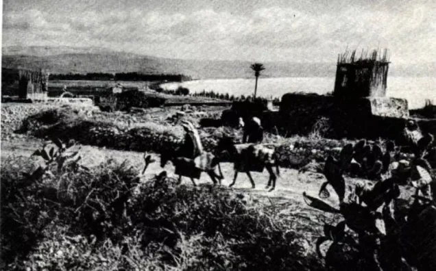
Al-Majdal (Tiberias)
About the depopulated village of Al-Majdal (Tiberias)
- District
- Tiberias
- Date Al-Majdal (Tiberias) was occupied
- 22 April 1948
- Population in 1948
- 418
- Brigade that carried it out
- Haganah (forces based in Tiberias) – probably, according to Khalidi
- Distance from the governorate centre
- 4 km northwest of Tiberias
- Elevation above sea level
- -200 m
- Cause of displacement
- A military attack by Zionist forces, together with the demoralising effect of the fall of neighbouring Tiberias – according to Benny Morris as cited by Khalidi
- Extent of destruction
- al-Majdal was mostly destroyed with the exception of its shrine.
- Ethnic cleansing
- al-Majdal inhabitants were completely ethnically cleansed.
- Settlements built on the land of Al-Majdal (Tiberias) before 1948
- Migdal, established in 1910 on land purchased by Zionists 1.5 km northwest of the village site, spread onto village lands as it expanded after 1948
Hover a dot to read the village name, or click to open its card.
Borders of the depopulated village of Al-Majdal (Tiberias)
al-Majdal: A Depopulated Palestinian Village in the Tiberias District
al-Majdal was a Palestinian village in the Tiberias District, located on the western shore of Lake Tiberias, approximately 4 kilometres northwest of the city of Tiberias, at an average elevation of about 200 metres below sea level. It was the smallest village in the district in terms of land area. Its inhabitants were displaced in April 1948, and most of its built-up area was subsequently destroyed, while the shrine of Muhammad al-'Ajami remained one of its principal surviving landmarks.
- Subdistrict
- Tiberias
- Distance from district center
- 4 km northwest of Tiberias
- Average Elevation
- 200 m below sea level
- Population in 1931
- 284
- Number of Houses in 1931
- 62
- Population in 1944/1945
- 360
- Estimated Population in 1948
- About 418 – a later demographic estimate, not an official census
- Total Land Area in 1945
- 103 dunams
- Attack and Depopulation
- The only fact Israeli sources give about the fall of the village is that its inhabitants left on 22 April 1948; Benny Morris, as cited by Khalidi, attributes their exodus partly to a military attack and partly to the effect of the fall of neighbouring Tiberias on 18 April. Khalidi considers it probable that Haganah forces based in Tiberias seized the village a few days after the city fell.
- Final Israeli Control
- No date is given in the sources: Khalidi considers it probable that Haganah forces based in Tiberias seized the village a few days after the city fell on 18 April 1948; its inhabitants left on 22 April 1948.
- Military Unit
- Haganah (forces based in Tiberias) – probably, according to Khalidi
- Cause of Depopulation
- A military attack by Zionist forces, together with the demoralising effect of the fall of neighbouring Tiberias – according to Benny Morris as cited by Khalidi
- Settlements Documented on Village Lands
- Migdal, established in 1910 on land purchased by Zionists 1.5 km northwest of the village site, spread onto village lands as it expanded after 1948
Location
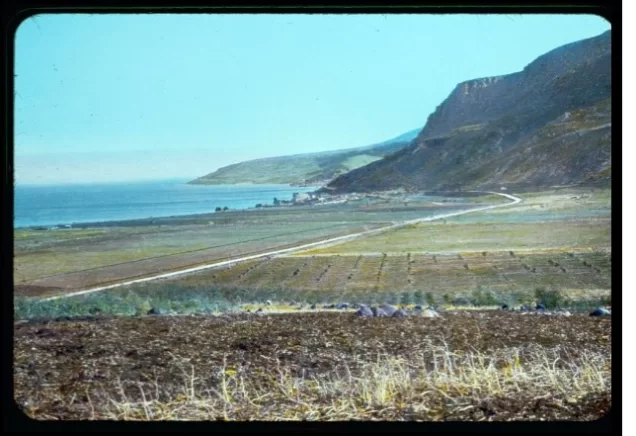
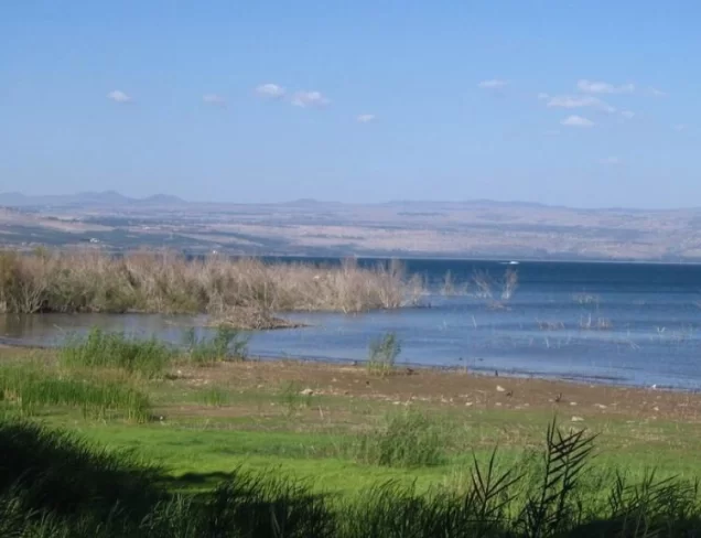
al-Majdal was situated on the western shore of Lake Tiberias, at the southern edge of the Ghuwayr Abu Shusha Plain, at the foot of a mountain that rose sharply above the plain to approximately 380 metres.
The village itself stood at a much lower elevation, averaging approximately 200 metres below sea level.
It was connected with the city of Tiberias by the main road that followed the western shore of the lake.
The Name al-Majdal and the History of the Site
The name “al-Majdal” is related to an ancient Semitic root associated with the meaning of a tower or elevated structure, a root that appears in numerous place names in Palestine and the surrounding region.
Walid Khalidi suggests that the site of the Palestinian village may have corresponded to ancient Magdala, traditionally associated in Christianity with Mary Magdalene. This identification is best treated as a probable historical association rather than as an absolutely established archaeological fact.
The material reproduced by Khalidi states that the site appeared in Talmudic sources as Migdal Nunaya and was associated with fishing and the salting of fish.
Khalidi also associates the site with Taricheae during the Roman period, described as a prosperous fortified town known for fishing, weaving, and dye production.
In 1821, traveller Johann Ludwig Burckhardt described the village as being in rather poor condition. By the late nineteenth century, the Survey of Western Palestine described al-Majdal as a stone-built village on a partially cultivated plain and estimated its population at approximately 80.
Architecture
In the modern period, al-Majdal had a rectangular layout. Most houses were clustered closely together, although a small number extended northward along the lakeshore.
The houses were constructed of stone, cement, and mud. Some had roofs made of wood and reeds covered with a layer of mud.
The built-up area amounted to only 6 dunams according to the 1944/1945 statistics.
All of the village's inhabitants were Muslims, and they maintained a shrine dedicated to Shaykh Muhammad al-'Ajami on the northern outskirts of the village.
Population
In the late nineteenth century, the population of al-Majdal was estimated at approximately 80.
The official 1931 Census of Palestine recorded 284 inhabitants living in 62 houses.
According to the Government of Palestine's 1944/1945 statistics, the population had increased to 360, all of whom were Palestinian Arab Muslims.
The figure of approximately 418 inhabitants for 1948 and the estimate of 2,565 refugees and descendants in 1998, published by Palestine Remembered, are later estimates rather than official censuses of the Government of Palestine.
Population of al-Majdal
- Late nineteenth centuryAbout 80Historical estimate
- 1931284Official census
- 1944/1945360Government of Palestine statistics
- 1948About 418Later estimate
- 19982,565Estimate of refugees and their descendants
Number of Houses
The 1931 census recorded 62 houses in al-Majdal. The figure of approximately 91 houses for 1948, published by Palestine Remembered, is a later estimate.
Number of Houses in al-Majdal
- 193162Official census
- 1948About 91Later estimate
Land of al-Majdal
al-Majdal was the smallest village in the Tiberias District in terms of land area. According to the 1944/1945 statistics, its lands covered only 103 dunams.
Arab ownership amounted to 88 dunams, while 15 dunams were classified as public land. No Jewish-owned land was recorded within the village's lands.
Land Ownership in al-Majdal in 1944/1945
- Arab ownership88 dunums85%
- Jewish ownership0 dunums0%
- Public land15 dunums15%
Agriculture and Economic Life
The economy of al-Majdal depended primarily on agriculture, with cereals and vegetables among its principal products.
According to the 1944/1945 statistics, 24 dunams were planted with citrus and bananas, 41 dunams were devoted to cereals, and 17 dunams were irrigated or used for plantations.
In total, 82 dunams were cultivated or suitable for cultivation, representing approximately 80 percent of the village's total land area.
Land Use in al-Majdal in 1944/1945, in Dunams
- Arab
- Public
- Citrus and bananas24 dunums
- Irrigated and plantation land17 dunums
- Cereals41 dunums
- Built-up area6 dunums
- Uncultivable land15 dunums
Archaeology and Historical Landmarks
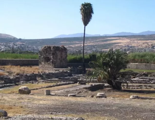
Archaeological remains found at al-Majdal indicate occupation of the site during earlier historical periods. These included remains of walls and arches, column fragments, foundations, and ancient burial sites.
Qal'at Na'la
On the summit of the mountain west of the village stood the remains of a fortress associated with Crusader Magdala, later known as Qal'at Na'la.
Hajar al-Namla
Approximately 1 kilometre south of al-Majdal, near the lakeshore, stood a perforated black stone mentioned by Arab travellers in the late seventeenth and early eighteenth centuries.
According to local belief, the holes had been made by ants, giving the landmark its Arabic name, Hajar al-Namla, or “the Ant Stone.”
The Shrine of Muhammad al-'Ajami
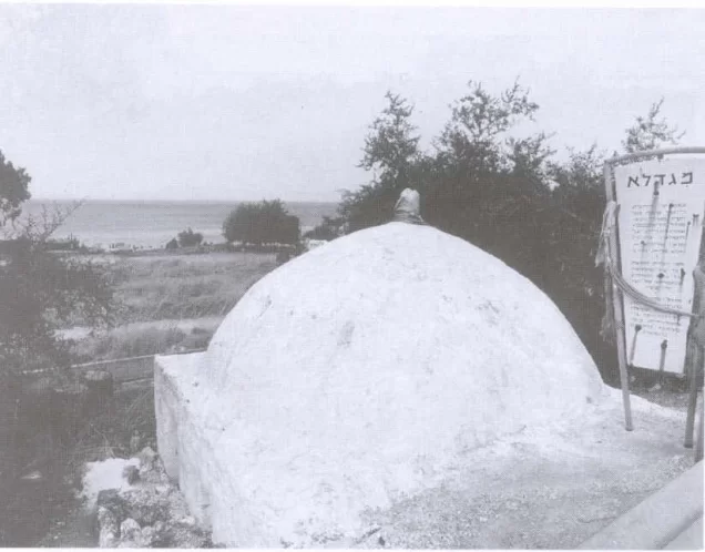
The shrine of Shaykh Muhammad al-'Ajami stood on the northern outskirts of the village, between al-Majdal and the mouth of Wadi al-Hamam. According to Walid Khalidi's documentation, it became the principal surviving landmark of the Palestinian village after the Nakba.
The Nakba and the Displacement of al-Majdal
The Fall of Tiberias
Zionist forces occupied the city of Tiberias on 18 April 1948. The fall of the city intensified the pressure on nearby Palestinian villages, including al-Majdal, which lay only about 4 kilometres away.
22 April 1948
The sources reproduced by Walid Khalidi record 22 April 1948 as the date on which the inhabitants of al-Majdal left the village.
PalQuest reproduces Khalidi's account, which in turn cites Israeli historian Benny Morris, stating that the depopulation was associated partly with a military attack and partly with the impact of the fall of neighbouring Tiberias four days earlier.
This account is included here only as transmitted through the Palestinian source and not through direct reliance on the original Israeli source.
The Force That Occupied the Village
Walid Khalidi considers it probable that Haganah forces based in Tiberias took control of al-Majdal a few days after the fall of the city.
However, the principal Palestinian sources reviewed do not document a named military operation associated with the occupation of al-Majdal, nor do they identify a specific brigade or battalion responsible for entering the village.
It is therefore more precise to state that the inhabitants of al-Majdal left on 22 April 1948 amid a military assault and the collapse of the Palestinian position around Tiberias, and that Haganah forces based in Tiberias probably took control of the village shortly afterward.
Occupation and Depopulation Chronology
- 22 April 1948
Depopulation of the village
The only fact Israeli sources give about the fall of the village is that its inhabitants left on this date; Benny Morris, as cited by Khalidi, attributes their exodus partly to a military attack and partly to the demoralising effect of the fall of neighbouring Tiberias on 18 April.
- A few days after 18 April 1948 (no exact date in the sources)
Final occupation
Khalidi considers it probable that Haganah forces based in Tiberias seized the village a few days after the city fell into their hands; the sources give no exact date for this and no named military operation.
- After 1948
Settlement expansion onto village lands
The settlement of Migdal, established in 1910 on land purchased by Zionists northwest of the village, was expanded to accommodate Jewish immigrants and spread onto village lands; its population grew from 213 in 1948 to 830 in 1983.
Fate of the Population and Buildings
The Palestinian community of al-Majdal was completely displaced during the Nakba and was not permitted to return and re-establish the village.
Most of the village's built-up area was subsequently demolished. Describing al-Majdal as having been literally “completely destroyed,” however, is not entirely accurate because the shrine of Muhammad al-'Ajami survived.
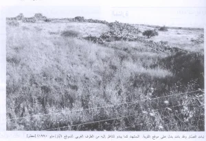
Ruins of the village houses remained scattered across the site alongside trees and vegetation associated with the former village landscape.
Migdal and the Lands of al-Majdal
Migdal
The settlement of Migdal was established in 1910 on land purchased by Zionists, approximately 1.5 kilometres northwest of the Palestinian village site.
It is therefore not accurate to state that Migdal was originally established on the lands of the Palestinian village itself.
After 1948, however, the settlement was expanded to accommodate new Jewish immigrants, and in the course of this expansion its buildings and facilities spread onto parts of al-Majdal's Palestinian lands.
- 1910Migdal
Originally established on purchased land outside the Palestinian village site; expanded after 1948 onto parts of al-Majdal's lands
The Site of al-Majdal After the Nakba
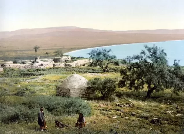
According to the field documentation used by Walid Khalidi, rubble from the village buildings was scattered throughout the site, together with Christ's-thorn and a small number of palm and olive trees.
The shrine of Muhammad al-'Ajami was the principal surviving landmark. It was a low, square stone structure topped by a dome that had formerly been whitewashed.
The surrounding lands were subsequently used for cultivation.
This description reflects the condition of the site at the time of the field documentation relied upon by Walid Khalidi and should not necessarily be interpreted as a comprehensive field survey updated to 2026.
Sources
- PalQuest – Interactive Encyclopedia of the Palestine Question: al-Majdal.
- PalQuest: al-Majdal.
- Palestine Remembered: al-Majdal, Tiberias District.
- Palestine Remembered: al-Majdal.
- Government of Palestine, Village Statistics 1945, as republished by Sami Hadawi and Palestine Remembered.
- Walid Khalidi, All That Remains, entry on al-Majdal.
- Government of Palestine, Census of Palestine, 1931.
Photo gallery






Photos from the village's people
Photos sent in by visitors and published after review.
Add a photo of this village
Log in to add photos of this village.
Other villages from Tiberias

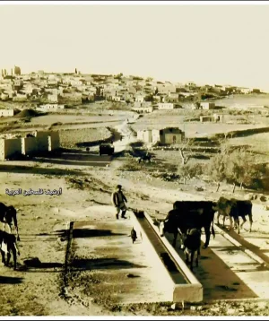
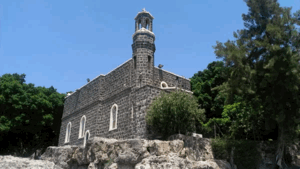
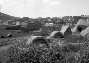
More from the archive

 Download Our Palestine App
The whole archive in the palm of your hand: depopulated villages, the Nakba, the massacres and Al-Aqsa — free, with no ads to erase the story.
Download Our Palestine App
The whole archive in the palm of your hand: depopulated villages, the Nakba, the massacres and Al-Aqsa — free, with no ads to erase the story.



Comments
No comments yet — be the first to write one.
Add your comment
Name and email are optional. Comments appear after review.