
The depopulated village of Al-Nuqayb / District of Tiberias

Al-Nuqayb
About the depopulated village of Al-Nuqayb
- District
- Tiberias
- Date Al-Nuqayb was occupied
- 10 June 1967
- Population in 1948
- 370
- Who defended the village
- Syrian Army
- Distance from the governorate centre
- 10 (km) East (across the lake) of Tiberias
- Elevation above sea level
- -200 m
- Cause of displacement
- Expulsion by Zionist troops
- Extent of destruction
- al-Nuqayb was completely defaced
- Ethnic cleansing
- al-Nuqayb inhabitants were completely ethnically cleansed.
- Settlements built on the land of Al-Nuqayb before 1948
- Ein Gev
Hover a dot to read the village name, or click to open its card.
Borders of the depopulated village of Al-Nuqayb
al-Nuqayb – Tiberias Subdistrict
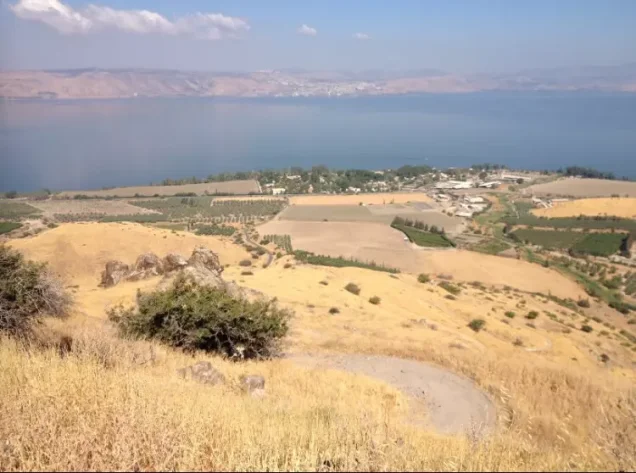
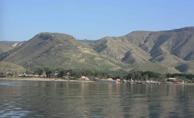
Al-Nuqayb, also rendered al-Naqib, was a Palestinian village in the Tiberias subdistrict on the eastern shore of Lake Tiberias. It lay approximately 10 km east of the city of Tiberias and about 200 meters below sea level. The Golan Heights rose to its east, while the Mandatory Palestine–Syria frontier was only about 1.5 km away.
Al-Nuqayb differs from many depopulated Palestinian villages because its displacement cannot be reduced to a single event in 1948. Haganah forces were already controlling the village site by 15 May 1948, but inhabitants remained or returned during the following years. Under the 1949 Syrian–Israeli Armistice Agreement, al-Nuqayb fell within the demilitarized zone, and Palestinian oral-history documentation records an Arab community at the site until the June 1967 war.
Location of al-Nuqayb
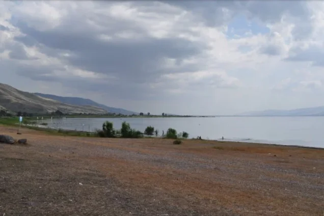
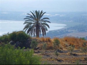
The village stood on relatively level ground along the eastern shore of Lake Tiberias. The city of Tiberias could be seen across the lake to the west, while the Golan Heights dominated the landscape to the east.
Wadi al-Muzaffar emptied into the lake approximately one kilometer north of the village site, while the deeper Wadi Samakh lay a few kilometers farther north.
Palestinian local documentation describes its approximate surroundings as follows:
| Direction | Village / Area |
|---|---|
| North and northeast | Syrian lands, including the area of al-Kursi |
| East and southeast | Syrian lands and the Golan Heights |
| South | Lands of the Palestinian village of al-Samra |
| West | Lake Tiberias, with the city of Tiberias across the lake |
Name and Origins of the Population
Walid Khalidi associates the name al-Nuqayb with its inhabitants, Arab al-Nuqayb, who were of Bedouin origin. Palestinian oral-history sources also use the names Arab al-Ruqaybat and al-Nuqayb al-'Arabiyya in discussing the village community.
A separate oral tradition associates the name with a local spring whose water was said to drip or “percolate.” Because this explanation rests on community memory, Khalidi's association of the village name with Arab al-Nuqayb remains the more clearly documented historical explanation.
Land Ownership before the Mandate Period
In the 1880s, Baha'u'llah, leader of the Babi movement that later developed into the Baha'i faith, acquired approximately 13,000 dunums associated with al-Nuqayb.
The Palestinian inhabitants continued cultivating the lands as tenants until at least the 1920s. The Baha'is subsequently sold most of the property to the Jewish National Fund while retaining approximately 200 dunums.
This history makes it necessary to distinguish between the Palestinian population that lived in and cultivated al-Nuqayb and the legal land-ownership classifications that had changed substantially before 1948.
Built Environment
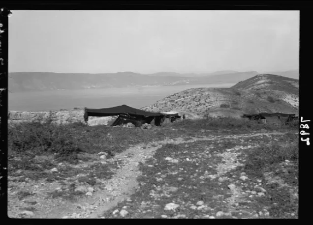
Al-Nuqayb had a roughly rectangular layout, but its houses were dispersed along the lakeshore rather than concentrated in a tightly packed village core.
Some residents continued living in tents, while others built houses of stone and mud, stone and cement, or concrete.
In the 1944/45 land statistics, approximately 30 dunums in the Arab ownership category were classified as built-up land.
Population of al-Nuqayb
- 1922103Official Census of Palestine; all enumerated inhabitants were Muslims
- 1931287Official census: 281 Muslims and 6 Baha'is, living in 60 occupied houses
- 1944/45 – al-Nuqayb320Within the combined statistical unit “'Ein Gev (Nuqeib)”; the official note specifies 310 Muslims and 10 “others” in Nuqeib
- 1944/45 – 'Ein Gev420 JewsPopulation of the Jewish settlement within the same statistical unit
- 1944/45 – combined unit740320 in al-Nuqayb plus 420 in 'Ein Gev; not the population of the Palestinian village alone
- 1948 – al-Nuqayb371Later estimate published by Palestine Remembered; not an official census
- 19982,280 refugees and descendantsLater demographic estimate published by Palestine Remembered
The figure of 740 must therefore not be presented as the Palestinian population of al-Nuqayb in 1945. It is the total for a statistical unit that also included the Jewish settlement of 'Ein Gev.
Number of Houses
- 193160Official Census of Palestine
- 194877Later estimate published by Palestine Remembered; not an official census figure
Land Ownership in 1944/45
The official land figures also require care because the Mandate statistics combined 'Ein Gev and Nuqeib into one unit.
- Arab967 dunums7%
- Jewish9,851 dunums76%
- Public2,192 dunums17%
These are the original official categories and are therefore retained as Arab / Jewish / Public.
The current Arabic Palestine Remembered ownership table contains an obvious display problem that omits the 9,851-dunum Jewish figure from its effective total. This article therefore uses the balanced official figures in Village Statistics and PalQuest rather than reproducing the broken simplified table.
Land Use in 1944/45
The official land-use figures for the combined “'Ein Gev (Nuqeib)” unit were:
- Arab
- Jewish
- Public
- Citrus and bananas62 dunums
- Plantations and irrigable land224 dunums
- Cereals5,819 dunums
- Built-up land151 dunums
- Non-cultivable land6,754 dunums
The figures balance exactly with the official ownership totals.
For the Arab village population specifically, Khalidi records 797 dunums devoted to cereals and 131 dunums used as plantations or irrigable land.
Economic Life in al-Nuqayb
Livestock breeding was one of the principal livelihoods of Arab al-Nuqayb, reflecting the community's Bedouin background and the grazing environment surrounding the village.
The villagers also cultivated cereals and vegetables. In 1944/45, 797 Arab dunums were planted with cereals and 131 dunums were irrigated or used for orchards.
The village's position directly on Lake Tiberias also supported fishing, particularly according to Palestinian oral-history accounts of periods when access to agricultural land became more difficult.
Water
Al-Nuqayb was closely tied to Lake Tiberias and to several nearby wadis and springs. Wadi al-Muzaffar entered the lake north of the village, while hot springs associated with Khirbat al-Hamma lay farther north.
A local oral tradition also recalls a spring within the village lands and connects it with an alternative explanation for the name al-Nuqayb.
Education
The reviewed official sources do not record a separate government school in al-Nuqayb before 1948.
Palestinian oral-history documentation states that boys initially received instruction in reading, arithmetic, and Qur'anic studies from a religious teacher in his home.
By the 1940s, some children from al-Nuqayb reportedly attended the government school at Samakh. This information derives from community oral history rather than from an independent administrative record for a school inside al-Nuqayb.
Religious Life
Although the great majority of the inhabitants were Muslims, Palestinian oral testimony states that no purpose-built mosque existed in the village before 1948.
Shaykh Khalid al-Ruqaybat reportedly gave the call to prayer from the roof of his house, where communal prayers were also held during Ramadan, religious holidays, and other occasions.
Local oral history also records a shrine known as Maqam al-Khidr in the lands between al-Nuqayb and the Syrian frontier. This remains a community tradition rather than an independently verified archaeological identification.
Archaeological Sites
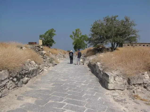
East of the village stood Qal'at al-Hisn, which Khalidi identifies as probably occupying the site of ancient Hippos, also known by its Aramaic name Susitha.
Hippos was one of the cities of the Decapolis during the Roman and Byzantine periods. Archaeological remains included walls, roads, buildings, cisterns, burial grounds, and a church.
The ancient church at Hippos should not be confused with the modern Palestinian village itself; it is evidence of an earlier archaeological settlement and not of an operating church in twentieth-century al-Nuqayb.
'Ein Gev on al-Nuqayb Village Lands
The kibbutz of 'Ein Gev was established in 1937 on al-Nuqayb village lands, approximately 1.5 km south of the village site.
Its establishment was closely connected to the earlier transformation of land ownership after most of the property held by the Baha'is was sold to the Jewish National Fund.
By 1944/45, 'Ein Gev had 420 Jewish residents and was combined with al-Nuqayb in the same statistical unit, which explains why the Palestinian village population must be separated from the settlement population when interpreting the official figures.
Al-Nuqayb during the 1948 War
The exact date on which Haganah forces first entered or established control over al-Nuqayb is not known from the core sources.
On 15 May 1948, as Syrian forces entered Palestine, they attempted to take al-Nuqayb. Khalidi cites a contemporary press report stating that Syrian troops surrounded the position and shelled it from the ground and air.
Khalidi concludes from this that the Haganah must already have controlled al-Nuqayb before the Syrian attack, although the source does not identify the date or military operation through which that control was first established.
Crucially, this was not the final depopulation of the Palestinian village. Khalidi states that its inhabitants remained until the end of the war.
The 1949 Demilitarized Zone
Under the Syrian–Israeli Armistice Agreement of July 1949, al-Nuqayb became part of the demilitarized zone along the frontier, together with several other Palestinian villages including al-Samra and al-Hamma in the Tiberias subdistrict and villages farther north in the Safad subdistrict.
The armistice arrangements were intended to protect civilian inhabitants and their property within the demilitarized zone.
In the following years, however, the continued Palestinian presence in the zone became the subject of intense pressure. Khalidi states that the Israeli authorities sought the removal of the residents for military, economic, and agricultural reasons. Many residents of the demilitarized-zone villages were transferred toward Syria, while some were moved to the Palestinian village of Sha'b near Acre.
Different Accounts of al-Nuqayb after 1949
The sources differ significantly on this period, and the discrepancy should be preserved.
Khalidi summarizes the inhabitants of al-Nuqayb and other demilitarized-zone villages as having been induced or pressured to leave between 1949 and 1956, with most transferred to Syria and some to Sha'b.
Palestinian oral-history documentation based on interviews with Abd al-Hamid Husayn al-Ruqaybat and Mawlud Khalid al-Ruqaybat instead states that people from al-Nuqayb returned after the 1949 armistice, rebuilt a nearby community known as “al-Nuqayb al-'Arabiyya,” and that an Arab population remained at the site until the June 1967 war.
The two accounts need not be entirely irreconcilable: removals may have affected part of the population while another part remained or returned. The available evidence does not provide sufficiently precise numbers for each stage, so al-Nuqayb should not be described as having been permanently emptied in either 1948 or 1956 without qualification.
Al-Nuqayb between 1949 and 1967
According to Palestinian oral history, villagers returning after the armistice built modest mud and adobe houses near the destroyed earlier settlement, and the community became known as al-Nuqayb al-'Arabiyya to distinguish it from 'Ein Gev.
The same oral record states that UNRWA provided assistance and that an elementary school was established in the area in 1951 for children of al-Nuqayb and Palestinian refugees living in nearby communities.
The inhabitants lived in a highly militarized frontier environment marked by recurring Syrian–Israeli clashes and restrictions affecting movement and agriculture.
The June 1967 War and the Final Departure in Local Oral History
Palestinian oral testimony records that the remaining people of al-Nuqayb left on 11 June 1967 after the occupation of the Golan Heights and the fall of Quneitra.
The testimonies state that they moved toward the Yarmuk Valley and that many later settled in and around the al-'A'idin camp at Dar'a and elsewhere in Syria.
This stage is not described in the same detail in Khalidi's village entry and is therefore presented here specifically as Palestinian community oral-history documentation.
Occupation and Displacement Chronology
- Before 15 May 1948
Haganah control of the site
Khalidi infers this from the Syrian assault on al-Nuqayb on 15 May, but the exact date and manner of the first takeover are unknown.
- 15 May 1948
Syrian attack on al-Nuqayb
Syrian forces surrounded and shelled the position in an attempt to capture it.
- Through the end of the 1948 war
Continued Palestinian presence
Khalidi states that the villagers remained, meaning 15 May was not the date of final depopulation.
- July 1949
Al-Nuqayb placed in the demilitarized zone
The village lands were included in the Syrian–Israeli demilitarized zone established by the armistice agreement.
- 1949–1956
Pressure and removals in the demilitarized zone
Khalidi records pressure and transfers toward Syria and Sha'b, but the exact proportion of al-Nuqayb residents removed at each stage is unclear.
- After 1949
Return / continued community of al-Nuqayb al-'Arabiyya
Palestinian oral history records villagers returning after the armistice and rebuilding a small community near the original site.
- 11 June 1967
Final departure according to local oral history
Community testimony states that the remaining villagers left following the occupation of the Golan Heights during the June war.
Military Unit
The village-specific evidence establishes that Haganah forces controlled al-Nuqayb before the Syrian attack of 15 May 1948.
The core Khalidi entry does not independently name the specific brigade or battalion responsible for the initial takeover. No particular formation should therefore be assigned to the occupation of al-Nuqayb without stronger village-specific documentation.
Refugees from al-Nuqayb
Palestine Remembered estimates the Palestinian population of al-Nuqayb in 1948 at approximately 371. This is a later estimate, not an official Mandate census.
It also estimates that refugees from the village and their descendants numbered approximately 2,280 in 1998.
The demographic history of al-Nuqayb is unusually complex because of repeated departure, return, pressure, and displacement between 1948 and 1967. It should therefore not be represented as a one-day depopulation event.
Israeli Settlement on al-Nuqayb Village Lands
| Settlement | Established | Relationship to al-Nuqayb |
|---|---|---|
| 'Ein Gev | 1937 | Established on al-Nuqayb village lands before the Nakba, approximately 1.5 km south of the village site |
Khalidi does not identify a separate post-1948 settlement newly established directly on the original village site.
al-Nuqayb Today
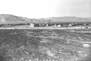
In Walid Khalidi's field description, the village site was fenced and covered with thorny grass and various trees, including Christ's-thorn. Piles of stones and remnants of walls remained visible.
The nearby settlement cultivated part of the surrounding land, while other areas were used for grazing.
This description derives from field research conducted before the publication of All That Remains in 1992 and is not a direct field verification of conditions at al-Nuqayb in 2026.
Later Palestinian community documentation also records the village, Qal'at al-Hisn, former village lands, and memories of the inhabitants. Such material is valuable for tracing the later history of the site but does not by itself constitute a comprehensive contemporary field or cadastral survey.
Sources
- PalQuestPalQuest – al-Nuqayb
- Palestine RememberedPalestine Remembered – al-Nuqayb, Tiberias District
- Palestine RememberedPalestine Remembered – al-Nuqayb entry from Walid Khalidi's All That Remains
- Institute for Palestine StudiesInstitute for Palestine Studies – Walid Khalidi, All That Remains
- palqura.comGovernment of Palestine – Village Statistics, April 1945
- pcbs.gov.psGovernment of Palestine – Census of Palestine 1922, PCBS historical copy
- all4palestine.orgGovernment of Palestine – Census of Palestine 1931
- sabil.meSami Hadawi – Village Statistics 1945: A Classification of Land and Area Ownership in Palestine
- palqura.comPalestinian Villages Encyclopedia – al-Nuqayb population and oral-history documentation
- palqura.comPalestinian Villages Encyclopedia – the June 1967 war and the final departure from al-Nuqayb, based on oral history
- palestinapedia.psPalestinian Encyclopedia – al-Nuqayb
Photo gallery
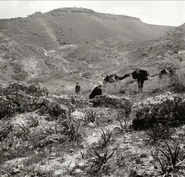
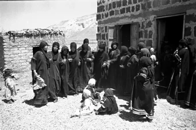


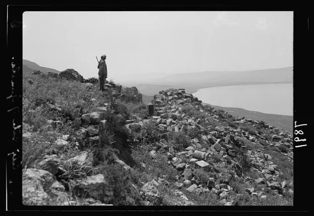
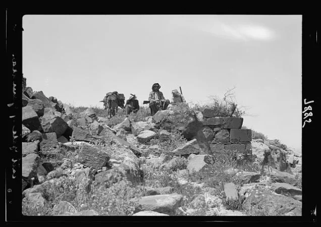


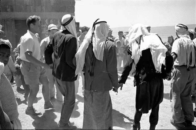
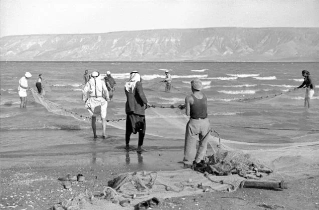
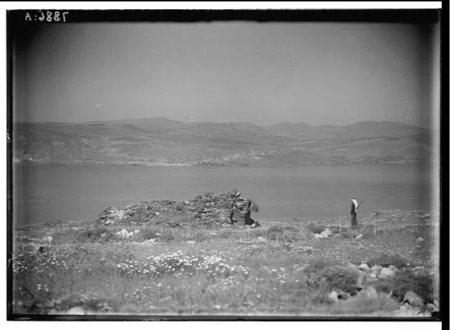
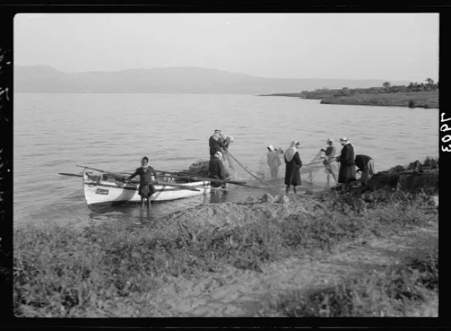


Photos from the village's people
Photos sent in by visitors and published after review.
Add a photo of this village
Log in to add photos of this village.
Other villages from Tiberias
More from the archive


 Download Our Palestine App
The whole archive in the palm of your hand: depopulated villages, the Nakba, the massacres and Al-Aqsa — free, with no ads to erase the story.
Download Our Palestine App
The whole archive in the palm of your hand: depopulated villages, the Nakba, the massacres and Al-Aqsa — free, with no ads to erase the story.



Comments
No comments yet — be the first to write one.
Add your comment
Name and email are optional. Comments appear after review.