
The depopulated village of Jarisha / District of Jaffa

Jarisha
About the depopulated village of Jarisha
- District
- Jaffa
- Date Jarisha was occupied
- 01 May 1948
- Population in 1948
- 220
- Distance from the governorate centre
- 7 (km) Northeast of Jaffa
- Elevation above sea level
- 25 m
- Cause of displacement
- Expulsion by Zionist troops
- Extent of destruction
- Jarisha was completely obliterated.
- Ethnic cleansing
- Jarisha inhabitants were completely ethnically cleansed.
- Settlements built on the built-up area of Jarisha after 1948
- A part of Shikun Vatikim (Ramat Gan)
Hover a dot to read the village name, or click to open its card.
Borders of the depopulated village of Jarisha
Jarisha – Depopulated Palestinian Village of the Jaffa District
Jarisha was a depopulated Palestinian village in the Jaffa District. It stood on a low hill on the central coastal plain, on the southern bank of the al-'Awja River, approximately 7 kilometers northeast of Jaffa, at an average elevation of about 25 meters above sea level.
Jarisha was known for its proximity to the al-'Awja River, its grain mills, cafés, gardens, and recreational areas frequented by residents of Jaffa. Walid Khalidi does not provide a precise date for its depopulation in 1948. He states that the village fell sometime before the end of the British Mandate on 15 May and considers it likely that its population joined the broader exodus triggered by the Irgun's kidnapping of five leaders of neighboring al-Shaykh Muwannis in late March.
Location and Geography
Jarisha stood on a low hill in the central coastal plain on the southern bank of the al-'Awja River, close to Jaffa and to the Palestinian villages surrounding the expanding urban area of Tel Aviv.
It lay approximately 7 kilometers northeast of Jaffa and had an average elevation of about 25 meters above sea level.
The main Jaffa–Haifa highway connected Jarisha with both cities. Tracks and secondary roads also linked it with neighboring al-Shaykh Muwannis, al-Sawalima, al-Jammasin al-Sharqi, al-Jammasin al-Gharbi, Salama, and other communities around Jaffa.
The al-'Awja River was one of the village's defining natural features and played an important role in agriculture and in powering local grain mills.
Name
Walid Khalidi suggests that the name Jarisha may derive from the Arabic verb jarasha, meaning to grind or crush grain, because grain mills stood near the village and along the al-'Awja River.
This is a plausible linguistic interpretation associated with the local economy rather than a conclusively established historical etymology.
Jarisha and Tall Jarisha
The Palestinian village stood approximately 200 meters from Tall Jarisha, an archaeological site that should be distinguished from the modern village itself.
The earliest occupation noted by Khalidi dates to the Early Bronze II period, approximately 2800–2600 BCE.
During the Middle Bronze period, approximately 2000–1500 BCE, the site developed into a fortified town associated with the Hyksos period. A Philistine settlement subsequently occupied the site in the twelfth century BCE.
These archaeological phases demonstrate long-term human occupation of the area but do not mean that the modern village existed continuously and unchanged from those ancient periods.
Ottoman Period
In 1596, Jarisha belonged to the nahiya of Bani Sa'b in the liwa' of Nablus and had an estimated population of approximately 121.
The villagers paid taxes on buffalo, goats, and beehives.
In the late nineteenth century, Jarisha was described as an adobe-built village flanked by an olive grove. It had its own well and a grain mill.
Built Environment and Social Life
In the modern period Jarisha had a generally rectangular layout, and its houses were constructed of cement, stone, and adobe.
The village was noted for its gardens, cafés, recreational spaces, and proximity to the river and wooded areas, attracting visitors from Jaffa.
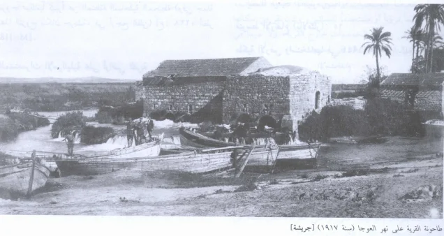
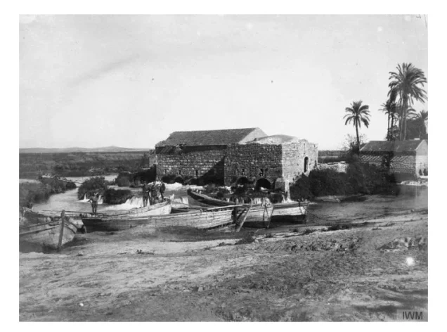
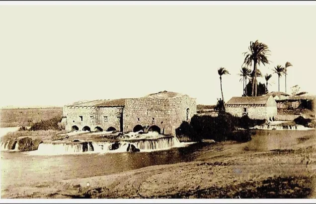
Palestinian memory of the area is also closely associated with the group of water mills known locally as the “Seven Mills,” which formed an important economic and social site along the al-'Awja River.
Population and Houses
Jarisha's inhabitants during the Mandate period were Muslims.
- 1596About 121Historical estimate derived from Ottoman records
- 192257Official Census of Palestine; all inhabitants were Muslims
- 1931183Official census; all inhabitants were Muslims
- 1945190Official statistics; all inhabitants were Palestinian Arab Muslims
- 1948About 220Later demographic estimate, not an official British census
- 1998About 1,354 refugees and descendantsLater estimate published by Palestine Remembered
The official 1931 census recorded 43 inhabited houses in Jarisha.
The figure of approximately 51 houses for 1948 published by Palestine Remembered is a later estimate rather than an official census count.
Education and Religious Institutions
Walid Khalidi and PalQuest do not document an independent formal school in Jarisha, nor does the principal village entry identify a specific mosque by name or location.
No formal school or mosque is therefore added without clearer Palestinian village-specific documentation.
Water and Mills
Jarisha had its own well for domestic water, while the al-'Awja River was important for irrigation.
The flow of the river also powered the grain mills closely associated with the village's name and economy.
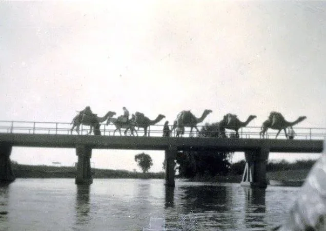
Palestinian historical photographs and local documentation record water mills and a bridge on the al-'Awja, with the mill area becoming one of Jarisha's best-known landmarks before the Nakba.
Economic Life
Jarisha had a diversified economy because of its proximity to Jaffa and to the main coastal highway.
Some residents worked in service industries, while others cultivated fruit, vegetables, citrus, bananas, and irrigated orchards.
The village's recreational character also contributed to its economy, as visitors from Jaffa frequented its cafés, parks, and gardens.
Land Ownership, 1944/45
The total land area of Jarisha was 555 dunams. Under the official Government of Palestine classification, ownership was distributed as follows:
- Arab397 dunums72%
- Jewish93 dunums17%
- Public65 dunums12%
Palestine Remembered presents the same figures using its simplified terminology: 397 dunams “Palestinian,” 93 dunams “Transferred to Zionists,” and 65 dunams “Communal/Public.”
The wording “Transferred to Zionists” should be preserved when reproducing Palestine Remembered's classification rather than automatically replacing it with the official “Jewish” category.
Land Use, 1944/45
- Arab
- Jewish
- Public
- Citrus and bananas379 dunums
- Plantations and irrigable land104 dunums
- Total cultivable/cultivated land483 dunums
- Non-cultivable land68 dunums
- Built-up land4 dunums
- Total non-cultivable and built-up72 dunums
The official table balances exactly: 483 dunams of cultivated or cultivable land plus 72 dunams of built-up and non-cultivable land equal the total village area of 555 dunams.
Palestine Remembered's simplified display requires caution because it places all 68 non-arable dunams in the Palestinian column. The official table shows that 65 of those dunams were Public and only 3 were Arab-owned.
Events Preceding Jarisha's Depopulation
The principal village account does not describe a major independent battle inside Jarisha itself.
Walid Khalidi considers it likely that the departure of Jarisha's inhabitants was closely connected with events in neighboring al-Shaykh Muwannis in late March 1948.
The residents of al-Shaykh Muwannis had reached a truce agreement with the Haganah, but this did not prevent an Irgun group from infiltrating the village and kidnapping five community leaders.
The incident triggered a large-scale flight from the Palestinian coastal communities north of Jaffa, and Khalidi considers Jarisha's inhabitants likely to have been among those who left.
Occupation and Depopulation
Walid Khalidi does not provide a precise day for Jarisha's fall. He states only that it came under Zionist control sometime before the end of the British Mandate on 15 May 1948.
Later Palestinian indexes give more specific but conflicting dates. Falastinuna indexes 1 April, while Palestine Remembered and the Palestinian Ministry of Foreign Affairs use 1 May 1948.
Khalidi's detailed village account does not provide evidence that allows either date to be treated as a securely documented day on which a military force physically entered Jarisha.
The most cautious reconstruction is therefore that the departure of Jarisha's inhabitants most likely began in late March or early April 1948 amid the collapse of Palestinian communities around al-Shaykh Muwannis, and that the village had fallen under Zionist control by the end of the Mandate on 15 May.
The Irgun and the Military Unit
The Irgun's role in the regional displacement should be distinguished from a directly documented attack on Jarisha.
The principal source establishes that the Irgun attacked the leadership of neighboring al-Shaykh Muwannis and kidnapped five of its leaders, triggering a broader exodus that probably included Jarisha.
It does not state that Irgun forces entered Jarisha itself or conducted a separate village-level assault there.
The village-specific account also does not identify a particular Haganah brigade or battalion as the formation that finally occupied Jarisha, nor does it name a specific military operation.
The village-level attacking unit should therefore be recorded as not securely identified in the principal source, while the Irgun's indirect role in generating the regional exodus is documented separately.
Occupation and Depopulation Chronology
- Before late March 1948
Truce agreement at al-Shaykh Muwannis
The villagers of al-Shaykh Muwannis had reached an agreement with the Haganah to maintain a local truce.
- Late March 1948
Kidnapping of al-Shaykh Muwannis leaders
An Irgun group infiltrated the neighboring village and kidnapped five community leaders.
- Late March–April 1948
Beginning of the regional exodus
The incident generated large-scale flight from the surrounding coastal area; Khalidi considers Jarisha's residents likely to have been among those who departed.
- 1 April 1948
Date indexed by one Palestinian source
Used by Falastinuna, but not established as a precise occupation date in Khalidi's detailed account.
- 1 May 1948
Date indexed by other Palestinian sources
Used by Palestine Remembered and the Palestinian Ministry of Foreign Affairs, but not identified by Khalidi as a securely documented military entry date.
- Before 15 May 1948
Latest securely established limit for the village's fall
Khalidi states that Jarisha fell before the end of the British Mandate.
- After 1948
Destruction and urban covering of the site
The village site was gradually covered by roads and Israeli suburban construction.
Israeli Settlements on Village Lands
According to Walid Khalidi and PalQuest, no Israeli settlement was established on Jarisha's village lands.
Ramat Gan, established in 1921, lay very close to the village site. Israeli urban construction subsequently expanded across Jarisha's lands after the Nakba.
Ramat Gan should therefore be distinguished from a settlement originally founded on Jarisha's village lands.
Jarisha Today
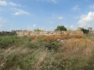
According to the field description published in Walid Khalidi's All That Remains, highways and suburban houses had almost completely covered the former village site.
The village lands became incorporated into the surrounding Israeli urban fabric, while Palestinian memory of Jarisha remained closely associated with the al-'Awja River, the mills, and the nearby archaeological tell.
This description should not be treated as a comprehensive field verification of conditions in 2026. Fieldwork for All That Remains was conducted between 1987 and 1990 and therefore records the site's condition during that survey period.
Sources
- PalQuest – Interactive Encyclopedia of the Palestine Question: Jarisha
- PalQuest – al-Shaykh Muwannis; for the late-March 1948 events connected with the regional exodus
- PalQuest – Abu Kishk; for the broader context of the fall of Palestinian villages north of Jaffa
- Palestine Remembered – Jarisha, Jaffa District
- Palestine Remembered – Walid Khalidi's account of Jarisha
- Palestinian Villages Encyclopedia – Jarisha; supporting Palestinian documentation
- Palestinian Central Bureau of Statistics – Historical Census Archive
- Institute for Palestine Studies – Walid Khalidi, All That Remains
- PalQuest – All That Remains: Methodology
Photo gallery



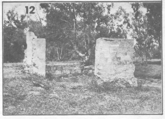
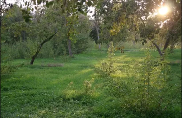

Photos from the village's people
Photos sent in by visitors and published after review.
Add a photo of this village
Log in to add photos of this village.
Other villages from Jaffa
More from the archive
 Download Our Palestine App
The whole archive in the palm of your hand: depopulated villages, the Nakba, the massacres and Al-Aqsa — free, with no ads to erase the story.
Download Our Palestine App
The whole archive in the palm of your hand: depopulated villages, the Nakba, the massacres and Al-Aqsa — free, with no ads to erase the story.



Comments
No comments yet — be the first to write one.
Add your comment
Name and email are optional. Comments appear after review.