
The depopulated village of Saqiya / District of Jaffa

About the depopulated village of Saqiya
- District
- Jaffa
- Date Saqiya was occupied
- 28 April 1948
- Population in 1948
- 1,280
- Military operation
- Operation Bi'ur Hametz
- Brigade that carried it out
- Alexandroni Brigade
- Distance from the governorate centre
- 8.5 (km) East of Jaffa
- Elevation above sea level
- 25 m
- Cause of displacement
- Military assault by Zionist troops
- Extent of destruction
- The village was mostly destroyed with the exception of ten houses remain standing.
- Ethnic cleansing
- Saqiya inhabitants were completely ethnically cleansed.
- Settlements built on the built-up area of Saqiya after 1948
- Ramat Pinkas
Hover a dot to read the village name, or click to open its card.
Borders of the depopulated village of Saqiya
Saqiya – A Depopulated Palestinian Village in the Jaffa Subdistrict
Saqiya was a Palestinian village in the Jaffa Subdistrict, situated approximately 8.5 km east of Jaffa on uneven ground in the central coastal plain, at an average elevation of about 25 meters above sea level.
Paved roads passing through or near the village connected it with Jaffa, Lydda, and neighboring Palestinian villages including al-Khayriyya, Kafr 'Ana, Bayt Dajan, and Yazur.
Saqiya was depopulated during the Nakba and the occupation of Palestine in 1948 in the course of Operation Hametz, an offensive designed to seize the Palestinian villages east of Jaffa and isolate the city from its hinterland. Sources disagree on the exact occupation date, placing it between 25 and 29 April 1948. PalQuest's detailed Operation Hametz chronology identifies the Alexandroni Brigade as the force that attacked and captured Saqiya and al-Khayriyya.
- Subdistrict
- Jaffa
- Distance from Jaffa
- Approximately 8.5 km east
- Elevation
- Approximately 25 m above sea level
- Population, 1944/45
- 1,100
- Estimated population, 1948
- 1,276
- Total land area
- 5,850 dunums
- Date of occupation
- Sources range from 25 to 29 April 1948; Palestinian and AP accounts place it on 27–28 April
- Military operation
- Operation Hametz
- Village-specific military unit
- Alexandroni Brigade
- Brigades participating in Operation Hametz
- Alexandroni, Kiryati, and Giv'ati
- Israeli settlement established on village land
- Or Yehuda, 1950
Location and Geography of Saqiya
Saqiya was built on uneven terrain in the central coastal plain. A network of paved roads passing through or close to the village provided access to Jaffa, Lydda, and surrounding Palestinian communities.
Its position east of Jaffa placed it in an intensively cultivated rural landscape close to the main road toward Lydda and the Lydda airport area.
Neighboring Villages and Localities
Mandate-era maps and Palestine Remembered's village maps indicate the following approximate geographical relationships:
- Northwest: al-Khayriyya.
- East: Kafr 'Ana.
- West and southwest: Yazur.
- South: Bayt Dajan.
- Southeast: the Lydda airport and al-Safiriyya area.
- North and northeast: the map labels Zionist colonies rather than a Palestinian locality called “Qubaniyat.”
These directions describe approximate geographical relationships and should not be treated as replacements for detailed cadastral boundaries.
Name of Saqiya
The Arabic name Saqiya refers to an irrigation channel or a water-lifting device, a name consistent with the agricultural environment of the village.
Saqiya under Ottoman Rule
In 1596, Saqiya was recorded in the nahiya of Ramla in the liwa' of Gaza, with an estimated population of about 270.
The villagers paid taxes on wheat, barley, fruit, sesame, goats, beehives, and vineyards.
In the mid-eighteenth century, the Syrian Sufi traveler al-Bakri al-Siddiqi recorded passing through Saqiya on his way to Jaffa.
Built Form of Saqiya
In the late nineteenth century, a well stood south of the village and the adobe-brick houses were closely clustered.
During the final years of the British Mandate, some concrete houses were built and the village expanded modestly.
The inhabitants were Muslims. A mosque was established late in the Mandate period, and the village also had an elementary school for boys.
Population of Saqiya
The official 1922 Census of Palestine recorded 427 inhabitants in Saqiya, all Muslims.
By the official 1931 census, the population had risen to 663, again all Muslims, living in 142 occupied houses.
The 1944/45 Village Statistics recorded 1,100 Arabs.
Palestine Remembered later estimated the population at 1,276 in 1948 and the number of refugees and their descendants at 7,836 in 1998. These are retrospective estimates rather than official British Mandate census counts.
- 1596Approximately 270Estimate derived from Ottoman tax records
- 1922427Official census; all Muslims
- 1931663Official census; all Muslims
- 1944/451,100Official British Mandate statistics
- 19481,276Later Palestine Remembered estimate, not an official census
- 19987,836 refugeesLater estimate of refugees and their descendants
Number of Houses
- 1931142Occupied houses recorded in the official census
- 1948273Later estimate reported by Palestine Remembered
Education in Saqiya
An elementary school for boys was established in Saqiya in 1936.
The school acquired 16 dunums of village land for agricultural training.
By the mid-1940s, 136 pupils were enrolled.
Land Ownership in Saqiya
The total area of Saqiya in the 1944/45 Village Statistics was 5,850 dunums.
Palestine Remembered presents the simplified ownership categories as follows:
- Palestinian5,151 dunums88%
- Transferred to Zionists447 dunums8%
- Communal/Public252 dunums4%
The official Village Statistics use the original categories Arab, Jewish, and Public: 5,151 dunums were classified as Arab, 447 as Jewish, and 252 as public land.
Land Use in 1944/45
- Arab
- Jewish
- Public
- Citrus and bananas2,515 dunums
- Plantations and irrigable land145 dunums
- Cereals2,888 dunums
- Built-up land30 dunums
- Non-cultivable land272 dunums
Cultivable land totaled 5,548 dunums, approximately 95 percent of the village area: 5,101 Arab dunums and 447 Jewish dunums.
This corrects a significant error in some simplified tables that give only 422 Arab dunums of citrus. The detailed official figure is 2,422 Arab dunums.
The 272 dunums of non-cultivable land also should not be assigned entirely to Palestinian private ownership: 20 dunums were Arab and 252 were public.
Economic Life
Agriculture formed the principal basis of life in Saqiya. Villagers cultivated fruit trees, particularly citrus, as well as cereals and vegetables.
In 1944/45, 2,422 Arab dunums were planted with citrus and bananas, making citrus one of the village's most important commercial crops.
Another 2,534 Arab dunums were devoted to cereals, while plantations and irrigable Arab land covered 145 dunums.
The village's proximity to Jaffa, Lydda, and the major road network facilitated the marketing of its agricultural produce.
Water
A well was recorded south of Saqiya in the late nineteenth century.
The village's intensive citrus and orchard cultivation also depended on groundwater and wells used for irrigation across the central coastal plain.
The Mosque
Saqiya's inhabitants were Muslims, and a mosque was established in the village during the final years of the British Mandate.
The principal source does not provide enough documentation about its construction date, dimensions, or architecture to support more detailed claims.
Occupation and Depopulation of Saqiya in 1948
During the final days of April 1948, Haganah forces launched a major offensive against Palestinian villages east of Jaffa in the context of Operation Hametz.
The precise date of Saqiya's occupation differs between sources. Israeli sources cited by Khalidi place the attack and capture on 25 April 1948.
A Palestinian source and an Associated Press dispatch, however, state that Saqiya fell several days later, on 27–28 April, together with al-Khayriyya and Kafr 'Ana.
PalQuest's detailed Operation Hametz chronology provides a third date. It states that the Haganah launched the main phase of the operation on 29 April 1948 and that Alexandroni units advanced from Kefar Azar, attacked Saqiya and al-Khayriyya, and captured both villages.
Because of this source conflict, no single day should be presented as uncontested. A cautious formulation places Saqiya's fall in the period 27–29 April 1948, while noting that older Israeli sources give 25 April.
Operation Hametz and the Military Unit
Saqiya was one of the Palestinian villages targeted during Operation Hametz. The purpose of the operation was to seize villages along both sides of the railway east of Jaffa, isolate the city from its Palestinian hinterland, and facilitate its fall.
Three Haganah brigades participated in the operation: Alexandroni, Kiryati, and Giv'ati, under the overall command of Dan Epstein, commander of the Alexandroni Brigade.
The operational assignments were distinct. Alexandroni Brigade units attacked Saqiya and al-Khayriyya; Kiryati operated against Salama and the northern suburbs of Jaffa; Giv'ati operated south of the railway toward Yazur and Tall al-Rish.
The most accurate village-specific military-unit entry for Saqiya is therefore Alexandroni Brigade. Carmeli Brigade was not one of the brigades listed for Operation Hametz.
The History of the Haganah, as cited by Khalidi, states that Saqiya and neighboring villages were captured “without a fight,” but provides no detailed account of what happened to the inhabitants during the entry of the forces.
- 25 April 1948
Israeli-source date cited by Khalidi
Attack and capture of Saqiya
- 27–28 April 1948
Palestinian source and Associated Press
Saqiya falls together with al-Khayriyya and Kafr 'Ana
- 29 April 1948
PalQuest Operation Hametz chronology
Alexandroni attacks and captures Saqiya and al-Khayriyya
- Late April 1948
Military operation
Operation Hametz, aimed at isolating Jaffa from its Palestinian hinterland
- Alexandroni Brigade
Village-specific force
Kiryati and Giv'ati participated in other sectors of the wider operation
Israeli Settlements on the Lands of Saqiya
Or Yehuda: Established in 1950 on the lands of Saqiya to settle Jewish immigrants from Iraq and North Africa.
Ramat Pinqas: Established nearby in 1952, but according to Khalidi and PalQuest it was built on land belonging to neighboring al-Khayriyya rather than Saqiya.
Or Yehuda is therefore the settlement that should be listed as having been established on Saqiya's village lands after 1948.
Saqiya Today
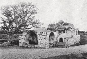
According to the field description published by Walid Khalidi in All That Remains, approximately ten village houses remained standing.
Some were occupied by Jewish families, one was being used as an automobile repair workshop, and others were deserted.
Khalidi described one inhabited house with a large front door and a sloping-roofed garret, a long rectangular house with numerous windows, and a two-storey house whose upper façade was decorated with broad pointed arches.
Ruined walls, adobe foundations, and other debris also remained at the site, together with cactus, sycamore, cypress, Christ's-thorn, and palm trees. Part of the surrounding land was cultivated while settlement construction covered other areas.
This description derives from fieldwork conducted before the publication of All That Remains in 1992 and does not constitute direct field verification of the condition or number of surviving houses in 2026.
Palestine Remembered contains later community photographs and documentation associated with Saqiya, but upload dates do not necessarily establish when photographs were taken, and the principal sources used here do not provide a comprehensive modern field survey capable of confirming the exact condition of the site in 2026.
Sources
- PalQuestPalQuest – Interactive Encyclopedia of the Palestine Question: Saqiya
- PalQuestPalQuest – Operation Hametz
- Palestine RememberedPalestine Remembered – Saqiya, Jaffa
- Palestine RememberedPalestine Remembered – Saqiya entry from All That Remains
- Institute for Palestine StudiesInstitute for Palestine Studies – Walid Khalidi, All That Remains
- pcbs.gov.psGovernment of Palestine – Census of Palestine 1922
- fada.birzeit.eduBirzeit University Repository – Census of Palestine 1931
- maktabatsabil.comGovernment of Palestine – Village Statistics 1945: Jaffa Sub-District, Population and Land Ownership
- palqura.comPalestinian Villages Encyclopedia – Saqiya: local boundaries and historical documentation
Photo gallery
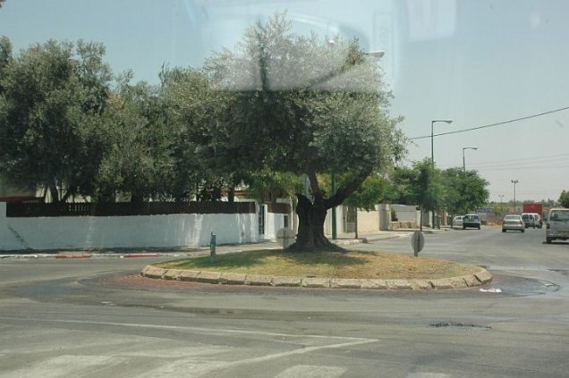


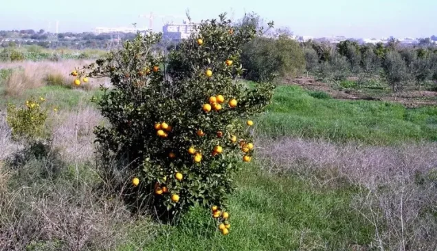

Photos from the village's people
Photos sent in by visitors and published after review.
Add a photo of this village
Log in to add photos of this village.
Other villages from Jaffa
More from the archive
 Download Our Palestine App
The whole archive in the palm of your hand: depopulated villages, the Nakba, the massacres and Al-Aqsa — free, with no ads to erase the story.
Download Our Palestine App
The whole archive in the palm of your hand: depopulated villages, the Nakba, the massacres and Al-Aqsa — free, with no ads to erase the story.



Comments
No comments yet — be the first to write one.
Add your comment
Name and email are optional. Comments appear after review.