
The depopulated village of Al-Dawayima / District of Hebron

Al-Dawayima
About the depopulated village of Al-Dawayima
- District
- Hebron
- Date Al-Dawayima was occupied
- 29 October 1948
- Population in 1948
- 4,300
- Military operation
- Operation Yoav
- Brigade that carried it out
- 89th Battalion of the 8th Brigade
- Who defended the village
- Egyptian Army
- Distance from the governorate centre
- 18 (km) Northwest of Hebron
- Elevation above sea level
- 350 m
- Cause of displacement
- Expulsion by Zionist troops
- Extent of destruction
- al-Dawayima was completely obliterated with the exception of one village house.
- Ethnic cleansing
- al-Dawayima inhabitants were completely ethnically cleansed.
Hover a dot to read the village name, or click to open its card.
Borders of the depopulated village of Al-Dawayima
Al-Dawayima was a depopulated Palestinian village in the Hebron Subdistrict. It lay west of Hebron and possessed 60,585 dunams of land. Published references give its distance from Hebron as either 18 or 24 kilometres; PalQuest's village profile records 18 kilometres, while its dedicated historical study of the massacre gives 24 kilometres.
Its lands bordered those of Idna, Dura, al-Qubayba, Bayt Jibrin, and Arab al-Jabbarat.
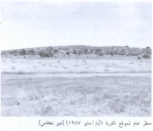
The village had a star-shaped layout and extended along the summit of a broad rocky ridge on the western side of the Hebron Mountains. It overlooked Wadi Qubayba to the north and faced higher mountains to the east.
The inhabitants were Muslim. Al-Dawayima contained several religious shrines, a mosque in the village centre, shops, and an elementary school.
Its houses were constructed from stone and mud. The economy rested principally on rainfed agriculture and animal husbandry.
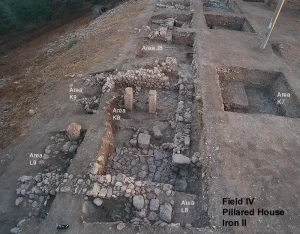
The village was built over an archaeological site and was surrounded by a number of khirbas, indicating a long history of settlement in the area.
| Field | Information |
|---|---|
| District | Hebron |
| Distance from Hebron | Approximately 18 km northwest of the city |
| Average Elevation | Approximately 350 meters above sea level |
| Population in 1931 | 2,688 inhabitants – including Khirbat Khallet Sabah, Khirbat Shi'ab Shuyukh, Khirbat Shi'ab Nazaza, and Khirbat Nasm Jibrin |
| Number of Houses in 1931 | 559 inhabited houses – including the four nearby khirbas listed in the census |
| Population in 1944/1945 | 3,710 inhabitants |
| Estimated Population in 1948 | Approximately 4,304 inhabitants – a later demographic estimate, not an official census |
| Total Land Area in 1945 | 60,585 dunams |
| Attack and Depopulation | 29 October 1948; al-Dawayima was attacked during Operation Yoav. Israeli forces shelled and entered the village, where a massacre was committed, and the assault led to the displacement of the surviving Palestinian population |
| Final Israeli Control | 29 October 1948; Israeli forces occupied the village and the consulted sources do not document its subsequent recovery by Palestinian forces |
| Military Operation | Operation Yoav |
| Military Unit that Attacked al-Dawayima | 89th Battalion of the 8th Brigade, commanded by Yitzhak Sadeh |
| Cause of Depopulation | Direct military assault and the massacre committed during the occupation of the village, accompanied by killing, shelling, expulsion, and the flight of Palestinian civilians during the Nakba |
| Settlement Documented on the Village Lands | Amatzia – established in 1955 on part of the ruins and lands of al-Dawayima |
Built Environment of al-Dawayima
The village's star-shaped plan allowed construction to expand in every direction, particularly toward the northeast and northwest along the roads connecting it with neighbouring villages.
Shops were distributed throughout the neighbourhoods around the village centre. Houses were built of stone and mud and separated by narrow paths and alleys. The oldest houses stood in closely grouped clusters, each sharing a hawsh: a large communal courtyard where women carried out domestic work, children played, and families gathered in the evenings and on special occasions. As the village expanded, residents built larger houses beyond the old centre. These newer buildings were made of whitewashed stone; some had thick stone walls known locally as jidari, from the Arabic word jidar, meaning “wall.” Unlike the older clusters, they generally stood apart and did not share courtyards.
The internal arrangement of the newer houses nevertheless resembled that of the older dwellings. Each typically had two levels: an upper floor for the family and a lower floor for livestock. Homes belonging to wealthier villagers had their own spacious courtyards, guest and sleeping rooms, storage rooms, and animal stables.
Education in al-Dawayima
Al-Dawayima had an elementary school that opened in 1937.
Economic Life in al-Dawayima
Rainfed agriculture formed the basis of the village economy. The principal crops included wheat, barley, maize, vegetables, figs, and grapes. According to the official 1944/45 land-use figures, 29,191 dunams were devoted to cereal cultivation and 1,206 dunams were irrigated or used for orchards. The figure of 21,191 dunams found in some narrative accounts is inconsistent with the official table and its cultivable-land total. Oaks, Palestine buckthorn, and other trees grew in the rugged terrain surrounding the village.
Animal husbandry was likewise important. Al-Dawayima had twenty-seven clans, or hamulas, each reportedly owning an average of 200 to 300 goats or sheep, together with some camels and cattle. The villagers grazed their animals over extensive uncultivated lands. They also spun fibre and wove tents and sacks for storing grain, tanned animal hides, and produced baskets for sale. The village had approximately thirty to fifty small shops, ten butcher shops, and two grain mills.
The local economy gained further momentum in 1944 with the establishment of a weekly Friday market. It attracted people from nearby villages and towns, including Bayt Jibrin, Hebron, and Gaza, who traded crops, clothing, baked goods, and other merchandise. The market was held on the village threshing floor and was known as Suq al-Barrayn, “the market of the two terrains,” because villagers understood it to bring together the commerce of the mountains and the plains.
Land Ownership in al-Dawayima
- Palestinian ownership60,560 dunums100%
- Jewish ownership0 dunums0%
- Public land25 dunums<1%
* One dunam equals approximately 1,000 square metres.
Land Use in al-Dawayima, 1944/45
- Palestinian ownership (dunams)
- Public land (dunams)
- Irrigated land and orchards1,206 dunums
- Olive cultivation**1,952 dunums
- Cereal cultivation29,191 dunums
- Cultivable land30,397 dunums
- Built-up area179 dunums
- Uncultivated land30,009 dunums
- Total land area60,585 dunums
* One dunam equals approximately 1,000 square metres.
** Olive acreage is a supplementary crop figure and is included within the broader agricultural classifications; it must not be added again to the cultivable-land total.
Population of al-Dawayima
The 1922 census recorded 2,441 inhabitants, all Muslim. The population rose to 2,688 in 1931, living in 559 houses, and to 3,710 in the official 1945 statistics. The latter figures included several nearby khirbas. A later estimate placed the population at approximately 4,304 in 1948. Armed Zionist forces occupied and depopulated the village during Operation Yoav. A figure of 3,358 is sometimes given for the number displaced in 1948, but its basis could not be verified and it is inconsistent with the estimated village population. The number of refugees from al-Dawayima and their descendants was estimated at 26,429 in 1998.
Population Figures for al-Dawayima
- 19222,441
- 19312,688
- 19453,710
- 1948 estimateApproximately 4,304
- Estimated refugees and descendants, 199826,429
* The 1922, 1931, and 1945 figures derive from British Mandate census or statistical records. The 1948 and 1998 figures are later estimates. The 1931 and 1945 totals include several nearby khirbas.
Mosques and Religious Shrines in al-Dawayima
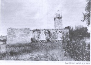
The village had several religious shrines, the most prominent of which was dedicated to a shaykh named Ali. The shrine comprised a large courtyard, several rooms, and a spacious prayer hall, and was surrounded by fig and carob trees and cactuses. It attracted visitors from neighbouring villages. A mosque in the centre of al-Dawayima was maintained by followers of the Khalwatiyya, a Sufi order associated with Shaykh Umar al-Khalwati, who died in 1397. Villagers enlarged and renovated the mosque during the 1930s and added a tall minaret.
Occupation and Depopulation Chronology
- 15 October 1948
Beginning of Operation Yoav
Israeli forces launched Operation Yoav in southern Palestine, expanding military operations and territorial control across the southern coastal plain, the Naqab, and the western approaches to the Hebron hills.
- Second half of October 1948
Military Operations Approach al-Dawayima
Israeli forces occupied a number of nearby Palestinian villages, bringing the fighting increasingly close to al-Dawayima.
- 27 October 1948
Egyptian Withdrawal from Bayt Jibrin
Egyptian forces withdrew from Bayt Jibrin toward Hebron. Palestinian refugees from Bayt Jibrin, al-Qubayba, and other nearby localities moved toward al-Dawayima and surrounding villages.
- Before 29 October 1948
Preparations to Defend the Village
Villagers organized night watches and limited local defenses, while some families began moving women, children, and elderly people away as the attacking forces approached.
- 29 October 1948
Attack on al-Dawayima
The 89th Battalion of the 8th Brigade advanced from the direction of al-Qubayba and attacked the village with armored vehicles, machine guns, and artillery, approaching from the north, south, and west while leaving the eastern side open.
- Midday, 29 October 1948
Entry into the Village
Faced with overwhelming military superiority, the small local defense collapsed, and Israeli forces entered al-Dawayima after shelling houses and firing during their advance.
- 29 October 1948
Al-Dawayima Massacre
A massacre of Palestinian civilians took place in village houses and lanes, in the village mosque, and in a nearby cave. Sources differ over the precise number of victims but document a large civilian death toll.
- 29 October 1948 and afterward
Displacement of the Palestinian Population
The assault and massacre displaced the surviving inhabitants. Many initially moved toward the Hebron hills and nearby villages and caves, while large numbers later became refugees in camps in the West Bank and Jordan.
- 29 October 1948
Final Israeli Control
Al-Dawayima remained under Israeli control after the attack, and its displaced Palestinian inhabitants were not permitted to re-establish the village after the Nakba.
Occupation of al-Dawayima and the Massacre
Al-Dawayima was occupied on 29 October 1948 during the Israeli army's Operation Yoav. The assault was carried out by the 89th Commando Battalion of the 8th Armored Brigade, commanded by Yitzhak Sadeh. Contemporary documentation and later testimony establish that Israeli soldiers killed Palestinian civilians in the village, including women, children, and elderly people, and that the massacre precipitated widespread flight from the surrounding area.
The precise number of victims remains disputed. An Israeli soldier's testimony referred to approximately 80–100 people killed by the initial attacking force. The village mukhtar later reported 455 named victims from al-Dawayima, in addition to people from elsewhere who had sought refuge there. Other contemporary diplomatic, military, and local reports offered estimates ranging from about 70 or 80 to several hundred. Because the site was not subjected to a complete independent investigation and United Nations access was initially restricted, no definitive death toll can be established. Estimates therefore vary substantially between sources.
Israeli Settlement on al-Dawayima's Lands
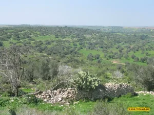
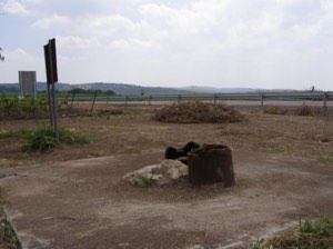
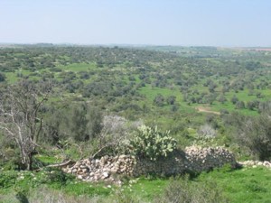
The Israeli moshav of Amatzya was established in 1955 on part of the ruins of al-Dawayima. The village site was later fenced. Stone terraces and the remains of a house survive in its southern section, while the eastern section is occupied by a residential area of the moshav. Cactuses and numerous carob and olive trees continue to grow on the slopes.
Sources
- PalQuestInteractive Encyclopedia of the Palestine Question (PalQuest): al-Dawayima
- PalQuestPalQuest: Al-Dawayima, 29 October 1948
- Institute for Palestine StudiesInstitute for Palestine Studies: Al-Dawayima Massacre, 29 October 1948
- palopenmaps.orgPalestine Open Maps: al-Dawayima
- Palestine RememberedGovernment of Palestine, Village Statistics, April 1945, reproduced by Palestine Remembered
Photo gallery


Photos from the village's people
Photos sent in by visitors and published after review.
Add a photo of this village
Log in to add photos of this village.
Other villages from Hebron
More from the archive
 Download Our Palestine App
The whole archive in the palm of your hand: depopulated villages, the Nakba, the massacres and Al-Aqsa — free, with no ads to erase the story.
Download Our Palestine App
The whole archive in the palm of your hand: depopulated villages, the Nakba, the massacres and Al-Aqsa — free, with no ads to erase the story.



Comments
No comments yet — be the first to write one.
Add your comment
Name and email are optional. Comments appear after review.