
The depopulated village of Zakariyya / District of Hebron

Zakariyya
About the depopulated village of Zakariyya
- District
- Hebron
- Date Zakariyya was occupied
- 23 October 1948
- Population in 1948
- 1,369
- Military operation
- Operation Ha-Har
- Brigade that carried it out
- Probably the Fourth Battalion of the Givati Brigade, according to Khalidi
- Who defended the village
- Egyptian Muslim Brotherhoods, local Palestinian militias and some Arab Liberation Army volunteers
- Distance from the governorate centre
- 25 km northwest of Hebron
- Elevation above sea level
- 275 m
- Cause of displacement
- Expulsion of the inhabitants on the decision of the Israeli authorities, taken in January 1950 and carried out on 9 June 1950, after they had remained in their village since its occupation in October 1948; the sources do not mention the means of expulsion
- Extent of destruction
- Zakariyya was partially destroyed, and the all remaining houses and its mosque became the property of the Jewish National Fund and Israeli government. Some Kurdish or Khazari Jews have taken residence in some of its houses.
- Ethnic cleansing
- Zakariyya was completely ethnically cleansed on June 9th, 1950 based on the orders of Yosef Weitz, a Jewish National Fund (JNF) official.
- Settlements built on the built-up area of Zakariyya after 1948
- Zekharya, established in 1950 on village land, close to the village site
- Refugees' migration routes
- Many of the villagers still live in the Dihaysha and al-'Aroub Refugee Camps in the Occupied Bethlehem and Hebron districts. Few of its orginial residents became internal refugees in Israel, and some were ethnically cleansed to al-Ramla.
Hover a dot to read the village name, or click to open its card.
Borders of the depopulated village of Zakariyya
Zakariyya: A Depopulated Palestinian Village in the Hebron District
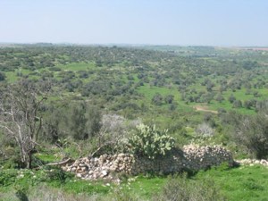
Zakariyya was a depopulated Palestinian village in the Hebron District, located approximately 25 kilometers northwest of the city of Hebron in the western foothills of the Hebron Mountains, at an average elevation of about 275 meters above sea level.
- Subdistrict
- Hebron
- Distance from district center
- 25 km northwest of Hebron
- Average Elevation
- 275 m above sea level
- Population in 1931
- 742
- Number of Houses in 1931
- 189
- Population in 1944/1945
- 1,180
- Estimated Population in 1948
- About 1,369 – a later demographic estimate, not an official census
- Total Land Area in 1945
- 15,320 dunams
- Attack and Depopulation
- A Haganah unit estimated at 100 men besieged the village together with Dayr Aban and Bayt Nattif and fired on it on 17–18 January 1948. Israeli units (probably the Fourth Battalion of the Givati Brigade) then broke through to the village on 23 October 1948 without expelling its inhabitants at the time of occupation; they remained until the village was emptied of them on 9 June 1950, most being transferred to Ramla.
- Final Israeli Control
- 23 October 1948, towards the end of Operations Ha-Har and Yoav; the inhabitants were not expelled at the time of occupation, and the village was emptied of them on 9 June 1950
- Military Operation
- Operation Ha-Har and Operation Yoav (the village was occupied towards the end of both, when Israel's operational areas became contiguous)
- Military Unit
- Probably the Fourth Battalion of the Givati Brigade, according to Khalidi
- Cause of Depopulation
- Expulsion of the inhabitants on the decision of the Israeli authorities, taken in January 1950 and carried out on 9 June 1950, after they had remained in their village since its occupation in October 1948; the sources do not mention the means of expulsion
- Settlements Documented on Village Lands
- Zekharya, established in 1950 on village land, close to the village site
The village was occupied on 23 October 1948 during the Nakba and the occupation of Palestine in 1948, in the context of Operations ha-Har and Yoav. Unlike many neighboring Palestinian villages, however, the inhabitants of Zakariyya were not displaced when the village was occupied. They remained there until 9 June 1950, when the village was emptied of its Palestinian inhabitants and most were transferred to Ramla. The settlement of Zekharya was established on village land in the same year.
Location of Zakariyya
- Zakariyya was located approximately 25 kilometers northwest of Hebron.
- Its average elevation was about 275 meters above sea level.
- The village stood on undulating ground in the western foothills of the Hebron Mountains, underlain by soft white Eocene limestone.
- It stood beside the road linking Bayt Jibrin with the Jerusalem–Jaffa highway and was connected by secondary roads to Bethlehem, 'Ajjur, Dayr al-Dubban, Tall al-Safi, and other Palestinian villages.
Zakariyya Through History
Walid Khalidi associates the village name with the continuity of settlement at the site during the Roman and Byzantine periods, when the locality was known as Caper Zacharia and fell within the administrative jurisdiction of Bayt Jibrin.
In 1596, Zakariyya was a village in the nahiya of Jerusalem within the liwa' of Jerusalem. Ottoman records cited by Khalidi give an estimated population of 259. The inhabitants paid taxes on wheat, barley, and olives, as well as goats and beehives.
The Built Environment of Zakariyya
In the late nineteenth century, Zakariyya stood on a slope above a broad, flat valley and was surrounded by extensive olive groves. The village had a rectangular layout, and its houses were constructed of stone and mud.
The older sections were concentrated in the center and in the northern and southern quarters. The village center contained a mosque, a shrine dedicated to Shaykh Hasan, a busy marketplace, and an elementary school. In later years, construction expanded in all directions, particularly north and south.
Water Supply in Zakariyya
The inhabitants obtained most of their drinking water from two communal wells: al-Saflani well near Wadi 'Ajjur and al-Sarara well north of the village.
Household cisterns and wells were also used to collect rainwater and supplement the village water supply.
Land Ownership in Zakariyya
The total land area recorded for Zakariyya in the 1944/1945 statistics was 15,320 dunums. The Arabic Palestine Remembered table uses the categories “Palestinian,” “Transferred to Zionists,” and “Masha'.” These terms are preserved below to reflect the terminology used by that source.
The Government of Palestine statistics, as reproduced by PalQuest, record 15,311 dunums as Arab-owned and 9 dunums as public land, with no Jewish-owned land recorded within the village lands.
Land Ownership in Zakariyya, 1944/1945, Using the Terminology of Palestine Remembered
- Palestinian15,311 dunums100%
- Transferred to Zionists0 dunums0%
- Masha' / Communal9 dunums<1%
Land Use in Zakariyya in 1944/1945
A total of 7,484 dunums was cultivated or classified as cultivable land, including 6,523 dunums devoted to cereals and 961 dunums irrigated or used for plantations. Of the latter, 440 dunums were planted with olive trees.
Non-cultivable land totaled 7,766 dunums, consisting of 7,757 dunums of Arab land and 9 dunums of public land. The built-up area covered a further 70 dunums.
Land Use in Zakariyya According to the 1944/1945 Statistics
- Arab
- Public
- Cereals6,523 dunums
- Plantations and Irrigable Land961 dunums
- Built-up Area70 dunums
- Non-Cultivable Land7,766 dunums
The 440 dunums planted with olive trees formed part of the 961 dunums classified as plantations and irrigable land and should not be added again as a separate land-use category.
Economic Life in Zakariyya
Rainfed agriculture formed the backbone of the village economy. The principal crops included cereals, beans, fruit, and olives.
Animal husbandry and poultry raising were also important. Villagers grazed sheep and goats on the wild vegetation growing along the surrounding hillsides and wadis.
Population of Zakariyya
Zakariyya had 682 inhabitants in the 1922 census and 742 in the 1931 census. The Government of Palestine's 1944/1945 statistics recorded 1,180 inhabitants, all of them Arab Muslims.
Later estimates, rather than official censuses, are available for the population immediately before occupation and displacement. Palestinian researcher Salman Abu Sitta estimated the population at approximately 1,369, a figure sometimes rounded to about 1,370 in Palestinian sources.
A Palestinian study drawing on Abu Sitta's data estimated the number of people from Zakariyya in 1998 at approximately 8,406, including 8,334 registered with UNRWA.
The figures of 383 inhabitants in 1948 and 2,351 refugees in 1998 currently displayed in the Palestine Remembered statistical table appear inconsistent with the other documented figures for Zakariyya and have therefore not been adopted in this version.
Population of Zakariyya
- 1596259Historical figure based on Ottoman records
- 1922682Official census under the British Mandate
- 1931742Official census under the British Mandate
- 1944/19451,180Government of Palestine statistics
- 19481,369Estimate by Salman Abu Sitta; rounded to 1,370 in some Palestinian sources
- 19988,406Estimate of people originating from the village; 8,334 were reported as registered with UNRWA
Number of Houses in Zakariyya
The 1931 census recorded 189 houses in Zakariyya.
Number of Houses in Zakariyya
- 1931189Official census under the British Mandate
Education and Village Landmarks
The village center included an elementary school, a mosque, the shrine of Shaykh Hasan, and a marketplace. Palestinian local accounts indicate that formal schooling developed during the British Mandate period after an earlier tradition of kuttab education.
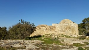
The mosque was one of the principal religious and architectural landmarks of Zakariyya and remained standing after the displacement of the inhabitants.
Archaeological Sites Around Zakariyya
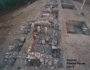
Several archaeological sites were located near the village. Tall Zakariyya stood approximately one kilometer southwest of the village and rose about 117 meters above the plain.
The tell was excavated in 1898 and has been identified by some researchers with the ancient town of Azekah. The plain east of the village has also been associated with the Valley of Elah mentioned in the Biblical account of David and Goliath. These identifications are presented as archaeological and textual interpretations rather than as independently established historical events.
The January 1948 Attack on Zakariyya
Zakariyya came under attack during an early stage of the Nakba in January 1948, in the course of fighting around the bloc of Jewish settlements known as Kfar Etziyon, south of Bethlehem.
According to Walid Khalidi, citing a New York Times report based on Arab sources, a Haganah force estimated at about one hundred men besieged Zakariyya together with Dayr Aban and Bayt Nattif. The action lasted approximately twenty-four hours, and the three villages came under fire on 17 and 18 January 1948.
This attack did not result in the permanent occupation of Zakariyya, which remained outside Israeli control until October.
Operations ha-Har and Yoav
The occupation of Zakariyya took place during the simultaneous Israeli advances of Operations ha-Har and Yoav in southern Palestine in October 1948.
Operation ha-Har lasted from 19 to 24 October and was intended to widen the Israeli-held Jerusalem corridor and connect it with territory occupied in the Hebron hills. Operation Yoav began on 15 October and continued into early November, targeting Egyptian forces and large areas of southern Palestine.
PalQuest lists Zakariyya among the villages affected by Operation ha-Har, while Walid Khalidi describes its occupation as occurring near the end of both Operations ha-Har and Yoav, when their operational areas became contiguous.
The Occupation of Zakariyya on 23 October 1948
Israeli forces occupied Zakariyya on 23 October 1948. Walid Khalidi considers it probable that the force that entered the village was the Fourth Battalion of the Giv'ati Brigade.
The capture of Zakariyya linked Israeli-held areas in the Hebron hills with the Jerusalem corridor.
Palestine Remembered contains an internal inconsistency regarding the unit involved: its statistical summary identifies the Fourth Battalion of the Golani Brigade, while the narrative reproduced from Khalidi identifies the Fourth Battalion of the Giv'ati Brigade. Because PalQuest and All That Remains support the Giv'ati attribution, that identification is used here.
The Villagers Remained After Occupation and Were Displaced in 1950
Unlike many Palestinian communities occupied during Operations ha-Har and Yoav, the inhabitants of Zakariyya were not expelled when the village was occupied in October 1948. They remained in their homes under Israeli rule.
According to information cited by Walid Khalidi, plans to remove the inhabitants emerged by late 1949 but were not immediately implemented. A decision to evacuate the village was taken in January 1950.
On 9 June 1950, Zakariyya was emptied of its Palestinian inhabitants. The sources cited by Khalidi do not specify the precise method used. Most residents were transferred to Ramla, while some may have gone to Jordan.
It is therefore important to distinguish between the occupation of Zakariyya on 23 October 1948 and the final displacement of its inhabitants on 9 June 1950.
Occupation and Depopulation Chronology
- 17–18 January 1948
First attack on the village
In the course of the battles around the Kfar Etziyon settlement bloc south of Bethlehem, a Haganah unit estimated at 100 men besieged Zakariyya, Dayr Aban and Bayt Nattif for about twenty-four hours in a 'punitive expedition' in retaliation for the ambush of a Palmach force nearby, and fired on the three villages on 17 and 18 January, according to the New York Times citing 'Arab sources' as quoted by Khalidi; the newspaper did not report the number of casualties among the villagers.
- 23 October 1948
Final occupation
Towards the end of Operations Ha-Har and Yoav, when Israel's operational areas had become contiguous, units of the Israeli occupation forces (probably the Fourth Battalion of the Givati Brigade) broke through to the village, linking the parts of the Hebron hills they held with the Jerusalem corridor. Unlike most of the inhabitants of villages conquered in these operations, the people of Zakariyya were not expelled at the time of occupation.
- March 1949
Proposal to house new immigrants in the village
The Israeli Interior Ministry official in charge of the Jerusalem subdistrict noted that 'in the village there are many good houses, and it is possible to accommodate in them several hundred new immigrants', according to Morris as cited by Khalidi. Morris describes the health and food situation in the village as 'appalling'.
- Around the end of 1949
Plan to expel the inhabitants
The Israeli military drew up a plan to evict the people of Zakariyya along with those of some seven other villages, mostly in northern Galilee, but 'political objections by the Foreign Ministry (and perhaps others) blocked implementation', according to Morris as cited by Khalidi.
- January 1950
Decision to expel the inhabitants
Israeli Prime Minister David Ben-Gurion met Foreign Minister Moshe Sharett and Jewish National Fund official Yosef Weitz, and they decided to evict the inhabitants of Zakariyya '[but] without coercion', according to Morris as cited by Khalidi.
- 9 June 1950
Expulsion of the inhabitants
Zakariyya was emptied of its inhabitants; the sources do not state the means of expulsion. Most were transferred to Ramla, and some possibly went to Jordan.
- 1950
Settlement on village lands
The settlement of Zekharya was established on village land, close to the village site.
Settlement Established on the Lands of Zakariyya
In 1950, the settlement of Zekharya was established on the lands of the Palestinian village, close to the original village site.
- Zekharya: established in 1950 on the lands of Zakariyya near the village site.
The Site of Zakariyya After the Nakba
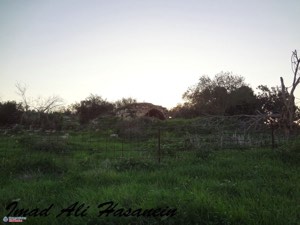
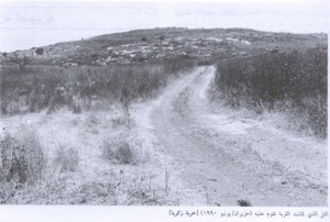
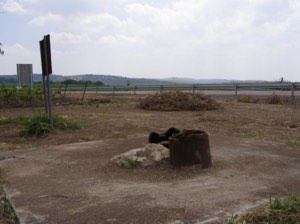
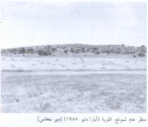
According to Walid Khalidi's field description, the mosque and a number of village houses remained standing. Some houses were deserted, while others were occupied by Jewish residents. Large areas of the site were covered with wild vegetation.
The mosque was described as being in a state of serious neglect, with vegetation growing over sections of its walls and roof and across the surrounding ground. Khalidi also recorded an Israeli flag placed on its minaret.
A more recent Palestinian heritage source reports that the mosque remains standing in poor condition and that barbed wire has been placed around it, restricting access.
Parts of the surrounding village lands continue to be cultivated. The survival of the mosque and several houses means that descriptions of Zakariyya as having been completely destroyed are inaccurate.
Sources
- PalQuestPalQuest – Interactive Encyclopedia of the Palestine Question: Zakariyya
- PalQuestPalQuest – Interactive Encyclopedia of the Palestine Question: Operation ha-Har
- PalQuestPalQuest – Interactive Encyclopedia of the Palestine Question: Operation Yoav
- Institute for Palestine StudiesInstitute for Palestine Studies: Walid Khalidi, All That Remains
- Palestine RememberedPalestine Remembered: Zakariyya – Hebron District
- darifta.psAl-Israa Magazine, Palestinian Dar al-Ifta: study on Zakariyya including demographic estimates based on Salman Abu Sitta
- palturath.comPalestinian Heritage Encyclopedia: Zakariyya Mosque
Photo gallery


Photos from the village's people
Photos sent in by visitors and published after review.
Add a photo of this village
Log in to add photos of this village.
Other villages from Hebron
More from the archive
 Download Our Palestine App
The whole archive in the palm of your hand: depopulated villages, the Nakba, the massacres and Al-Aqsa — free, with no ads to erase the story.
Download Our Palestine App
The whole archive in the palm of your hand: depopulated villages, the Nakba, the massacres and Al-Aqsa — free, with no ads to erase the story.



Comments
No comments yet — be the first to write one.
Add your comment
Name and email are optional. Comments appear after review.