
The depopulated village of Kuwaykat / District of Akka (Acre)
Subdistrict: Acre
Estimated population of Kuwaykat in 1948: 1,218
Date of occupation and depopulation: Night of 9–10 July 1948
Military units: Carmeli Brigade and Sheva‘ (Seventh) Brigade
Israeli settlement established on Kuwaykat’s lands after 1948: Kibbutz ha-Bonim, established in January 1949 and later renamed Beyt ha-Emeq
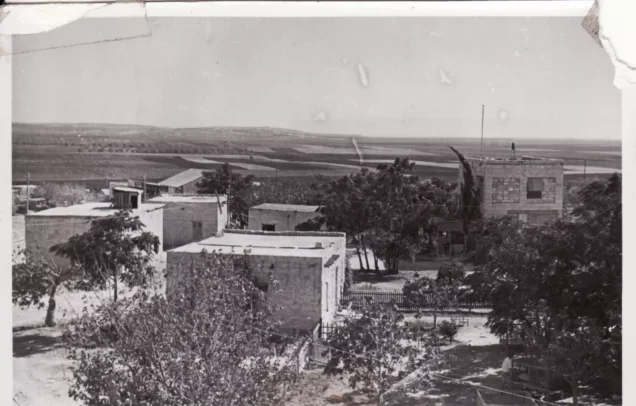
Kuwaykat was a Palestinian village situated approximately 9 km northeast of Acre, on a slightly elevated hill at the eastern edge of the Acre plain. Secondary roads connected it with the Acre–Safad highway and neighbouring villages. Abu Sinan was among the nearest villages and subsequently became a place of forced refuge for many of Kuwaykat’s displaced inhabitants.
The village stood at an average elevation of approximately 55 metres. Its population was entirely Muslim, and agriculture—particularly the cultivation of cereals, olives, and watermelons—formed the principal basis of the local economy.
The original Arabic text included a paragraph concerning the occupation of Mi‘ar between 15 and 18 July. That passage has been removed because it relates to another Palestinian village and not to the history of Kuwaykat.
Boundaries of Kuwaykat
Kuwaykat was bordered by the following Palestinian villages:
- North and west: al-Ghabisiyya.
- South and southeast: Abu Sinan.
- East and northeast: ‘Amqa.
Kuwaykat: Origin of the Name
According to local oral tradition, the name Kuwaykat was inherited across generations. Ottoman records indicate that the village was known by the same name from at least the mid-sixteenth century. During the Crusader period, the locality was recorded under the name “Coket.”
The Lands of Kuwaykat
Kuwaykat’s lands covered a total of 4,733 dunums, including 65 dunums classified as public land. The 1944/45 village statistics record no Jewish land ownership in the village.
The village possessed some of the most fertile agricultural land in the Acre Subdistrict. Its principal crops were cereals, olives, and watermelons. In 1944/45, approximately 500 dunums were planted with olive trees. In addition to farming, residents raised livestock and poultry and produced dairy products and olive oil.
Land Ownership in Kuwaykat
| Ownership category | Land ownership in dunums* |
|---|---|
| Palestinian Arab-owned | 4,668 |
| Jewish-owned | 0 |
| Public land | 65 |
| Total | 4,733 |
*One dunum is equivalent to approximately 1,000 square metres. “Public land” is the classification used in the official 1944/45 village statistics and should not be confused with private communal ownership.
Land Use in Kuwaykat in 1944/45
| Land-use category | Area in dunums* |
|---|---|
| Irrigated land and orchards | 1,246 |
| Land planted with olive trees, included within irrigated land and orchards | 500 |
| Land planted with cereals | 3,316 |
| Built-up area | 26 |
| Total cultivable land | 4,562 |
| Non-cultivable land | 145 |
*One dunum is equivalent to approximately 1,000 square metres. The 500 dunums planted with olive trees formed part of the 1,246 dunums classified as irrigated land or orchards and should not be added to that figure separately.
Population of Kuwaykat
According to the British census of 1922, Kuwaykat had 604 inhabitants. The population increased to 789 in 1931, when the census recorded 163 inhabited houses. The official estimate for 1945 placed the population at 1,050. A later demographic projection estimated that approximately 1,218 people lived in the village in 1948.
The village’s built-up area expanded as its population grew, reaching 26 dunums by 1944/45.
Population of Kuwaykat
| Year | Population* |
|---|---|
| 1596 | Approximately 300 |
| 1922 | 604 |
| 1931 | 789 |
| 1945 | 1,050 |
| 1948 estimate | 1,218 |
| Estimated number of refugees in 1998 | 7,480 |
*The figures for 1948 and 1998 are later demographic estimates rather than contemporary official census counts. The sixteenth-century figure is derived from Ottoman fiscal records and is also approximate.
Number of Houses in Kuwaykat
| Year | Number of houses |
|---|---|
| 1931 | 163 |
| 1948 estimate | 251 |
*The figure for 1931 comes from the official census, whereas the 1948 figure is a later estimate.
Landmarks of Kuwaykat
The Khan:
Local accounts refer to an inn in the centre of the village known as Khan Kuku. It reportedly had a spacious courtyard and a large gate that was closed at night. According to local tradition, it was probably established during the Ottoman period to accommodate merchants and travellers who stopped in Kuwaykat before continuing to Acre. This description derives primarily from village memory rather than from a surviving administrative record.
The Shrine of al-Qurayshi:
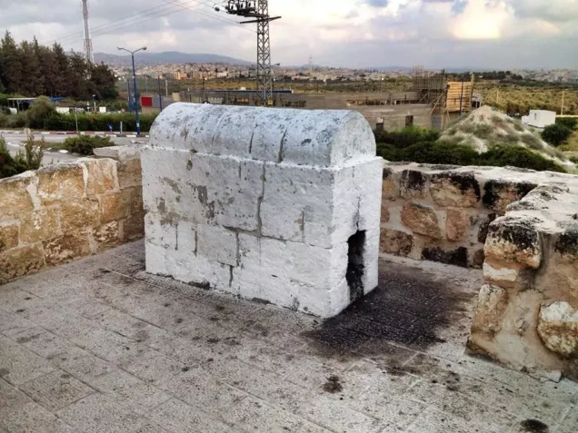
The shrine and tomb of Shaykh Abu Muhammad al-Qurayshi stood southeast of the village. PalQuest identifies him as a Druze religious figure, while local oral tradition describes him as a religious preacher who lived in Kuwaykat and was buried there after his death. The shrine was visited by villagers before the Nakba. The identification and biography of the person buried there therefore vary between written and oral sources.
Archaeological remains in and around Kuwaykat, particularly at Tall Mimas, included ancient water reservoirs, wine presses, and rock-hewn tombs.
Economic Life in Kuwaykat
Kuwaykat’s lands were regarded as among the most fertile in the Acre Subdistrict. Cereals, olives, and watermelons were the village’s principal agricultural products. In 1944/45, 3,316 dunums were devoted to cereals, while 1,246 dunums were irrigated or used for orchards. This latter category included approximately 500 dunums planted with olive trees.
Wells supplied water for domestic use and irrigation. Alongside agriculture, villagers raised livestock and poultry and engaged in dairy and olive-oil production. Kuwaykat’s proximity to Acre also gave its inhabitants access to the city’s commercial, medical, and educational services.
Education in Kuwaykat
Before formal schooling became available, children received elementary instruction from the village shaykh, and oral accounts indicate that literacy was found among many of Kuwaykat’s older inhabitants.
According to the account reproduced in Walid Khalidi’s All That Remains and PalQuest, Kuwaykat had an elementary school constructed during the Ottoman period in 1887. This differs from the local account that dates the opening of the school to 1935. The discrepancy may reflect a later reorganization, reopening, or expansion, but the available sources do not conclusively explain it. Students wishing to continue beyond the grades available in Kuwaykat attended schools in Kafr Yasif and subsequently in Acre.
Occupation and Depopulation of Kuwaykat
The first major attack on Kuwaykat occurred on 11 June 1948, immediately before the first truce came into effect. According to villagers interviewed in later years, the attack was repelled by a local Palestinian militia of approximately sixty men armed with between thirty-five and fifty rifles of various types and one Bren light machine gun.
The Palestinian newspaper Filastin had previously reported an attack on 18–19 January 1948 involving approximately eighty Jewish militiamen. The newspaper stated that this attack was repelled. It also reported another unsuccessful attack during the night of 6–7 February, without providing casualty figures.
Villagers interviewed in 1973 stated that representatives of the Arab Liberation Army visited Kuwaykat during the first truce and advised the community not to evacuate its women and children, arguing that their continued presence would strengthen the resolve of the village militia. This information derives from later oral testimony.
On 9 July 1948, as the first truce came to an end, individuals described by villagers as Arab collaborators reportedly approached the mukhtar and requested the village’s surrender. He refused. Operation Dekel began that night, and Kuwaykat was subjected to heavy artillery bombardment.
One villager later recalled that the inhabitants awoke to an unprecedented din of exploding shells and artillery fire. Panic spread through the village as women screamed, children cried, and many residents fled while still wearing their nightclothes. In the confusion, the wife of Qassim Ahmad Sa‘id reportedly ran carrying a pillow instead of her child.
According to the villagers’ testimony documented in later historical research, two people were killed and two others were wounded in the bombardment. These casualty figures originate from oral testimony and are not independently confirmed by a contemporary casualty register.
The local militia withdrew to a hilly position east of Kuwaykat, where it remained for four days while awaiting reinforcements from the Arab Liberation Army that did not arrive. Many villagers fled to Abu Sinan, Kafr Yasif, and other nearby villages that subsequently surrendered. Those who remained in Kuwaykat, most of whom were elderly, were soon expelled to Kafr Yasif. During the first days following the occupation, some women reportedly returned covertly to retrieve food and clothing.
According to Israeli historian Benny Morris, the forces that captured Kuwaykat belonged to the Carmeli and Sheva‘ (Seventh) brigades. A company commander from the Twenty-First Battalion who participated in the assault subsequently confirmed that the village had been heavily bombarded before the ground attack. Although he stated that he did not know whether the shelling had caused casualties, he acknowledged that it achieved its intended psychological effect by causing non-combatants to flee before the assault began.
Israeli Settlements on Kuwaykat’s Lands
- In January 1949, Kibbutz ha-Bonim was established near the former village site on Kuwaykat’s lands.
- The settlement was subsequently renamed Beyt ha-Emeq.
Oshrat is located near the former village site, but the principal academic sources consulted identify Beyt ha-Emeq—not Oshrat—as the Israeli settlement established on Kuwaykat’s lands.
Segev, Ya‘ad, and Manof were removed from the original list because the consulted sources do not identify them as settlements established on Kuwaykat’s lands.
Kuwaykat Today
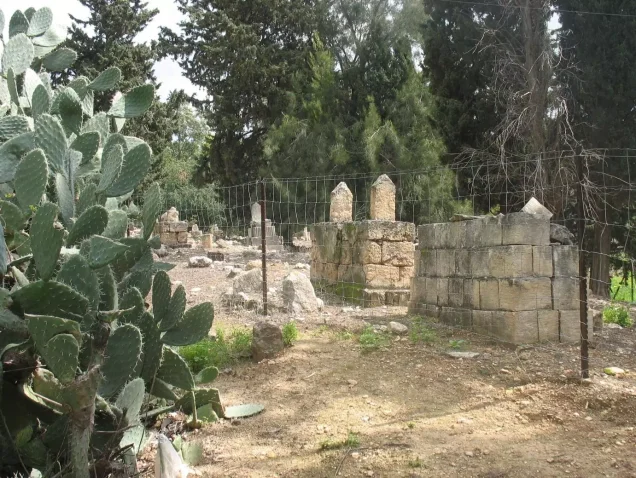
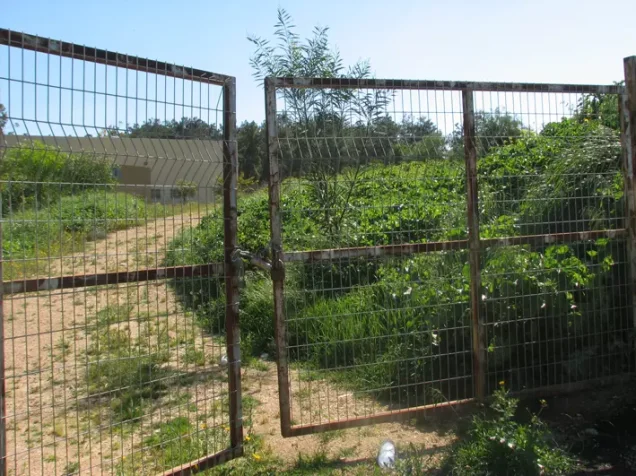
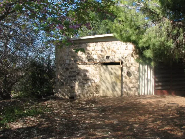
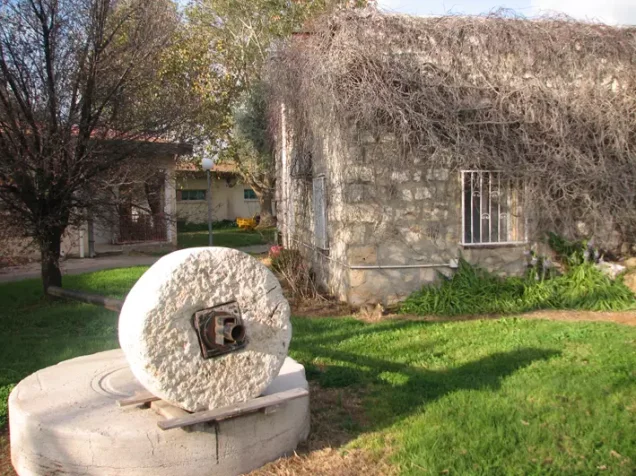
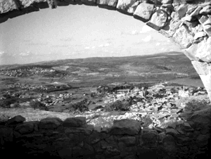
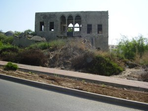
Little remains of Kuwaykat apart from rubble from its houses and the abandoned village cemetery, which has become overgrown with vegetation. Two surviving grave inscriptions identify Hamad ‘Isa al-Hajj and Shaykh Salih Iskandar, the latter of whom died in 1940.
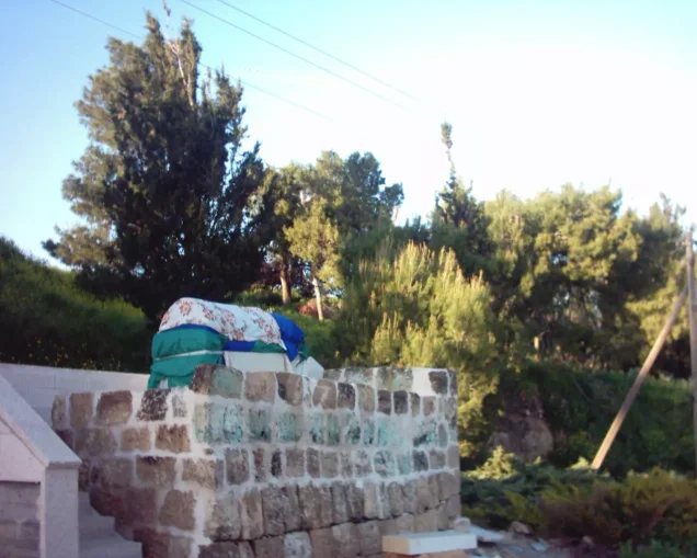
The shrine of Shaykh Abu Muhammad al-Qurayshi remains standing, although its stone base is cracked and deteriorating. Pine and eucalyptus trees have been planted at the site.
Sources
- Interactive Encyclopedia of the Palestine Question: Kuwaykat.
- Walid Khalidi, ed., All That Remains: The Palestinian Villages Occupied and Depopulated by Israel in 1948, Institute for Palestine Studies, 1992.
- Palestine Remembered: Kuwaykat, Acre Subdistrict.
- Historical account of Kuwaykat reproduced by Palestine Remembered.
- Village Statistics of 1945: A Classification of Land and Area Ownership in Palestine.
Photo gallery









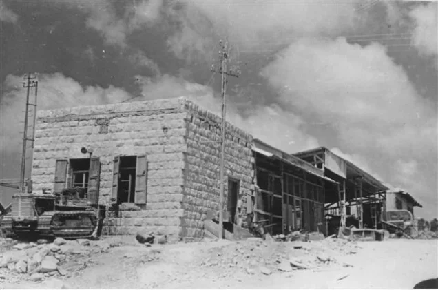
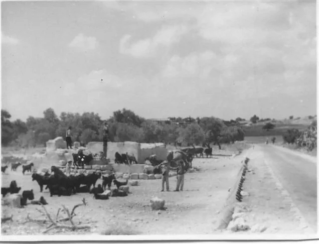


Photos from the village's people
Photos sent in by visitors and published after review.
Add a photo of this village
Log in to add photos of this village.
Other villages from Akka (Acre)
 Download Our Palestine App
The whole archive in the palm of your hand: depopulated villages, the Nakba, the massacres and Al-Aqsa — free, with no ads to erase the story.
Download Our Palestine App
The whole archive in the palm of your hand: depopulated villages, the Nakba, the massacres and Al-Aqsa — free, with no ads to erase the story.



Comments
No comments yet — be the first to write one.
Add your comment
Name and email are optional. Comments appear after review.