
The depopulated village of Al-Sumayriyya / District of Akka (Acre)

Subdistrict: Acre
Estimated population of al-Sumayriyya in 1948: 882
Date of occupation and depopulation: 14 May 1948
Military operation: Operation Ben-Ami
Military force: Carmeli Brigade
Israeli settlements established on al-Sumayriyya’s lands before 1948: None
Israeli settlement established on the former village site after 1948: Lohamei HaGeta’ot
Israeli settlements established on al-Sumayriyya’s lands after 1948: Lohamei HaGeta’ot and Shomrat
Al-Sumayriyya was a depopulated Palestinian village situated approximately 6 kilometres north of Acre, near the Mediterranean coast. The Crusaders referred to it as Someleria.
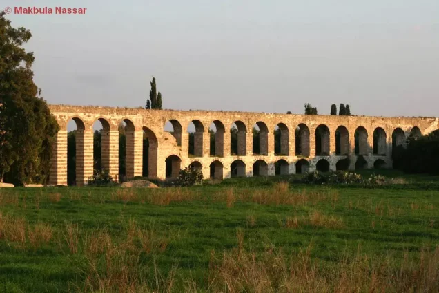
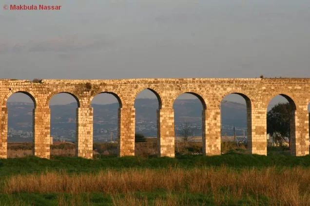
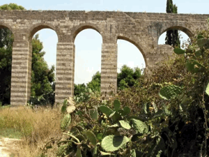
The village stood on a sandstone hill within a plain surrounded by olive and fig trees. South of it were the historic al-Kabri aqueducts, which crossed Wadi al-Majnuna and Tall al-Zuhur. The latter was named for the abundance of wildflowers in the area and was used as a recreational site by residents of Acre and the surrounding villages. The al-Kabri water channel passed west of al-Sumayriyya on its way to Acre.
The coastal highway connected the village with Acre and Ra’s al-Naqura and continued northward toward Beirut.
Al-Sumayriyya had a mosque.
Boundaries of al-Sumayriyya
Al-Sumayriyya was bordered by the following towns, villages, and geographical areas:
- North: al-Mazra‘a.
- West: the Mediterranean Sea.
- South: Acre.
- East: Abu Sinan.
Population and Housing in al-Sumayriyya
The population of al-Sumayriyya was recorded as 392 in the 1931 British Mandate census. In 1945, it was estimated at 760, all of whom were Palestinian Arabs and Muslims. A retrospective demographic projection places the population at approximately 882 in 1948.
Many of the village houses were built of sandstone, while others were constructed of adobe. The 1931 census recorded 92 houses. A later projection estimated that the village would have had approximately 207 houses in 1948.
Population of al-Sumayriyya
| Year | Population |
|---|---|
| Late nineteenth century | Approximately 200–400 |
| 1931 | 392 |
| 1945 | 760 |
| 1948 | Approximately 882 |
| Estimated refugee population in 1998 | 5,414 |
The 1948 population and 1998 refugee figures are retrospective demographic estimates rather than contemporary official census counts.
Number of Houses in al-Sumayriyya
| Year | Number of houses |
|---|---|
| 1931 | 92 |
| 1948 | Approximately 207 |
The 1931 figure is an official census count; the 1948 figure is a later estimate.
Education in al-Sumayriyya
An elementary school for boys was established in al-Sumayriyya in 1943. Approximately 60 pupils were enrolled in the school by 1945.
Economic Life in al-Sumayriyya
Most residents of al-Sumayriyya worked in agriculture, while others were employed in the village’s stone quarries. The principal crops included citrus fruit, cucumbers, melons, wheat, sesame, and other cereals.
According to the 1944/45 village statistics, 7,856 dunams were classified as cultivable. Of this area, 6,854 dunams of Palestinian-owned land and 16 dunams of public land were devoted to cereals, producing a total of 6,870 dunams. A further 632 dunams were planted with citrus and bananas, while 354 dunams were irrigated or used for orchards.
Palestinian residents owned 7,935 dunams. Another 607 dunams were classified as public land, bringing the village total to 8,542 dunams. The built-up area covered 28 dunams.
Land Ownership in al-Sumayriyya, 1944/45
| Ownership category | Area (dunams)* |
|---|---|
| Palestinian ownership | 7,935 |
| Jewish ownership | 0 |
| Public land | 607 |
| Total | 8,542 |
* One dunam equals approximately 1,000 square metres.
Land Use in al-Sumayriyya, 1944/45
| Land-use category | Palestinian ownership (dunams)* | Public land (dunams)* | Total (dunams)* |
|---|---|---|---|
| Citrus and banana cultivation | 632 | 0 | 632 |
| Irrigated land and orchards | 354 | 0 | 354 |
| Olive groves** | 200 | 0 | 200 |
| Cereal cultivation | 6,854 | 16 | 6,870 |
| Built-up area | 28 | 0 | 28 |
| Cultivable land | 7,840 | 16 | 7,856 |
| Uncultivated land | 67 | 591 | 658 |
* One dunam equals approximately 1,000 square metres.
** The olive-grove figure is reported separately and should not be added to the cultivable-land total, because olive land may overlap with the orchard classification.
Archaeological Sites in al-Sumayriyya
The village contained two principal archaeological sites. Tall al-Sumayriyya included carved stones, a mosaic floor, tombs, columns, and stone capitals. The second site, Abu Ataba, contained an Islamic shrine and fragments of pottery.
Occupation and Depopulation of al-Sumayriyya
Al-Sumayriyya was occupied on the morning of 14 May 1948, when the Carmeli Brigade attacked it from the northwest and south during Operation Ben-Ami. The village was subjected to mortar fire while the eastern side was left open, providing a route through which the Palestinian population was driven to flee.
The fall of Haifa and Safad and the military attacks against other Palestinian communities had already undermined security throughout the region. Some residents of al-Sumayriyya therefore left before the final assault.
Accounts of the resistance and casualties differ. Palestinian historian Arif al-Arif states that the village was captured after heavy fighting and that its young defenders were killed after exhausting their ammunition. The History of the Haganah provides a shorter account, stating that forces landed from the sea nearby and proceeded to capture the village.
Eyewitness testimony records that the village militia consisted of approximately 35 men and was surprised by an armoured force approaching from the south. Most women and children had already been evacuated to Acre and neighbouring villages. The men attempted to resist the attack from the northwest before withdrawing, leaving an undetermined number of people dead or wounded.
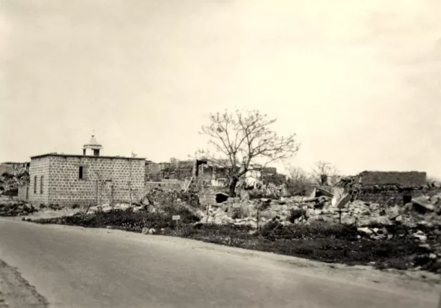
Some residents later returned to bury those killed but reported recovering only one body from the southern part of the village. A person who briefly returned stated that most of al-Sumayriyya had been destroyed. A photograph published later in May 1948 showed extensive damage attributed in its caption to demolition squads.
Because no reliable, independently verified casualty total has been established for al-Sumayriyya, the number of people killed should not be presented as a definitive figure.
Israeli Settlements and Development on the Lands of al-Sumayriyya
By June 1948, the Jewish National Fund had begun levelling al-Sumayriyya with the authorisation of David Ben-Gurion. On 27 January 1949, Lohamei HaGeta’ot was established on the village ruins. Shomrat, founded in 1948, was also established partly on land belonging to al-Sumayriyya.
Regba and Shavei Zion lie near the northern boundaries of al-Sumayriyya’s lands, but the Palestinian reference sources consulted state that they were established on land belonging to the neighbouring Palestinian village of al-Mazra‘a. Later neighbourhoods of these localities may have approached the boundaries of al-Sumayriyya, but their presence on its land could not be verified with sufficient precision.
Bustan HaGalil is generally identified by Walid Khalidi as having been established on land belonging to the depopulated Palestinian village of al-Manshiyya rather than al-Sumayriyya. It is therefore not listed here as a settlement established on al-Sumayriyya’s lands.
Al-Sumayriyya Today
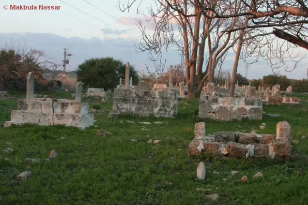
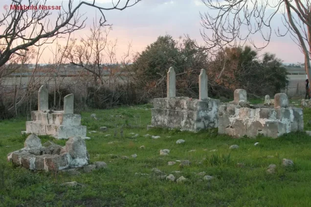
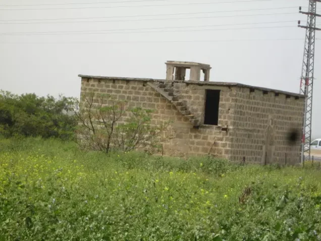
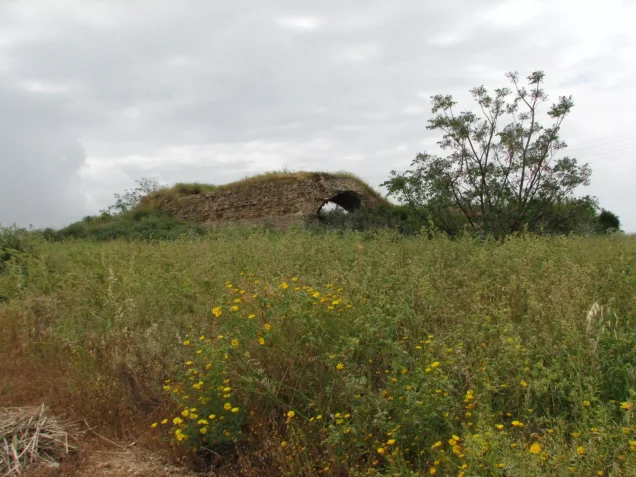
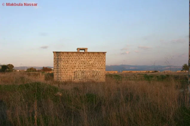
One room of the village mosque remains standing, together with parts of another building, fragments of walls and arches from collapsed houses, and several graves.
The surviving mosque room is a square stone structure with a flat roof supported by girders and crossbeams. Its round-arched entrance is now closed. Most of the former village site is covered by eucalyptus trees, bushes, wild grass, and other vegetation. A cowshed occupies the northern section of the site.
The surrounding agricultural land is cultivated by residents of Regba.
Sources
- PalQuest, “al-Sumayriyya”.
- Palestine Remembered, “al-Sumayriyya — Acre”.
- Walid Khalidi (ed.), All That Remains: The Palestinian Villages Occupied and Depopulated by Israel in 1948, Institute for Palestine Studies, 1992.
- PalQuest, methodology and sources for depopulated Palestinian villages.
- Government of Palestine, Census of Palestine, 1931.
- Government of Palestine, Village Statistics, April 1945.
- Arif al-Arif, al-Nakba: Nakbat Bayt al-Maqdis wa-l-Firdaws al-Mafqud, consulted for the Palestinian account of the fighting.
- Benny Morris, The Birth of the Palestinian Refugee Problem Revisited, consulted for the military configuration of the assault and the subsequent levelling of the village.
Photo gallery




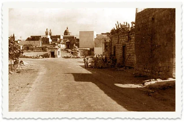
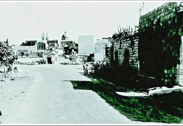
Photos from the village's people
Photos sent in by visitors and published after review.
Add a photo of this village
Log in to add photos of this village.
Other villages from Akka (Acre)

 Download Our Palestine App
The whole archive in the palm of your hand: depopulated villages, the Nakba, the massacres and Al-Aqsa — free, with no ads to erase the story.
Download Our Palestine App
The whole archive in the palm of your hand: depopulated villages, the Nakba, the massacres and Al-Aqsa — free, with no ads to erase the story.



Comments
No comments yet — be the first to write one.
Add your comment
Name and email are optional. Comments appear after review.