
The depopulated village of Al-Ghabisiyya / District of Akka (Acre)

Subdistrict: Acre
Estimated population of al-Ghabisiyya in 1948: approximately 800
Date of occupation: 20–21 May 1948
Military operation: Operation Ben-Ami
Military unit: Carmeli Brigade
Israeli settlements established on the village’s lands before 1948: None
Israeli settlements established on the village’s lands after 1948: Netiv ha-Shayyara
Al-Ghabisiyya
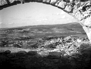
Al-Ghabisiyya was a Palestinian village in the Acre Subdistrict. It stood on a rocky hill rising from the Acre Plain, in the foothills of the western Galilee mountains. The village was approximately 11.5 kilometres north-east of Acre and had an average elevation of about 75 metres above sea level.
Wadi al-Mafshukh passed less than one kilometre north of the village. Al-Ghabisiyya lay immediately south of the road connecting Acre with Tarshiha and other localities in northern Palestine.
Al-Ghabisiyya, Shaykh Dawud and Shaykh Dannun formed a closely connected group of villages. Shaykh Dawud and Shaykh Dannun overlapped in some places, while al-Ghabisiyya stood approximately 500 metres from them. British Mandate land statistics consequently recorded many figures for the three villages as a combined administrative and cadastral unit.
Boundaries of al-Ghabisiyya
Al-Ghabisiyya was situated among the following Palestinian villages and localities:
- To the north: al-Kabri.
- To the north-west: al-Nahr.
- To the west: al-Mazra'a.
- To the south-west: Abu Sinan.
- To the south: 'Amqa.
- To the east: Khirbat Jiddin.
- To the north-east: Tarshiha.

Architecture and Public Buildings in al-Ghabisiyya
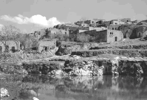
In the late nineteenth century, al-Ghabisiyya was described as a stone-built village situated on the ridge of a hill. It then had approximately 150 residents and was surrounded by olive, fig and pomegranate trees and cultivated gardens.
The village’s houses were later built mainly of reinforced concrete. Some were constructed from stone bonded with mud or cement mortar. Al-Ghabisiyya also had a school founded during the Ottoman period in 1886 and a stone mosque distinguished by its dome, arched doors and windows, and decorative interior arches.
Numerous caves used as burial places were found around the village. These remains have been interpreted as evidence that the area may have contained a sizeable Canaanite settlement, although the archaeological identification is not conclusive.
Economic Life in al-Ghabisiyya
The economy of al-Ghabisiyya was based on agriculture and animal husbandry. Cereals and vegetables were the principal crops, while the villagers also cultivated olives, figs, pomegranates and other fruit trees.
Olives were processed in two animal-powered presses, one in al-Ghabisiyya and the other in Shaykh Dawud. In 1944/45, approximately 300 dunams within al-Ghabisiyya itself were planted with olive trees.
British Mandate statistics combined the agricultural lands of al-Ghabisiyya, Shaykh Dawud and Shaykh Dannun. Within this combined unit, 6,633 dunams were allocated to cereal cultivation, while 1,371 dunams were irrigated or used for orchards.
Land Ownership in al-Ghabisiyya, Shaykh Dawud and Shaykh Dannun
The following figures refer to the combined cadastral lands of the three villages rather than to al-Ghabisiyya alone.
| Ownership category | Land ownership (dunams)* |
|---|---|
| Palestinian ownership | 11,771 |
| Jewish ownership | 0 |
| Public land | 15 |
| Total | 11,786 |
* One dunam equals approximately 1,000 square metres. These figures include al-Ghabisiyya, Shaykh Dawud and Shaykh Dannun.
Land Use in 1945
The following land-use figures likewise cover the combined lands of al-Ghabisiyya, Shaykh Dawud and Shaykh Dannun.
| Land-use category | Palestinian ownership (dunams)* | Public land (dunams)* | Total (dunams)* |
|---|---|---|---|
| Irrigated land and orchards | 1,371 | 0 | 1,371 |
| Cereal cultivation | 6,633 | 0 | 6,633 |
| Built-up area | 58 | 0 | 58 |
| Cultivable land | 8,004 | 0 | 8,004 |
| Uncultivated land | 3,709 | 15 | 3,724 |
* One dunam equals approximately 1,000 square metres. The built-up area and land-use figures include all three villages. The 300 dunams planted with olive trees in al-Ghabisiyya formed part of the broader orchard category.
Population of al-Ghabisiyya
In the late nineteenth century, al-Ghabisiyya had an estimated population of approximately 150. The official 1922 census recorded 427 residents, all Muslims. The population increased to 470 in 1931 and to 690 in 1945. Its projected population in 1948 was approximately 800.
The frequently cited figures of 1,240 residents in 1945 and 1,438 in 1948 represent the combined population of al-Ghabisiyya, Shaykh Dawud and Shaykh Dannun. They should not be presented as the population of al-Ghabisiyya alone.
| Year | Al-Ghabisiyya | Combined total including Shaykh Dawud and Shaykh Dannun |
|---|---|---|
| Late nineteenth-century estimate | Approximately 150 | Not available |
| 1922 | 427 | Not listed as a combined figure |
| 1931 | 470 | 847 |
| 1945 | 690 | 1,240 |
| 1948 estimate | Approximately 800 | Approximately 1,438 |
| Estimated refugees and descendants in 1998 | Not separately established | Approximately 8,833 |
* The 1948 and 1998 figures are demographic estimates rather than contemporaneous census totals.
Number of Houses in al-Ghabisiyya
The 1931 census recorded 125 inhabited houses in al-Ghabisiyya. The combined number for al-Ghabisiyya, Shaykh Dawud and Shaykh Dannun was 206 houses. The figure of 382 houses sometimes assigned to al-Ghabisiyya in 1948 is a later estimate based on the combined population and is not a contemporaneous count of houses in al-Ghabisiyya alone.
| Year | Al-Ghabisiyya | Combined total including Shaykh Dawud and Shaykh Dannun |
|---|---|---|
| 1931 | 125 | 206 |
| 1948 | No verified separate figure | Approximately 382* |
* A retrospective estimate rather than an official census count.
Occupation and Depopulation of al-Ghabisiyya
Al-Ghabisiyya was occupied on 20–21 May 1948 during the concluding phase of Operation Ben-Ami, a Haganah offensive carried out by the Carmeli Brigade in north-western Palestine. The operation sought to occupy Acre and the Palestinian coastal villages extending northwards towards the Lebanese border during Israel’s occupation of Palestine—the Nakba.
According to testimonies collected by Palestinian researcher Nafez Nazzal, the attack approached al-Ghabisiyya from the north and south-east. The attacking force seized a house at the southern edge of the village and used it as a position from which to fire on the village. Residents reported that a number of people were killed or wounded while attempting to escape.
Some inhabitants had already left following the occupation of Acre. The village militia, reportedly comprising approximately twenty poorly armed men, concluded that it could not withstand the attacking force. Many displaced residents initially remained in other Galilee villages. After the occupation of the remaining Galilee region in October 1948, many were forced towards Lebanon.
Not all residents were displaced at the same time. Some remained in or returned to al-Ghabisiyya for a period, but a further expulsion took place in February 1949. The inhabitants of Shaykh Dawud and Shaykh Dannun who had remained in Palestine were later permitted to return, together with a small number of families from al-Ghabisiyya and other displaced villages. Al-Ghabisiyya itself, however, was not repopulated.
Israeli Settlements on the Lands of al-Ghabisiyya
Netiv ha-Shayyara was established in 1950 on the lands of al-Ghabisiyya, approximately 1.25 kilometres west of the former village centre. Its residents cultivated the non-forested agricultural lands surrounding the village site.
Al-Ghabisiyya Today
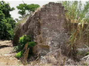
The village mosque is the principal surviving landmark. It is a domed stone building with arched doors and windows and decorative interior arches. The building has remained unused, while vegetation has spread across its roof and the plaster covering its dome has deteriorated.
Ruins of houses, agricultural terraces and sections of the village cemetery remain visible among the cypress trees planted over the village site and part of its lands. Cactus plants also grow across the area. The neighbouring settlement of Netiv ha-Shayyara uses much of the adjacent land that was not planted with forest for agriculture.
Sources
- Interactive Encyclopedia of the Palestine Question: al-Ghabisiyya, Institute for Palestine Studies and the Palestinian Museum.
- Interactive Encyclopedia of the Palestine Question: Operation Ben-Ami.
- Palestine Remembered: al-Ghabisiyya, Acre Subdistrict.
- Palestine Remembered Oral History Project: Interview concerning al-Ghabisiyya.
- Walid Khalidi, ed., All That Remains: The Palestinian Villages Occupied and Depopulated by Israel in 1948, Institute for Palestine Studies, 1992, pp. 13–14.
- Nafez Nazzal, The Palestinian Exodus from Galilee, 1948, Institute for Palestine Studies, 1978, pp. 63–64.
- Government of Palestine, Census of Palestine, 1922.
- Government of Palestine, Census of Palestine, 1931.
- Government of Palestine, Department of Statistics, Village Statistics, April 1945.
Photo gallery


Photos from the village's people
Photos sent in by visitors and published after review.
Add a photo of this village
Log in to add photos of this village.
Other villages from Akka (Acre)

 Download Our Palestine App
The whole archive in the palm of your hand: depopulated villages, the Nakba, the massacres and Al-Aqsa — free, with no ads to erase the story.
Download Our Palestine App
The whole archive in the palm of your hand: depopulated villages, the Nakba, the massacres and Al-Aqsa — free, with no ads to erase the story.



Comments
No comments yet — be the first to write one.
Add your comment
Name and email are optional. Comments appear after review.