
The depopulated village of Tarshiha / District of Akka (Acre)

Subdistrict: Acre
Estimated population of Tarshiha in 1948: Approximately 4,460
Date of occupation and depopulation: 30 October 1948
Military operation: Operation Hiram
Israeli settlements established after 1948 on lands historically recorded jointly for Tarshiha and al-Kabri: Me‘ona, En Ya‘aqov, Ma‘alot, and other settlements whose precise placement between the lands of the two villages cannot always be determined from the available Mandate-era records
Location of Tarshiha
- Tarshiha is located approximately 27 kilometres northeast of Acre.
- The Palestinian town stands on Jabal al-Mujahid in northern Palestine, within the western part of the Galilee. It is approximately 16 kilometres east of the Mediterranean coast and about 25 kilometres south of the Lebanese border.
- Tarshiha is surrounded by the Palestinian localities of Mi‘ilya, Fassuta, Hurfish, al-Buqay‘a, Yanuh, Kafr Sami‘, and the depopulated village of Suhmata. Several Israeli settlements and localities were subsequently established in the surrounding area, including Ma‘alot, Me‘ona, Hosen, En Ya‘aqov, Yehi‘am, and Ga‘aton. However, the surviving Mandate-era records do not always allow the lands of Tarshiha to be separated conclusively from those of neighbouring al-Kabri.
- Tarshiha rises approximately 550–600 metres above sea level, giving it a comparatively mild mountain climate.
- Its location at the intersection of roads linking the surrounding Galilee villages made Tarshiha an important centre for transportation, trade, services, and regional commerce. Its weekly market was traditionally held in the streets of the old town and continues in a different form near the town’s entrance.
Boundaries of Tarshiha
Tarshiha was situated among the following Palestinian villages and localities:
- To the north: Mi‘ilya.
- To the west: Khirbat Jiddin.
- To the south: Yanuh.
- To the east: Suhmata.
- To the northeast: Dayr al-Qasi.

Population of Tarshiha
The British Mandate census of 1922 recorded approximately 1,880 inhabitants in Tarshiha. By 1931, the population had risen to 2,522. The official Village Statistics for 1944/45 recorded 3,840 inhabitants in Tarshiha itself. A second figure of 5,360 found in the same statistical records represents the combined population of Tarshiha and neighbouring al-Kabri and should not be attributed to Tarshiha alone.
On the eve of the Nakba, Tarshiha’s population was estimated at approximately 4,460. The substantially higher figure of 5,700 reported in some local accounts is not supported by the principal Mandate-era statistics and should therefore be treated as an alternative estimate rather than a definitive figure.
Most of Tarshiha’s inhabitants were displaced during Israel’s occupation of Palestine—the Nakba—in October 1948. Some residents remained or later returned, however, allowing a Palestinian community to survive in the town. In 1961, Tarshiha’s Palestinian population was recorded at approximately 1,150. The statement that its present population is 4,500 is outdated and should not be used as a current demographic figure.
Religious Sites and Places of Worship in Tarshiha
Tarshiha contains a number of Islamic and Christian religious sites, many of which remain standing. The principal exception mentioned in local accounts is the al-‘Umari Mosque, of which only the site on which it stood is said to remain.
Islamic Religious Sites
- Jami‘ al-Hamula: Local accounts date this mosque, situated in Harat al-Hamula, to the middle of the eighteenth century.
- The shrine of al-Shaykh Mujahid: Located on Jabal al-Mujahid above the town.
- Al-Jami‘ al-Jadid, or the New Mosque: Built during the rule of Abdullah Pasha, the governor of Acre, around 1840. Its architectural design reflects the style associated with important mosques constructed under the governors of Acre.
- Al-Zawiya al-Shadhiliyya: Traditionally attributed to Shaykh ‘Ali al-Yashruti. It served adherents of the Shadhiliyya-Yashrutiyya Sufi order and received visitors arriving in Tarshiha. Local tradition describes it as one of the earliest zawiyas associated with this branch of the Shadhiliyya order in Palestine.
Christian Religious Sites
- The Melkite Greek Catholic Church: Built around 1865 and regarded as one of the larger churches in the Galilee in terms of its area and architectural scale.
- The Greek Orthodox Church: Constructed as a replacement for an older church. Building work began in 1905 and was completed in 1913, after which religious services were transferred from the old church to the new building.
- The Old Greek Orthodox Church: No longer in regular use. Local accounts date the structure to several centuries ago, although estimates of its precise age vary.
Education in Tarshiha
- In the 1944/45 school year, the boys’ school in Tarshiha provided instruction through the seventh elementary grade, while the girls’ school provided instruction through the sixth grade.
- Education attracted considerable participation in Tarshiha. Local educational records report approximately 350 pupils at the boys’ school in 1937. The first-grade class included more than 60 pupils, while the seventh grade included more than 40.
- By the end of the 1930s, local accounts estimated that more than 70 percent of the town’s adult men could read and write. The girls’ school opened in the late 1920s with three grades and reportedly expanded to five grades by the end of the 1930s.
Economic Life in Tarshiha
- Tarshiha’s lands were mountainous and intersected by several valleys. The inhabitants obtained water for domestic use from springs, pools, and wells. Much of the surrounding land was used for grazing, while cultivable areas were planted with cereals, olives, fruit trees, and other crops.
- Tarshiha was particularly known for cultivating tobacco, which was exported and sold in several areas.
- The town hosted a weekly market attended by residents of villages across northern Palestine and southern Lebanon. This market strengthened Tarshiha’s position as an important regional commercial and service centre.
Land Ownership in Tarshiha and al-Kabri, 1944/45
The final British Mandate land records grouped Tarshiha together with al-Kabri. The following ownership figures therefore represent the combined lands of both Palestinian villages and cannot be attributed exclusively to Tarshiha.
| Ownership category | Land area in dunams* |
|---|---|
| Palestinian ownership | 37,308 |
| Jewish ownership | 90 |
| Public land | 10,030 |
| Total | 47,428 |
* These figures combine the lands of Tarshiha and al-Kabri. One dunam equals approximately 1,000 square metres.
Land Use in Tarshiha and al-Kabri, 1944/45
The following figures also combine the lands of Tarshiha and al-Kabri. The available records do not permit every category to be divided reliably between the two villages.
| Land-use category | Palestinian-owned land (dunams)* | Jewish-owned land (dunams)* | Public land (dunams)* | Total (dunams)* |
|---|---|---|---|---|
| Citrus and bananas | 743 | 0 | 0 | 743 |
| Irrigated land and orchards | 5,278 | 23 | 0 | 5,301 |
| Olive groves* | 4,047 | 0 | 0 | 4,047 |
| Cereal cultivation | 14,056 | 67 | 0 | 14,123 |
| Built-up area | Recorded jointly for Tarshiha and al-Kabri | 252 | ||
| Cultivable land | 20,077 | 90 | 0 | 20,167 |
| Uncultivated land | 16,979 | 0 | 10,030 | 27,009 |
* These figures combine the lands of Tarshiha and al-Kabri. The olive-grove figure is included within the orchard category and should not be added separately to the cultivable-land total. One dunam equals approximately 1,000 square metres.
Population Figures for Tarshiha
| Year | Population* |
|---|---|
| 1596 | Approximately 585 |
| 1922 | 1,880 |
| 1931 | 2,522 |
| 1944/45 | 3,840 |
| 1948 estimate | Approximately 4,460 |
| 1961 | Approximately 1,150 |
* The frequently cited figure of 5,360 for 1944/45 combines the populations of Tarshiha and al-Kabri. Tarshiha’s separately recorded population was 3,840. The 1948 figure is a demographic estimate rather than a census count.
Occupation and Depopulation of Tarshiha
Tarshiha was an important Palestinian centre of resistance in the western Galilee. The town was defended by local Palestinians and members of the Arab Liberation Army. Israel’s assault on the remaining Palestinian-held area of the Upper Galilee was designated Operation Hiram. The operation involved forces drawn from the Seventh, Oded, Golani, and Carmeli brigades and was conducted during the final days of October 1948.
On the afternoon of 28 October 1948, aircraft approached Tarshiha from the northwest. Residents initially believed that they might be Syrian aircraft because Syrian planes had attacked Nahariyya approximately one week earlier. The aircraft instead bombed positions near the company headquarters and artillery emplacements. Artillery shelling began approximately one hour later and continued during the night.
Local accounts state that artillery fire came from several directions, including the area of Jiddin, Tall al-Waqiyya, a nearby settlement, and the direction of the coast. These accounts estimate that approximately 50 shells per hour fell on Tarshiha at certain stages of the bombardment. The Arab Liberation Army’s artillery response was limited and reportedly failed to strike the principal attacking positions.
At approximately five o’clock on the morning of 29 October, aircraft again bombed the town. Local testimony identifies several locations struck during the raid, including Karm Zaytun Abu Rasin, Hakurat al-Raghab, the former Tarshiha police post—which was owned by the mukhtar Shafiq al-Mahmud—and homes belonging to the ‘Abd ‘Umar, Haydar, and al-Hawari families. The exact number and type of bombs described in local accounts cannot be independently confirmed in every detail.
The aerial and artillery bombardment caused civilian casualties and extensive destruction. Academic research published by the Institute for Palestine Studies records that members of at least one family were killed or wounded in the bombing. Estimates of the total number of victims vary between sources.
Tarshiha came under Israeli control on 30 October 1948 during Operation Hiram. Much of its population and the defending forces had already withdrawn under the pressure of the bombardment and advancing military units. Local testimony maintains that Israeli soldiers entered the built-up area only after the majority of the inhabitants and defenders had departed and that they fired into houses while searching for remaining fighters.
Although the town was largely depopulated during the Nakba, Tarshiha was not physically erased in the same manner as many neighbouring Palestinian villages. Some inhabitants remained or subsequently returned, preserving a continuous Palestinian presence in the town despite military rule, land confiscation, and the displacement of most of its original population.
Tarshiha After the Nakba
Tarshiha survives today as a Palestinian town, although the majority of its inhabitants were displaced in October 1948 and prevented from returning. Ma‘alot was established nearby in 1957 and was later administratively joined with Tarshiha under the name Ma‘alot-Tarshiha. This administrative designation did not erase Tarshiha’s distinct Palestinian history, community, or urban identity.
Me‘ona, established in 1949; En Ya‘aqov, established in 1950; and Ma‘alot, established in 1957, lie east of the former village site. Because the last British Mandate map grouped the landholdings of Tarshiha and al-Kabri, the available records do not allow the land occupied by each locality to be assigned conclusively to one of the two Palestinian villages.
Kefar Vradim was established in 1984, primarily on land associated with al-Kabri rather than within Tarshiha’s built-up area. It should therefore not be presented without qualification as a settlement established exclusively on Tarshiha’s land.
The earlier claim that Even Menachem, Kfar Rosenwald, Shtula, and Shomera were established on Tarshiha’s lands is geographically inaccurate. Those localities are associated with lands belonging to other depopulated Palestinian villages nearer the Lebanese border and have therefore not been attributed to Tarshiha in this article.
Sources and References
- Interactive Encyclopedia of the Palestine Question: Operation Hiram
- Institute for Palestine Studies: Resistance and Survival in Central Galilee, July 1948–July 1951
- Nafez Nazzal, The Palestinian Exodus from Galilee, 1948, Institute for Palestine Studies, Beirut, 1978.
- Walid Khalidi, ed., All That Remains: The Palestinian Villages Occupied and Depopulated by Israel in 1948, Institute for Palestine Studies.
- Palestine Open Maps: Tarshiha
- Palestine Remembered: Tarshiha, Acre Subdistrict
- Government of Palestine, Village Statistics, April 1945, population, land-ownership, and land-use tables for Tarshiha and al-Kabri.
Photo gallery
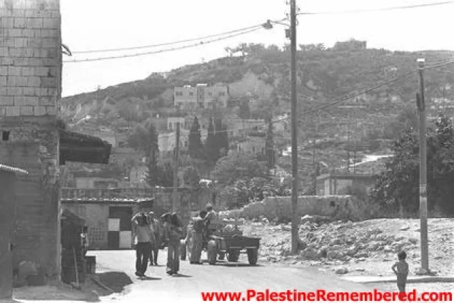
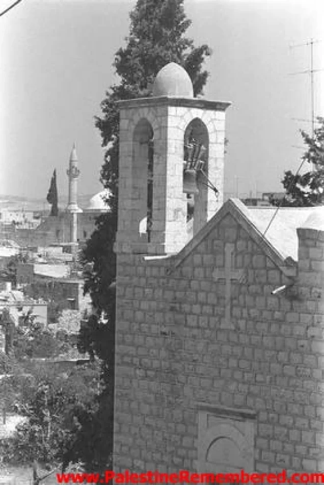
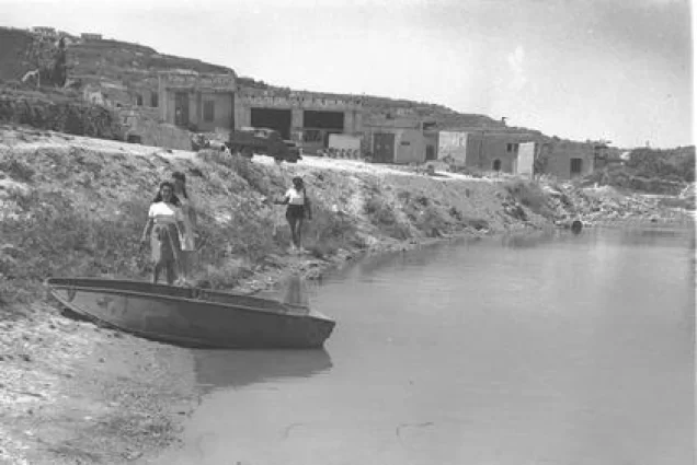
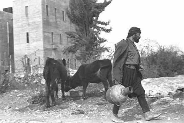

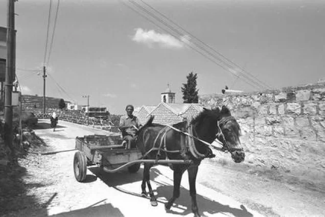
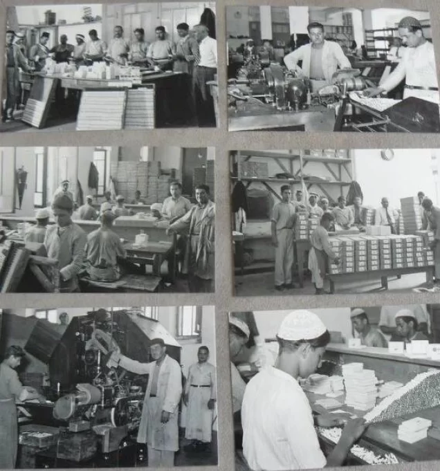
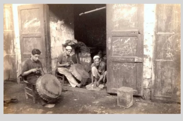
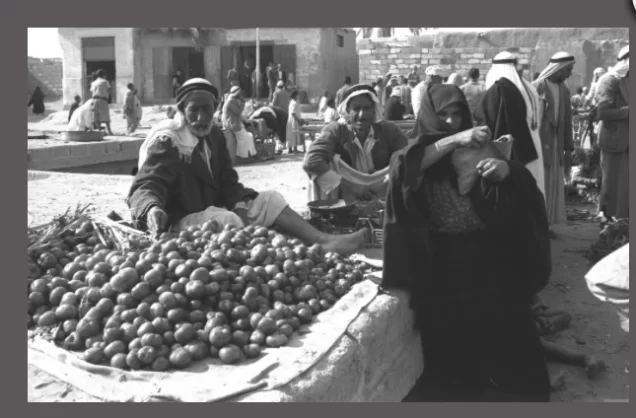
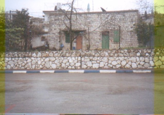
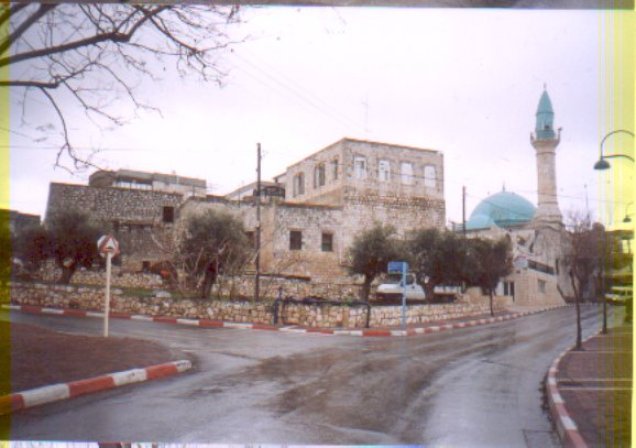
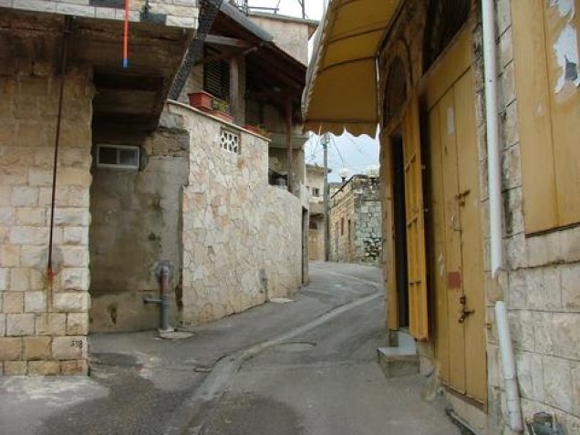
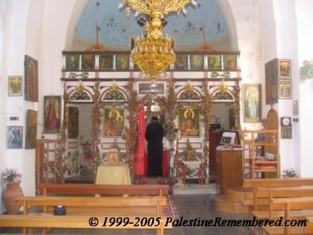
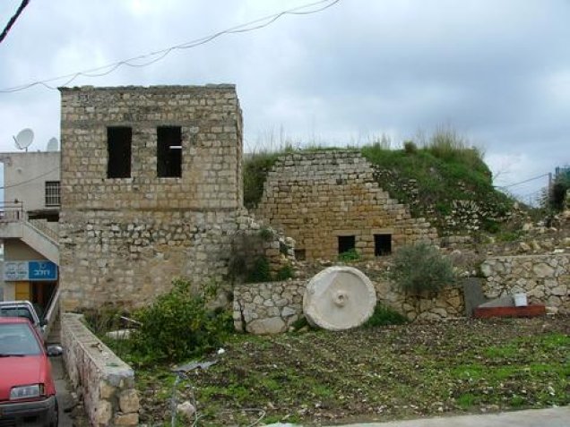

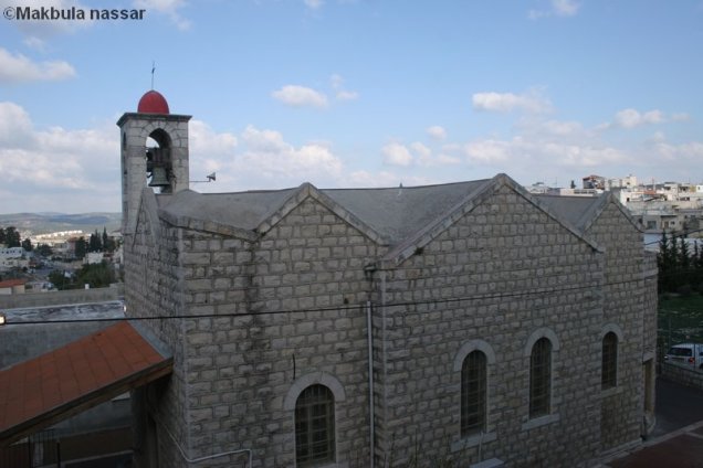

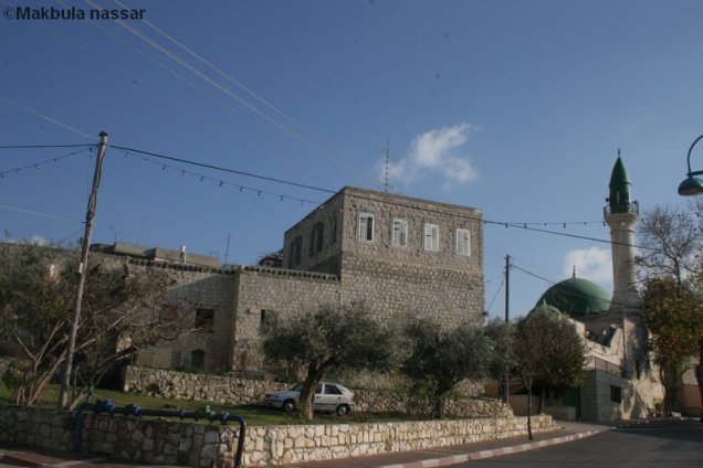
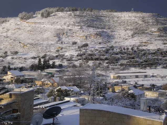
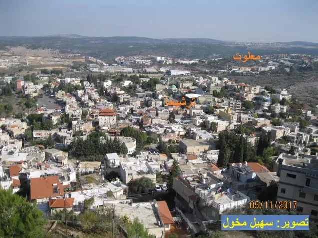
Photos from the village's people
Photos sent in by visitors and published after review.
Add a photo of this village
Log in to add photos of this village.
Other villages from Akka (Acre)
 Download Our Palestine App
The whole archive in the palm of your hand: depopulated villages, the Nakba, the massacres and Al-Aqsa — free, with no ads to erase the story.
Download Our Palestine App
The whole archive in the palm of your hand: depopulated villages, the Nakba, the massacres and Al-Aqsa — free, with no ads to erase the story.



Comments
No comments yet — be the first to write one.
Add your comment
Name and email are optional. Comments appear after review.