
The depopulated village of Al-Kabri / District of Akka (Acre)
Subdistrict: Acre
Estimated population of al-Kabri in 1948: Approximately 1,770
Date of occupation and depopulation: Night of 20–21 May 1948
Occupying military unit: Carmeli Brigade
Israeli settlements established on al-Kabri’s lands before 1948: None
Israeli settlements established on the village site after 1948: Kibbutz Kabri
Overview of al-Kabri
Al-Kabri was a depopulated Palestinian village situated approximately 12.5 kilometres northeast of Acre.
The village belonged administratively to the Acre Subdistrict. Its population was estimated at approximately 1,770 Palestinians on the eve of the Nakba. During Israel’s occupation of Palestine—the Nakba—the village was occupied, its inhabitants were displaced, and most of its buildings were subsequently destroyed.
Al-Kabri stood where the western slopes of the Galilee Mountains met the Acre Plain. Its inhabitants cultivated the surrounding land with fig, olive, pomegranate, mulberry, and apple trees. The village was particularly renowned for its abundant springs. Its population was entirely Muslim, and it contained a mosque and an elementary school for boys. Agriculture and animal husbandry formed the principal foundations of its economy.
The village was built over part of an extensive archaeological site that extended southwest toward the neighbouring villages of al-Nahr and al-Tall. Archaeological evidence indicates that the area was first inhabited around 3200 BCE and remained densely populated until approximately 500 BCE, when the region came under Persian rule.
Boundaries of al-Kabri
Al-Kabri was situated among the following Palestinian villages and localities:
- To the north: al-Bassa.
- To the west: al-Zib.
- To the southwest: Umm al-Faraj.
- To the south: al-Nahr.
- To the east: Mi‘ilya.

Population of al-Kabri
Ottoman records from 1596 listed approximately 70 inhabitants in al-Kabri. Later nineteenth-century estimates varied: the village was reported to have 469 inhabitants in 1872 and approximately 690 inhabitants in the late 1880s. Because these were historical estimates rather than modern censuses, the figures should be treated with caution.
The British Mandate census of 1922 recorded 553 inhabitants, all of whom were Muslims. By the 1931 census, the population had increased to 728—371 males and 357 females—living in 173 houses. The official 1944/45 statistics recorded 1,520 inhabitants. A demographic projection places the population at approximately 1,770 in 1948.
Some later compilations give substantially higher figures of 6,218 inhabitants and 1,477 houses for 1948. These figures are inconsistent with the documented 1931 and 1944/45 records and appear to result from a statistical or transcription error. They have therefore not been presented as established historical facts. The descendant refugee population was estimated at 38,183 in 1998 and 51,621 in 2008, but these are demographic projections rather than contemporaneous census figures.
Economic Life in al-Kabri
Al-Kabri’s economy was based primarily on agriculture and animal husbandry. In 1944/45, the land statistics for al-Kabri and Tarshiha were recorded jointly. The combined figures listed 743 dunams devoted to citrus and bananas, 14,056 dunams of Palestinian-owned land used for cereal cultivation, and 5,278 dunams of Palestinian-owned irrigated land and orchards. Of the orchard area associated with al-Kabri, approximately 540 dunams were planted with olive trees. During the latter part of the British Mandate, some inhabitants also raised cattle.
Because the final British Mandate land records combined al-Kabri and Tarshiha, most agricultural and ownership figures cannot be assigned exclusively to al-Kabri. They are therefore identified below as combined figures rather than being attributed entirely to the village.
Land Ownership in al-Kabri and Tarshiha, 1944/45
| Ownership category | Land area in dunams* |
|---|---|
| Palestinian ownership | 37,308 |
| Jewish ownership | 90 |
| Public land | 10,030 |
| Total | 47,428 |
* These figures combine the lands of al-Kabri and Tarshiha because the final British Mandate land records did not separate the two villages. One dunam equals approximately 1,000 square metres.
Land Use in al-Kabri and Tarshiha, 1944/45
| Land-use category | Palestinian-owned land (dunams)* | Jewish-owned land (dunams)* | Public land (dunams)* | Total (dunams)* |
|---|---|---|---|---|
| Citrus and bananas | 743 | 0 | 0 | 743 |
| Cereal cultivation | 14,056 | 67 | 0 | 14,123 |
| Irrigated land and orchards | 5,278 | 23 | 0 | 5,301 |
| Olive groves associated with al-Kabri | 540 | 0 | 0 | 540 |
| Built-up area | Recorded jointly for al-Kabri and Tarshiha | 252 | ||
| Cultivable land | 20,077 | 90 | 0 | 20,167 |
| Uncultivated land | 16,979 | 0 | 10,030 | 27,009 |
* Except for the 540 dunams of olive groves specifically associated with al-Kabri, these figures combine al-Kabri and Tarshiha. The olive-grove figure is included within the orchard category and should not be added separately to the total. One dunam equals approximately 1,000 square metres.
Population Figures for al-Kabri
| Year | Population* |
|---|---|
| 1596 | Approximately 70 |
| Late nineteenth century | Estimates vary between approximately 400 and 690 |
| 1922 | 553 |
| 1931 | 728 |
| 1944/45 | 1,520 |
| 1948 estimate | Approximately 1,770 |
| Estimated descendant refugee population in 1998 | 38,183 |
| Estimated descendant refugee population in 2008 | 51,621 |
* The figures for 1922 and 1931 are census results, while the 1944/45 figure comes from British Mandate statistics. The 1948, 1998, and 2008 figures are demographic estimates. Estimates vary between sources.
Number of Houses in al-Kabri
| Year | Number of houses |
|---|---|
| 1931 | 173 |
| 1948 | Not reliably documented |
* The reported figure of 1,477 houses in 1948 is inconsistent with the documented population and housing records and has therefore not been treated as reliable.
Archaeological Remains in al-Kabri
The archaeological remains at the site included building foundations, fragments of mosaic, and tombs carved into the rock. Beside the village stood a khirba containing the remains of a square structure built from roughly dressed stone, as well as water cisterns carved into the rock. The wider archaeological area extended southwest toward the neighbouring villages of al-Nahr and al-Tall.
The Importance of al-Kabri and Its Springs
In the late nineteenth century, al-Kabri was described as a stone-built village with approximately 400 inhabitants. The surrounding land was planted with fig, olive, pomegranate, mulberry, and apple trees.
The village was renowned for four principal springs: Ayn Mafshuh, Ayn Fawwar, Ayn al-‘Asal, and Ayn Kabri. Together, these springs discharged approximately 8.6 million cubic metres of water annually. They made al-Kabri one of Palestine’s principal freshwater sources and the most important source of drinking water in the Acre Subdistrict.
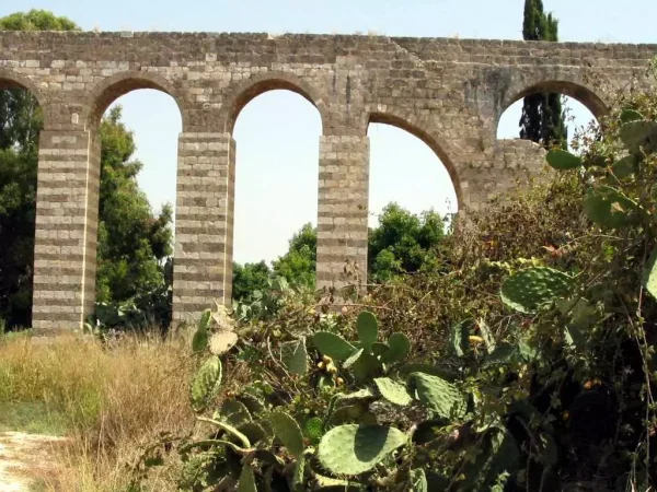
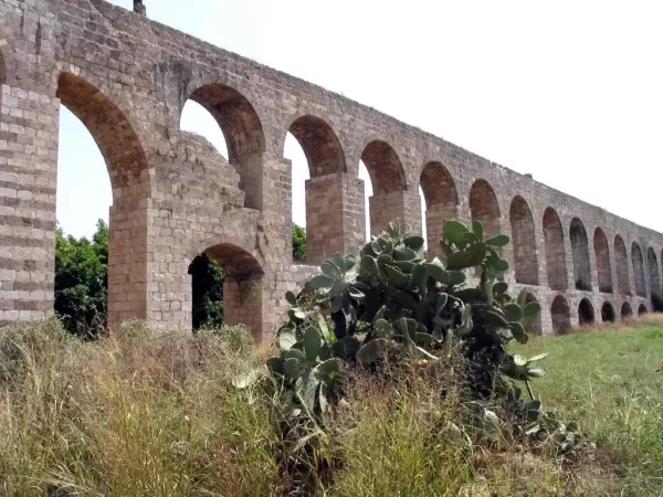
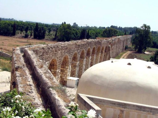
Aqueducts carrying water from the springs to Acre were constructed during the Hellenistic period. Two further water channels were built for the same purpose during the nineteenth century: one under Ahmad Pasha al-Jazzar in 1800 and another under Sulayman Pasha in 1814.
Occupation and Depopulation of al-Kabri
Events connected with Israel’s occupation of Palestine—the Nakba—reached al-Kabri several months before its final occupation. According to oral testimony collected by the Palestinian historian Nafez Nazzal, a Zionist military unit raided the village on 1 February 1948 and attempted to demolish the home of one of its local leaders.
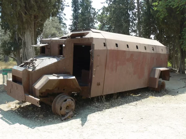
On 28 March 1948, villagers confronted a Haganah convoy travelling near al-Kabri. Accounts of the convoy’s composition and the number of casualties differ. Palestinian testimonies collected by Nazzal reported that 74 Haganah members were killed. Contemporary reports cited a lower number and also recorded Palestinian casualties. Because the available accounts differ, the casualty figures should not be regarded as conclusively established.
Al-Kabri was occupied during the night of 20–21 May 1948 as part of the second stage of Operation Ben-Ami. The attack was conducted by the Carmeli Brigade. Many inhabitants had already been forced to leave because of earlier attacks and the deteriorating security situation. Palestinian eyewitnesses reported that an unknown number of villagers were captured during the final assault and that some were killed. Other displaced inhabitants were reportedly killed while attempting to find refuge elsewhere in the Galilee after their connection to al-Kabri became known. The available Palestinian documentation does not establish a definitive total number of victims.
Israeli Settlements on al-Kabri’s Lands
Kibbutz Kabri was established on 18 January 1949 in the northwestern part of the destroyed village site.
Ga‘aton, established in 1948; Me‘ona, established in 1949; En Ya‘aqov, established in 1950; and Ma‘alot, established in 1957, are located east of al-Kabri. However, the final British Mandate landholding map combined the lands of al-Kabri and Tarshiha. It is therefore not possible to determine conclusively whether each of these settlements was built on land belonging specifically to al-Kabri or to Tarshiha.
Kefar Vradim was established on al-Kabri’s lands in 1984, rather than in 1948 as stated in some accounts.
Al-Kabri Today
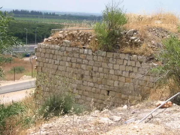
Only sections of crumbling walls and piles of stone remain from the Palestinian village. The ruins are covered with thorns, weeds, and shrubs. Kibbutz Kabri uses the land surrounding the village site for agriculture and livestock grazing.
Sources and References
- Interactive Encyclopedia of the Palestine Question: Al-Kabri
- Walid Khalidi, ed., All That Remains: The Palestinian Villages Occupied and Depopulated by Israel in 1948, Institute for Palestine Studies.
- Institute for Palestine Studies: Nakba 1948—The Depopulation of Palestinian Cities, Towns, and Villages
- Palestine Remembered: Al-Kabri, Acre Subdistrict
- Palestine Open Maps: Al-Kabri
- Our Palestine: The Depopulated Palestinian Village of Al-Kabri
Photo gallery

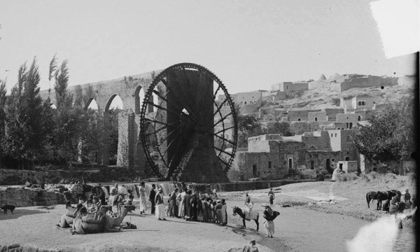
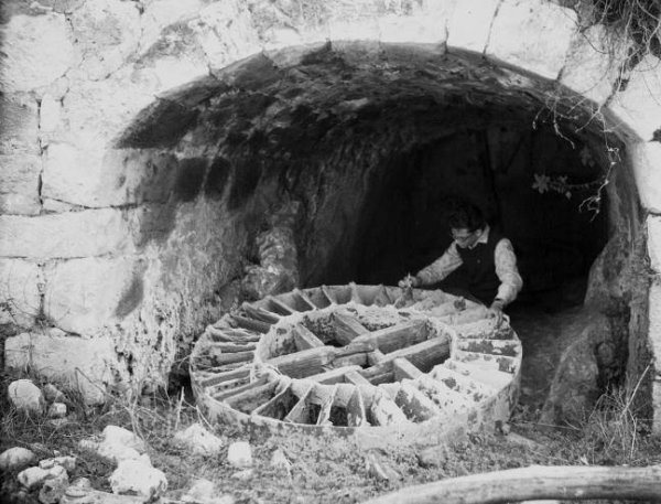

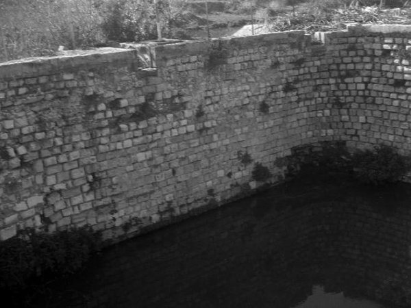
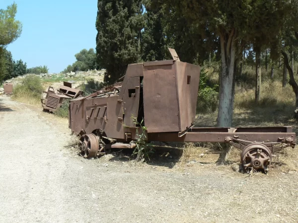
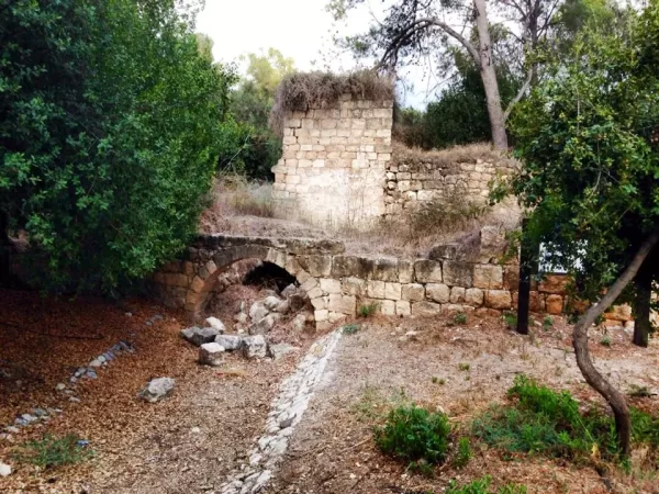
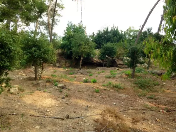
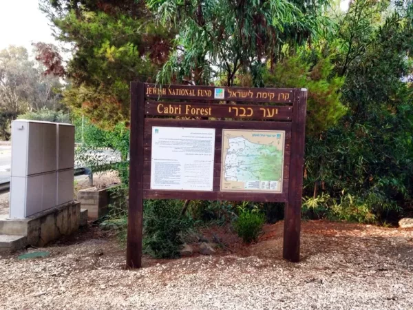


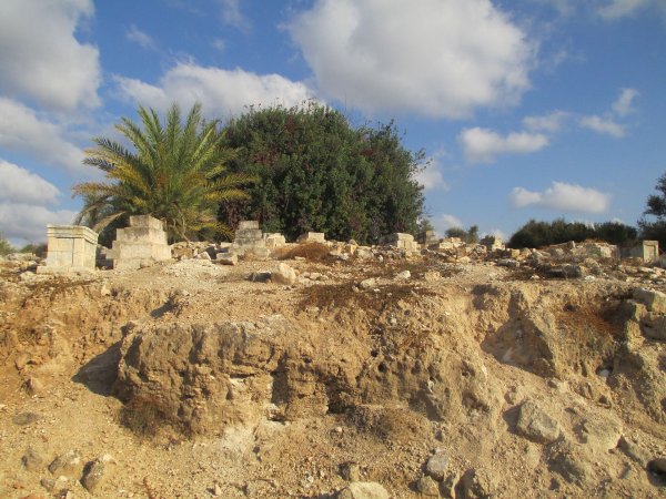
Photos from the village's people
Photos sent in by visitors and published after review.
Add a photo of this village
Log in to add photos of this village.
Other villages from Akka (Acre)

 Download Our Palestine App
The whole archive in the palm of your hand: depopulated villages, the Nakba, the massacres and Al-Aqsa — free, with no ads to erase the story.
Download Our Palestine App
The whole archive in the palm of your hand: depopulated villages, the Nakba, the massacres and Al-Aqsa — free, with no ads to erase the story.



Comments
No comments yet — be the first to write one.
Add your comment
Name and email are optional. Comments appear after review.