
The depopulated village of Al-'Ubaydiyya / District of Tiberias
Subdistrict: Tiberias
Estimated population in 1948: approximately 1,010
Documented date of depopulation: 3 March 1948
Date of subsequent military occupation or destruction: Not precisely documented
Israeli settlements established on the village’s lands before 1948: None
Israeli settlements established on the village site after 1948: None
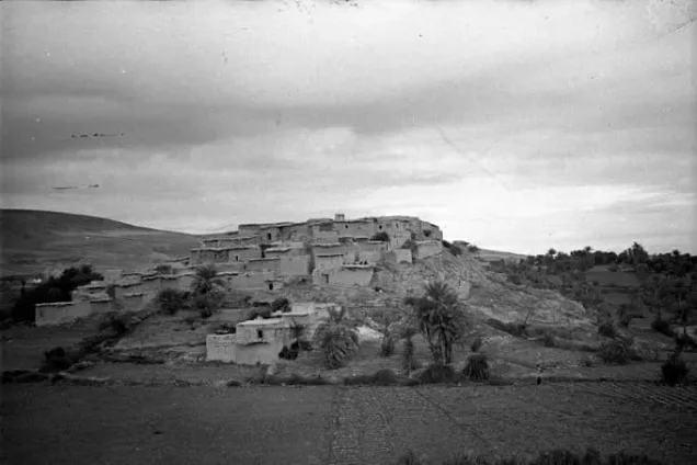
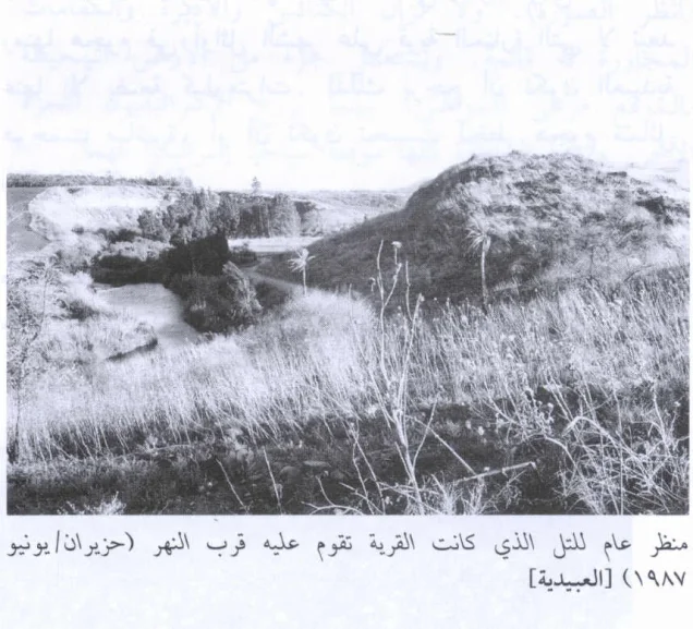
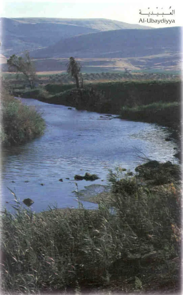
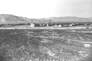
Al-'Ubaydiyya was a Palestinian village in the Tiberias Subdistrict, approximately 11 kilometres south of Tiberias. It stood on a small, rounded hill on the western bank of the Jordan River, about 2.5 kilometres south of Lake Tiberias and approximately one kilometre south of the mouth of Wadi al-Fajjas. The village was depopulated during Israel’s occupation of Palestine—the Nakba.
Some historical sources suggest that al-'Ubaydiyya may have been built over the remains of the Canaanite settlement of Bayt Shamash. This identification remains tentative and should not be confused with other ancient places bearing the same name. A watermill operated in the village.
Location and Boundaries of al-'Ubaydiyya
Al-'Ubaydiyya was situated among the following Palestinian villages and localities:
- To the north: al-Manara.
- To the west: Hadatha.
- To the south-west: 'Awlam.
- To the south: Jisr al-Majami'.
- To the east: Samakh.
A secondary road connected the village with the road leading north towards Samakh and Tiberias. Its position beside the Jordan River and near the southern shore of Lake Tiberias gave it access to fertile agricultural land and abundant water resources.
Architectural Structure of al-'Ubaydiyya
Because the village stood beside a pronounced bend in the Jordan River, its built-up area followed the topography of the riverbank. It extended along a north–south axis and formed a narrow rectangle at its southern end. Most houses were built of sun-dried mud brick, while their roofs were commonly made of reeds covered with a layer of mud.
Economic Life in al-'Ubaydiyya
A watermill in al-'Ubaydiyya was powered by water conveyed through an elevated channel. Agriculture formed the basis of the village economy, and its cultivated fields extended between the residential area and the road connecting it with Samakh. Cereals and vegetables occupied the largest cultivated area, while date palms were particularly common north of the village.
In 1944/45, Palestinian cultivators allocated 1,349 dunams to cereal cultivation and 1,014 dunams to irrigated land and orchards. A further four dunams within the orchard area were planted with olive trees.
Land Ownership in al-'Ubaydiyya
| Ownership category | Land ownership (dunams)* |
|---|---|
| Palestinian ownership | 4,031 |
| Jewish ownership | 1,139 |
| Public land | 3 |
| Total | 5,173 |
* One dunam equals approximately 1,000 square metres.
Land Use in al-'Ubaydiyya in 1945
| Land-use category | Palestinian ownership (dunams)* | Jewish ownership (dunams)* | Public land (dunams)* |
|---|---|---|---|
| Citrus cultivation | 3 | 0 | 0 |
| Irrigated land and orchards | 1,014 | 525 | 0 |
| Olive cultivation* | 4 | 0 | 0 |
| Cereal cultivation | 1,349 | 612 | 0 |
| Built-up area | 24 | 2 | 0 |
| Cultivable land | 2,366 | 1,137 | 0 |
| Uncultivated land | 1,641 | 0 | 3 |
* One dunam equals approximately 1,000 square metres. Olive cultivation was included within the broader category of irrigated land and orchards and should not be added separately when calculating the total cultivated area.
Population of al-'Ubaydiyya
In the late nineteenth century, al-'Ubaydiyya was described as a village of approximately 200 residents. The official 1922 census recorded 336 inhabitants, all Muslims. Its population increased to 625 in 1931 and to 870 in 1945. The projected population for 1948 was approximately 1,009, commonly rounded to 1,010.
| Year | Population* |
|---|---|
| Late nineteenth century | Approximately 200 |
| 1922 | 336 |
| 1931 | 625 |
| 1945 | 870 |
| 1948 estimate | 1,009 |
| Estimated number of refugees and their descendants in 1998 | 6,198 |
* The 1948 and 1998 figures are demographic estimates rather than contemporaneous census totals.
Number of Houses in al-'Ubaydiyya
| Year | Number of houses |
|---|---|
| 1931 | 137 |
| 1948 estimate | 221 |
Education in al-'Ubaydiyya
An elementary school was founded in al-'Ubaydiyya during the Ottoman period and continued to operate under the British Mandate. The available records do not provide sufficient detail about its enrolment or highest grade.
Historical and Archaeological Context
The modern Palestinian village should be distinguished from the nearby Lower Palaeolithic archaeological site known as 'Ubeidiya. Archaeological research dates the earliest occupation layers at that site to approximately 1.4 million years ago, making it one of the earliest known prehistoric sites outside Africa. This date concerns ancient human activity in the surrounding landscape and does not mean that the historical village itself had existed for 1.4 million years.
Other archaeological remains in the vicinity included Khirbat al-Shamsawi. The suggestion that the village occupied the site of the Canaanite Bayt Shamash is plausible but has not been conclusively established.
Occupation and Depopulation of al-'Ubaydiyya
Palestinian historical compilations record that the inhabitants of al-'Ubaydiyya left for the Nazareth area on 3 March 1948. Their departure occurred amid growing insecurity, isolation and fear of an anticipated Zionist military attack during the months preceding Israel’s occupation of Palestine—the Nakba.
The surviving documentation does not establish that al-'Ubaydiyya was directly assaulted on that date, nor does it provide a firmly documented date for its subsequent military occupation and destruction. The date of 1 May 1948 appears in some later compilations, but its precise evidentiary basis is unclear. It should therefore not be presented as a definitive occupation date.
Israeli Settlements on the Lands of al-'Ubaydiyya
No Israeli settlement was established directly on the village site or within its recorded land boundaries. Beyt Zera', founded east of the Jordan River before 1948, lies near the site but was not established on the lands of al-'Ubaydiyya.
Al-'Ubaydiyya Today
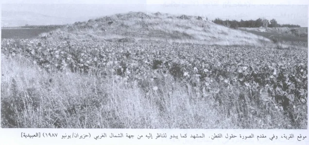
Remains visible at the site include sections of the former water channel, ruined houses, piles of stone, wall foundations, agricultural terraces and several palm trees. Much of the surrounding land has been cultivated, including areas used for cotton production.
Sources
- Palestinian Museum Digital Archive and Interactive Encyclopedia of the Palestine Question: al-'Ubaydiyya.
- Palestine Remembered: al-'Ubaydiyya, Tiberias Subdistrict.
- Walid Khalidi, ed., All That Remains: The Palestinian Villages Occupied and Depopulated by Israel in 1948, Institute for Palestine Studies, Washington, D.C., 1992.
- Government of Palestine, Census of Palestine, 1922.
- Government of Palestine, Census of Palestine, 1931.
- Government of Palestine, Department of Statistics, Village Statistics, April 1945.
Photo gallery

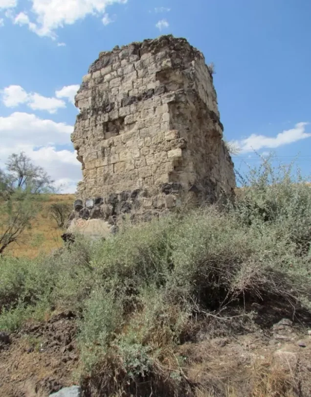
Photos from the village's people
Photos sent in by visitors and published after review.
Add a photo of this village
Log in to add photos of this village.
Other villages from Tiberias
 Download Our Palestine App
The whole archive in the palm of your hand: depopulated villages, the Nakba, the massacres and Al-Aqsa — free, with no ads to erase the story.
Download Our Palestine App
The whole archive in the palm of your hand: depopulated villages, the Nakba, the massacres and Al-Aqsa — free, with no ads to erase the story.



Comments
No comments yet — be the first to write one.
Add your comment
Name and email are optional. Comments appear after review.