
The depopulated village of Hittin / District of Tiberias
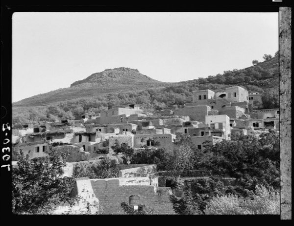
Estimated population in 1948: 1,380
Date of occupation and depopulation: 17 July 1948
Military operation: Operation Dekel
Military unit: Seventh Brigade
Israeli settlements subsequently established on village land: Arbel and Kfar Zeitim
Hittin was located approximately 8 kilometres northwest of Tiberias.
Hittin was a Palestinian village in the Tiberias Subdistrict. Its inhabitants were displaced and the village was largely destroyed during Israel’s occupation of Palestine—the Nakba—in 1948. The village lands are also associated with the Battle of Hittin of 1187, in which the Ayyubid forces led by Salah al-Din defeated the Crusader armies, a victory that consolidated Ayyubid control over much of Palestine.
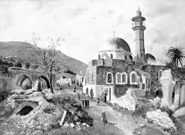
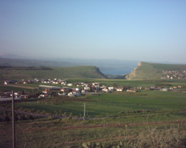
The village stood at the edge of a small valley on the northern slope of Mount Hittin, overlooking the plain where the historic battle took place. Orchards, olive groves, and cultivated fields surrounded the village. Its northwestern centre contained a small market, an elementary school, and a mosque serving its entirely Muslim population. The shrine of the Prophet Shu'ayb, an important Druze pilgrimage site, stood to the southwest of the village.
Boundaries of Hittin
Hittin lay amid the following Palestinian villages, localities, and lands:
- To the north: Khirbat al-Wa'ra al-Sawda.
- To the northwest: Eilabun.
- To the northeast: Wadi al-Hamam.
- To the east: al-Majdal.
- To the southeast: Tiberias.
- To the west and southwest: Nimrin.
- To the south lay the broader lands extending towards Lubya.
Land Ownership in Hittin
| Ownership category | Land area in dunams* |
|---|---|
| Palestinian ownership | 22,086 |
| Jewish ownership | 147 |
| Public land | 531 |
| Total | 22,764 |
* One dunam equals approximately 1,000 square metres.
Land Use in Hittin, 1944/45
| Land-use category | Palestinian ownership (dunams)* | Jewish ownership (dunams)* | Public land (dunams)* | Total (dunams)* |
|---|---|---|---|---|
| Irrigated land and orchards | 1,936 | 28 | 0 | 1,964 |
| Cereal cultivation | 10,253 | 23 | 186 | 10,462 |
| Built-up area | 70 | 0 | 0 | 70 |
| Cultivable land | 12,189 | 51 | 186 | 12,426 |
| Uncultivated land | 9,827 | 96 | 345 | 10,268 |
* One dunam equals approximately 1,000 square metres.
The village's olive groves covered approximately 200 dunams in 1942/43. This area formed part of the land classified as orchards and should therefore not be added separately to the land-use totals.
Population of Hittin
| Year | Population* |
|---|---|
| 1922 | 889 |
| 1931 | 931 |
| 1945 | 1,190 |
| 1948 | 1,380 |
| Estimated refugee population in 1998 | 8,477 |
* The 1948 population and the 1998 refugee population are demographic estimates rather than contemporary census counts.
Number of Houses in Hittin
| Year | Number of houses |
|---|---|
| 1931 | 190 |
| 1948 | 281 (estimated) |
Hittin: The Village Name
Several interpretations have been proposed for the name Hittin. The village may have stood near the site of the ancient settlement identified as Siddim or Ziddim. By the third century BCE, the locality was reportedly known as Kefar Hattin, interpreted as “the village of grain,” possibly in reference to cereal cultivation in the surrounding plain. Its later Arabic name, Hittin, preserved an older form of the place-name. These identifications remain historical and archaeological hypotheses rather than conclusively established facts.
Archaeological and Religious Landmarks in Hittin
- Hittin and its surroundings contain archaeological remains from several historical periods. Ruins, building remains, caves, and rock-cut features have been reported at nearby sites, including Khirbat al-'Ayka and Madyan, as well as in the vicinity of Wadi al-Hamam.
- Religious landmarks associated with the village and its surroundings included the shrine of the Prophet Shu'ayb and the locally remembered shrines of al-Sitt Zahra and al-'Ajami.
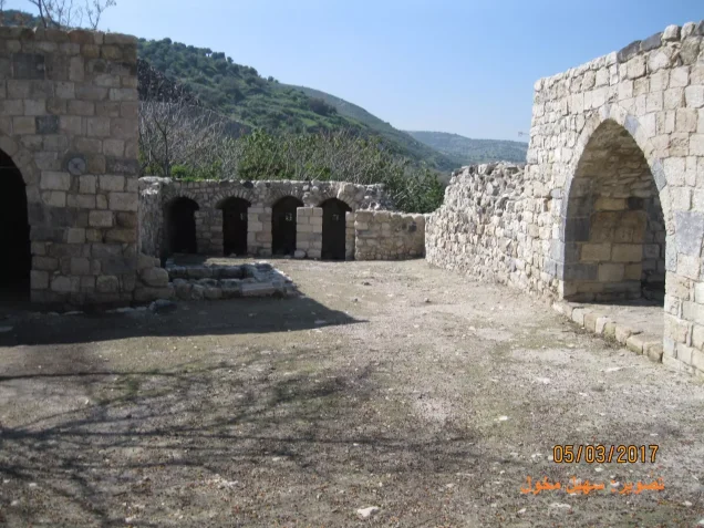
- The village mosque was commonly known as al-Jami' al-'Umari. Local tradition attributes its original construction to the early Islamic period and its restoration to Salah al-Din after the Battle of Hittin. Firm documentary evidence for these particular construction accounts remains limited.
- Local accounts also refer to several khans dating from the Ottoman period, when Hittin occupied a position near routes used by merchants and caravans travelling between Syria and Egypt.
Economic Life in Hittin
- The village economy was based principally on agriculture and livestock raising. Wheat, barley, olives, fruit, and other crops were among its principal products.
- Fertile soil, adequate rainfall, and accessible groundwater supported a productive agricultural economy. In 1944/45, 10,462 dunams were devoted to cereal cultivation, while 1,964 dunams were irrigated or used for orchards.
- In 1945, Hittin had a population of 1,190 and a total land area of 22,764 dunams, of which 22,086 dunams were recorded under Palestinian ownership.
Occupation and Depopulation of Hittin
The inhabitants of Hittin first became directly involved in the fighting on 9 June 1948, when Palestinians from Hittin took part in repelling an attack on the neighbouring village of Lubya shortly before the first truce. Oral testimony collected from former villagers also records that an armoured force advancing towards Hittin from the direction of Mitzpa was resisted for several hours and forced to withdraw.
After the first truce ended, the Seventh Brigade launched a renewed offensive in the area as part of Operation Dekel. Following the occupation of Nazareth on 16 July and the withdrawal of Arab Liberation Army fighters from the vicinity, most of Hittin's inhabitants left during the night of 16–17 July. A small group of defenders initially remained before also withdrawing northwards. The village was occupied on 17 July 1948, immediately before the second truce took effect.
Many displaced residents initially remained near the village in the hope of returning. They were subsequently prevented from doing so, and most eventually sought refuge in Lebanon and elsewhere.
Israeli Settlements on the Land of Hittin
Arbel was established to the north of the village site in 1949, while Kfar Zeitim was established to the northeast in 1950. Both were established on land belonging to Hittin. The earlier settlements of Kfar Hittim and Mitzpa were located nearby but were not established on Hittin's registered village land.
Hittin Today
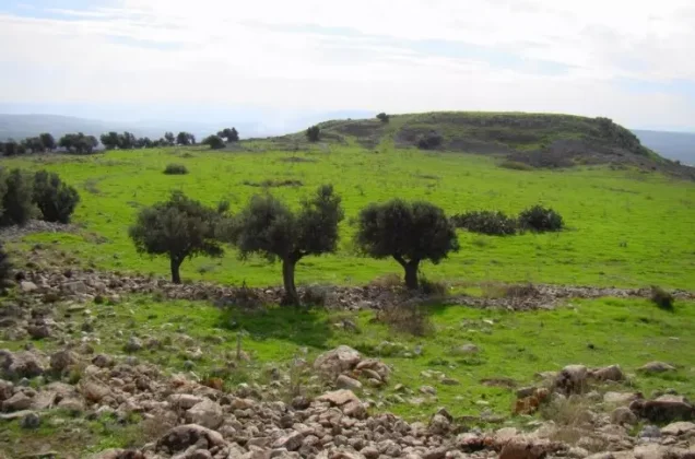
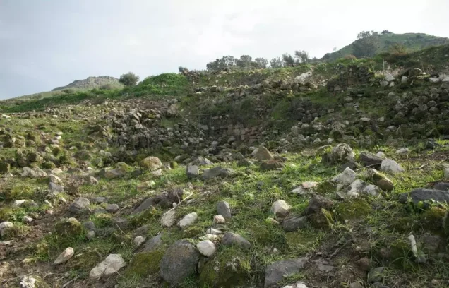
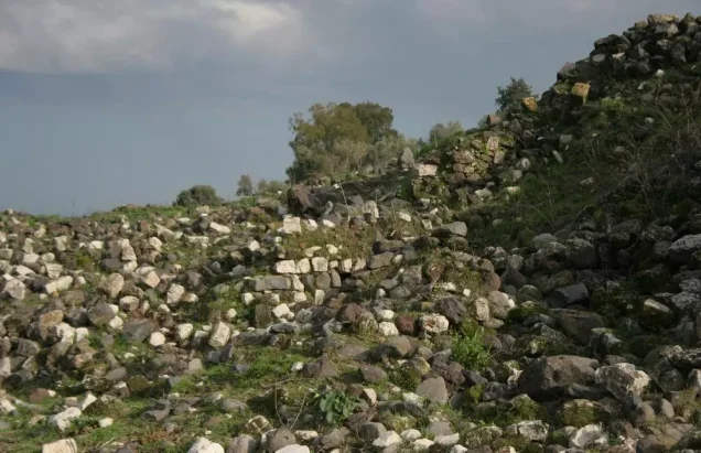
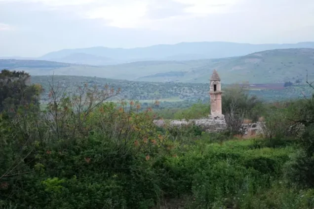
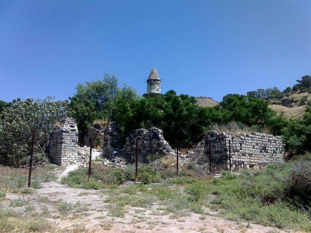
The village site is now overgrown with grass and scattered with piles of stone from destroyed buildings. The abandoned mosque remains standing, although parts of its structure and arches have deteriorated. Fig, mulberry, eucalyptus, and cactus plants grow around the site. The surrounding plain is cultivated, while sections of the hill land are used for grazing. The shrine of the Prophet Shu'ayb remains an important Druze pilgrimage site.
Sources
- Interactive Encyclopedia of the Palestine Question, “Hittin”, Institute for Palestine Studies.
- Walid Khalidi, ed., All That Remains: The Palestinian Villages Occupied and Depopulated by Israel in 1948, Institute for Palestine Studies, 1992.
- Nafez Nazzal, The Palestinian Exodus from Galilee, 1948, Institute for Palestine Studies, 1978.
- Palestine Remembered, “Hittin, Tiberias”.
- Government of Palestine, Village Statistics, April 1945, British Mandate administration.
Photo gallery








Photos from the village's people
Photos sent in by visitors and published after review.
Add a photo of this village
Log in to add photos of this village.
Other villages from Tiberias

 Download Our Palestine App
The whole archive in the palm of your hand: depopulated villages, the Nakba, the massacres and Al-Aqsa — free, with no ads to erase the story.
Download Our Palestine App
The whole archive in the palm of your hand: depopulated villages, the Nakba, the massacres and Al-Aqsa — free, with no ads to erase the story.



Comments
No comments yet — be the first to write one.
Add your comment
Name and email are optional. Comments appear after review.