
The depopulated village of Lubya / District of Tiberias
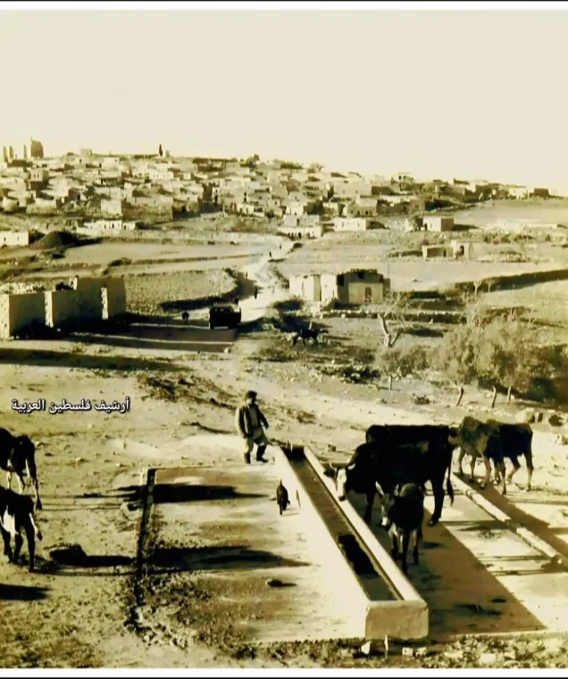
Subdistrict: Tiberias
Estimated population of Lubya in 1948: Approximately 2,730
Date of occupation and depopulation: 17 July 1948; some sources date the completion of the occupation to 18 July.
Military operation: Operation Dekel
Military unit: Seventh Brigade
Israeli settlements established on Lubya’s land before 1948: None
Israeli settlement firmly documented as having been established on Lubya’s land after 1948: Lavi
Later developments associated with parts of Lubya’s former lands or their immediate vicinity: Giv'at Avni and the Golani industrial and junction area; cadastral attribution varies between sources.
Lubya was a Palestinian village situated approximately 10.5 kilometres west of Tiberias, near the road connecting Tiberias with al-Nasira. Its inhabitants were displaced and the village was destroyed during Israel’s occupation of Palestine—the Nakba—in 1948. The British Mandate census recorded 405 occupied houses in 1931, while the official village statistics listed 2,350 inhabitants in 1945.
Location of Lubya
Lubya was located approximately 10.5 kilometres west of Tiberias.
The village stood at an elevation of approximately 300 metres on the summit of a rectangular rocky hill extending from east to west and overlooking the Tar'an plain to the south. It was built over the remains of earlier settlements and therefore constituted an archaeological site. The nearest Palestinian village to the north was Nimrin.
Boundaries of Lubya
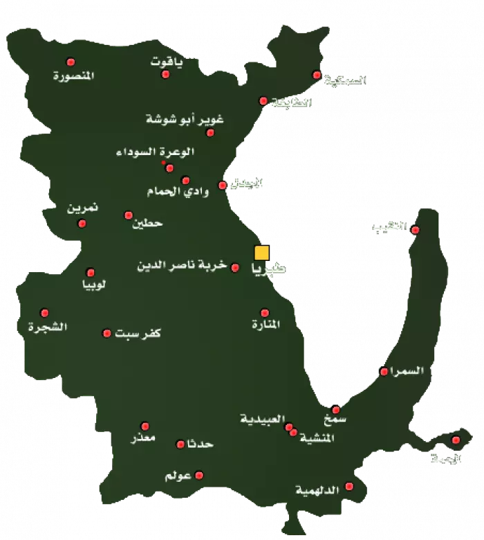
Lubya lay amid the following Palestinian villages, towns, and lands:
To the north: Nimrin.
To the west: Tur'an.
To the southwest: al-Shajara.
To the south: Kafr Sabt.
To the southeast: al-Manara.
To the east: Tiberias.
To the northeast: Hittin.
Architectural Structure of Lubya
The houses of Lubya were constructed on a hill connected by a secondary road to the main Tiberias–al-Nasira road. This secondary road divided the village into eastern and western sections.
Most of the older houses, as well as the newer buildings erected during the British Mandate, were concentrated on the eastern part of the hill. This pattern of development may have reflected the fact that the eastern side overlooked the village’s cultivated land.
Agriculture in Lubya
Lubya was the second-largest village in the Tiberias Subdistrict in terms of land area. Its registered lands covered 39,629 dunams, while its built-up area covered 210 dunams.
The village was known throughout the region for the quality of its wheat, which was grown principally in the fields of the Tar'an depression. Olive and fig trees were cultivated on the hilly land, especially north of the village. Olive groves reportedly covered approximately 1,520 dunams, although this figure formed part of broader agricultural categories and should not be added separately to the official land-use totals.
The village’s built-up area expanded mainly towards the east, overlooking its agricultural land. A secondary road divided the eastern and western sections and connected Lubya to the Tiberias–al-Nasira road.
Land Ownership in Lubya
| Ownership category | Land area in dunams* |
|---|---|
| Palestinian ownership | 32,895 |
| Jewish ownership | 1,051 |
| Public land | 5,683 |
| Total | 39,629 |
* One dunam equals approximately 1,000 square metres.
Land Use in Lubya, 1944/45
| Land-use category | Total area in dunams* |
|---|---|
| Irrigated land and orchards | 1,655 |
| Cereal cultivation | 32,310 |
| Built-up area | 210 |
| Cultivable land | 33,965 |
| Uncultivated land | 5,454 |
* One dunam equals approximately 1,000 square metres.
The official and secondary statistical tables do not consistently allocate every land-use category among Palestinian, Jewish, and public ownership. Combined totals are therefore presented here to avoid assigning public land incorrectly. Some published summaries give 31,026 dunams for cereal cultivation; the detailed ownership table yields 32,310 dunams. Estimates vary between sources.
Population of Lubya
The British Mandate census recorded 1,712 inhabitants in 1922, including 1,705 Muslims, four Christians, and three Druze. By 1931, the population had risen to 1,850, comprising 1,849 Muslims and one Christian, living in 405 occupied houses.
The official 1945 village statistics recorded 2,350 inhabitants, all of whom were Muslims. Based on demographic projections, the population reached approximately 2,730 in 1948. An elementary school for boys had been established during the Ottoman period in 1895 and continued to operate under the British Mandate.
Population of Lubya by Year
| Year | Population* |
|---|---|
| 1596 | Approximately 1,177 |
| Early to late nineteenth century | Approximately 400–700 |
| 1922 | 1,712 |
| 1931 | 1,850 |
| 1945 | 2,350 |
| 1948 | Approximately 2,730 |
| Estimated refugee population in 1998 | 16,741 |
* The figures for 1596, the nineteenth century, 1948, and the refugee population in 1998 are estimates rather than contemporary census counts.
Number of Houses in Lubya
| Year | Number of houses |
|---|---|
| 1931 | 405 |
| 1948 | Approximately 596 |
* The 1948 figure is an estimate rather than a contemporary housing census.
Archaeological Remains in Lubya
Lubya itself was an archaeological site containing rock-cut tombs and dressed stones that had been reused as building material. Although the village was constructed over earlier remains, the assertion that these remains were specifically Greek has not been conclusively established.
Approximately two kilometres east of the village stood the remains of a structure known as Khan Lubya. The site contained a ruined pool, cisterns, and traces of construction using large stones. It may have served as a caravansary or stopping place for merchants during the Ottoman period, although this interpretation remains provisional.
Occupation and Depopulation of Lubya
The Palestinian newspaper Filastin reported that Zionist forces attacked Lubya during the night of 20 January 1948, killing one villager. The raid was reportedly coordinated with another attack on the nearby town of Tur'an.
Another confrontation occurred on the outskirts of Lubya on 24 February. According to the contemporary Palestinian account, a four-hour clash with an armed convoy left one Palestinian dead and two wounded, while the convoy also sustained casualties.
A further assault took place during the first week of March. Palestinian historian 'Arif al-'Arif reported that Haganah forces attempted to advance along the road between Tiberias and al-Shajara and attacked Lubya at dawn. The attackers reached the village’s western edge but were repelled by the villagers. According to this account, six Palestinian defenders and seven members of the attacking force were killed. Filastin subsequently reported another attempted infiltration on 11 March, preceded by mortar shelling.
Following the occupation of Tiberias in mid-April 1948, Lubya became increasingly isolated, and its inhabitants appealed to al-Nasira for assistance. Former villagers interviewed by Palestinian historian Nafez Nazzal recalled another attack on 10–11 June, shortly before the first truce. An infantry force occupied positions south of the village but withdrew by the evening of 11 June. Lubya’s militia also briefly participated alongside the Arab Liberation Army in fighting near al-Shajara before returning to defend the village during the truce.
After the truce ended, Israeli forces launched Operation Dekel. News of the occupation of al-Nasira reached Lubya on 16 July. The villagers requested military assistance from a nearby Arab Liberation Army contingent, but their request was not met. During the night of 16–17 July, most residents left towards Nimrin, Eilabun, and subsequently Lebanon, while members of the local militia and some elderly inhabitants remained behind.
When an armoured force from the Seventh Brigade approached on 17 July, the lightly armed defenders withdrew. Palestinian eyewitness testimony states that the village was shelled before the troops entered, after which some houses were destroyed and others were commandeered. Some elderly residents sheltered in a nearby cave; a few later escaped, while the fate of others was not conclusively documented.
The best-supported evidence therefore places the effective occupation of Lubya on 17 July 1948. Some references use 18 July, possibly reflecting the completion of military control. The village’s occupation and depopulation formed part of Israel’s occupation of Palestine—the Nakba.
Israeli Settlements and Later Developments on Lubya’s Land
The Israeli settlement of Lavi was established in 1949 on land belonging to Lubya, northeast of the former village site.
Giv'at Avni was established several decades later to the east or northeast of the site. Palestinian local sources associate parts of it with Lubya’s former lands, while the principal cadastral summary in Walid Khalidi’s encyclopedia identifies Lavi as the settlement conclusively established on registered village land. This difference should therefore be acknowledged rather than presenting the attribution as undisputed.
The Golani junction, industrial area, and military museum were developed near Lubya’s lands. They are not residential settlements and should not be listed as villages established directly on the former built-up area.
Lubya Today
Most of Lubya’s inhabitants and their descendants live outside the village, including substantial communities in refugee camps and other localities in Lebanon, Syria, Jordan, and elsewhere. Large communities historically lived in al-Yarmouk refugee camp near Damascus and Ayn al-Hilwa refugee camp near Sidon.
The village itself was almost entirely destroyed. The Lavi pine forest was planted on the western side of the site, covering much of the rubble of the Palestinian houses. Another forest, commonly called the South Africa Forest, was planted nearby.
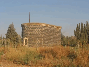
Scattered wells formerly used to collect rainwater remain visible, while pomegranate and fig trees and cactus plants continue to grow around the site. The secondary road that once connected Lubya with the Tiberias–al-Nasira road can still be identified.
The surrounding agricultural land is cultivated by the nearby Israeli settlement. A military museum commemorating the Golani Brigade was also established near the village site. These later developments have substantially altered the landscape, although surviving wells, vegetation, roads, graves, and building remains continue to mark the location of the Palestinian village.
Sources
- Walid Khalidi, ed., All That Remains: The Palestinian Villages Occupied and Depopulated by Israel in 1948, Institute for Palestine Studies, 1992, pp. 527–529.
- Palestine Remembered, “Lubya, Tiberias”.
- Sami Hadawi, Village Statistics 1945: A Classification of Land and Area Ownership in Palestine, Palestine Liberation Organization Research Centre.
- Government of Palestine, Village Statistics, April 1945, Department of Statistics and Department of Lands.
- Government of Palestine, Palestine: Report and General Abstracts of the Census of 1922.
- Government of Palestine, Census of Palestine, 1931: Population of Villages, Towns and Administrative Areas.
- Nafez Nazzal, The Palestinian Exodus from Galilee, 1948, Institute for Palestine Studies, 1978.
- Mahmoud Issa, “Resisting Oblivion: Historiography of the Destroyed Palestinian Village of Lubya,” Refuge, vol. 21, no. 2, 2003.
Photo gallery


Photos from the village's people
Photos sent in by visitors and published after review.
Add a photo of this village
Log in to add photos of this village.
Other villages from Tiberias

 Download Our Palestine App
The whole archive in the palm of your hand: depopulated villages, the Nakba, the massacres and Al-Aqsa — free, with no ads to erase the story.
Download Our Palestine App
The whole archive in the palm of your hand: depopulated villages, the Nakba, the massacres and Al-Aqsa — free, with no ads to erase the story.



Comments
No comments yet — be the first to write one.
Add your comment
Name and email are optional. Comments appear after review.