
The depopulated village of Safuriyya / District of Nazareth

Saffuriyya: History, Depopulation, and the Village Today
Subdistrict: Nazareth
Population in 1944/45: 4,330
Estimated population in 1948: approximately 5,020; estimates vary between sources
Date of occupation and depopulation: 16 July 1948
Israeli settlements established on village land before 1948: None recorded
Israeli settlements established on village land after 1948: Tzippori, HaSolelim, Allon HaGalil, Hosha'aya, and Hanton
About Saffuriyya
Saffuriyya was a depopulated Palestinian village in the Nazareth Subdistrict, situated approximately 6 kilometres northwest of Nazareth.
The village stood on the southwestern slope of a rocky outcrop rising about 110 metres above the plain to its south. A secondary road connected it with the Nazareth road and, farther northwest, with the coastal highway. The surrounding area formed a gateway to Lower Galilee, giving Saffuriyya strategic importance from antiquity onward.
The origin of the village's name is not certain. One interpretation associates it with the Syriac word Sefre, meaning “bird,” perhaps alluding to the way the settlement appeared to perch on its hill.
Location and Surrounding Localities
Saffuriyya lay within a network of villages and towns in Lower Galilee, including:
- North: Kafr Manda.
- West: Shefa-'Amr.
- South: Nazareth.
- Southeast: Al-Rayna.
- East: Al-Mashhad.
Other localities in the wider surrounding area included Rummana, Sakhnin, Ilut, I'billin, and several smaller rural sites. These directional descriptions identify the village's broader geographical setting and should not be read as a cadastral statement of every shared boundary.

Architecture and Village Layout
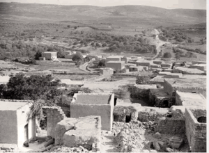
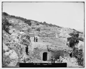
Saffuriyya was the largest village in the Nazareth Subdistrict in both population and land area. Its houses were constructed from stone, mud, and, increasingly, cement. The modern village followed a broadly rectangular plan, with streets intersecting near its commercial centre. In its later years, new construction extended toward the northwest and southeast.
The Name of Saffuriyya Through History
In classical sources, the town was known as Sepphoris. Under the Roman emperor Hadrian, it was also called Diocaesarea, while the Crusaders later referred to it as Le Sephorie. The modern Arabic name, Saffuriyya, preserved the long continuity of the place-name, although its precise linguistic origin remains uncertain.
Following the Roman conquest of Palestine, Sepphoris became an important administrative centre in Galilee. After the suppression of the First Jewish Revolt in 70 CE, the town gradually developed into a major centre of Jewish religious life. During the Byzantine period, it was home to both Jewish and Christian communities.
Muslim forces took the town in 634 CE during the early Islamic conquest. In the Crusader period, a fortress was constructed there. Salah al-Din al-Ayyubi recovered the town following the Battle of Hittin in 1187. Arab and Muslim geographers and chroniclers—including al-Baladhuri, Yaqut al-Hamawi, and Ibn al-Imad al-Hanbali—later referred to Saffuriyya in their writings.
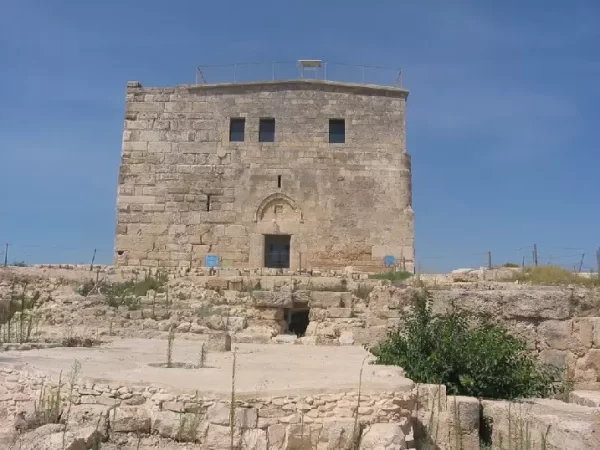
In 1596, Saffuriyya formed part of the nahiya of Tiberias in the liwa' of Safad and had an estimated population of about 2,200. Its residents paid taxes on wheat, barley, olives, goats, beehives, and a press used for olives or grapes. In 1745, Zahir al-Umar al-Zaydani built a fortress on the hill above the village.
Education and Public Life
Saffuriyya had two elementary schools, one for boys and another for girls. The boys' school was founded in 1900 during the late Ottoman period.
The Local Council
A local council was established in Saffuriyya in 1923. Its annual expenditure, which remained slightly below its revenue, rose from 74 Palestinian pounds in 1929 to 1,217 Palestinian pounds in 1944.
Archaeological and Religious Sites
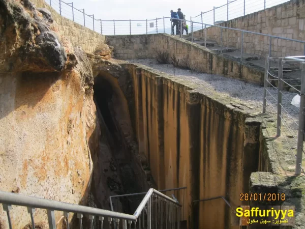
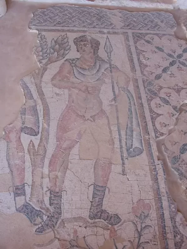
Saffuriyya and its surroundings contain extensive archaeological remains reflecting the site's long history. Nearby sites and landmarks cited in local accounts include Khirbat al-Khalidiyya, Khirbat al-Mushayrifa, Khirbat Mashmasiyya, Khirbat Umm Ahmad, Ayn al-Qastal, Ayn Abu Ras, and al-Nabi Iqbal. Ancient Hanton was located in the broader region.
Among the best-known remains are a Roman theatre, fortifications associated with the Crusader and later periods, and several churches. The Church and Monastery of Saint Anna are among the site's most prominent Christian landmarks. Archaeological research indicates that the site was inhabited almost continuously from the Hellenistic period, despite repeated episodes of destruction and rebuilding.
Economic Life
The area surrounding Saffuriyya had fertile soil and substantial surface and underground water resources. Agriculture formed the foundation of the village economy, and olives were its principal crop. In 1944/45, 21,841 dunums were allocated to cereal cultivation, while 5,310 dunums were irrigated or used for orchards. Of the latter area, 3,720 dunums were planted with olive trees.
Land Ownership in Saffuriyya, 1944/45
| Ownership Category | Area (Dunums) |
|---|---|
| Palestinian ownership | 41,748 |
| Jewish ownership | 0 |
| Public land | 13,630 |
| Total | 55,378 |
* One dunam equals approximately 1,000 square metres.
Land Use in Saffuriyya, 1944/45
| Land-Use Category | Area (Dunums) |
|---|---|
| Irrigated land and orchards | 5,310 |
| Olive groves (included within orchards) | 3,720 |
| Cereal cultivation | 21,841 |
| Built-up area | 102 |
| Total cultivable land | 27,151 |
| Uncultivated land | 28,125 |
* One dunam equals approximately 1,000 square metres. The olive-grove figure is a subset of irrigated land and orchards and should not be added to the total cultivable area.
Population of Saffuriyya
| Year | Population | Status of Figure |
|---|---|---|
| 1596 | Approximately 2,200 | Estimate derived from Ottoman fiscal records |
| Nineteenth century | Approximately 2,500 | Contemporary estimate |
| 1912 | 2,767 | Reported historical figure |
| 1922 | 2,582 | British Mandate census |
| 1931 | 3,147 | British Mandate census; includes Arab al-Hujayrat and Arab al-Hajajira |
| 1944/45 | 4,330 | Official village estimate: 4,320 Muslims and 10 Christians |
| 1948 | Approximately 5,020 | Retrospective estimate; sources variously report 5,020 or 5,023 |
| Estimated refugees and descendants, 1998 | Approximately 30,845 | Retrospective demographic estimate, not an official census count |
Number of Houses in Saffuriyya
| Year | Number of Houses | Status of Figure |
|---|---|---|
| 1931 | 747 | British Mandate census |
| 1948 | Approximately 1,192 | Retrospective estimate rather than a contemporaneous census count |
Occupation and Depopulation
Saffuriyya was occupied during Operation Dekel, the Israeli offensive in Lower Galilee in July 1948. According to historical accounts, the force that advanced on the village included an armoured battalion of the Sheva Brigade and two infantry battalions of the Carmeli Brigade. The assault began during the night of 15 July, and the occupation was completed by dawn on 16 July 1948.
Accounts differ over the intensity of the battle. One Israeli military account emphasized surprise and described little fighting, while historian Benny Morris wrote that the village offered strong resistance. Palestinian villagers interviewed by historian Nafez Nazzal recalled that three Israeli aircraft bombed Saffuriyya during the night, dropping barrels containing explosives and metal fragments, nails, and glass. According to these oral testimonies, the bombing killed and wounded an unspecified number of residents and drove many people into the orchards, while the village militia continued to resist without effective coordination. Because the precise casualty total is not established by the cited sources, no definitive number can be given.
By morning, many residents sheltering in the orchards had moved north or east. A number remained or later returned. Israeli sources cited by researchers state that further expulsions took place in September 1948 and again in January 1949, when returnees were transported to nearby Palestinian communities including Ilut, Al-Rayna, and Kafr Kanna. From February 1949 onward, parts of Saffuriyya's land were allocated to neighbouring Israeli settlements.
Saffuriyya Today
The agricultural settlement of Tzippori was founded on Saffuriyya's land in 1949, approximately 3 kilometres southeast of the former village site. HaSolelim was also established on village land in 1949, to the west of the site. Three additional Israeli settlements were later founded on Saffuriyya's land: Allon HaGalil in 1980, Hosha'aya in 1981, and Hanton in 1984.
Only a small number of Palestinian houses remain, including houses identified as having belonged to Abd al-Majid Sulayman and Ali Mawjuda. Much of the site is covered by a pine forest planted by the Jewish National Fund. Zahir al-Umar's fortress still stands on the hill, although parts of its walls have collapsed, and archaeological excavations surround it.
The Monastery of Saint Anna remains on the northern side of the former village, alongside a Greek Orthodox church. On the southern approach stands a synagogue housed in what sources identify as a former Muslim shrine, with a more recent Israeli cemetery nearby. Although the Palestinian village was depopulated and its built environment largely destroyed, the name Saffuriyya continues to be used by its displaced community and descendants.
Sources
- Interactive Encyclopedia of the Palestine Question (PalQuest): Saffuriyya
- Institute for Palestine Studies: Saffuriyya Village
- Palestine Remembered: Saffuriyya, Nazareth Subdistrict
- Government of Palestine, Village Statistics, April 1945 (reproduced by Palestine Remembered)
- Government of Palestine, Census of Palestine, 1931
- Palestine Open Maps: Saffuriyya
Photo gallery








Photos from the village's people
Photos sent in by visitors and published after review.
Add a photo of this village
Log in to add photos of this village.
Other villages from Nazareth
 Download Our Palestine App
The whole archive in the palm of your hand: depopulated villages, the Nakba, the massacres and Al-Aqsa — free, with no ads to erase the story.
Download Our Palestine App
The whole archive in the palm of your hand: depopulated villages, the Nakba, the massacres and Al-Aqsa — free, with no ads to erase the story.



Comments
No comments yet — be the first to write one.
Add your comment
Name and email are optional. Comments appear after review.