
The depopulated village of Al-Mujaydal / District of Nazareth

Al-Mujaydil: History, Depopulation, and the Village Today
Subdistrict: Nazareth
Population in 1944/45: 1,900
Estimated population in 1948: approximately 2,204
Date of occupation and depopulation: 14 or 15 July 1948; sources vary
Israeli settlements established on village land before 1948: Yif'at was established in 1926 on land traditionally belonging to Al-Mujaydil
Israeli settlements established on village land after 1948: Migdal HaEmek
Al-Mujaydil was a Palestinian village in the Nazareth Subdistrict. Its population was officially estimated at 1,900 in 1944/45 and retrospectively estimated at approximately 2,204 in 1948. Israeli forces occupied and depopulated the village during the Nakba, and most of its built environment was subsequently destroyed.
Location of Al-Mujaydil
The village stood approximately 6 kilometres southwest of Nazareth, at an average elevation of about 230 metres above sea level. It occupied the gently sloping southern side of Wadi al-Mujaydil and lay beside the paved Nazareth–Haifa highway. The Mosul–Haifa oil pipeline passed to the south of its lands, while Wadi al-Mujaydil, a tributary of the Kishon River, ran to the north.
Surrounding Villages and Towns
Al-Mujaydil lay among the following localities:
- North: Ma'lul.
- South: Afula.
- East: Yafa an-Naseriyye.
These directions describe the village's wider geographical setting and should not be treated as a complete cadastral account of every shared boundary.

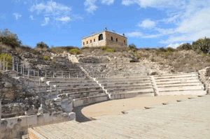
The Depopulated Palestinian Village of Al-Mujaydil
The Depopulated Palestinian Village of Al-Mujaydil
Topography and Architecture
Al-Mujaydil had a broadly triangular layout, with its base toward the south. Its houses were clustered closely together and constructed from stone and mud, stone and cement, or concrete. The 1931 British Mandate census recorded 293 houses. By 1945, the built-up area covered 34 dunums, while the village's total land area amounted to 18,836 dunums.
In 1945, Al-Mujaydil was the third-largest village in the Nazareth Subdistrict by population. Its 1,900 residents comprised 1,640 Muslims and 260 Christians.
Public Institutions and Economic Life
The village had two elementary schools, one for boys and another for girls. It also had a Roman Catholic church and monastery, as well as a local council responsible for village affairs. Official records indicate that the council spent 36 Palestinian pounds in 1929, 80 pounds in 1937, and 34 pounds in 1942, although its revenue continued to grow.
Agriculture was the foundation of Al-Mujaydil's economy, and grain was its principal crop. In 1944/45, 14,982 dunums of Palestinian-held land, 437 dunums of Jewish-held land, and 55 dunums of public land were allocated to cereal cultivation, producing an overall total of 15,474 dunums. Irrigated land and orchards covered 1,719 dunums in total, including 1,685 dunums of Palestinian-held land and 34 dunums of Jewish-held land.
Approximately 1,600 dunums were planted with olive trees. Al-Mujaydil was the second-largest olive producer in the Nazareth Subdistrict and had two mechanised olive presses. The villagers also drew water from several nearby springs, most of which lay southwest of the village. Local names recorded for these springs include Ayn al-Nab'a, Ayn al-Naqab, Ayn Marjana, and Ayn al-Surhayna.
Land Ownership in Al-Mujaydil, 1944/45
| Ownership Category | Area (Dunums) |
|---|---|
| Palestinian ownership | 18,165 |
| Jewish ownership | 485 |
| Public land | 186 |
| Total | 18,836 |
* One dunam equals approximately 1,000 square metres.
Land Use in Al-Mujaydil, 1944/45
| Land-Use Category | Palestinian-Held Land (Dunums) | Jewish-Held Land (Dunums) | Public Land (Dunums) | Total (Dunums) |
|---|---|---|---|---|
| Irrigated land and orchards | 1,685 | 34 | 0 | 1,719 |
| Olive groves (included within orchards) | 1,600 | 0 | 0 | 1,600 |
| Cereal cultivation | 14,982 | 437 | 55 | 15,474 |
| Built-up area | 34 | 0 | 0 | 34 |
| Total cultivable land | 16,667 | 471 | 55 | 17,193 |
| Uncultivated land | 1,464 | 14 | 131 | 1,609 |
* One dunam equals approximately 1,000 square metres. Olive groves form part of the orchard category and must not be added again when calculating cultivable land.
Population of Al-Mujaydil
| Year | Population | Status of Figure |
|---|---|---|
| 1596 | Approximately 22 | Estimate derived from Ottoman fiscal records |
| 1859 | Approximately 800 | Contemporary estimate |
| 1912 | 853 | Reported historical figure |
| 1922 | 1,009 | British Mandate census |
| 1931 | 1,241 | British Mandate census; includes Arab al-Khurayfat |
| 1944/45 | 1,900 | Official village estimate: 1,640 Muslims and 260 Christians |
| 1948 | Approximately 2,204 | Retrospective demographic estimate, not a contemporaneous census count |
| Estimated refugees and descendants, 1998 | Approximately 13,535 | Retrospective demographic estimate, not an official census count |
Education and Religious Life
Al-Mujaydil maintained two elementary schools, one for boys and one for girls. The village also contained a Roman Catholic church and monastery. Together with the local council, these institutions formed an important part of its educational, religious, and civic life.
Archaeological Remains
Traces of a Roman road were found near Al-Mujaydil. This evidence suggests that the surrounding area was settled or used intensively during the Roman period, although it does not by itself establish the exact nature or extent of the ancient settlement.
Occupation and Depopulation
According to the History of the Haganah, a unit of the Golani Brigade occupied Al-Mujaydil during the second stage of Operation Dekel as Israeli forces advanced toward Nazareth. Sources place the event on either 14 or 15 July 1948, making it inappropriate to present either date as entirely undisputed.
The village was attacked during the operation and was completely emptied of its Palestinian inhabitants before being largely razed. Some accounts also report aerial bombing, but the sources consulted do not provide a sufficiently detailed operational record to establish its precise scale. By the end of July 1948, approximately 1,200 displaced residents of Al-Mujaydil had reportedly reached Nazareth, although it is unclear how many remained there permanently. Many villagers and their descendants became internally displaced Palestinians, while others entered the wider refugee diaspora.
Israeli Settlements on Village Land
Yif'at, established in 1926 on land traditionally belonging to Al-Mujaydil, lies approximately 2 kilometres west of the former village site. Because it predates 1948, it should be listed among settlements established on the village's traditional lands before the village's occupation.
In 1952, Jewish immigrants from Iran established Migdal HaEmek on Al-Mujaydil's land, less than 1 kilometre southwest of the former village site. It is therefore the principal post-1948 Israeli settlement identified by the consulted academic sources as having been established on village land.
Al-Mujaydil Today
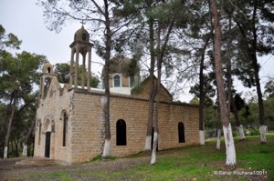
Most of the former village site is covered by a pine forest used as an Israeli park. The monastery and portions of the damaged church are among the principal surviving buildings, and monks continued to reside at the monastery when the site was surveyed.
Remains of destroyed houses and sections of the cemetery walls are still visible. Cactus plants and pomegranate, olive, and fig trees grow around the site, and several wells remain across the surrounding land.
Sources
- Interactive Encyclopedia of the Palestine Question (PalQuest): Al-Mujaydil
- Interactive Encyclopedia of the Palestine Question: Operation Dekel
- Palestine Remembered: Al-Mujaydil, Nazareth Subdistrict
- Government of Palestine, Village Statistics, April 1945 (reproduced by Palestine Remembered)
- Government of Palestine census reports for 1922 and 1931
- Institute for Palestine Studies: The Last Days of “Free Galilee”
Photo gallery

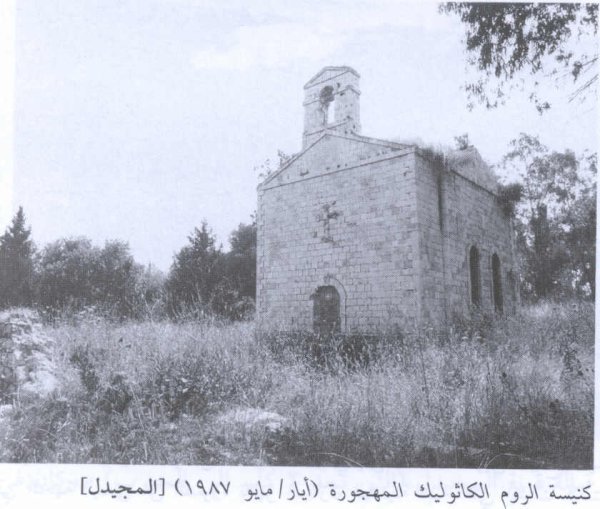


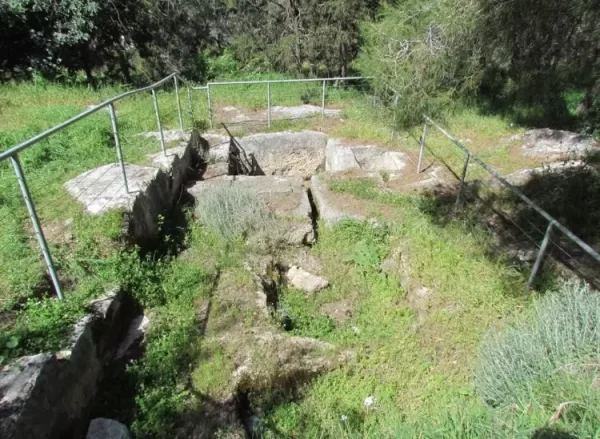

Photos from the village's people
Photos sent in by visitors and published after review.
Add a photo of this village
Log in to add photos of this village.
 Download Our Palestine App
The whole archive in the palm of your hand: depopulated villages, the Nakba, the massacres and Al-Aqsa — free, with no ads to erase the story.
Download Our Palestine App
The whole archive in the palm of your hand: depopulated villages, the Nakba, the massacres and Al-Aqsa — free, with no ads to erase the story.



Comments
No comments yet — be the first to write one.
Add your comment
Name and email are optional. Comments appear after review.