
The depopulated village of Ghuwayr Abu Shusha / District of Tiberias

Subdistrict: Tiberias
Estimated Palestinian population of Ghuwayr Abu Shusha in 1948: Approximately 1,440
Date of occupation: 24 April 1948; the displacement of the population unfolded in stages between 21 and 28 April.
Military unit: Palmach
Israeli settlement established on land traditionally belonging to the village before 1948: Ginnosar
Israeli settlement established on village land after 1948: Livnim
Ghuwayr Abu Shusha was located approximately 8 kilometres northwest of Tiberias and about 2 kilometres west of the shore of Lake Tiberias.
The village consisted of two principal sections:
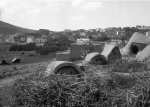
The first section: The compact southern section contained most of the permanent houses. These were constructed using reinforced concrete, stone and cement, stone and mud, or adobe. Some roofs were made of timber, reeds, and mud. In 1945, the Palestinian village’s built-up area covered approximately 6 dunams, making it one of the smallest built-up village areas in the Tiberias Subdistrict.
The second section: The northern section extended for approximately half a kilometre and included tents made of woven animal hair. In 1945, the wider statistical unit associated with Ghuwayr Abu Shusha and Ginnosar covered 12,098 dunams. Of this land, 8,609 dunams were under Palestinian ownership, 3,439 dunams under Jewish ownership, and 50 dunams were classified as public land.
Population and Economic Life in Ghuwayr Abu Shusha
In 1945, Ghuwayr Abu Shusha had a Palestinian population of 1,240, all of whom were Muslims. The same statistical unit also recorded 157 Jewish inhabitants associated with Ginnosar, producing a combined total of 1,397. These figures should not be interpreted as meaning that the 157 Jewish residents lived inside the Palestinian village’s six-dunam built-up area.
The available sources do not record formal schools, clinics, or comparable public institutions in Ghuwayr Abu Shusha. Several springs supplied the inhabitants with drinking water, while agriculture formed the principal basis of village life.
Population of Ghuwayr Abu Shusha
| Year | Palestinian population* |
|---|---|
| 1945 | 1,240 |
| 1948 | Approximately 1,440 |
| Estimated refugee population in 1998 | 8,833 |
* The 1948 population and the refugee population in 1998 are demographic estimates rather than contemporary census counts. The wider 1945 statistical unit had a combined population of 1,397 when the 157 Jewish residents associated with Ginnosar were included.
Economic Life in Ghuwayr Abu Shusha
The villagers obtained drinking water from several springs and depended primarily on agriculture for their livelihood. They cultivated vegetables and cereals mainly in the eastern part of the village lands.
Orange groves covering approximately 200 dunams to the west, north, and south of the village were under Jewish ownership. According to the detailed 1944/45 statistics for the combined Ghuwayr Abu Shusha–Ginnosar land unit, 115 dunams were devoted to citrus and bananas, 2,827 dunams were irrigated or used for orchards, and 3,702 dunams were devoted to cereal cultivation.
The Palestinian component of these totals included 21 dunams devoted to citrus and bananas, 1,377 dunams of irrigated land and orchards, and 1,848 dunams used for cereal cultivation.
Land Ownership in Ghuwayr Abu Shusha
| Ownership category | Land area in dunams* |
|---|---|
| Palestinian ownership | 8,609 |
| Jewish ownership | 3,439 |
| Public land | 50 |
| Total | 12,098 |
* One dunam equals approximately 1,000 square metres.
The British Mandate statistics treated Ghuwayr Abu Shusha and Ginnosar as a combined land unit. The figures above should therefore not be interpreted as referring exclusively to land inside the Palestinian village’s residential area.
Land Use in Ghuwayr Abu Shusha, 1944/45
| Land-use category | Palestinian ownership (dunams)* | Jewish ownership (dunams)* | Public land (dunams)* | Total (dunams)* |
|---|---|---|---|---|
| Citrus and bananas | 21 | 94 | 0 | 115 |
| Other irrigated land and orchards | 1,377 | 1,450 | 0 | 2,827 |
| Cereal cultivation | 1,848 | 1,854 | 0 | 3,702 |
| Built-up area | 6 | 41 | 0 | 47 |
| Cultivable land | 3,246 | 3,398 | 0 | 6,644 |
| Uncultivated land | 5,357 | 0 | 50 | 5,407 |
* One dunam equals approximately 1,000 square metres.
The Jewish-owned land-use figures, including the additional built-up area of 41 dunams, relate primarily to Ginnosar within the combined statistical unit rather than to the Palestinian village’s built-up area.
The Name Ghuwayr Abu Shusha
The village name consists of two parts. Ghuwayr is an Arabic diminutive of ghawr, a term used for a low-lying or depressed area. The name reflected the village’s location in the northern section of the Jordan Valley and Lake Tiberias basin.
Local explanations associate the second part of the name with a shrine in or near the village. The best-documented sources identify the surviving shrine as that of Shaykh Muhammad, while other oral accounts call it the shrine of Abu Shusha or associate it with a figure named Hasan Abu Shusha. Because the identification varies between sources, no single genealogy can be presented as conclusively established.
Archaeological Heritage of Ghuwayr Abu Shusha
The village and its surroundings contained several historical, archaeological, and religious landmarks:
Historical remains:
- Nearby Khirbat Abu Shusha contained remains of water-powered mills that had operated beside Wadi Rubadiyya. Stone ruins and other structural remains were also recorded in the area.
- Nineteenth-century descriptions mentioned a small shrine, several rough stone buildings, ruined mills, and a square vaulted structure built from large dressed stones. The precise date and original function of this structure remain uncertain.
- The cemetery south of the village, locally associated with an area known as Ghar al-Kamil, formed part of the village’s cultural landscape.
- Another burial area lay near the shrine in the centre of the village, while local accounts refer to additional graves in areas known as al-Hammara and al-Khan.
The claim that approximately sixty dunams at Khirbat Abu Shusha were excavated between 1902 and 1905 by the archaeologist R. A. Stewart Macalister appears to conflate this site with his excavations at Tell Jazar. No reliable evidence was found connecting those excavations to Ghuwayr Abu Shusha.
The prehistoric human remains discovered at Mugharet al-Zuttiyeh were found in Wadi al-Amud by Francis Turville-Petre in 1925. They are archaeologically important, but they do not establish that the modern village site itself was inhabited continuously from the prehistoric period.
Religious landmarks:
- The shrine of Shaykh Muhammad, also associated in local accounts with the name Abu Shusha, stood within the village.
- Oral accounts mention a shrine called Ways between the upper and lower sections of the village lands, near the heights of Yaquq.
- Local tradition also records shrines or sacred places known as Abu Shala, Abu 'Usayfir, Abu Faraj, and 'Azzam. Documentary information about their origins and dates is limited.
Occupation and Depopulation of Ghuwayr Abu Shusha
The Palestinian newspaper Filastin reported that forty armed Zionist militiamen attacked Ghuwayr Abu Shusha at approximately 3:00 a.m. on 3 January 1948. The villagers resisted the assault. According to the newspaper, the son of the village mukhtar and an unidentified woman were killed, along with three members of the attacking force.
After the occupation of Tiberias in April 1948, the security situation surrounding Ghuwayr Abu Shusha deteriorated. Palestinian survivors later testified that the villagers were prepared to defend their community but did not receive the requested weapons from the Arab Liberation Army. Women, children, and elderly residents were consequently moved to al-Rama, while forty-eight men reportedly remained with approximately thirty-five to forty rifles.
At dawn on 24 April 1948, Palmach forces carried out a surprise attack while the armed village defenders were sleeping at positions west of the residential area. Finding the village itself unprotected, the defenders decided that a counterattack would expose the remaining inhabitants and therefore withdrew.
The residents initially stayed in al-Rama and returned periodically to Ghuwayr Abu Shusha to recover belongings. When al-Rama was occupied in late October 1948, many were displaced again and forced towards Lebanon. Some eventually settled in Ayn al-Hilwa refugee camp near Sidon.
Sources record displacement on 21 and 28 April, while Palestinian oral testimony places the direct Palmach occupation on 24 April. These dates are not necessarily contradictory: they indicate that the village’s depopulation occurred in stages before and after the military entry. The claim that the population left “three months after the fall of Tiberias” is chronologically incorrect; the events occurred within days of Tiberias’s occupation.
The occupation and depopulation of Ghuwayr Abu Shusha formed part of Israel’s occupation of Palestine—the Nakba.
Israeli Settlements on the Land of Ghuwayr Abu Shusha
- Ginnosar was established in 1937 approximately two kilometres east of the Palestinian village, on land traditionally associated with Ghuwayr Abu Shusha. The British Mandate’s 1945 statistics consequently combined the village and settlement within the same land unit.
- Livnim was established in 1982 on village land, approximately one kilometre northwest of the former Palestinian village site.
Ghuwayr Abu Shusha Today
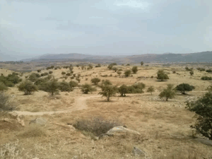
The village site is covered with thorns and wild vegetation, including Christ’s-thorn trees and cactus plants. The shrine of Shaykh Muhammad and the remains of a watermill can still be seen among piles of stone and several surviving olive trees.
The lower-lying lands are cultivated with bananas and citrus fruit, while the higher land is used for livestock grazing. These remains, together with the springs, mill ruins, cemetery areas, and village shrine, continue to mark the location of Ghuwayr Abu Shusha.
Sources
- Interactive Encyclopedia of the Palestine Question, “Ghuwayr Abu Shusha”, Institute for Palestine Studies.
- Walid Khalidi, ed., All That Remains: The Palestinian Villages Occupied and Depopulated by Israel in 1948, Institute for Palestine Studies, 1992, pp. 516–518.
- Palestine Remembered, “Ghuwayr Abu Shusha, Tiberias”.
- Sami Hadawi, Village Statistics 1945: A Classification of Land and Area Ownership in Palestine, Palestine Liberation Organization Research Centre.
- Government of Palestine, Village Statistics, April 1945, Department of Statistics and Department of Lands.
- Nafez Nazzal, The Palestinian Exodus from Galilee, 1948, Institute for Palestine Studies, 1978, pp. 30–33.
- Visualizing Palestine, “The Story of Ghuwayr Abu Shusha”.
- Our Palestine, “The Depopulated Village of Ghuwayr Abu Shusha”.
Photo gallery


Photos from the village's people
Photos sent in by visitors and published after review.
Add a photo of this village
Log in to add photos of this village.
Other villages from Tiberias
 Download Our Palestine App
The whole archive in the palm of your hand: depopulated villages, the Nakba, the massacres and Al-Aqsa — free, with no ads to erase the story.
Download Our Palestine App
The whole archive in the palm of your hand: depopulated villages, the Nakba, the massacres and Al-Aqsa — free, with no ads to erase the story.



Comments
No comments yet — be the first to write one.
Add your comment
Name and email are optional. Comments appear after review.